Good evening, everyone. It’s full steam ahead toward the big storm system rumbling into town for the weekend. This system will bring some wicked weather in here before a frost threat shows up behind another system next week.
I have no changes to how the weekend rolls along:
- Temps Saturday make a run into the upper 70s and low 80s on a strong southwest flow
- Showers and storms move into the west and some of those may be strong or severe during the afternoon and evening
- These storms weaken as they move into central Kentucky late Saturday evening into the wee hours of Sunday morning
- Low pressure pops along this boundary by early Sunday and that brings widespread gusty showers for central and eastern Kentucky
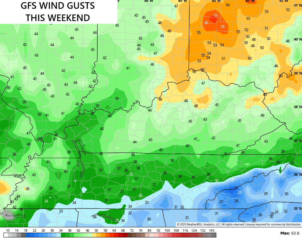
- Winds are the main player during this time with 40mph-45mph gusts Saturday night and Sunday
- Temps drop into the 50s behind the departing low Sunday afternoon
- Clearing skies Sunday night allows temps to drop into the upper 30s and low 40s
As mentioned, the wind gusts are the big player with some of the models showing gusts approaching 50mph…
In terms of severe weather, the Storm Prediction Center continues with the Slight Risk across the west and the Marginal Risk into central Kentucky for Saturday…

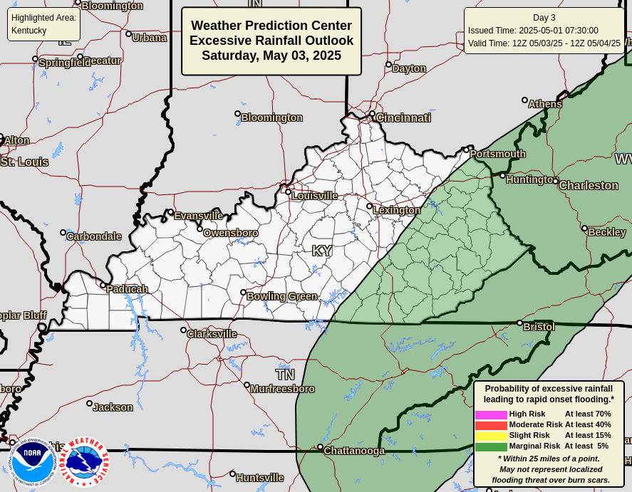
I’m not really concerned about the heavy rain threat over the weekend as we should only get some pockets of an inch or two with many areas under an inch. The Weather Prediction Center has the best risk for excessive rains in the west…
Temps Sunday afternoon may even crash into the upper 40s for some spots. The models are just now picking up on this…
A full-blown frost threat joins the fun next week and I’ll get into all that with the full update later tonight. Enjoy the evening and take care.
