Good Friday, everyone. It’s another nice fall day, but the clouds streaming across our sky signify a big change into the upcoming weekend. This comes from a potent fall storm system rolling through here. This kicks off a very active pattern that will likely bring us frost next week.
Speaking of frost, some patchy stuff is possible out there this morning in some of the coldest valleys of central and eastern Kentucky. Clouds then filter in through the day, but your sky stays dry. Temps are generally in the 70–75-degree range.
SATURDAY
- Central and eastern Kentucky look dry.
- Storms roll into western Kentucky during the afternoon, and some could be strong or locally severe.
- Highs reach the upper 70s and low 80s across the entire state.
- Southwest winds start to crank and may reach 30mph-35mph in the west and central by late afternoon.
SATURDAY NIGHT
- Showers and storms arrive from west to east.
- A few strong storms will be possible across the western half of the state early on.
- Winds will absolutely crank and may hit 40mph or greater.
- Locally heavy rains will be noted.
SUNDAY
- Early day rumbles of thunder fade to the east as gusty showers continue.
- The rain ends from west to east during the afternoon and evening.
- Winds will still be gusty and may reach 40mph at times, even as they become westerly and northwesterly.
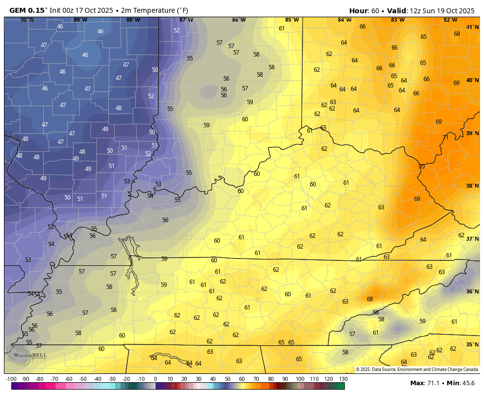
- Temps drop into the upper 40s to low 50s for central and eastern Kentucky during the afternoon.
- This is just a nasty weather day, folks!
SUNDAY NIGHT and MONDAY
- Clearing skies kick in from the west during the evening.
- Winds slowly calm down but are still up there.
- Temps are chilly with upper 30s and low 40s by Monday morning.
- Partly sunny skies will be noted Monday with highs ranging from the upper 50s to middle 60s across the state.
In terms of severe weather, the Storm Prediction Center continues to highlight the threat across western Kentucky for Saturday…

Damaging winds are the main player…

The large hail and tornado threats are much lower…


As mentioned, the wind gusts are the biggest player of Saturday night and Sunday with pretty widespread gusts of 40mph-45mph. Some of the models continue to suggest wind gusts to 50mph…
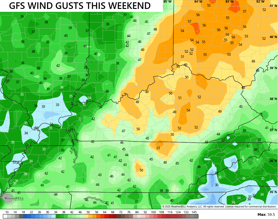
That’s probably a little too high, but some issues are a good bet.
Temps as the clock strikes midnight Sunday will be around 70 in central and eastern Kentucky. Those numbers drop quickly from west to east with readings into the 40s by afternoon and evening. This temp animation starts at 8am Sunday and goes through 8pm Sunday…
Lows by Monday morning reach the upper 30s and low 40s…
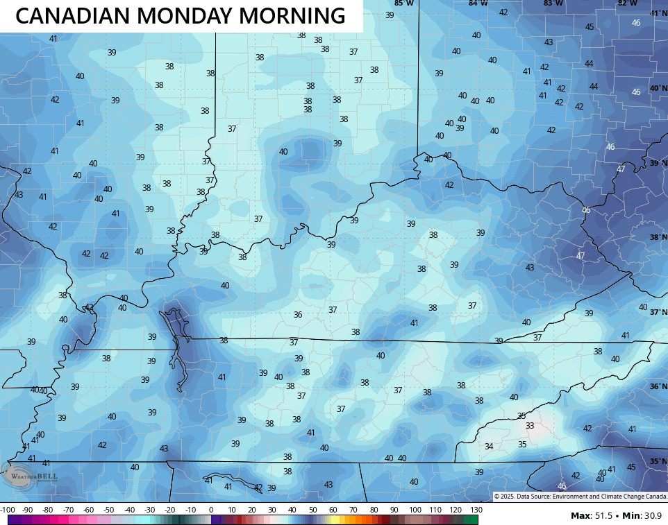
Gusty winds will make it feel chillier than that.
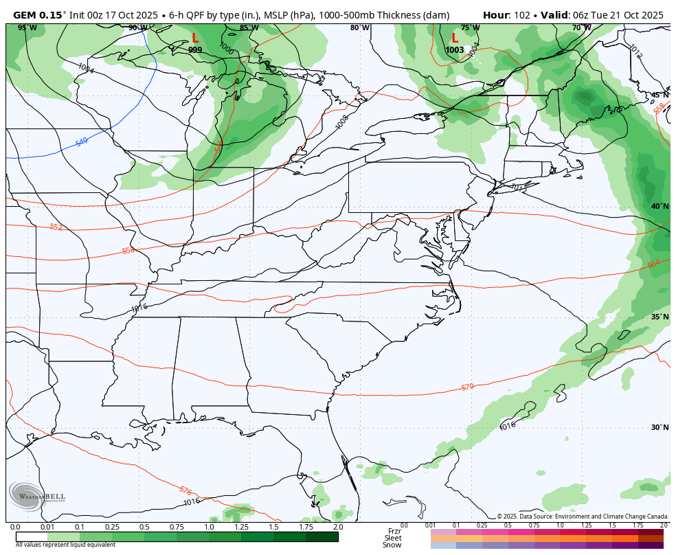
Another shot of chill comes in behind the next front on Tuesday…
Frost is a good bet Wednesday and/or Thursday mornings as temps drop deep into the 30s.
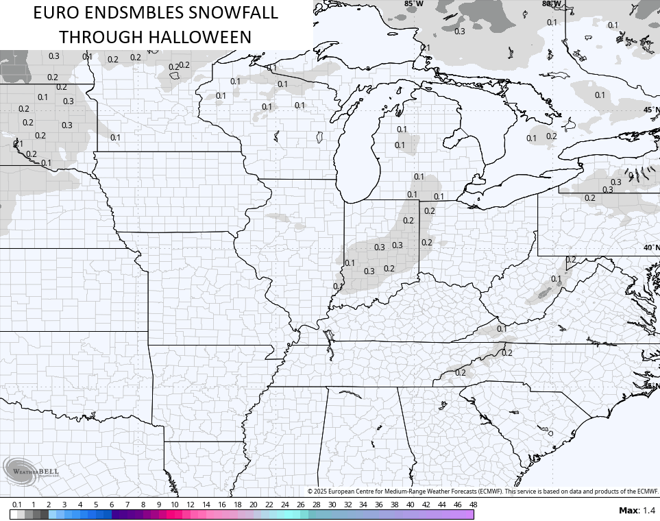
Another system may follow that up later in the week with the jet stream trying to really buckle in the days leading up to Halloween.
With the potential for that end of October trough showing up, we find the EURO Ensembles also showing some flake potential close to us…
Looking into November, the EURO Weeklies continue to grow colder with each run. The various teleconnection signals from the most recent run were all very middle of the road which would suggest there’s no driving force that alters the overall pattern. Given that, we find a pretty stable week to week pattern of lower heights across the Plains and eastern half of the country…
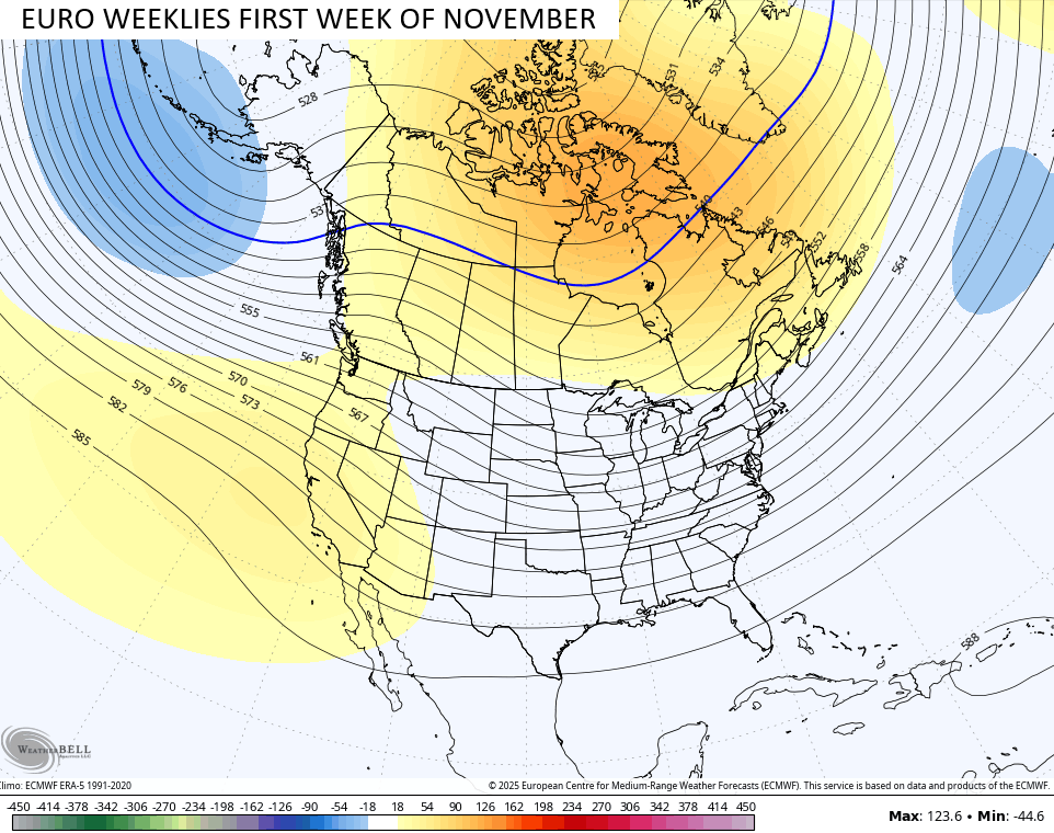
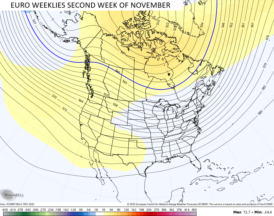
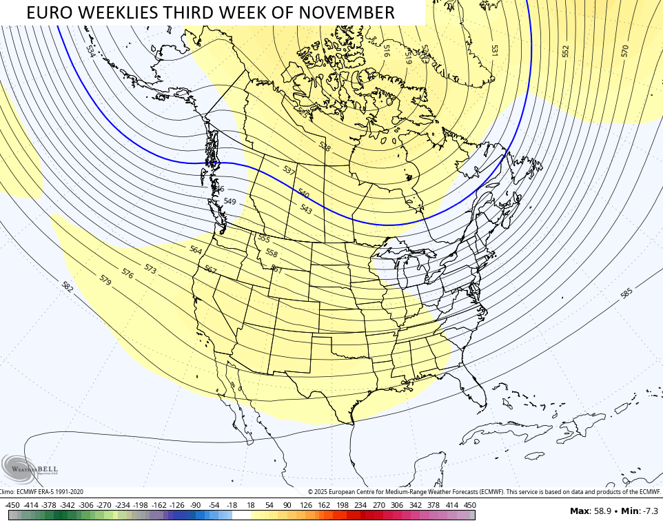
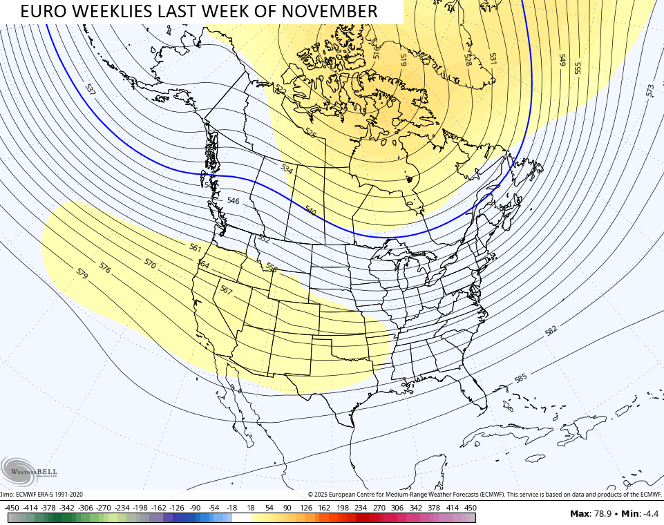
That type of pattern is why I’m pretty high on some early season flake chances in November.
Man… You guys just got your first loaded post of the season!!!
I’ll have another update later today. Have a fantastic Friday and take care.

Have I missed the first ‘Pot of Chili’ alert? I always look forward to that!
I believe Chris put out the first one back on September 7th.
Thank you!! Looks like I missed it while traveling . I’ll go ahead and make chili anyway this weekend, then. Ha!
I’ll be sure to get my yard work done today and tomorrow. 🙂
Yard work on Saturday, pot ‘o chili on Sunday!
During the height of the drought in central Warren County my maple and sweet gum trees lost a ton of leaves, and I was raking weeks earlier than I had in at least 2 decades (lawn & leaf bags worth), but they’ve tailed off since then. That was a huge change compared to last year, when I I continued raking into the 2nd week of December. Still a lot of green left on trees in the area, there’s some color, but a lot of brown. Hopefully this weekend’s gusty winds will knock a bunch off.
Still not convinced that we’ll pick up a lot of rain. The bulk of the precip over the past several months has fallen in far western Kentucky, basically parallel to the Ohio river. We’re most definitely ready for a good soaking.
Joe, the trees are beginning to show color in my area. I have a forest of trees surrounding my home, so it looks like average Autumn color in my area. We only had about inch of rain this month. I agree with your thoughts about the precipitation amounts. The best rains will only occur where the warm air is ascending. That would be Western Kentucky, and areas North along the Ohio River. Weaker high pressure there. High winds will dry us out more, to only increase the wildfire danger. The following cool down won’t last that long, but there’s another chance at the end of next week. I have a feeling though, in my area, that this October will go out frost free. I can’t recall any October being free of frost.
On the other side of the World, the weather there is very Cold and Snowy. It has always been this way, if it’s warm here, it’s Cold there. I guess the Polar Vortex will set up shop, North of Siberia this coming Winter ? Interesting.
NOAA’s Winter outlook. Looks and acts like a typical La Nina Winter. Cold and Snowy from Washington State, East to Michigan ( Lake Snows ), to the State of Maine. Warm and Dry Southwest to Southeast. Kentucky is again on the fence. Here’s the link :
https://climateimpactcompany.com/daily-feature-noaa-cpc-winter-outlook-is-edging-colder-snowier-2/
Maybe one of these Winters, the CONUS will have a weak ENSO / El Nino, operating with a strong positive ( PDO ) to bring our area a Cold and Snowy Winter ?
c