Good evening, folks. Milder winds are kicking in ahead of our big fall storm system ready to push across our region. This brings some big winds, strong storms, heavy rains and a dramatic temp drop to our area.
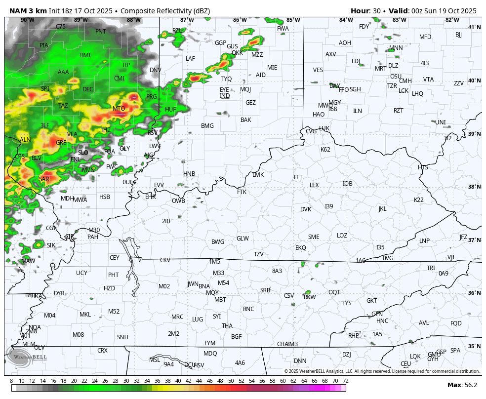
The start time of this system looks a little delayed from earlier thinking, but the bulk of the action arrives overnight Saturday into Sunday. The future radar from the Hi Res NAM shows our line of showers and storms followed by wraparound rains behind the departing low pressure.
This animation starts at 8pm Saturday and goes through 2am Monday…
The Storm Prediction Center continues to highlight the severe storms risk for later Saturday and Saturday night. The greatest risk is still in the far west with a Marginal Risk into central Kentucky…

Damaging wind is the main threat…

The SPC has upped the risk for tornadoes, though it’s still a low-end threat…

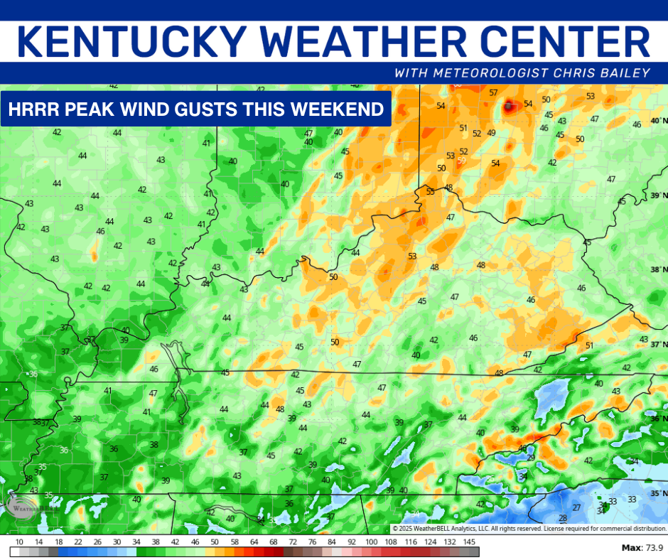
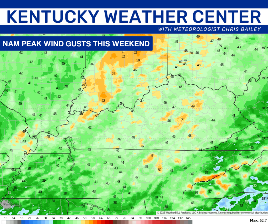
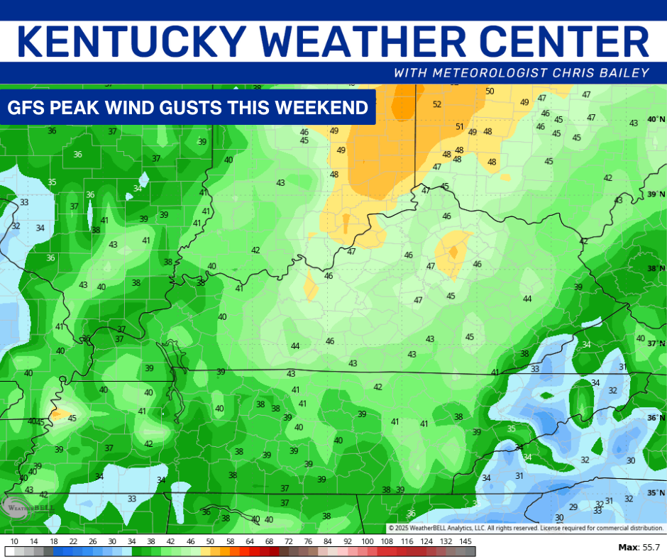
Wind gusts of 40mph-45mph are likely with or without thunderstorms Saturday night and Sunday. Some of the forecast models continue to show some gusts above 50mph…
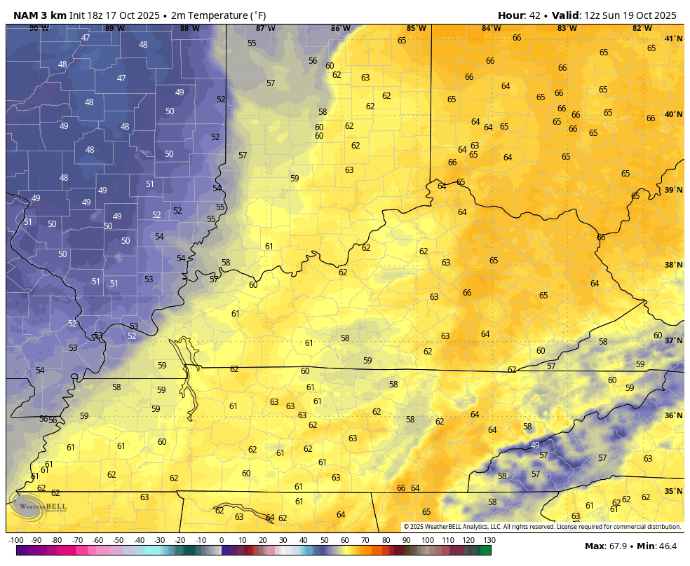
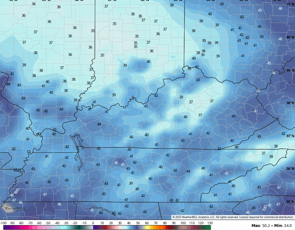
Chilly winds kick in very quickly on Sunday. The day starts with 70 in the east and 60s elsewhere, but those numbers drop into the 40s by afternoon and early evening. Watch this animation from 8am Sunday to 11pm Sunday…
That sets the stage for a cold Monday morning with areas of frost possible as temps hit the 30s in several areas…
The threat for widespread frost looks good Wednesday and Thursday mornings as even colder air sinks in.
Your full update comes your way later tonight. Have a great evening and take care.
