Good Saturday, everyone. Our weekend storm system is about to blast the Bluegrass state with all kinds of nasty. This kicks off a very active pattern setup that may carry us into an earlier than normal start to winter as we get into November. Sit back and enjoy another loaded KWC post!
Temps out there today are warm with 80-85 in many areas on a strong southwest wind flow. This is ahead of our storm system rolling into the region tonight and Sunday. Here are the highlights:
- Showers and storms impact western Kentucky later today into the evening. Some of these may be strong or severe.
- Storms rumble into central Kentucky and should weaken some. The low-end severe risk continues with this line.
- Winds are the main story with 40mph-45mph wind gusts tonight and Sunday. Pockets of higher winds may show up.
- Sunday is ugly across central and eastern Kentucky with widespread gusty rains.
- Temps Sunday drop into the upper 40s during the afternoon and early evening.
- Monday morning is cold with upper 30s delivering a kiss of frost to a few areas.
The future radar from the HRRR runs from this afternoon through 8pm Sunday and shows our system well…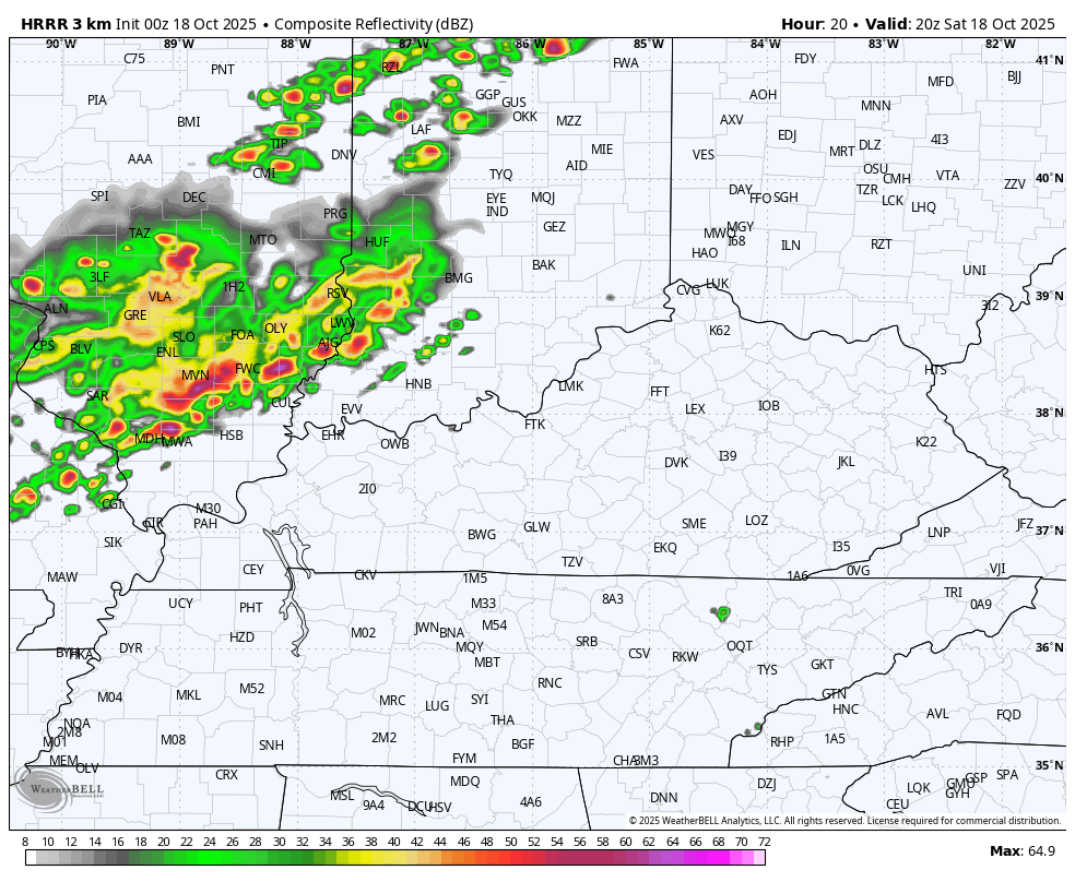
As mentioned, winds are the big factor with widespread gusts topping 40mph. Some of the models continue to point toward some 50mph gusts…
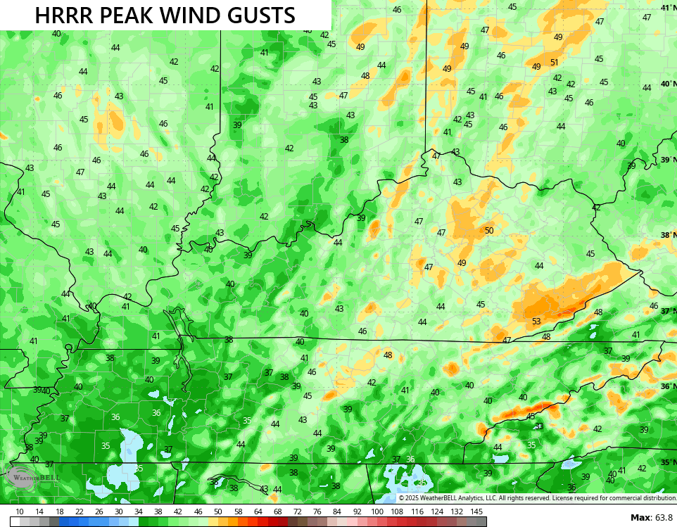
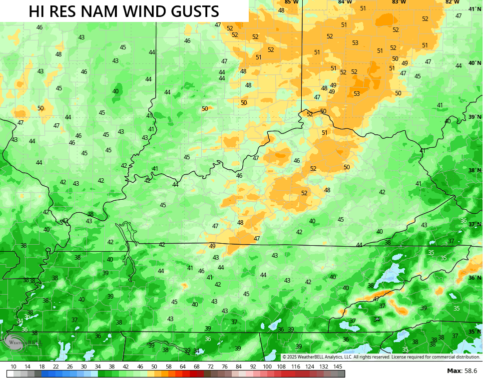
Those winds come in two BIG bursts with the first arriving with the front late tonight. The second as low pressure cranks and pulls away to our north on Sunday.
In terms of the severe threat, the greatest risk continues to be in the west. That’s where the Storm Prediction Center continues with the Slight Risk today. The Marginal Risk extends farther east into parts of central Kentucky…

Damaging wind is the main threat…

There is also a low-end tornado risk in the west…

The SPC does have a Marginal Risk for Sunday morning severe storms in the east…

This is one stout temp drop from Sunday morning through Sunday afternoon and evening…
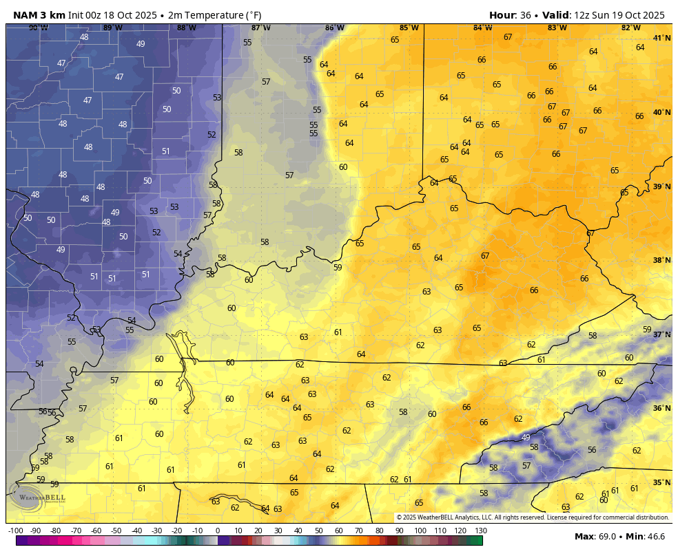
Areas of upper 30s likely show up by Monday morning…
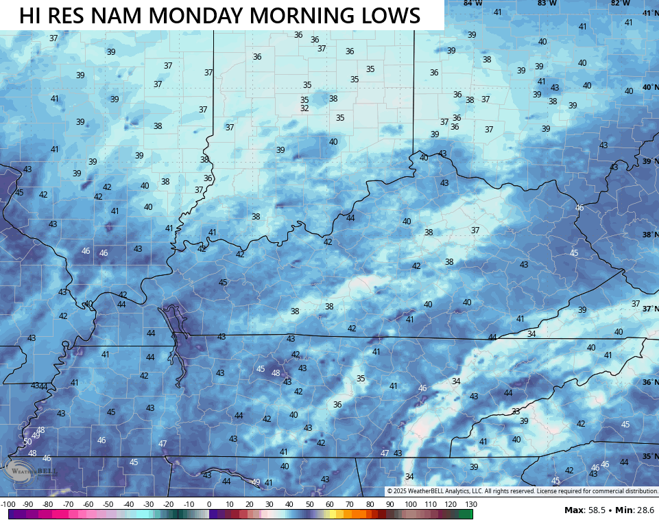
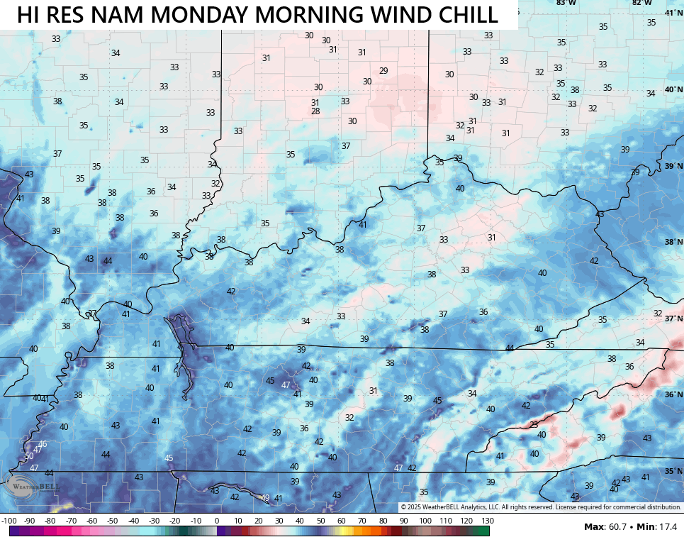
Some patchy frost is possible in the sheltered valleys, but the winds won’t fully calm down which means wind chills will show up…
The next system then slides through here on Tuesday unleashing the coldest air mass of the fall season, so far…
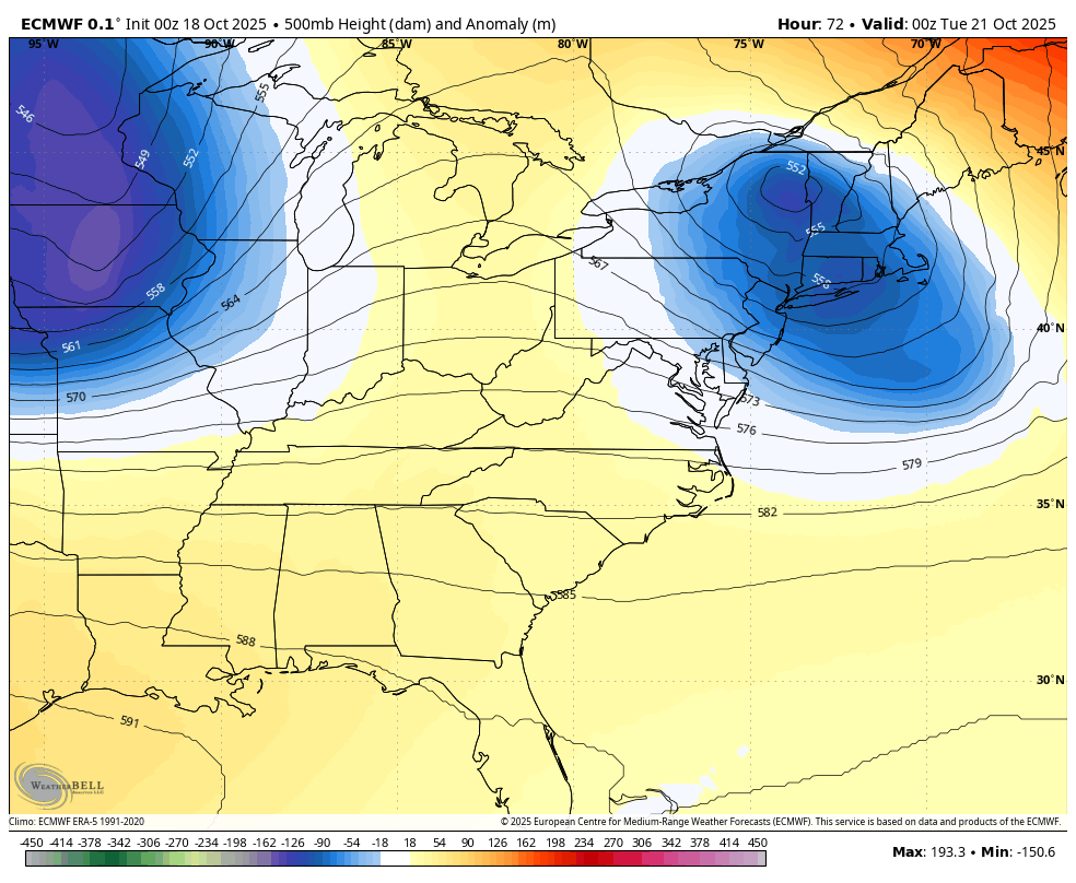
Lows will be deep into the 30s with a widespread frost potential Wednesday and/or Thursday mornings.
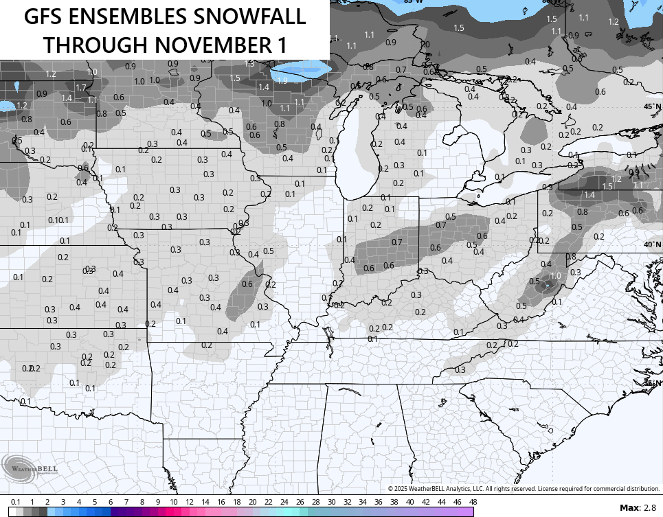
The trough digging into the eastern half of the country has been on my radar for a while now and it continues to show up well on the operational models and the various Ensembles like the GFS…
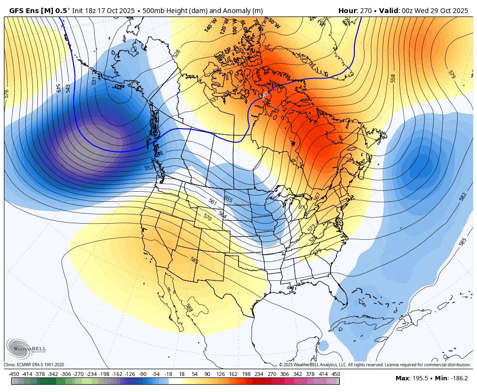
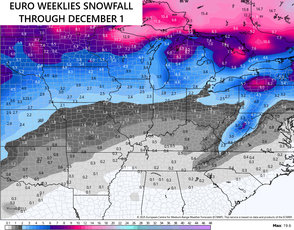
It’s interesting to note some of the recent runs of the GFS Ensembles have been showing flake action during that time…
I continue to watch the evolution on the EURO Weeklies as they continue to trend toward a very active November that may get winter started a little early. The overall forecast continues to be remarkably consistent but the trough in the east shows up a little stronger with each run.
Here’s the weekly breakdown of the 500mb height anomalies from the EURO Weeklies…
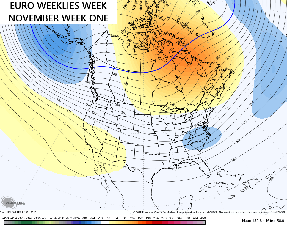
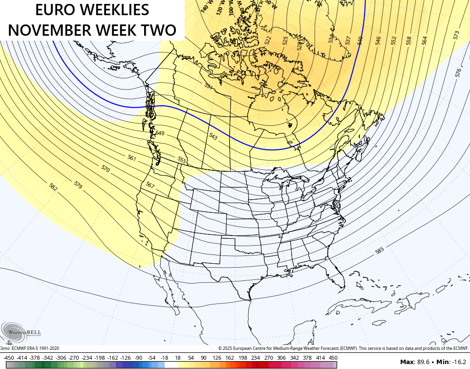
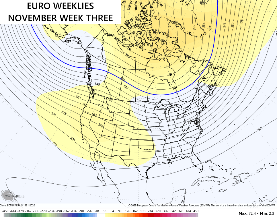
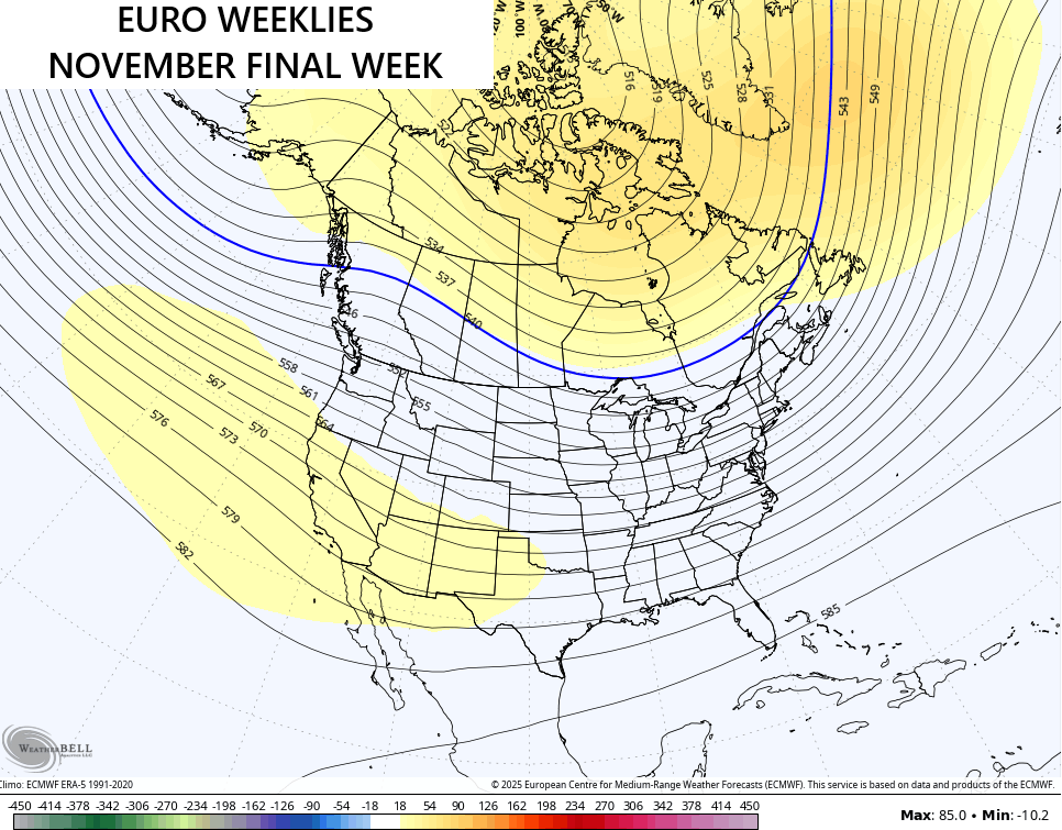
The signal is for an active November with above normal precipitation…
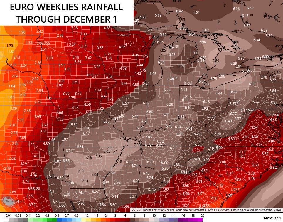
You can clearly see an active Ohio Valley storm track with that. I do expect some of that to fall in flake form and so do the Weeklies…
I’m liking this early season pattern as you can probably tell by the length of me recent posts. Y’all know I like my winter early!!
I will have updates as needed today and on my Meteorologist Chris Bailey Facebook Page
Until then, here are your storm tracking tools for the day…


Current watches

Possible Watch Areas

Make it a great Saturday and take care.

Thanks Chris. Very detailed blog this morning, but I can’t agree on all those model’s forecast for the next thirty days. It looks like the various models are not factoring in, that we are presently in the La Nina phase of ENSO. I too like my Winter weather early. A week before Thanksgiving, and the first accumulating Snow a week later, to get everyone in the Christmas Sprit. This year I have strong thoughts that it won’t happen, but in past late Autumns, where I lived before, it has.
NOAA’s latest thirty day outlook. Looks warm and dry to me. Sorry to contradict.
https://www.cpc.ncep.noaa.gov/products/predictions/long_range/lead14/
Schroeder, I think that the historic effects that are expected from La Nina, ENSO Neutral, and El Nino continue to be overwhelmed by the influence of a warming atmosphere. The fluctuations in sea surface temperatures remain the trigger for changes in the direction of the trade winds, but the continuing rise in temperature obscures the expected result. The same is true with the various indexes like AO and PDO: they continue to manifest, but we don’t see the expected result of each index on the forecast models, especially the long range climate models. The model algorithms are in some ways confused by the data on which the models run, and this will continue until the models are tweaked, again!
Exactly Joe, I think so too.
Exactly Joe, I think so too.
Joe, all the oscillations are effected by this warming of our global atmosphere, which would also alter the ENSO phases. I never thought of this. Now I know. Thanks Joe.
I like winter precipitation spread out over the season instead of one big snow.
Jeff, you would have like the Winter of 1969 -70. Where we had one Snowstorm, that started a pace spread over the entire there months of Winter. This happened in South Central Indiana, where I grew up.
Jeff, you would have like the Winter of 1969 -70. Where we had one Snowstorm, that started a pace spread over the entire there months of Winter. This happened in South Central Indiana, where I grew up.
Sorry, for duplicates Chris. I can’t explain why that happened. Hope this post go through, and prints only once. Spelling correction, three not there.
I want winter early and late spring. I just wish power bills weren’t so OUTRAGEOUS. I remember when first moving here, it would be like $60 or $70 (and it was the same in TN, and NC (where I lived before), running heat/ac without giving it a second thought. Now it’s like $250 EASY… and I know that’s nothing compared to some of your power bills.
My last month’s electric bill was only $124.00. With these pleasant temperatures during the day, and the cool nights is cheap living, except for food prices. To tell you the truth, I hope the Winter is mostly mild, but you can still have Snowstorms when it’s just moderately cold.
The one that JUST came out for me was $155. The previous month I think was like $240
Even in the winter, my electric bill almost never goes over $200.
Jeff, when it really gets frigid. I keep my thermostats at 67 degrees. When it’s just normally cold, I keep it at 65. I have no complants so far, but all prices on every item keeps increasing. Fixed income for this retired person. Could get rough, if food prices continue to go up.
Another spelling correction, complains not complants. Old eyes are getting tired. Done for the day.