Good Sunday to one and all. Our powerhouse of a fall storm system continues to push through the region today, bringing gusty winds, showers and storms with a temp crash coming along for the ride. This kicks off what looks like a really active setup for the rest of the month and into November.
Here’s what happens out there today and tonight:
- A line of showers and storms is pushing across the state very early this morning.
- A few of those storms may be strong or locally severe, but the severe threat is pretty low.
- Gusty showers will be common across central and eastern Kentucky through the rest of the day.
- Winds are a big player with or without storms with gusts topping 40mph on more than one occasion today.
- Temps have already hit the highs for the day by the time you’re reading this.
- The numbers this afternoon and early evening drop into the upper 40s and low 50s.
- Skies clear out later tonight with temps hitting the upper 30s in many areas.
- I can’t rule out a touch of frost in the sheltered valleys to start Monday, but winds may stay up enough to prevent that.
- Oh, it’s our first taste of a wind chill reading tonight and early Monday. Wind chills to start Monday will be near freezing.
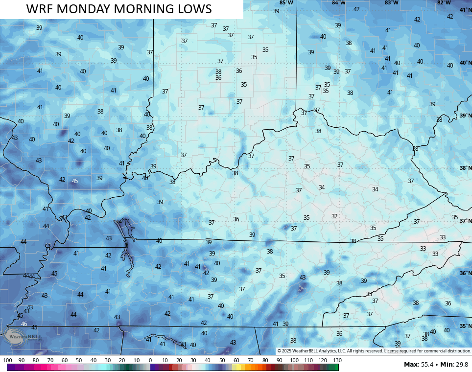
The WRF has had the “hot hand” when it comes to our cold nights of this early fall season. It currently has the coldest Monday morning lows with some areas reaching the middle 30s…
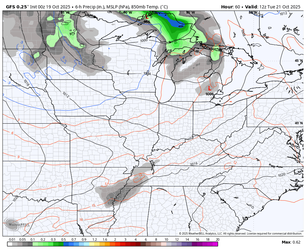
The next system sweeps in quickly on Tuesday with a gusty band of showers ahead of another fall cold front. This front gives us the chance for frost Wednesday morning and/or Thursday morning depending on clouds.
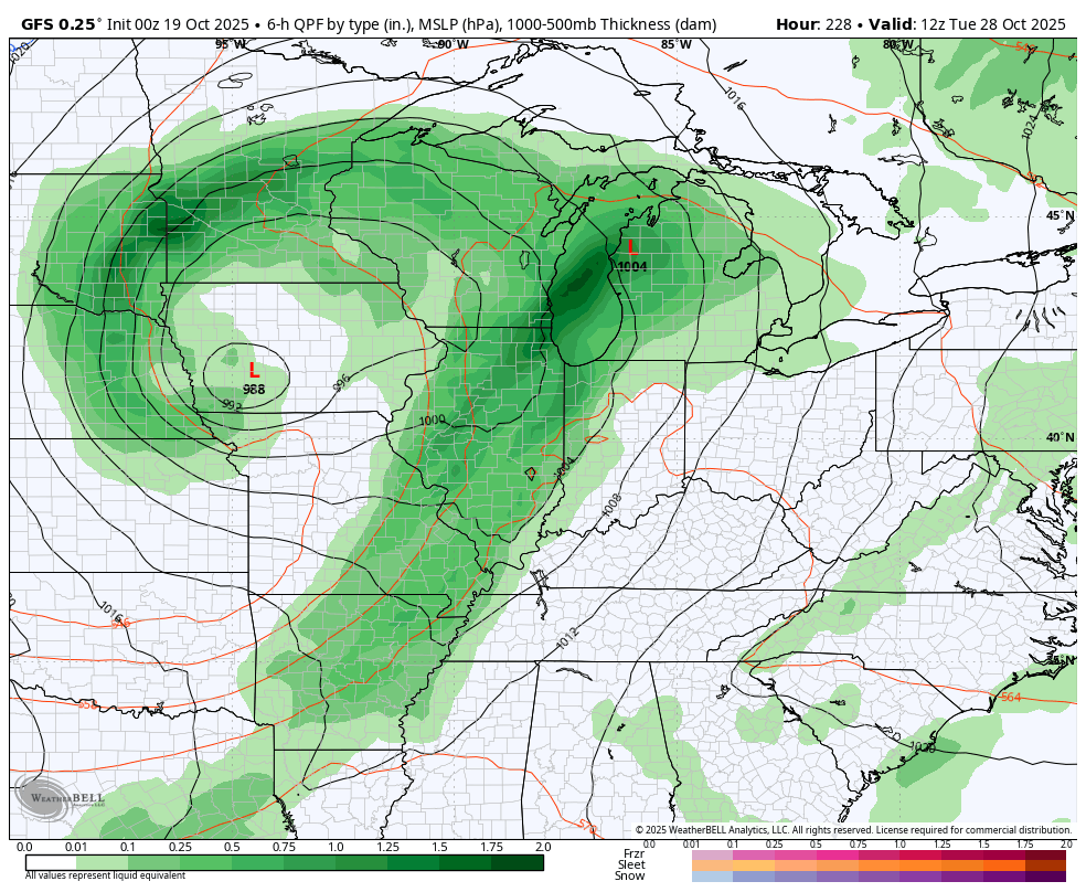
That system looks to be followed by a chilly wet weather maker next weekend. Here are both systems on the GFS…
All of this leads us into an interesting look for Halloween week as the jet stream is likely to really amplify. This is something I’ve been pointing toward for a while and now we are seeing the operational models jumping on a big storm or two that can tap some cold air.
Given how far away this is, the model swings are wild as one would expect. As you guys know, we are only looking for trends and the trend supports this.
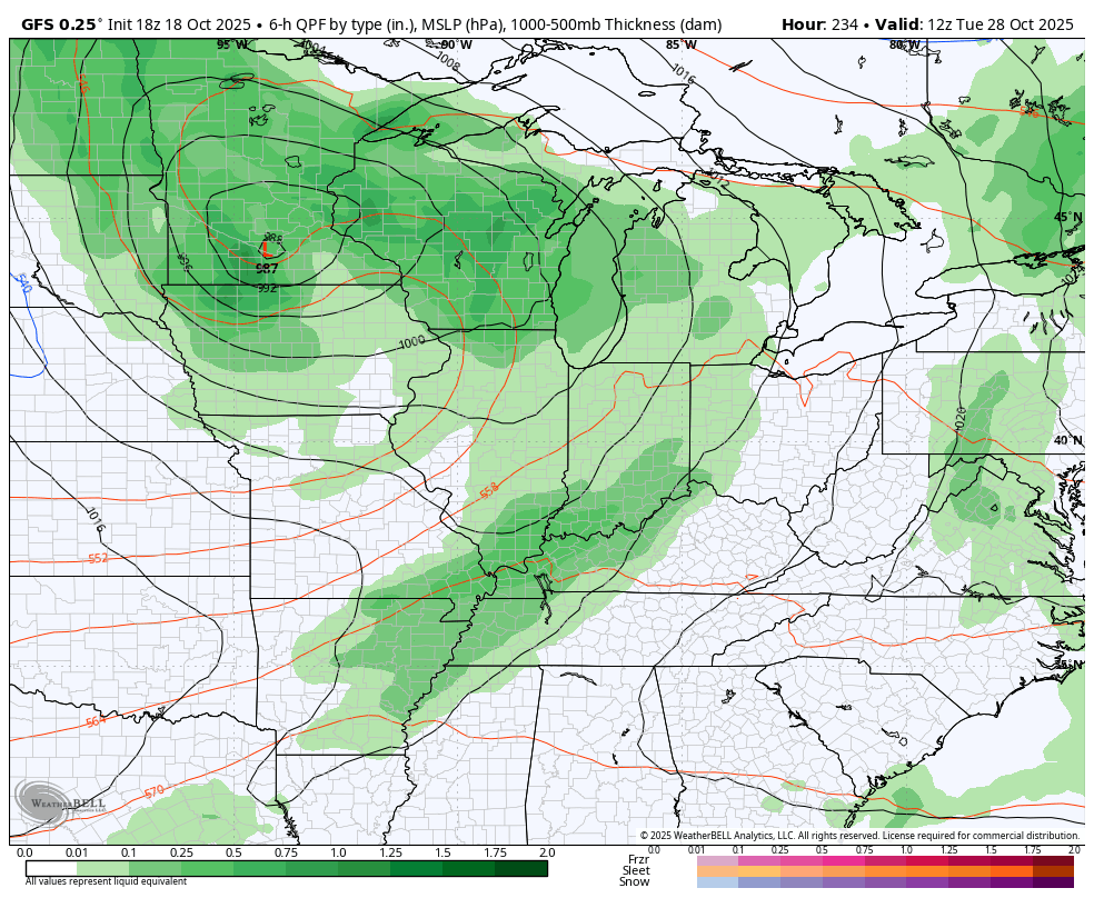
The last two runs of the GFS confirm the trends and confirm the wild swing from run to run…
I will have updates as needed today and on my Meteorologist Chris Bailey Facebook Page
Until then, here are your rain and wind tracking tools for the day…


Current watches

Possible Watch Areas

Make it a great Sunday and take care.

The rain can get outta here already.
Jeff, most areas of the state needed this rain. Taylor county is one of them.
I’ve had plenty. Don’t be dismissive.
Sorry…..forgot it’s all about you.
Come up with something intelligent to say.
The first cold front has cleared the Bowling Green area, and my PWS indicates we received 1.7 inches of rain overnight. Hopefully this signals the beginning of the end for the drought in our area. We also recorded a maximum wind gust of 31.5 mph.
Joe, we had about an inch. I wasn’t expecting much more than that. Wind gusts are terrible here. Has knocked out the power three times this morning. Glad you received a good amount of rain, as you indicated that South Bowling Green needed such. We all need to have weekly Rains or Snows through the rest of Fall and all of Winter and Spring, to really end this drought.
Joe, we had about an inch. I wasn’t expecting much more than that. Wind gusts are terrible here. Has knocked out the power three times this morning. Glad you received a good amount of rain, as you indicated that South Bowling Green needed such. We all need to have weekly Rains or Snows through the rest of Fall and all of Winter and Spring, to really end this drought.
I think there is something wrong with this lap top computer. Something that I can’t fix. LOL….
Wow what a difference a day makes yesterday 83 now 53 and dropping to the 40s tonight. Anyone want to jump in on the upcoming winter lol anyone at all????? Glad we got a little rain. Hope everyone did.