Good evening, everyone. Our massive temperature drop is here with a true blue fall blast out there today. This is kicking off a very busy pattern to end October and begin November with frost threats showing up in the week ahead.
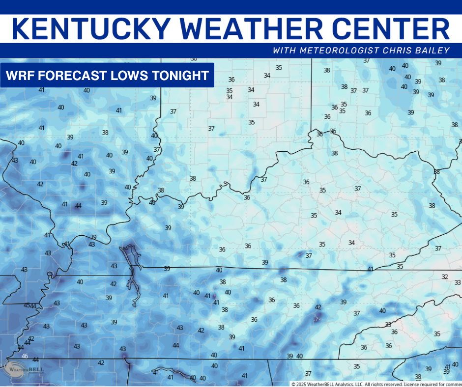
High winds are calming down now after leaving thousands in the dark today, especially in central and eastern Kentucky. Skies slowly clean up later tonight, leaving us with temps in the upper 30s and low 40s. Winds may be up too much for frost, but some patchy stuff will be possible in the colder valleys.
The frost potential would be greater if the WRF verifies…
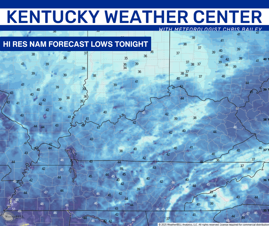
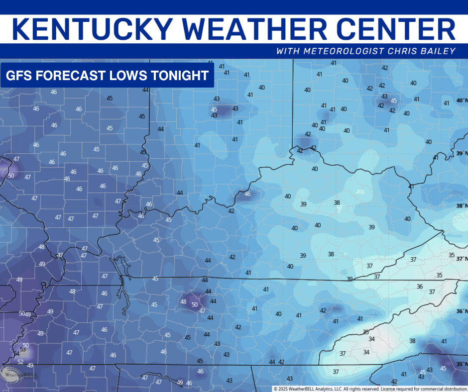
The Hi Res NAM and GFS are more in line with my thinking…
Winds will make it feel like the low 30s in many areas.
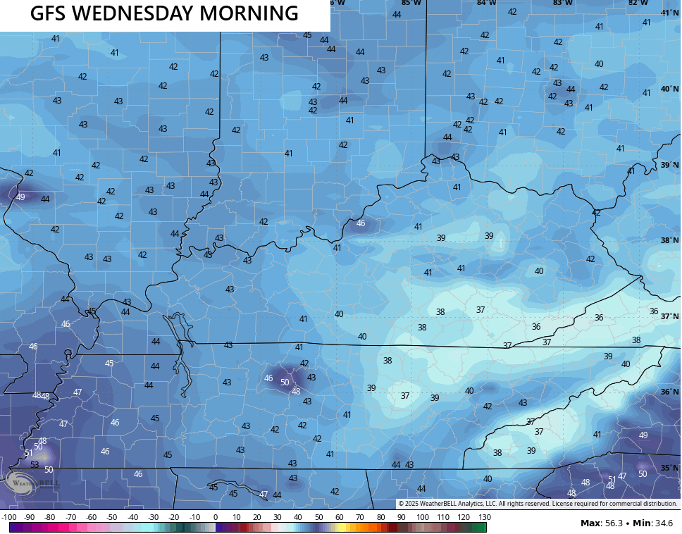
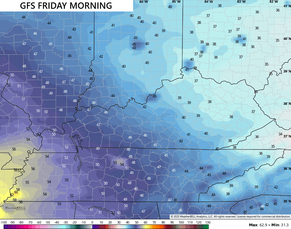
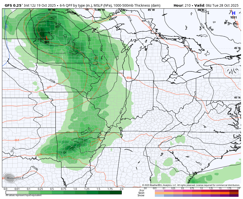
Another fall cold front arrives with a broken band of showers on Tuesday. That boundary has even colder air coming in behind it with the widespread frost possible. The best chances may now show up Thursday and Friday as some clouds may get in the way Wednesday morning.
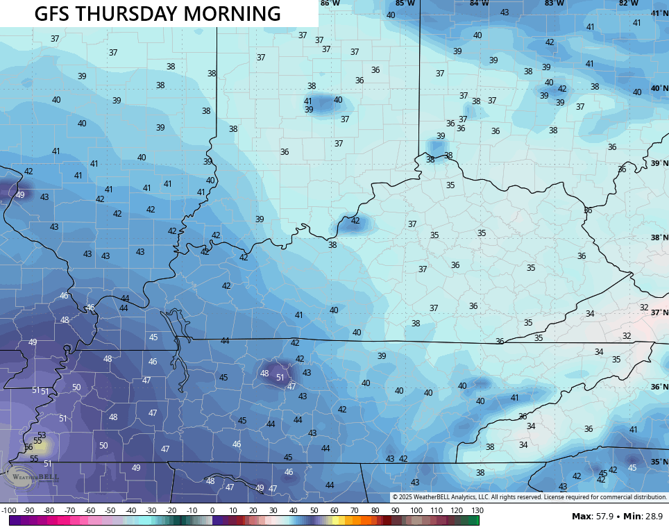
Here are the lows from the GFS…
Some of the other models are even colder for Friday with the Canadian going full blown freeze…
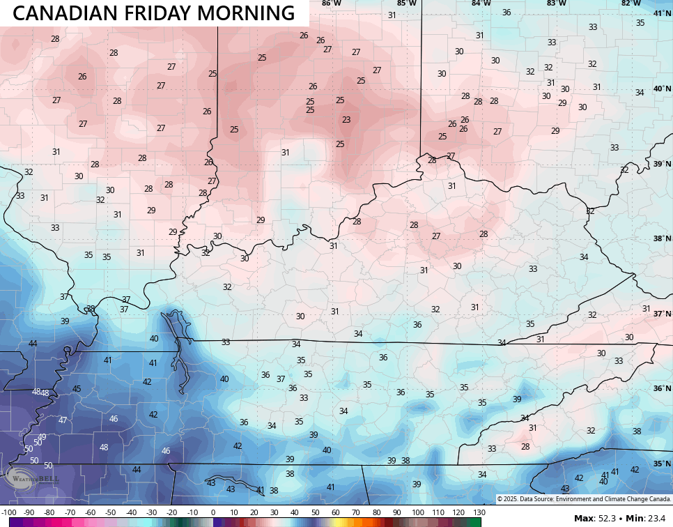
That’s probably too cold, but the ICON is pushing the freezing mark at the same time…
![]()
![]()
Friday morning’s temps depend on how quickly the next system pushes in for the upcoming weekend. This looks like a chilly shower maker…
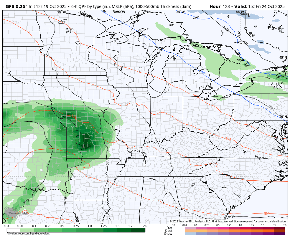
The setup for Halloween week continues to look interesting as a big storm system or two looks to spin across the eastern half of the country. These should be able to tap some cold air…
I’ll have your full update coming later tonight. Until then, here are your rain and wind tracking tools for the rest of the day…


Make it a great evening and take care.
