Good Monday, everyone. Our big weekend storm system has come and gone but it’s just the first in a series of big systems likely over the next few weeks. This pattern is also one likely leading us into a quicker start to winter as we get deeper into November.
Temps this morning range from the middle 30s to low 40s with a bit of a breeze adding to the chill. Yes, that’s a wind chill you’re feeling out there this morning.
Our next fall cold front sweeps in here tomorrow with a broken band of showers along and ahead of it. The air coming in behind it is the coldest of the season, so far, with frost threats showing up Wednesday through Friday mornings.
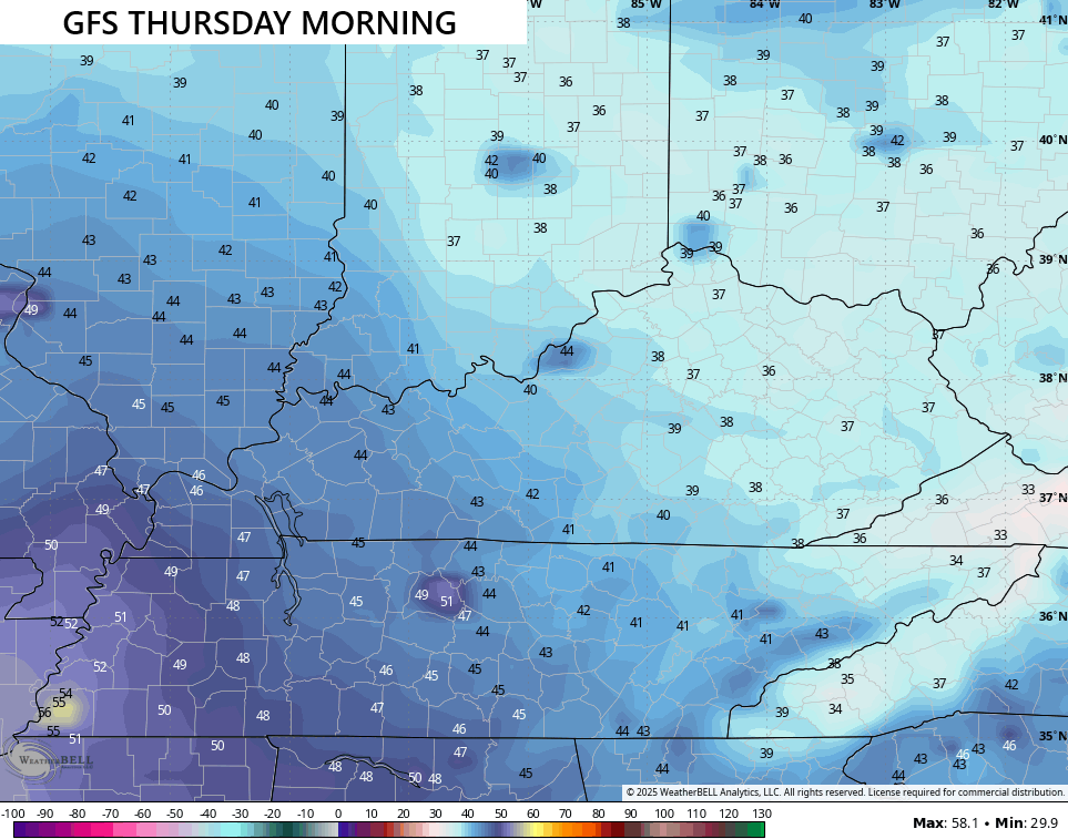
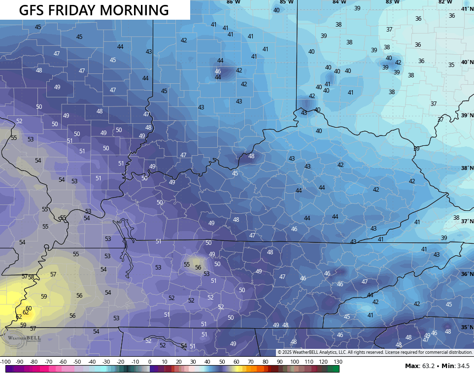
Thursday and Friday may very well offer up the best chance for widespread frost. The GFS likes Thursday morning but has clouds already increasing ahead of the next system by Friday morning…
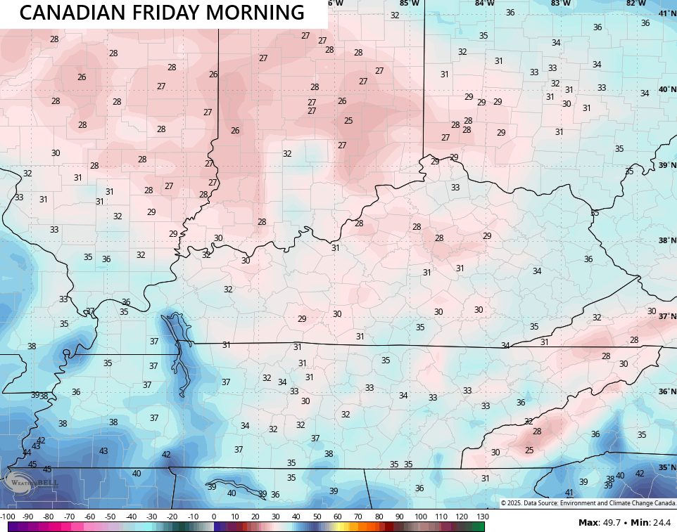
The Canadian is slower with the weekend system and tanks the Friday morning lows…
Highs this week average below normal with Wednesday likely staying in the 50s.
Our next system looks to roll in this weekend, bringing some chilly showers along for the ride.
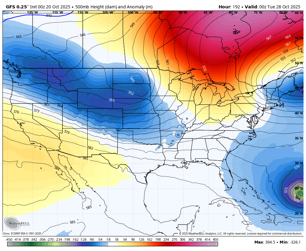
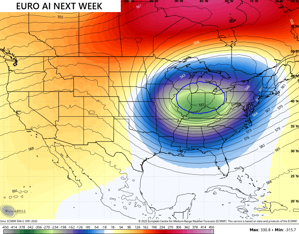
If you’re a regular reader, you know I’ve been pointing toward Halloween week for some time now. The signal has been there for a while for a deepening trough across the eastern half of the country and that signal keeps on keeping on. It’s way too early for anything specific as we are still in the “watching the trends” phase. The same can be said of the models as they change from run to run. Still, the signal is there. Check out the energy showing up on the GFS…
That matches pretty well with other models, including the EURO AI…
At the same time, something tropical system may becoming out of the Caribbean. This is something the National Hurricane Center is highlighting for development…

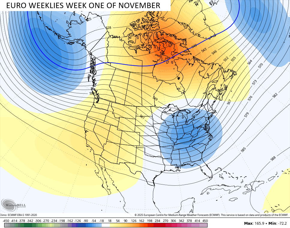
Looking toward November, we find the EURO Weeklies continuing with a consistent signal for a trough in the eastern half of the country. As we get closer, the signal grows stronger for that trough in the first week of the new month…
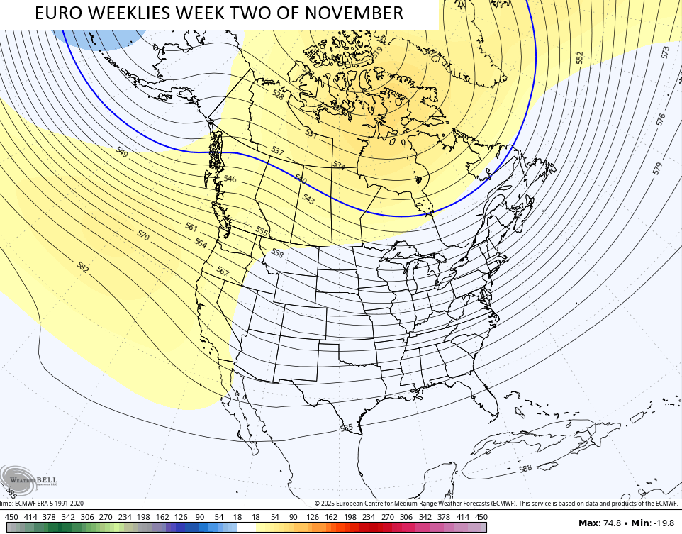
The second week…
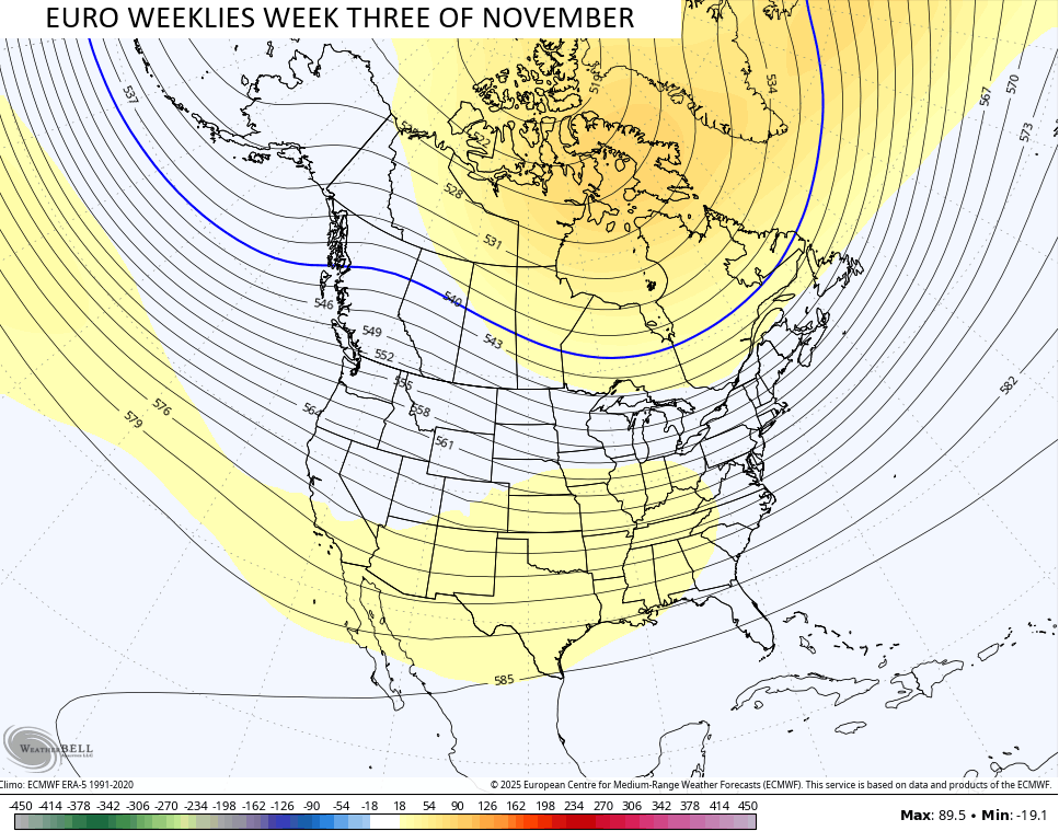
There’s the relaxation in the third week…
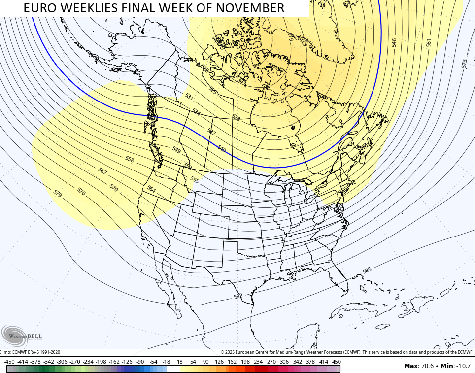
With the trough digging back in for the final week of the month…
The Weeklies now go into early December and they appear to be starting out Meteorological Winter with the trough in the east and ridging up the west coast…
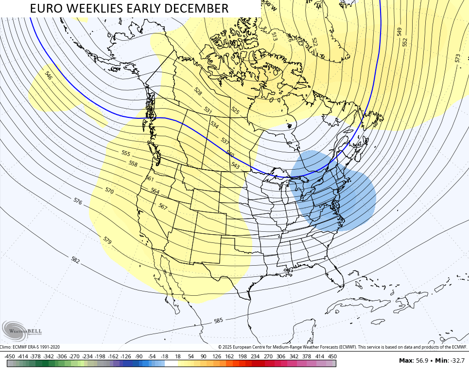
Meshes with my ideas for another quicker than normal start to winter.
I’ll have another update this evening. Enjoy your Monday and take care.
