Good evening, everyone. I wanted to drop by for a quick update on the busy pattern ahead. It’s a pattern throwing some frost threats later this week ahead of what may be a monster of a storm for Halloween week.
Before we look ahead, let’s look back at our Sunday and a weak tornado that touched down just west of downtown Nicholasville. This wasn’t your typical tornado as it came from a cold air funnel that actually touched the ground for about a minute. Here’s the information on the EF-1 tornado…
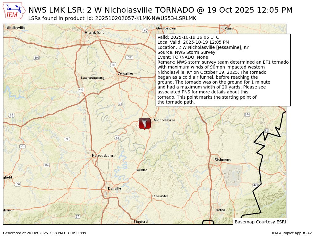
That happened with temps in the upper 50s. How crazy is that?
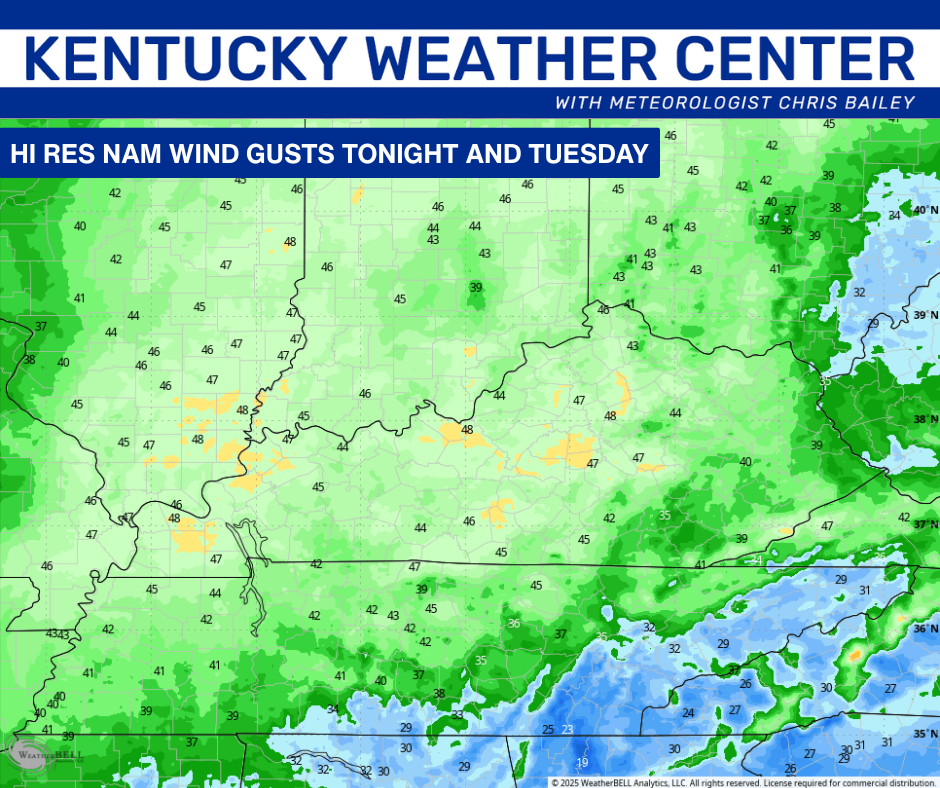
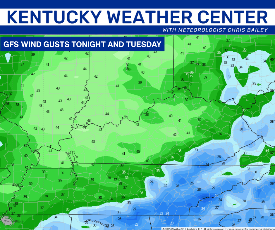
Speaking of crazy, the winds are blowing right back in here later tonight and Tuesday. Gusts to 40mph will be possible…
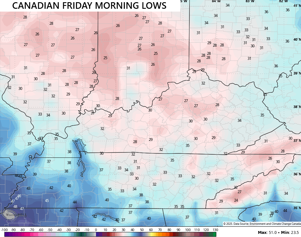
Those winds are blowing much colder air into town with the potential for patchy frost Wednesday morning and the chance for widespread frost Thursday and Friday mornings. The Canadian Model continues to throw below freezing temps at us Friday morning…
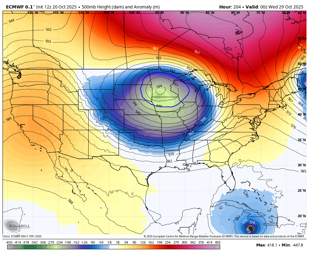
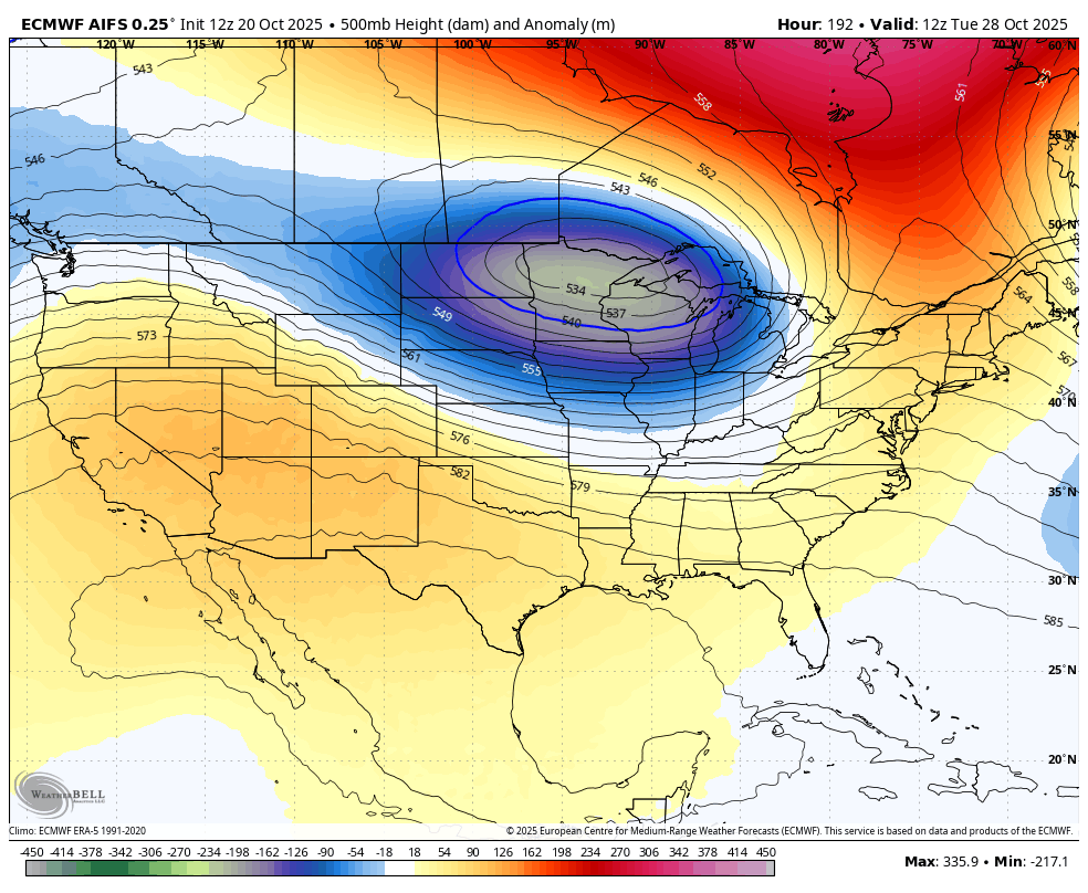
Showers move in for the weekend with the setup for Halloween week that continues to look a little ugly. This is the look of a monster storm…
EURO
EURO AI
Enjoy the evening and take care.
