Good Tuesday everyone. It’s another windy day across Kentucky as a cold front sweeps across the state. This unleashes cold temps with the likelihood of frost before the week is over, meaning Green Thumbs are on alert. Beyond this comes a very active looking pattern.
Winds are gusting out there today with 30mph-35mph gusts possible. There’s the chance for a shower or two zipping across eastern Kentucky ahead of our front…

Colder winds tonight and early Wednesday mean a wind chill that can dip below the freezing mark. This wind chill animation starts at 8 this evening and goes through 8 Wednesday morning…
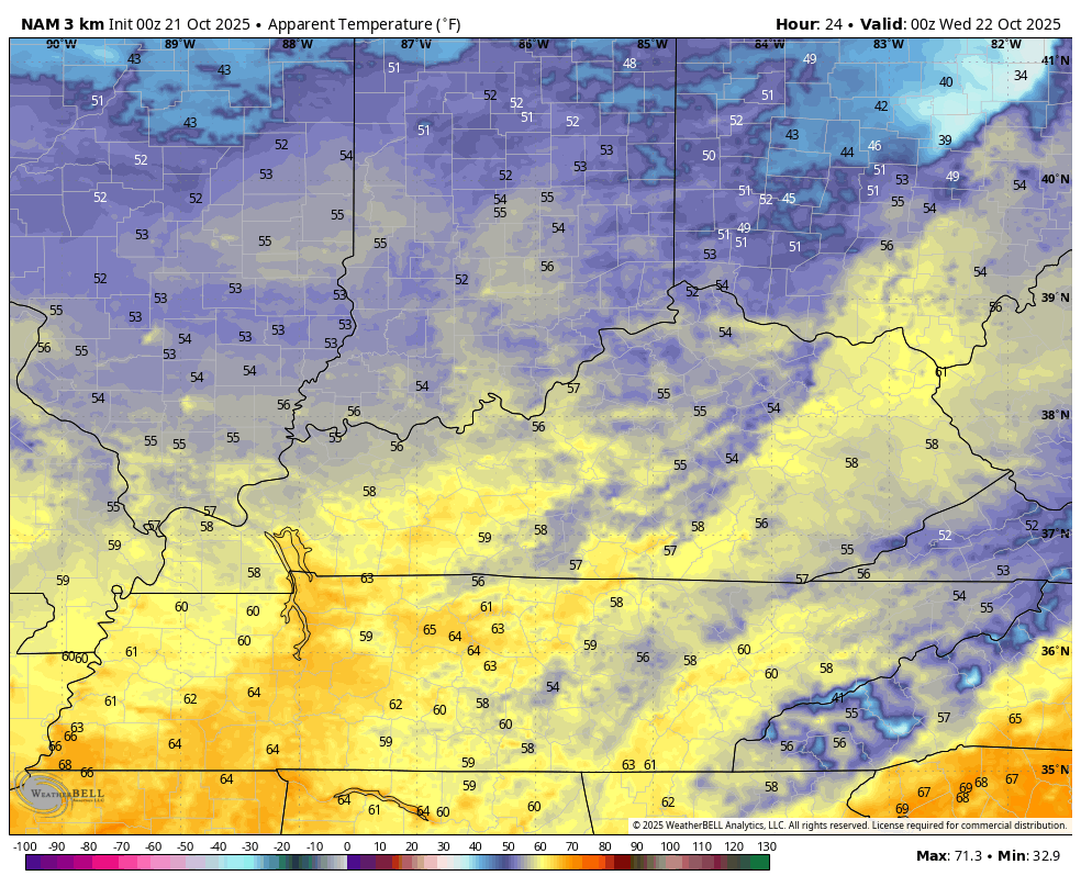
The rest of Wednesday is very chilly with many thermometers staying in the 50s for highs. Gusty winds will make it feel rather blustery at times.
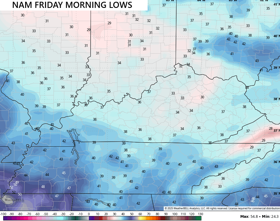
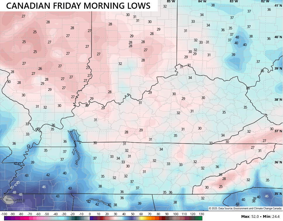
Widespread frost is likely as temps drop deep into the 30s, especially across central and eastern Kentucky with the best chance coming Friday…
A weak system then spins in here over the upcoming weekend with a few showers possible, but the cold high to our northeast may hold stronger than I originally thought and keep us more on the dry side.
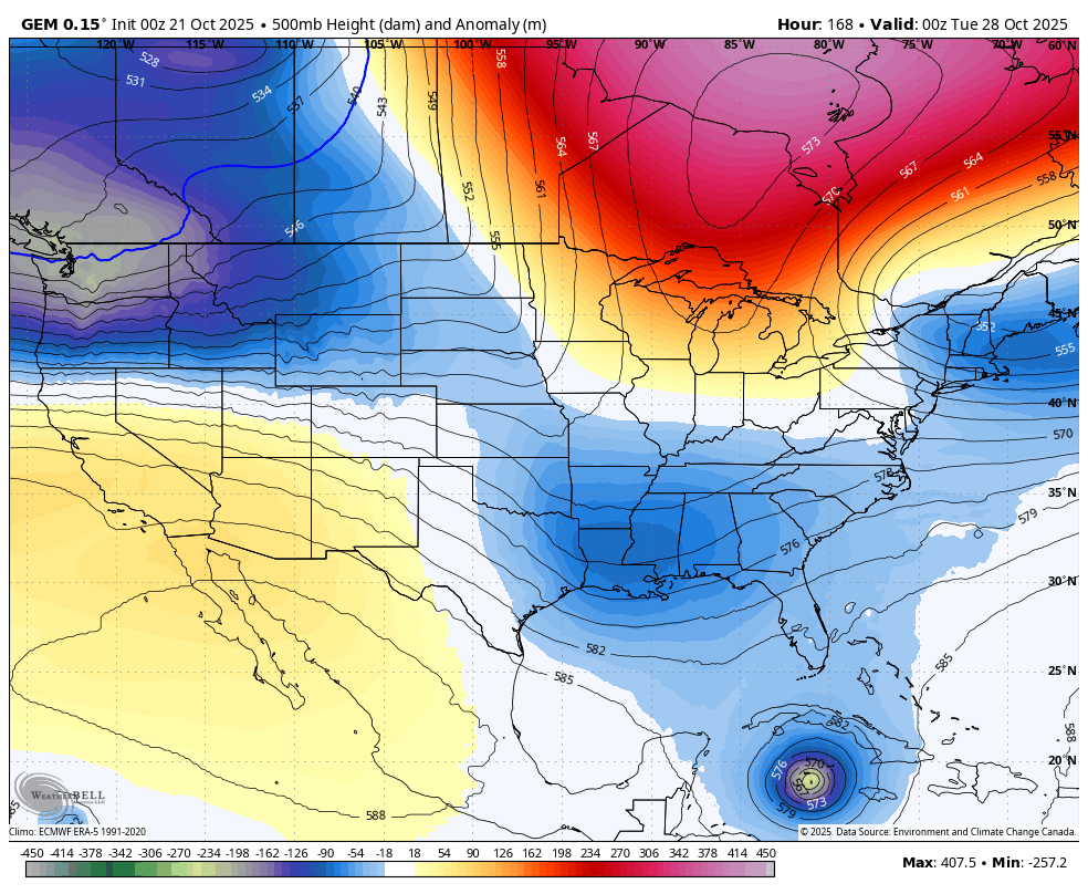
Halloween week has a lot of potential across the eastern half of the country with a big time blocked system developing…
Something to consider is the likely tropical system developing in the Caribbean…

Can this interact with that deep system, or does it follow the seasonal trend and curve out into the open Atlantic?
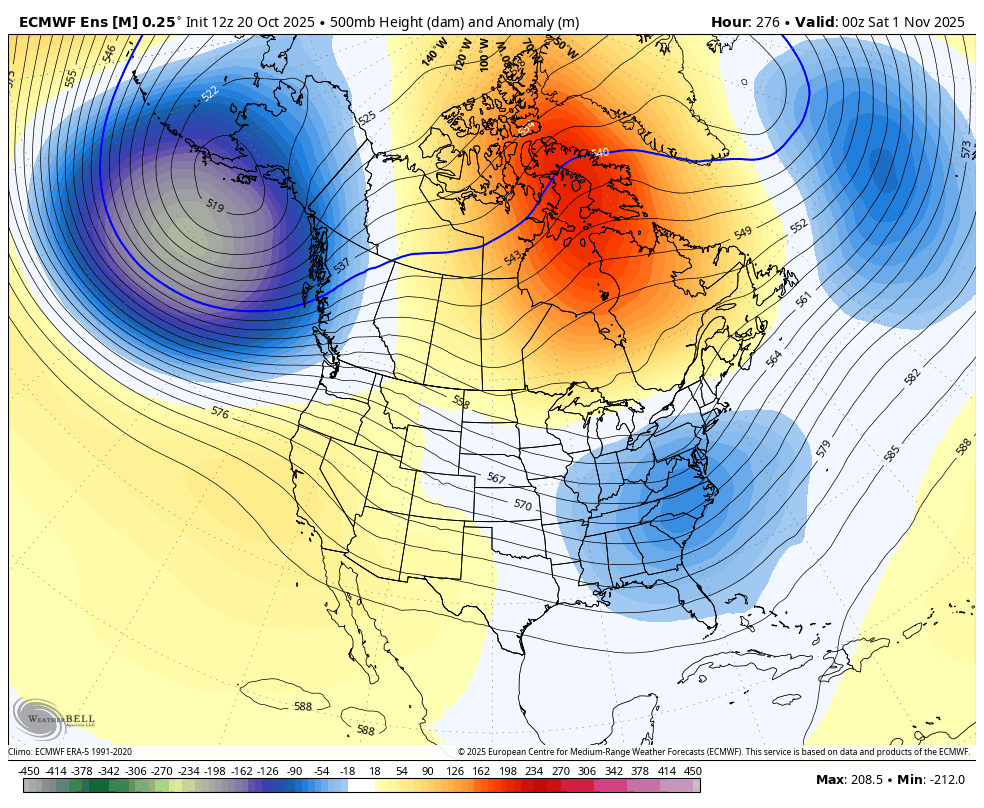
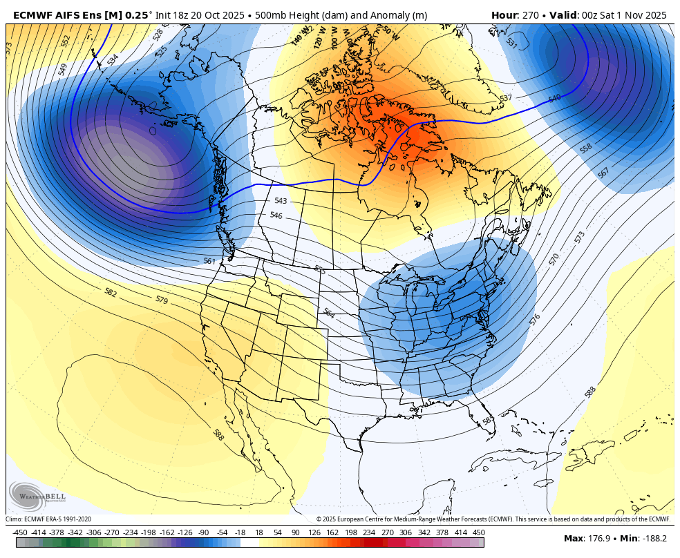
Looking into the start of November and we find the increasing signal for a deep trough in the eastern half of the country. This is something all the Ensembles are all agreeing upon…
EURO Ensembles
EURO AI Ensembles
GFS Ensembles
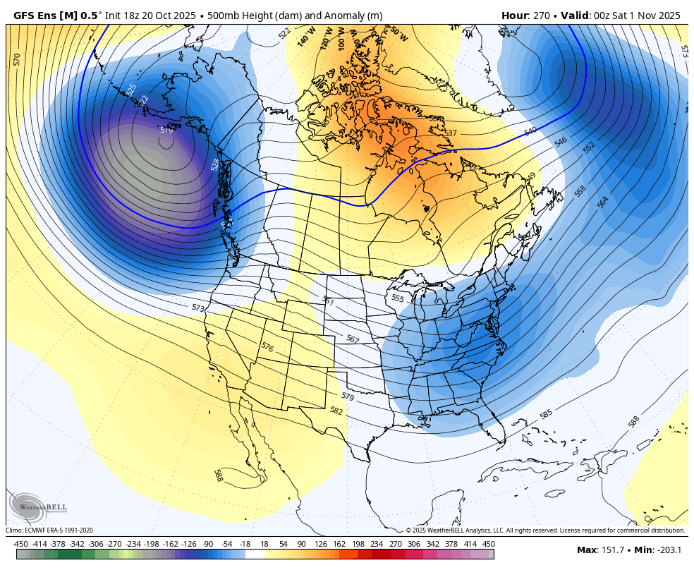
If you’re a fan of winter, that’s a good sign for the potential for some early season fun in November.
I’ll throw you another update later this evening at some point. Make it a terrific Tuesday and take care.

Thanks Chris. We had a light frost yesterday morning, so Autumn weather is here, and the trees are showing more color around my home. With the winds coming up, I expect the trees will become dormant soon, with lots of leaves to rake around my home.
Tropical Cyclone Melissa is forecast to become a category 1 Hurricane before hitting Cuba, then move Northeast into the Atlantic.