Good evening, everyone. Gusty winds continue to blow across the Commonwealth as much colder air pours in from the west and northwest. This cold air sets the stage for frost and even the potential for a light freeze by Friday morning.
The chance for some patch frost is there in the coldest valleys Wednesday but a much better threat for some frost shows up Thursday morning with temps in the 30s for areas with clear skies…
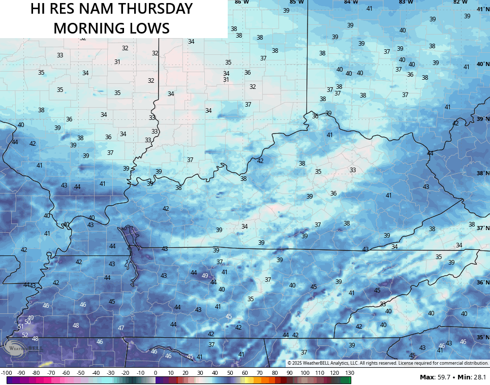
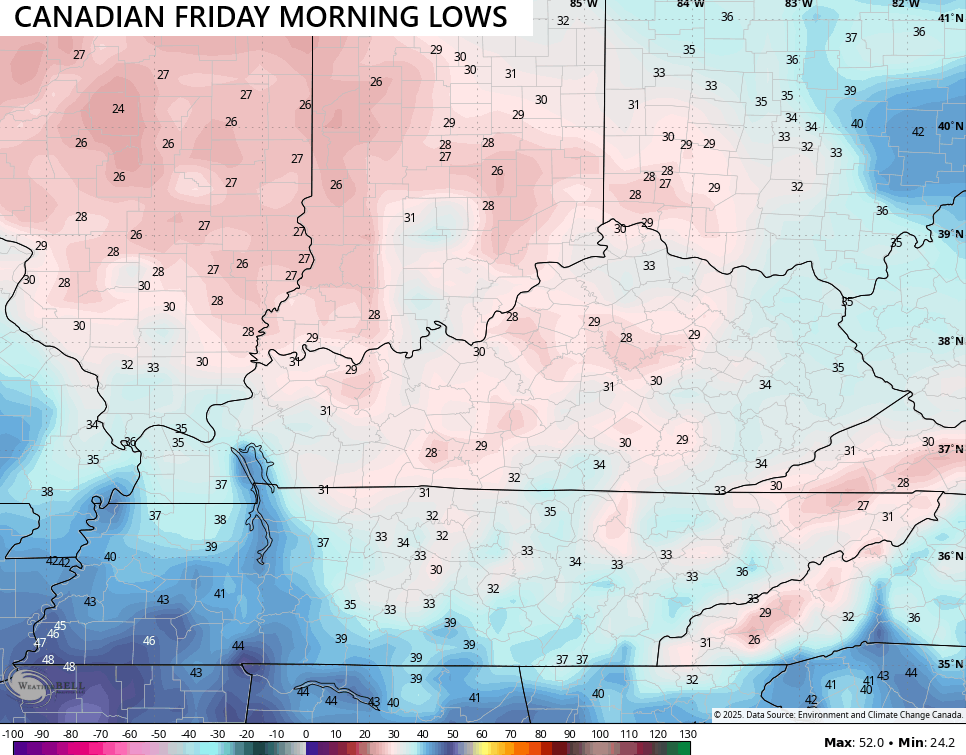
Thursday night and Friday morning features the coldest of the season, so far, with the chance to dip to freezing or a tad below. Of course, we have to have clear skies for that to happen, but several models think that’s possible.
The Canadian has been leading the charge with the potential for some upper 20s and it continues to do so…
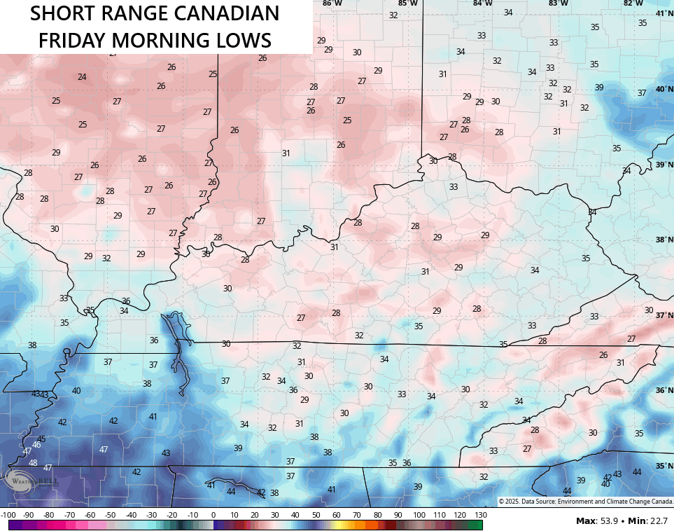
The Short Range Canadian looks similar…
Other models aren’t as cold but take us into the low and middle 30s.
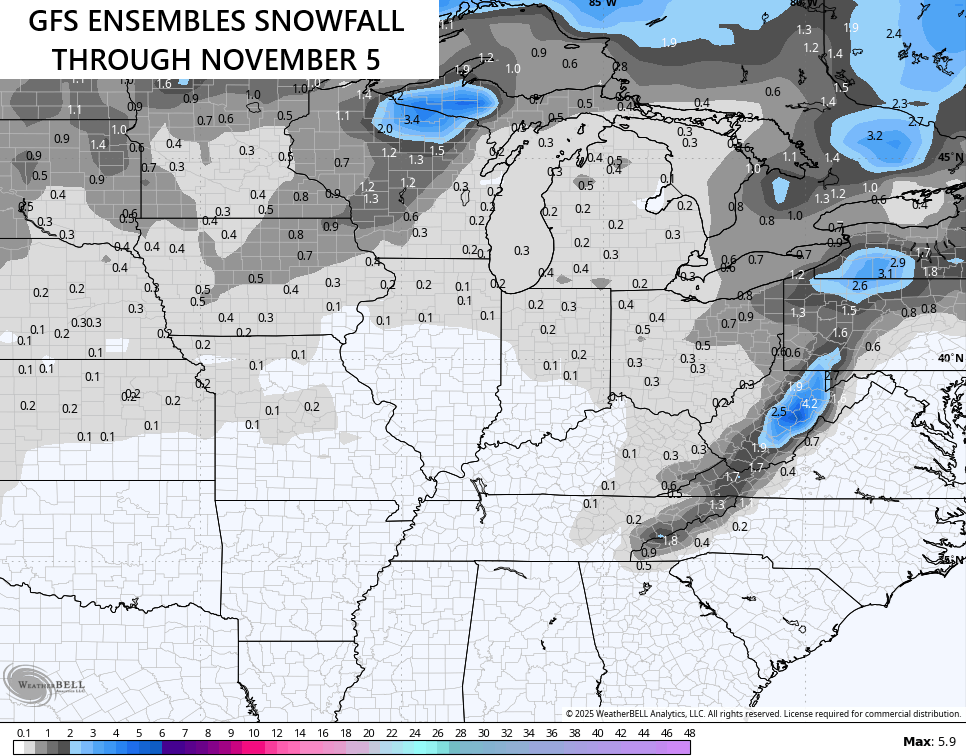
The weekend continues to look more dry than anything else ahead of the potent Halloween Week storm system. That’s likely to be followed up by a deep trough in the eastern half of the country to open November and we have the ensembles seeing the chance for some early season flakes…
I’ll get into all that with the full update later tonight. Enjoy the evening and take care.
