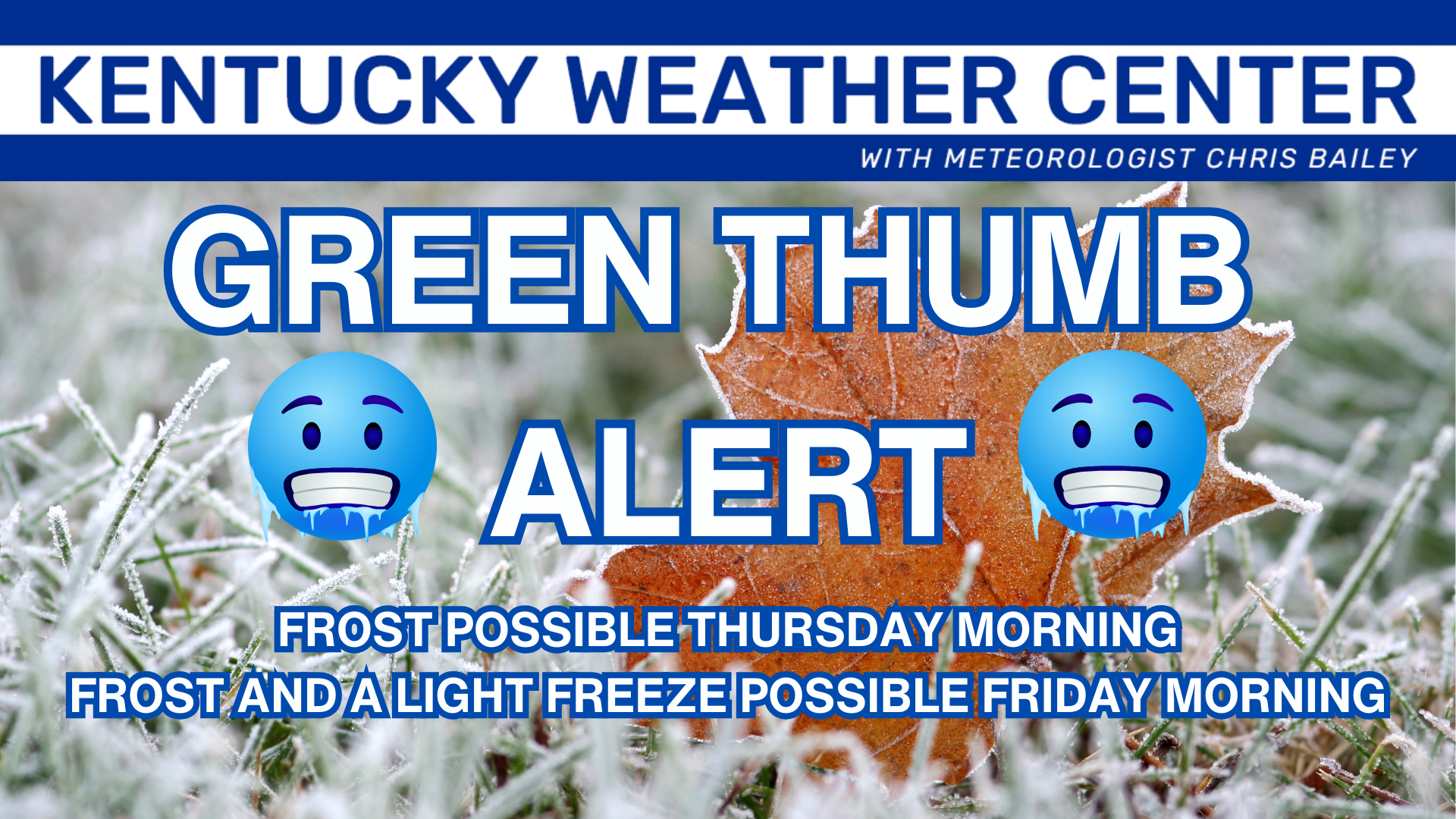
Good Wednesday to one and all. Cold winds continue to blow across the region and that wind is blowing in the coldest air of fall, so far. This means we are officially putting out a Green Thumb ALERT for the next few mornings.
Here’s a breakdown of this cold shot:
- Temps today are generally in the 50s with gusty winds making it feel pretty darn chilly.
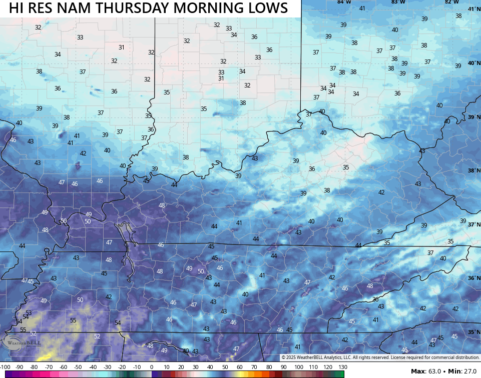
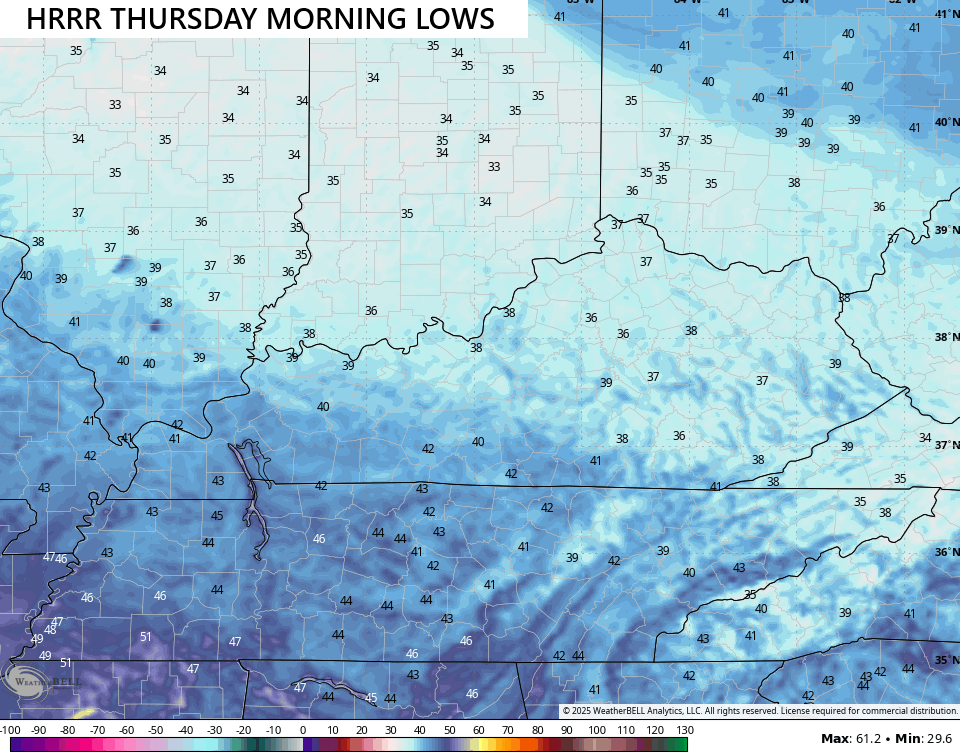
- Patchy frost is a good bet for many tonight and early Thursday as temps drop into the 30s.
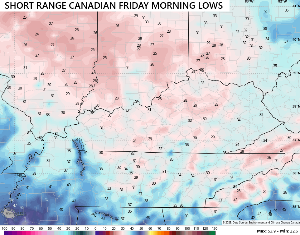
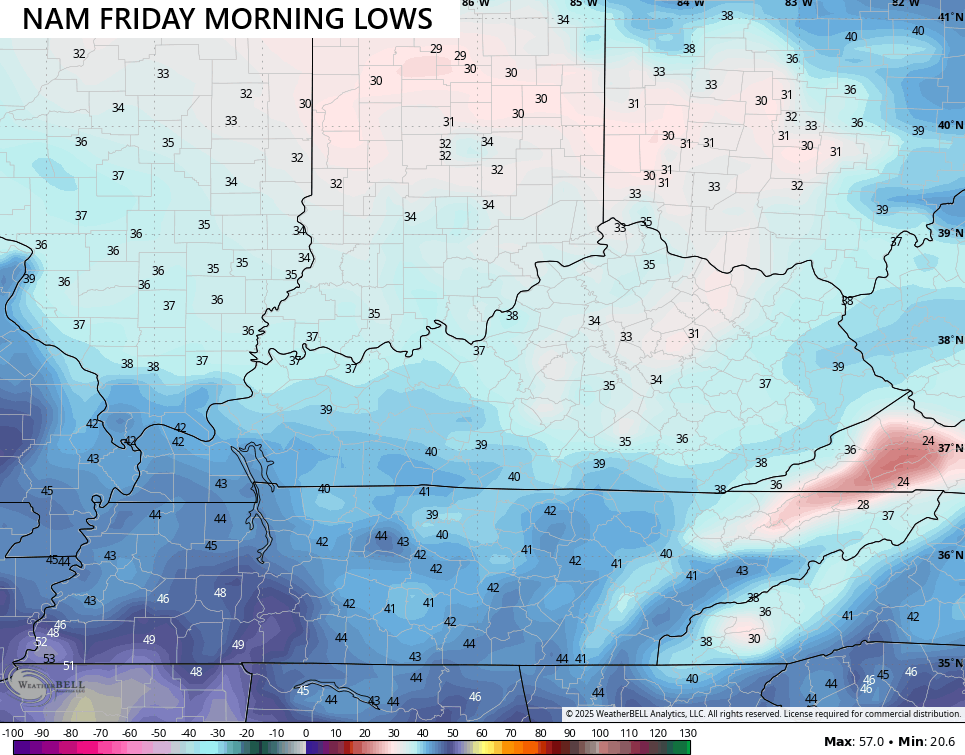
- Friday morning looks to bring us widespread frost and a light freeze.
- With clear skies Friday morning, temps can drop into the upper 20s and low 30s in some areas.
- Areas with any type of clouds will be above freezing.
- Another frost threat is likely Saturday morning across central and eastern Kentucky.
Here’s a look at some of the forecast lows for Thursday morning…
The models are colder for Friday morning, giving us the chance for that light freeze…
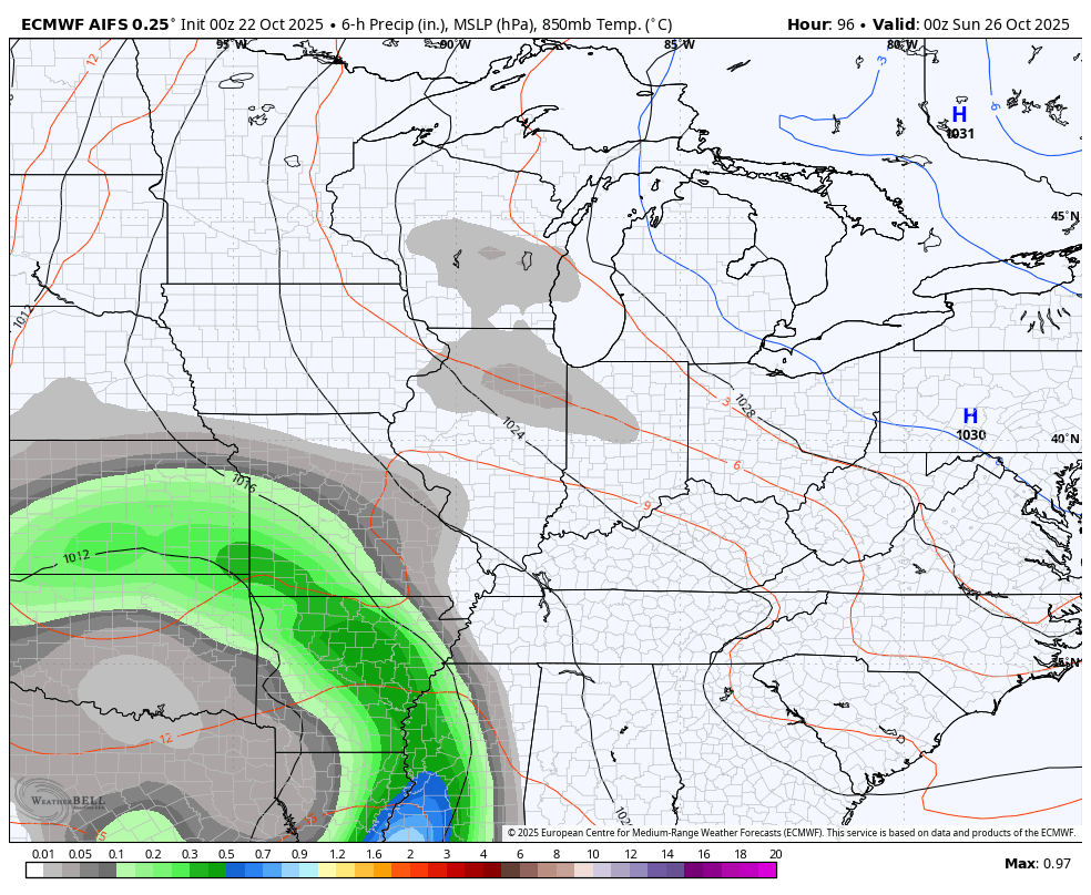
This will be followed up by a mainly dry Saturday with the chance for some showers sneaking in Sunday into Monday as an area of low pressure moves in. This system is still a bit of a question mark, but I think the EURO AI is picking up on this much better than some of the other models…
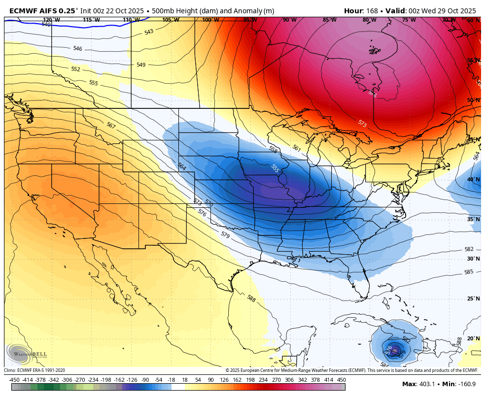
You can see the start of the bigger system working in behind that as the pattern cuts off a big storm system in the eastern half of the country…
As all of this is happening, we have Melissa on pace to become a hurricane down in the Caribbean…

I don’t think that gets directly involved with the trough in the east and should head toward the open Atlantic.
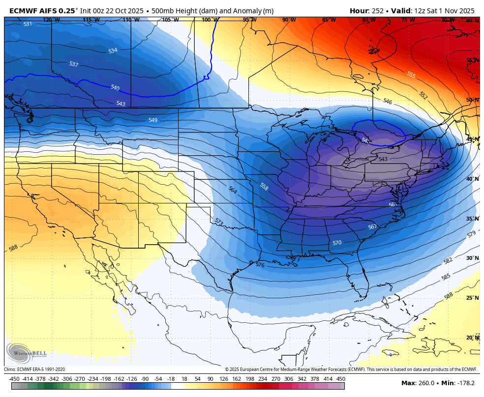
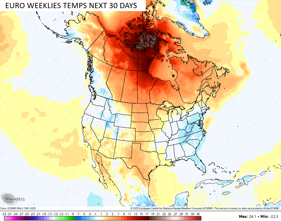
Early November continues to take on a winter look with a pretty darn deep trough in the east…
Looking at the EURO Weeklies for the next month, they continue to grow more emphatic with a trough in the eastern half of the country…
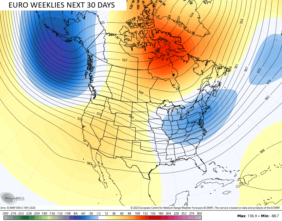
You’ve heard me talk many times before about how the Weeklies struggle to see troughs and colder than normal temps, so it’s impressive to see them showing an increasing area of below normal temps around here during that same 30 day window…
Notice how warm Canada is during this same period? This reminds me a lot of the pattern of the past few years that led to all the wildfires up in Canada.
In terms of this trough possibly producing early season winter weather around here, you already know I’m pretty keen on the chance for early season flakes. The total run of the EURO Weeklies through December 5th look like this…
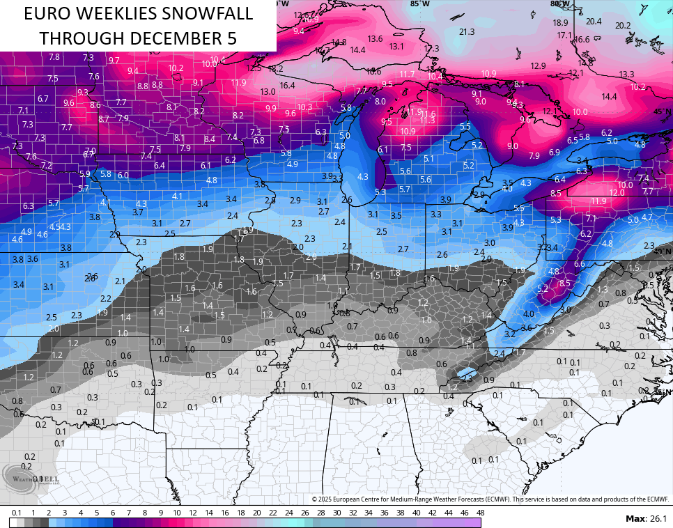
Bring. It. On.
Let me end this with a shoutout to the Mr. Rouse and his “Bluegrass Land and Life” class at Lafayette High School in Lexington. They had me come by and talk to the class about my passion that is Kentucky Weather. Believe it or not, they read KWC in class every single day…


Shoutout to the “Winter Is Coming” teachers, too. Shouldn’t I get something as part of my NIL deal with those shirts? HAHA
I’ll throw you another update later today. Until then, make it a wonderful Wednesday and take care.

I hope the early flake prediction totally busts.
After you said that Jeff, I’m hoping for tons of Snow this Winter. LOL…
Just not when I have to drive in it. 🙂
Thanks Chris. Glad that I was wrong about not having frost this month. With all those troughs, an early Snow event is very possible. A huge high pressure near Hudson Bay is holding and forcing the frigid Arctic air into China and Russia for now.
Very glad to see all the young students, that may be interested in studying Meteorology. If I was just starting out, I would have majored in Meteorology, but Agriculture is very important too.
Discussion on Tropical Cyclone Melissa :
https://www.weatherstreet.com/hurricane/2025/Melissa.htm