Good Thursday to one and all. Frost is on the some of the pumpkins this morning with a widespread frost and light freeze by Friday morning. As the growing season ends, we turn our attention toward a very active setup to end October and begin November.

Temps are in the 30s with that bit of frost to start today. Sunny skies and windy weather will be noted again today with upper 50s and low 60s for most of the state. This sets the stage for frigid temps tonight and Friday morning with some areas hitting the upper 20s and low 30s.
Expect Freeze Warnings to go up for many…

Friday afternoon temps may be down a bit compared to today as some clouds sneak in from the west.
Those clouds will thicken on Saturday with the chance for a few late day showers across the west. That’s ahead of a system rolling in with some rain for Sunday and Monday…
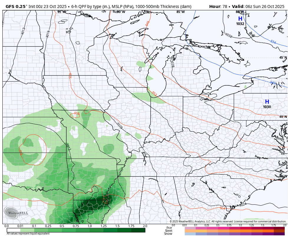
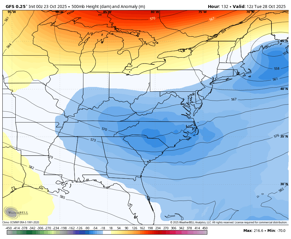
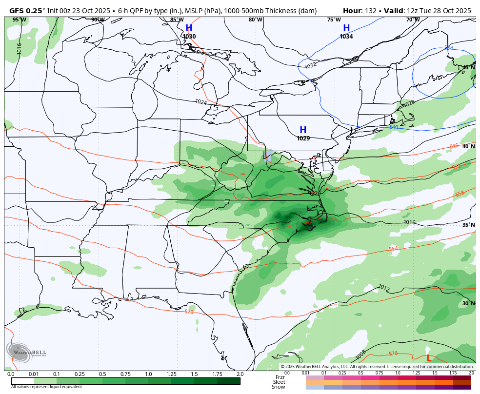
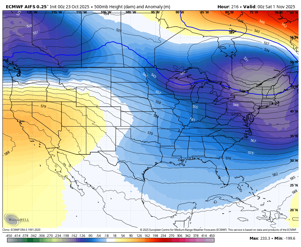
Behind that comes our big system digging into the eastern half of the country for Halloween Week. The models are, as expected, struggling with how to handle this setup, but a hefty storm system is likely to develop.
The GFS is very likely too progressive with this whole setup…
The new EURO AI actually looks quite a bit like the GFS…
Complicating things even more is soon to be Hurricane Melissa down in the Caribbean. Melissa is not going to move much at all as it works across super warm waters in the coming days…

That has the potential to become an absolute beast as it slams Jamaica and, perhaps, Cuba into early next week. I still think this finally lifts toward the open Atlantic, but this monster system in the east may try to tug this thing a bit west.
The first week of November continues to look cold with a deep trough in the east…
I’ll update things later today so check back. Make it a great Thursday and take care.

Thanks Chris. That large trough over the Eastern CONUS, looks as though it’s been amplified, like the high pressure systems this past Summer, and this Fall. This light freeze coming up will not end the growing season, but that may be coming soon. By the looks of the trough ( European Model ) some areas of the Eastern CONUS may receive their first major Snowstorm.
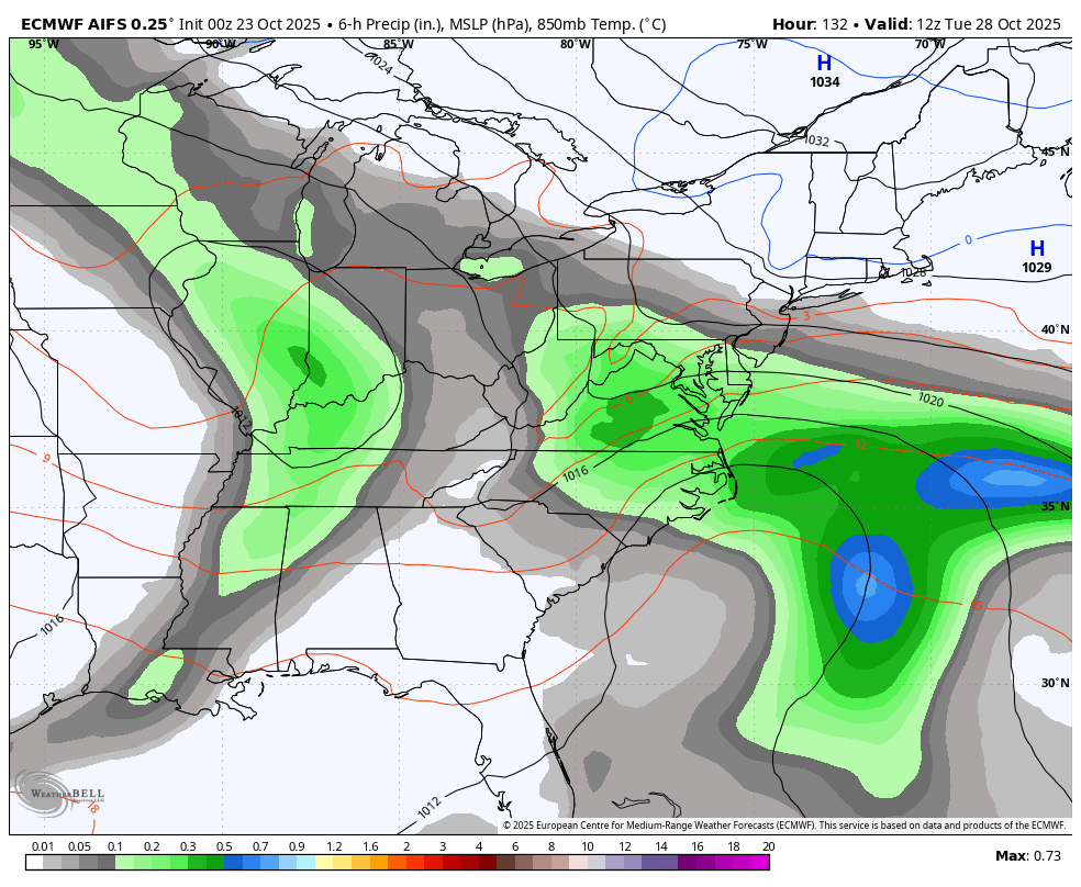
Tropical Cyclone Melissa is forecast to become a Category 4 Hurricane. The Hurricane is expected to stall before turning North, because of high pressure blocking in the Gulf of America. The storm may phase with the trough along the Southeast. That may bring our area a long wet period. We shall see how all this plays out.
The southern Caribbean where Melissa is positioned is the only area in the equatorial Atlantic where tropical development can proceed. Surrounding sea surface temperatures are 4 to 5 degrees above normal, it sits in an area where upper and lower steering winds are essentially null, and strong shear exists to the west and north into the Gulf of Mexico and the northern Caribbean. It is the “perfect storm” in the perfect place, and could easily grow into a strong Cat 4 to Cat 5 system, but the further north it meanders, the more likely it will rapidly lose strength.
Joe, it will probably phase with that huge trough over the entire Eastern US. I hope that we may receive several rainy days from the remnants. That would end this awful drought in my area.
Here’s more detail information, as to what will happen with T. C. Melissa :
https://climateimpactcompany.com/north-atlantic-basin-10-day-tropical-monitor-melissa-remains-a-ri-candidate-2-2/