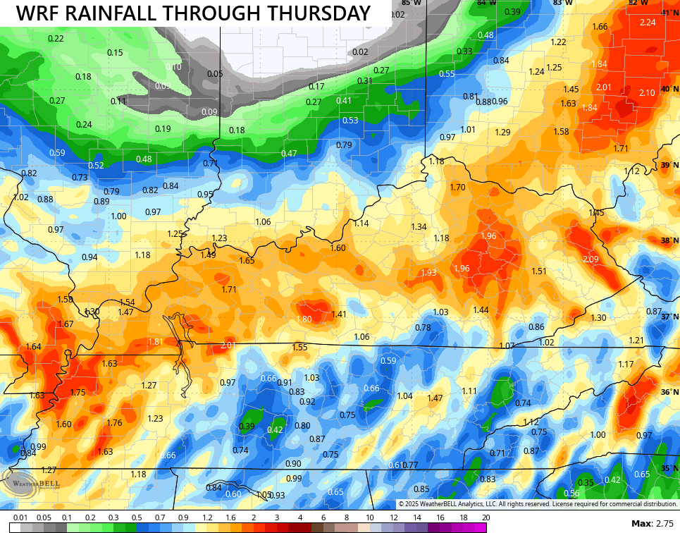
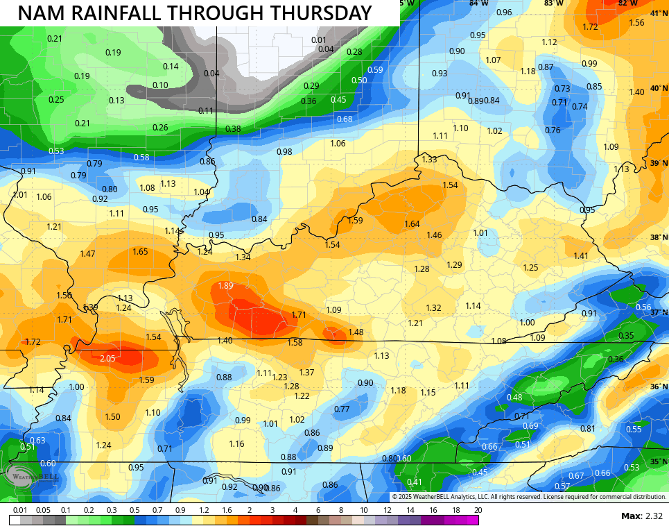
Good Wednesday to one and all. Today is a full-blown super soaker of a weather day across Kentucky as a potent fall storm system pushes through. This brings the chance for a little too much rain to go along with gusty winds and chilly temps.
Rounds of heavy rain spin around low pressure rolling through the Tennessee Valley today and tonight. This low wraps up to our east and northeast Thursday and brings a serious wraparound band of showers across central and eastern Kentucky.
A general 1″-2″ of rain is likely with the potential for locally higher amounts. The models continue to indicate this widespread heavy rain event…
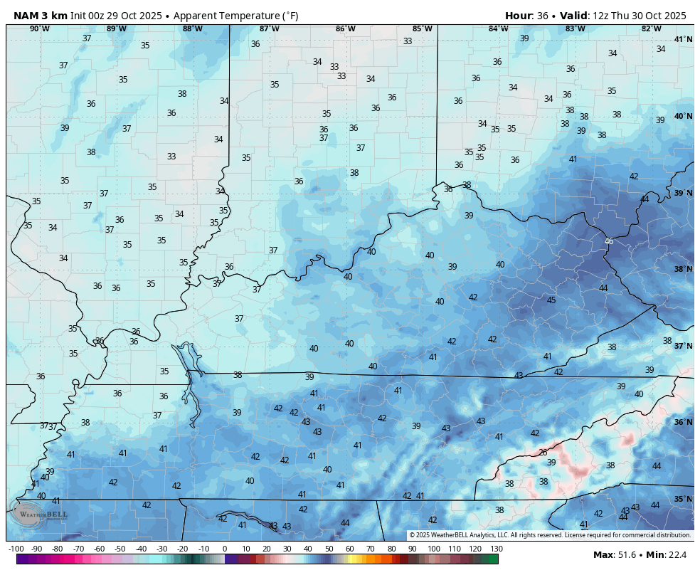
Wind gusts will be near 30mph or a little greater today through Thursday. Highs today stay in the upper 40s to low 50s but will feel a little colder courtesy of that wind. Overall this is a really nasty weather day and that looks to continue into Thursday, especially in the central and east.
It’s so nasty that wind chills come into play. Check out the wind chill forecast from the Hi Res NAM from 8am Thursday to 8am Halloween…
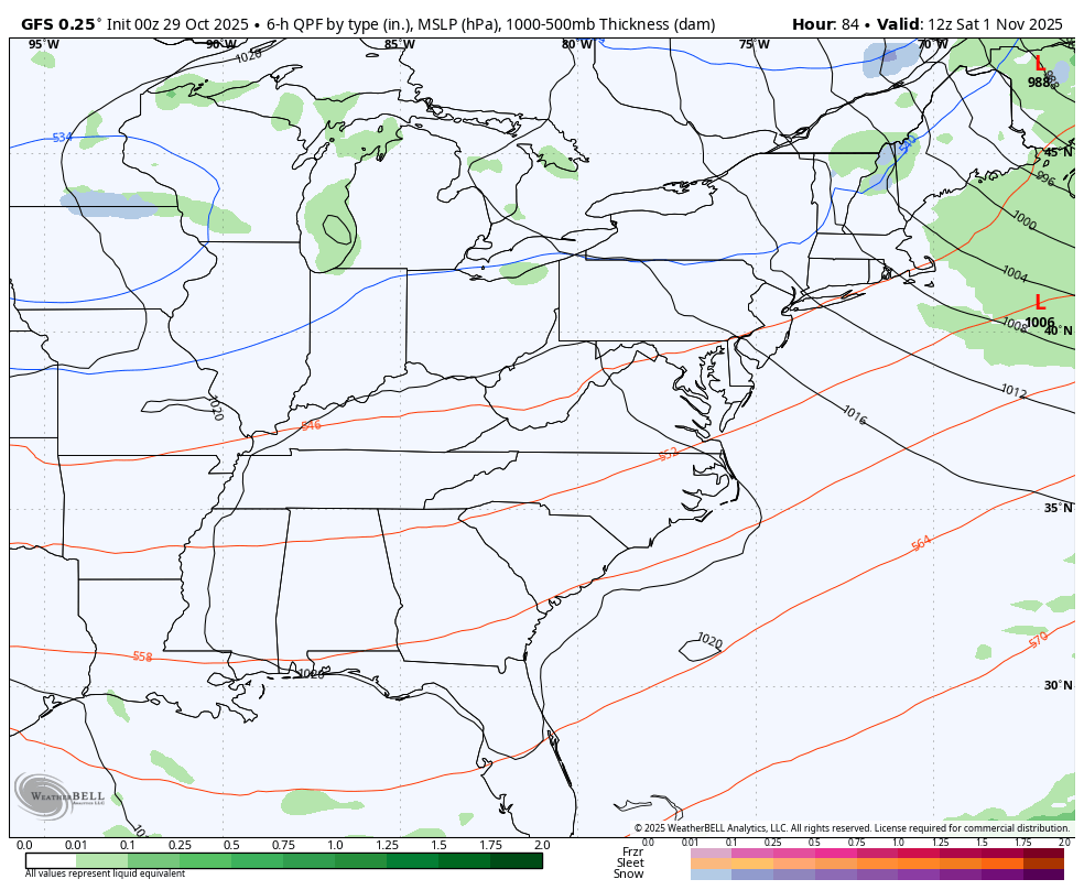
What happens after this continues to be a question mark as a couple of systems drop in from the northwest. The models continue to struggle with these troughs in the east. The GFS keeps showing a bit of a cutoff low that ejects out and attempts to hook up with another system dropping in from the northwest…
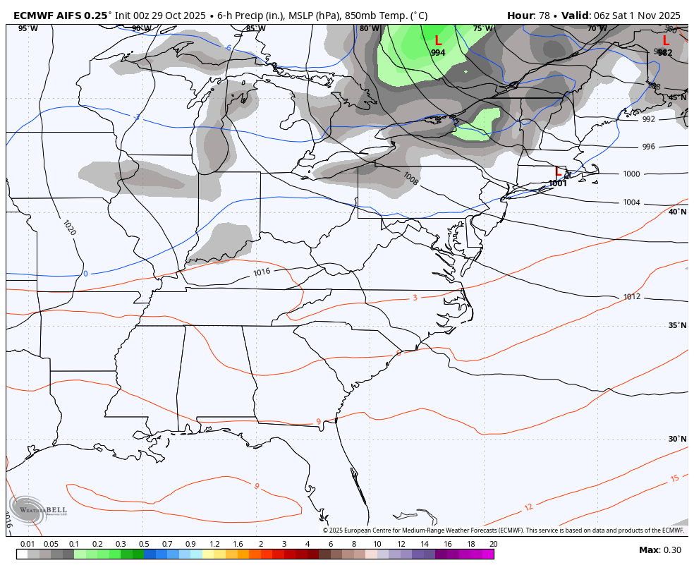
The EURO AI has a similar look…
I will have updates as needed and on my Meteorologist Chris Bailey Facebook Page
Until then, here are your rain and wind tracking tools for the day…


Make it a great Thursday and take care.

Yuck
It’s so crazy that not long ago we were incredibly dry….. and yet here we set at 53 inches of rain for the year. I know we’ve had other wet years but I don’t ever remember any of those other wet years having a long dry period like we had this year.
Mark, it has definitely been a year of extremes in both temperature and rainfall. I was looking at my PWS YTD rain totals, which currently sit at 56.95 inches. I need to take a deeper dive at the data, but I would not be surprised to see that 75-80 percent of that rainfall took place in April and May. Those extreme swings will continue through the foreseeable future, which is why we should expect to see severe weather outbreaks taking place in any month of the year, instead of during two specific seasons.
At least were not getting the rain all at one time that usually happens. This system is one of those rare all day slow soaker and has this been in January we be getting a snow thumper.