Good Thursday, everyone. Our big fall storm system slowly pulls away from us later today but not before leaving behind a ton of rain. This post will look ahead toward Halloween, the start of November and a look into what I think will be a fast start to winter.
Let’s begin with the rain. We’ve picked up a general 1″-4″ of rain across Kentucky this week with more falling early today in the central and east. Record daily rains fell for some areas, including Lexington on Thursday. Lexington is also breaking the record for the wettest October on record. Wow!
Skies become partly sunny across the west today with the cloud and showers slowly pulling out of the east by the evening. With temps in the 40s in these areas, wind chills will be even chillier. Take a look at the wind chill numbers from 8am this morning to 8am Friday…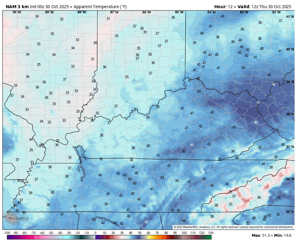
This is just another ugly day for many of us!
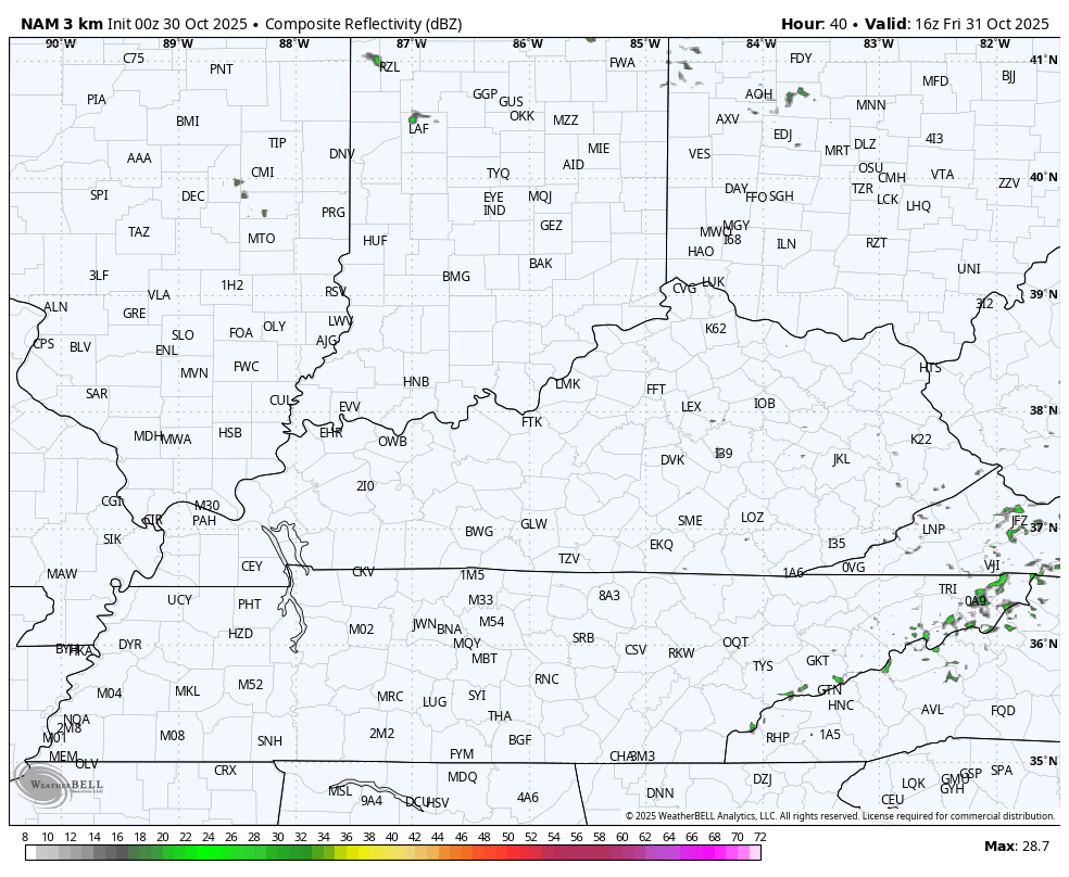
Halloween continues to look mainly dry with the slightest chance for a sprinkle or shower popping in the afternoon and early evening. The Future Radar from the Hi Res NAM shows a few of these…
Highs are in the 50s but will generally be in the 40s for trick-or-treating.
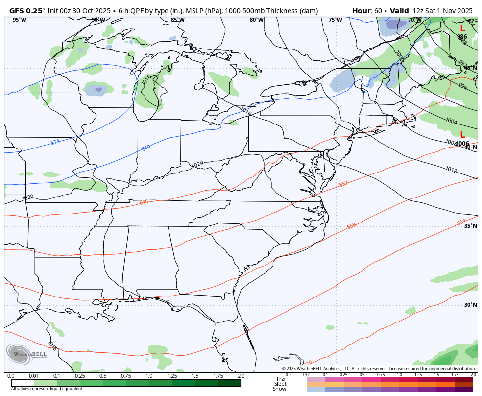
Another system looks to push in here to start November over the weekend with the models still trying to figure out how to handle it. The GFS continues to take this system a bit farther south…
A nice stretch of weather looks to kick in for much of next week before a back and forth setup kicks in…
If you’re a regular reader of KWC, you guys know I haven’t been shy about my thoughts on winter getting off to a pretty fast start. Some of my analog years have a strong signal for this with December having a lot of potential.
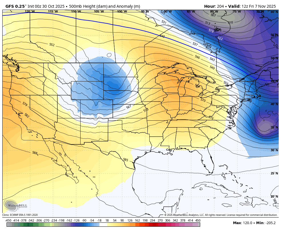
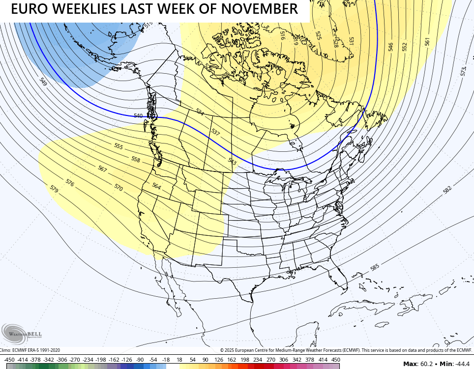
The latest from the EURO Weeklies keeps giving me confidence in my overall thought process. It’s essentially setting us up with a ridge going up the west coast all the way into Alaska with a downstream trough in the eastern half of the country.
You can see the progression of all this in the 7 day increments showing up on the weeklies. Here’s what that looks like for the final week of November…
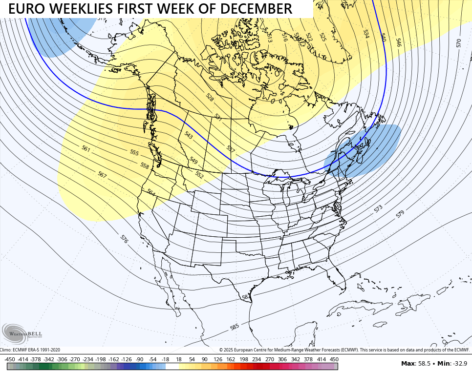
That trough deepens into week one of December…
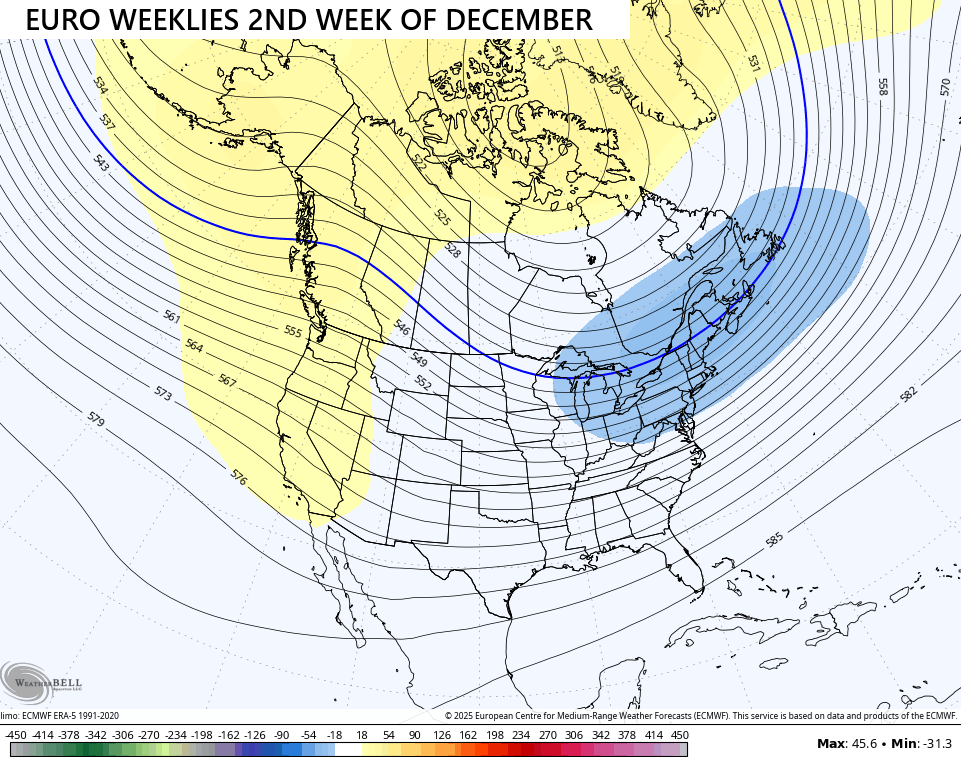
And that trough continues to deepen into the second week of December…
The snowfall forecast average from the 101 members that make up the EURO Weeklies is pretty robust across the country…
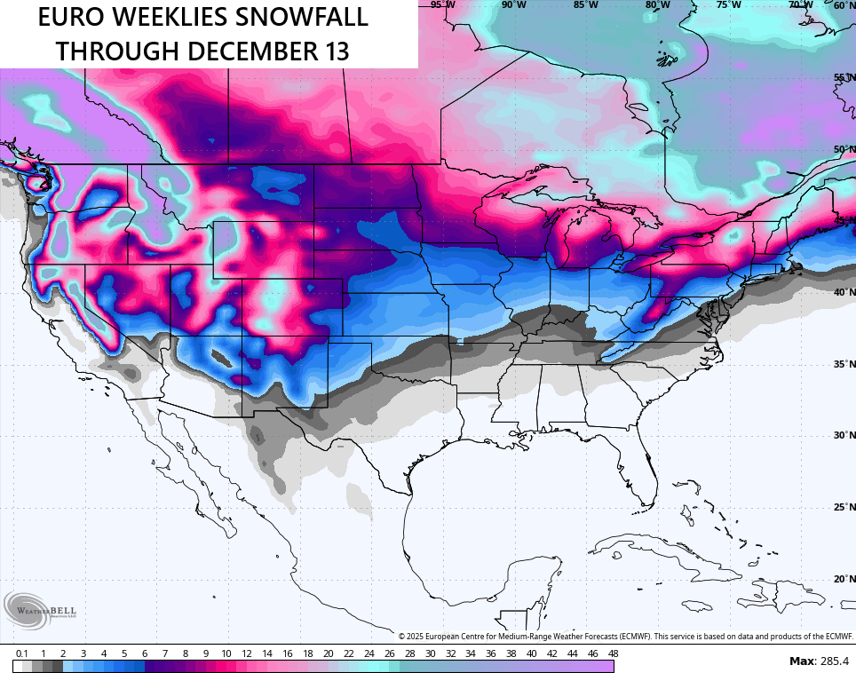
If you’re like me and you like winter weather in the Christmas season, you very well may be in luck this year!
I will have update things later today and on my Meteorologist Chris Bailey Facebook Page
Until then, here are your rain and wind tracking tools for the day…


Make it a great Thursday and take care.
