Good Friday and Happy Halloween! As crazy as it is to believe, we’ve made it to the final day of October with November just hours away. Our Halloween looks pretty good before a chilly rainmaker rolls in here to begin the new month.
I’ll also be taking another longer range look via the Euro Weeklies, so pay attention winter lovers.
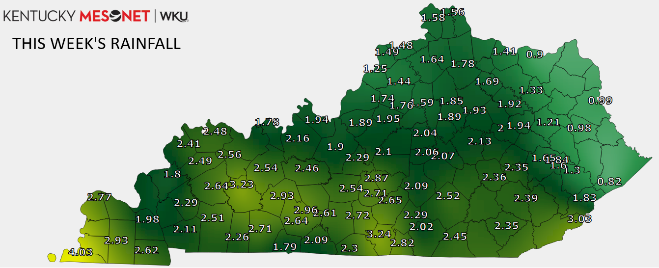
Before we look too far ahead, let’s look back at our pre-Halloween week storm system. We said to expect a widespread 1″-3″ rainfall and Mother Nature delivered the goods…
Most of our Halloween is dry with highs in the 50s, but there’s still the chance for a stray shower or a few sprinkles going up across the eastern half of the state. Just in case something pops, here are your Kentucky Weather Radars…

Temps for Trick-or-Treating drop into the 40s.
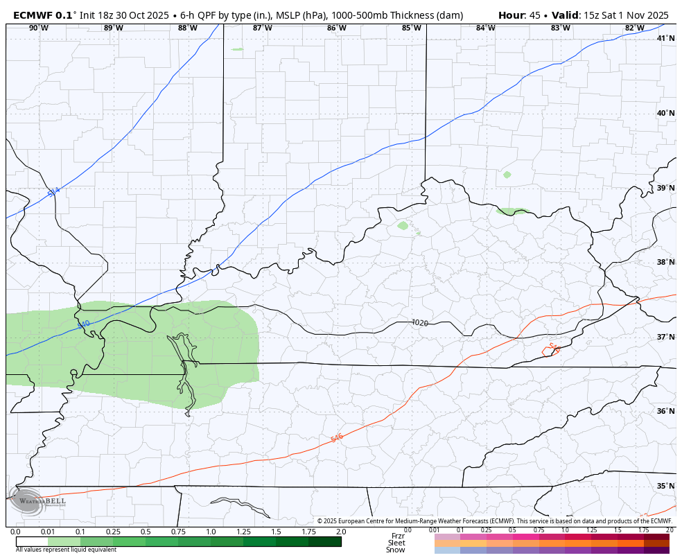
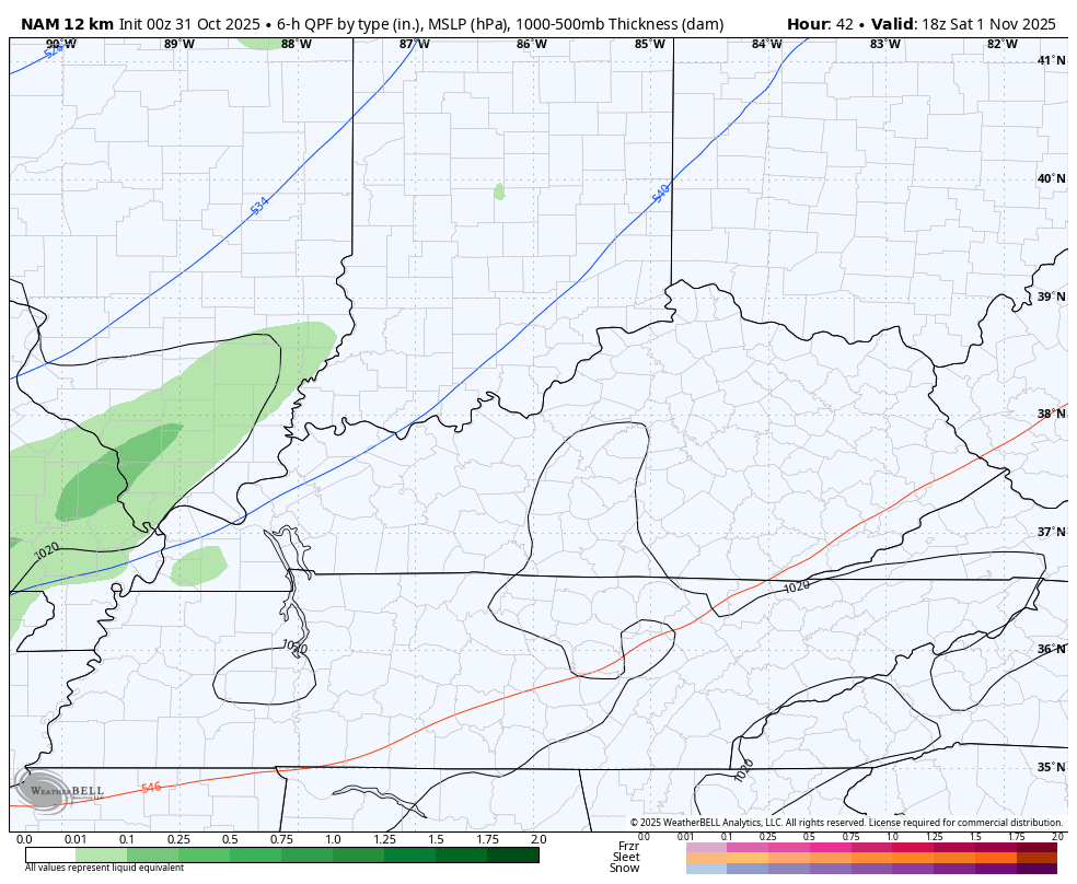
November starts with another system working across the state with chilly showers developing later Saturday and continuing into Sunday. This can drop another half to 1″ of rain for some areas as we find the EURO and NAM in pretty good agreement with this…
EURO
 NAM
NAM
Highs Sunday look to stay in the 40s for much of central and eastern Kentucky.
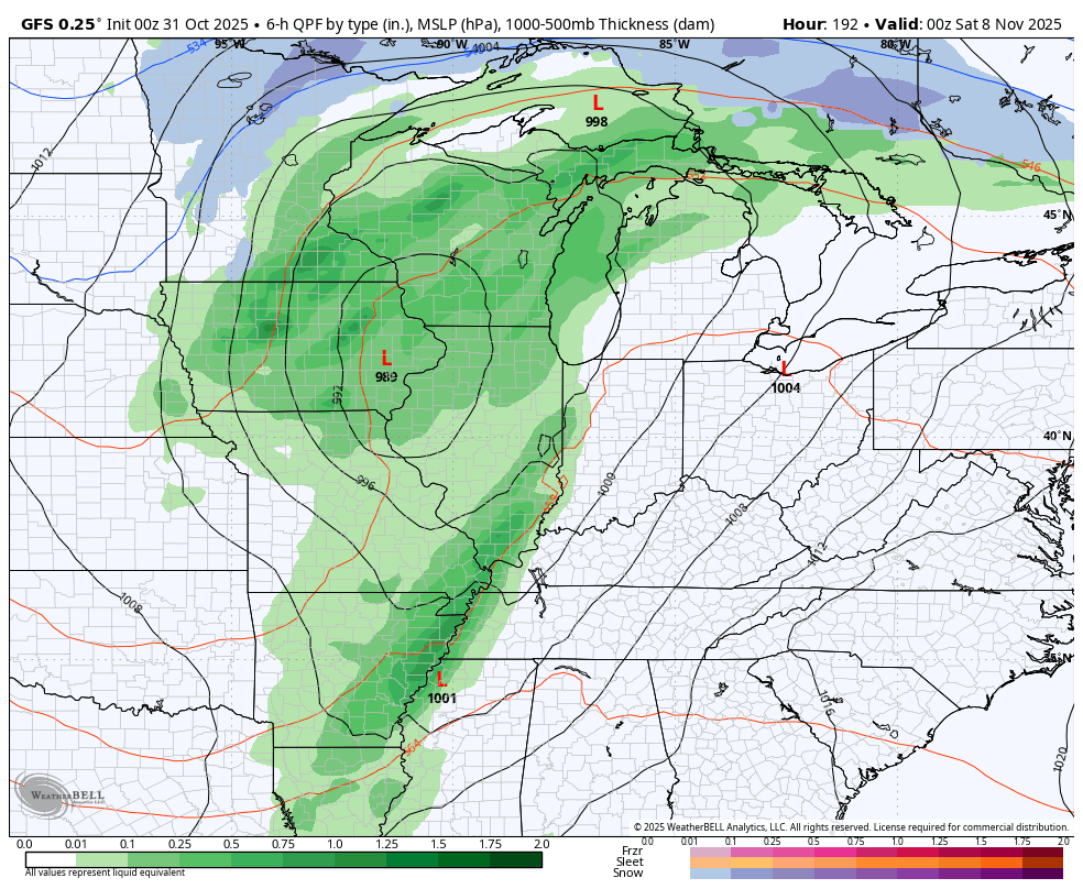
Next week looks seasonable ahead of a setup that turns busy again next weekend into early the following week. The trend is there for a couple of nice fall cold fronts that have the chance for some Ohio Valley/Appalachian Mountain flakes behind them…
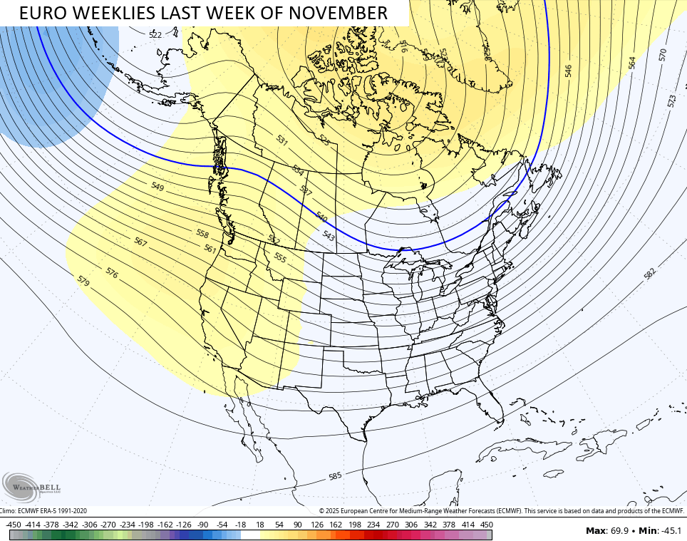
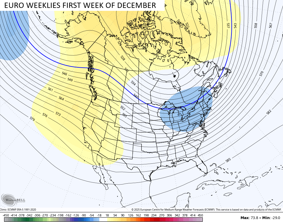
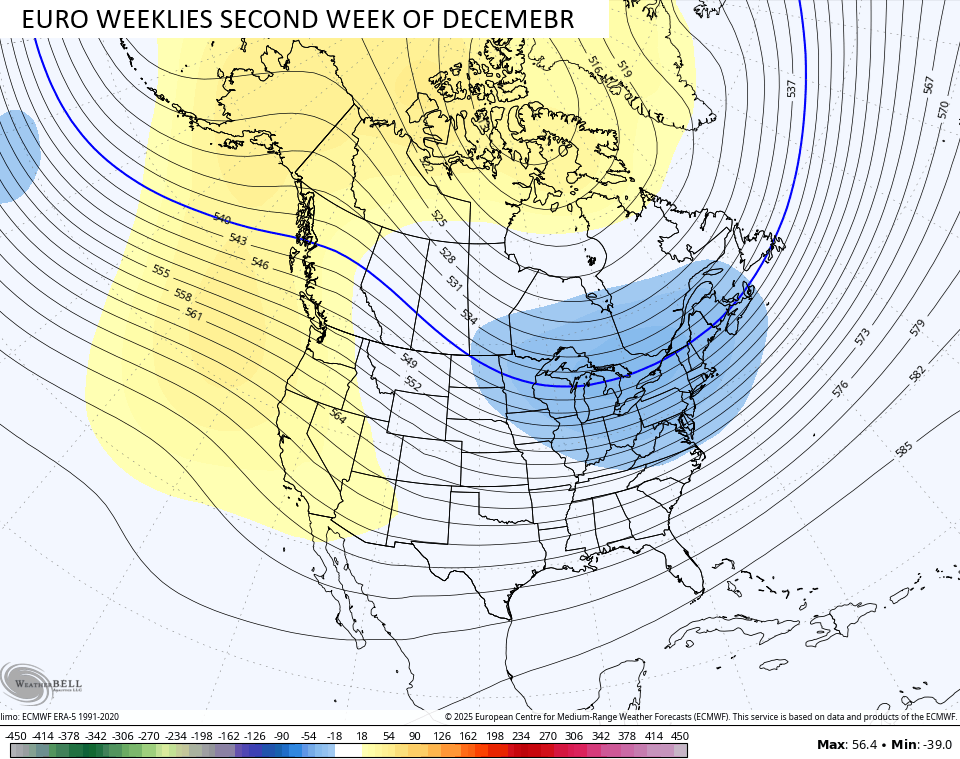
Not to beat a dead horse, but the EURO Weeklies aren’t letting up with the potential for a very fast start to winter as they continue to show a deep trough getting established in the eastern half of the country.
This gets started in the last week of November…
Then really digs in in the first half of December…
The snowfall average from the 101 members of the EURO Weeklies…
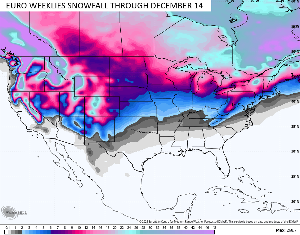
Maybe my thoughts about an early start to winter have some merit? Hmmm
I’ll try to throw you another update later today. Make it a great Halloween and take care.

I’ll believe it when I see it. Re: snow