Good evening and Happy Halloween!! It’s a chilly evening for Trick-or Treaters as they make their candy rounds across Kentucky. This chilly weather hangs tough into the weekend as some showers join in to start the month of November.
The showers start in the west Saturday afternoon and overspread the rest of the state during the evening and into Saturday night. This comes from another upper level system spinning across Kentucky, keeping chilly showers going into Sunday for the central and east.
Here’s the GFS showing the showers from Saturday morning through Sunday…
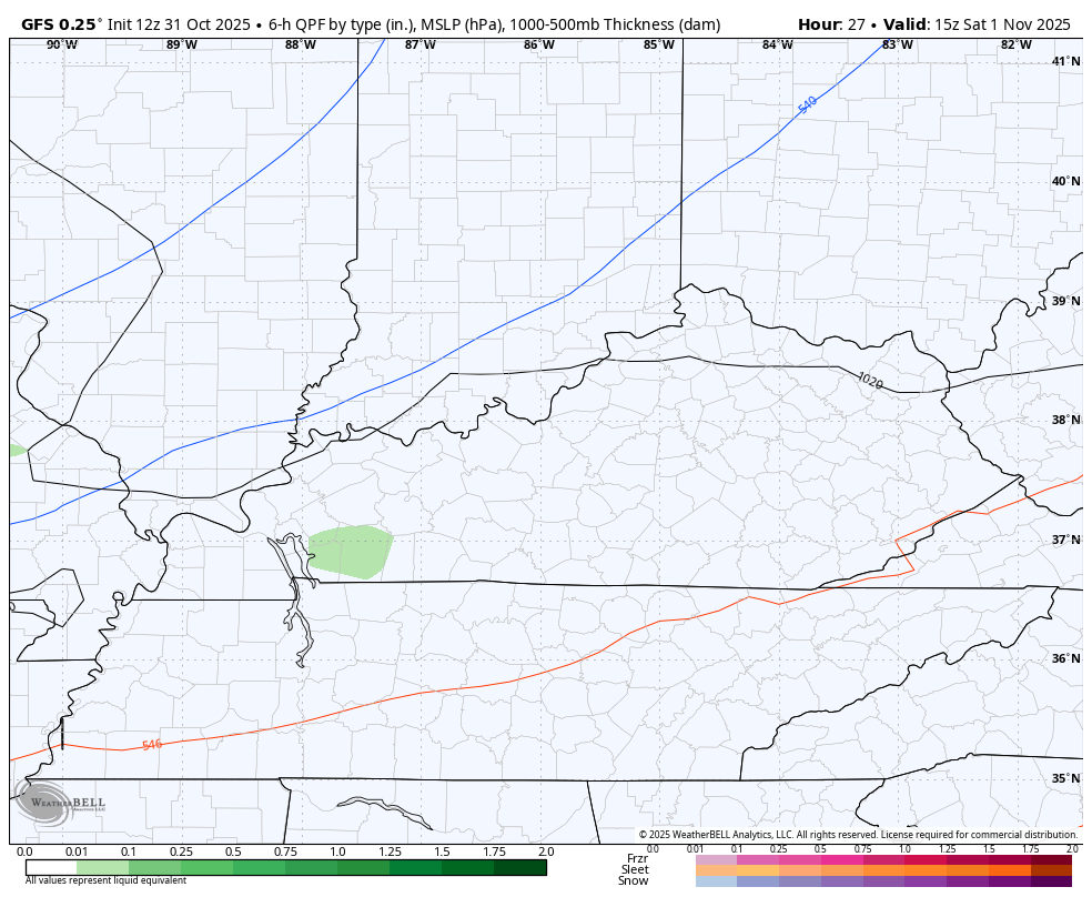
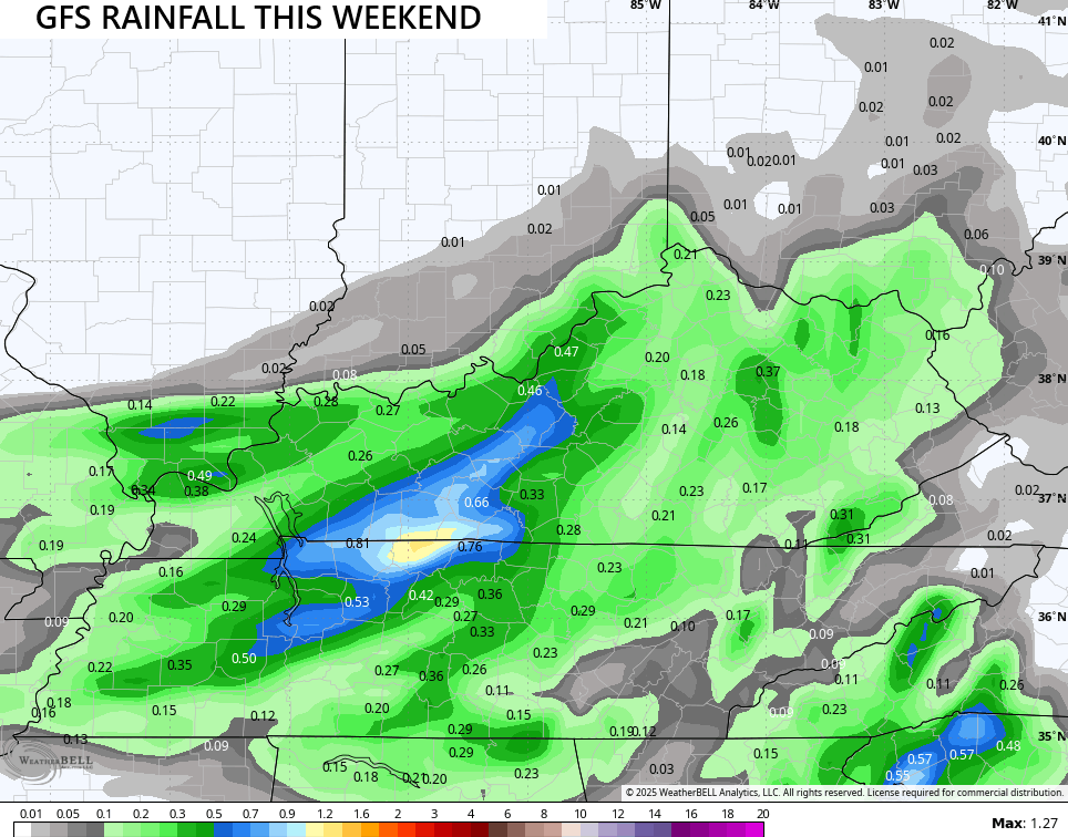
The heaviest rains with this look to fall across south-central Kentucky with a half to 1″ possible. Lighter amounts show up farther east…
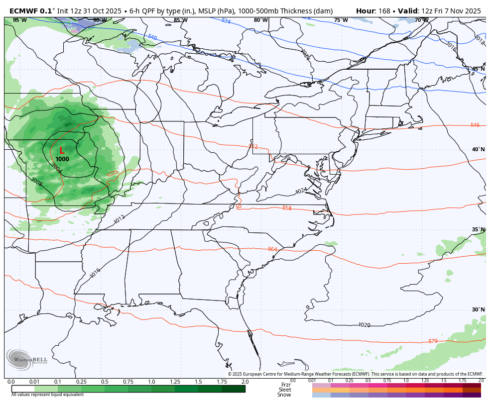
Milder winds kick in next week with upper 50s and low 60s from Tuesday through Thursday. This is ahead of a cold front bringing gusty showers in here later Friday into the start of next weekend. That will be followed up by another system a few days later.
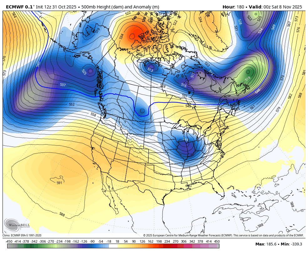
Here’s how the EURO sees these systems…
You can see these big dips in the jet stream that continue to target the eastern half of the country…
I’ll see you guys later tonight with a full update. Enjoy the rest of your Halloween and take care.
