Good Sunday, everyone. Chilly showers continue to push across the state today, weakening as we get deeper into the day. Once into the week ahead, temps and conditions look pretty darn good. Once into next weekend, the pattern turns active once again.
I’ll also take a deep dive into the winter months from one of the latest seasonal models.
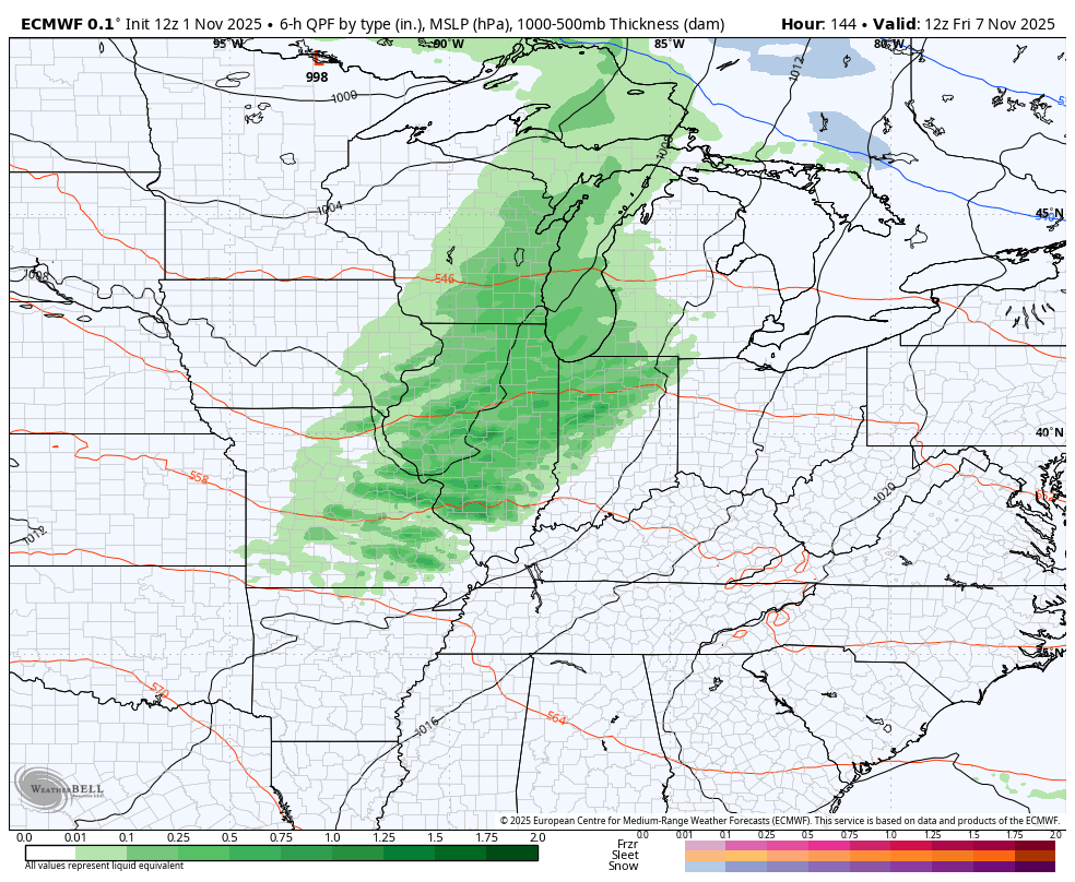
Today’s showers are spinning around an upper-level low spinning southeast through the region. This action diminishes from northwest to southeast today and you can track it all on your Kentucky Weather Radars…

Monday starts with cold temps and some fog with temps reaching the 50s during the afternoon. 60-65 degree highs are a good bet for Tuesday and Wednesday but may come down just a smidge behind a backdoor cold front on Thursday.
A strong southwest wind then kicks in on Friday ahead of the first in a series of systems dropping in from the northwest. This leads to some serious temp swings with the chance for a few flakes to show up at some point.
The EURO likes that idea…
Check out those temp swings on that run of the EURO…
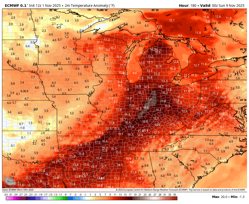
That’s rather dramatic and rude.
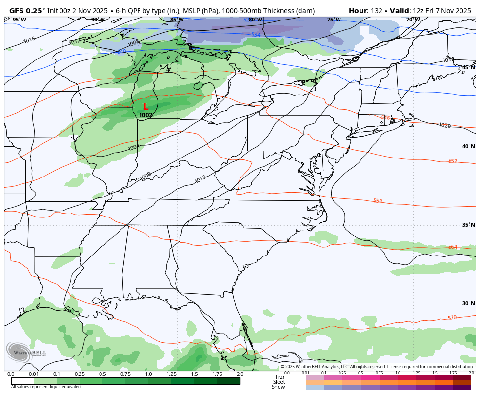
The GFS has similar ideas…
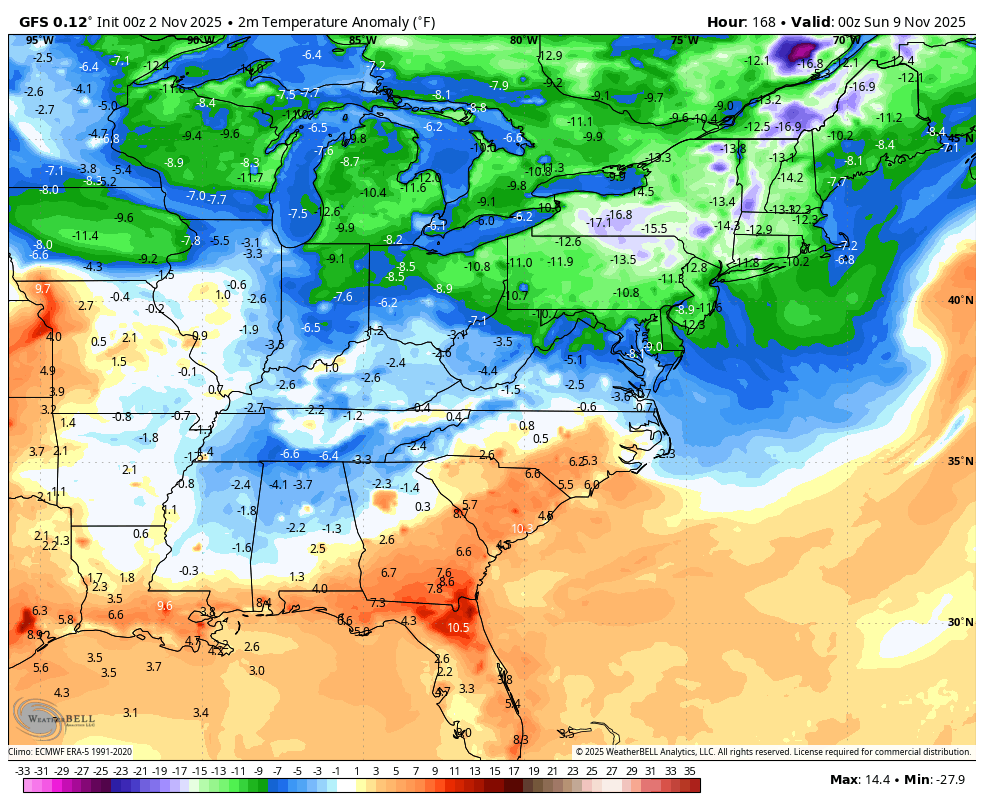
The EURO AI is also on board…

The idea of a fast start to winter is getting another boost from the seasonal model known as the CANSIPS. This model comes out at the first of each month and had been showing a very warm December across the country. That is no longer the case as it now shows the coldest temperatures relative to normal in the entire northern hemisphere expanding into our region…

It’s important to note seasonal models aren’t meant to give accurate forecasts, but they are of good value if we understand the overall theme of what they show. Here’s how that looks across North America for December…
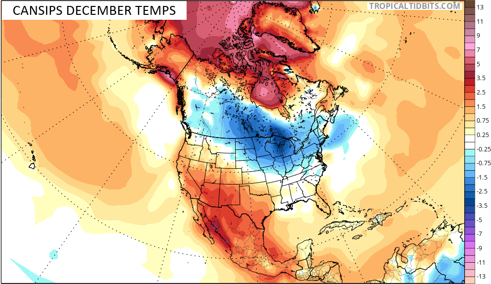
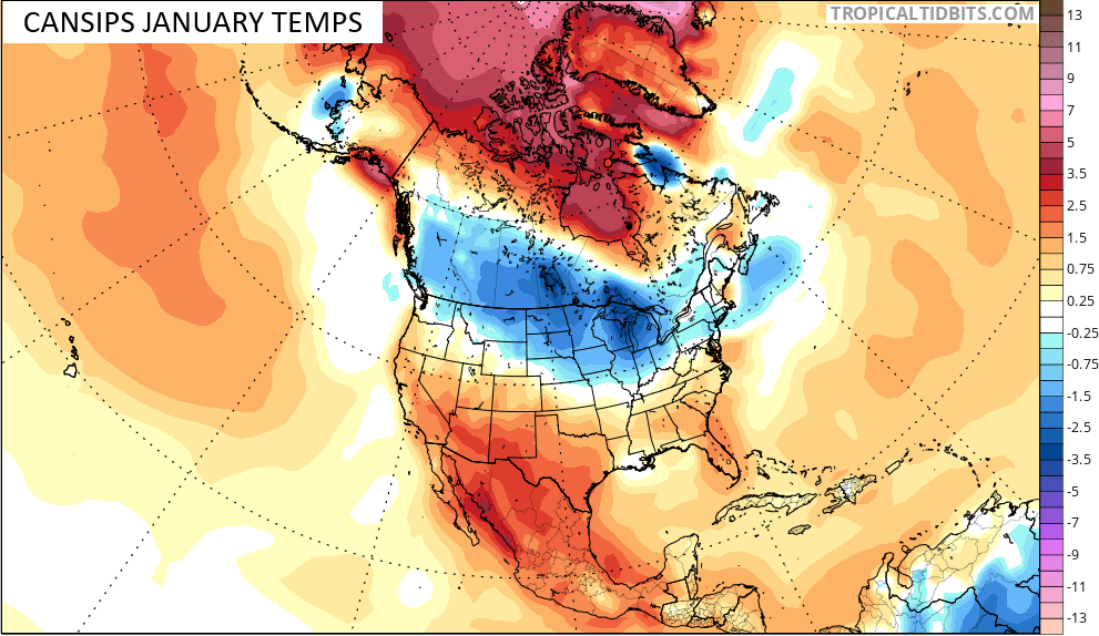
That same general look holds into January…
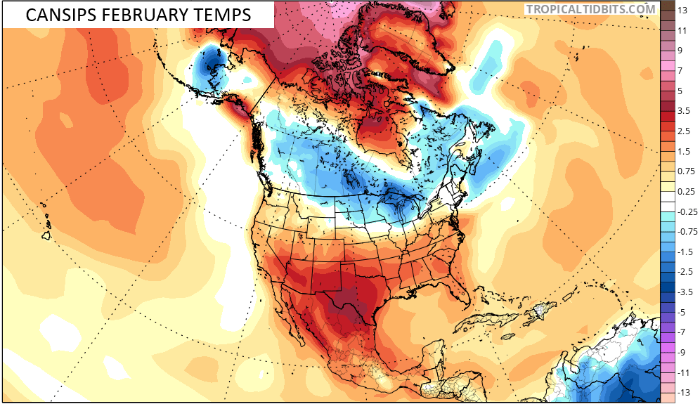
It does show some relaxation of that in February…
For a seasonal model that doesn’t see cold air very well to have a look like that, winter weather lovers should be happy seeing that from this far out.
I’ll have another update later today. Until then, make it a great Sunday and take care.

Thanks Chris, For showing all the CANSIPS models. Looks like a Cold Weather Sandwich with High Pressure being the bread. Can’t figure out where the Polar Vortex will set up this coming Winter. I read the Polar Vortex may be in Siberia, but that was an earlier forecast. Also looks like a lot of Clipper Systems in that Northwest flow continuing off and on through the three months of Winter. Lake effect Snows may be unually heavy this coming Winter. Also, there may be a lot of merging occuring along the East Coast ( Noreaster’s. ) As far as Winter weather in my area of Kentucky, I would expect below normal Snowfall, and up and down temperature changes, which is typical of La Nina Winters in my area. High Pressure in the South and Low Pressure in the North is La Nina in a Nut shell. The reverse for El Nino, which can produce Cold and above normal Snowfall for the entire State of Kentucky. The weak El Nino has the best chance in producing such.
Here’s the three month CANSIP forecast models that gives the entire year. Both in temperature and precipitation :
https://www.tropicaltidbits.com/analysis/models/?model=cansips®ion=us&pkg=apcpna_multimonth&runtime=2025110100&fh=2
If that February model verified, I’d be happy.
Could have Severe Weather increase, if February is mostly warm. Joe said the otherday that La Nina will phase into ENSO / neutral causes an ” uptick in Severe Weather. ” Possibly a Tornado outbreak somewhere in the State. Most likely in the Western or Central Kentucky. That would be terrible. Don’t want that to happen agin.
February and March are our Snowiest months, but that may be ( a not anymore. )
As always, we shall see. 🙂