Good evening, everyone. It’s a gorgeous stretch of weather that continues through Thursday before we change it up in a hurry. Gusty showers roll in for Friday with the chance for the first taste of winter behind it late Sunday and Monday.
Let’s talk about the Friday front right out of the gate. Showers and a rumble of thunder cross the state Friday and Friday night. Most of this is gone before the sun comes up Saturday…
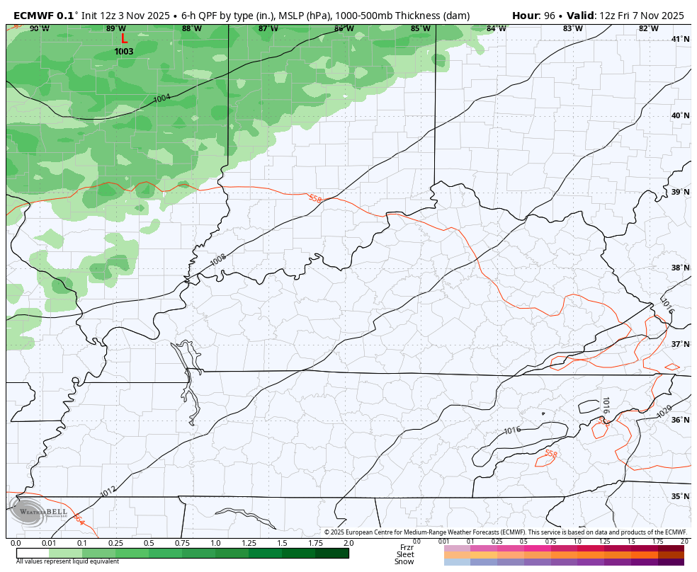
40mph wind gusts look to accompany this cold front moving in!
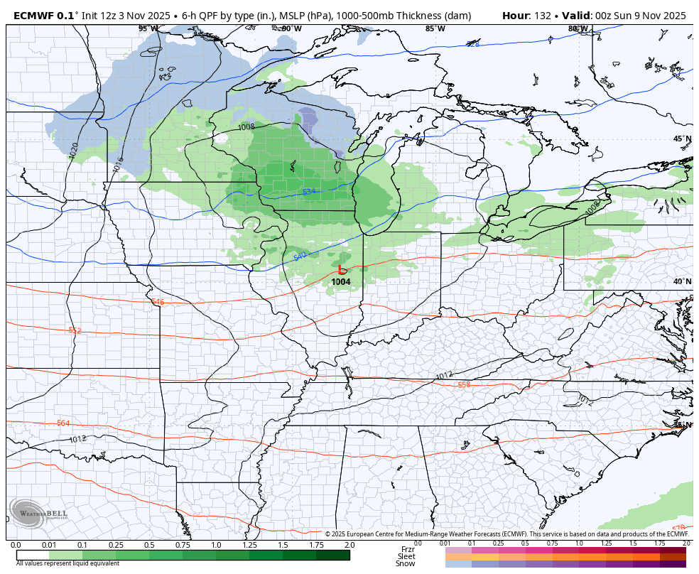
The setup late Sunday into early next week is straight out of wintertime with a deep trough digging into our region. Rain showers and crashing temps show up later Sunday with the chance for some flurries or even a snow shower from Sunday night through Monday evening. Festive flakes already???
The Euro shows this very well…
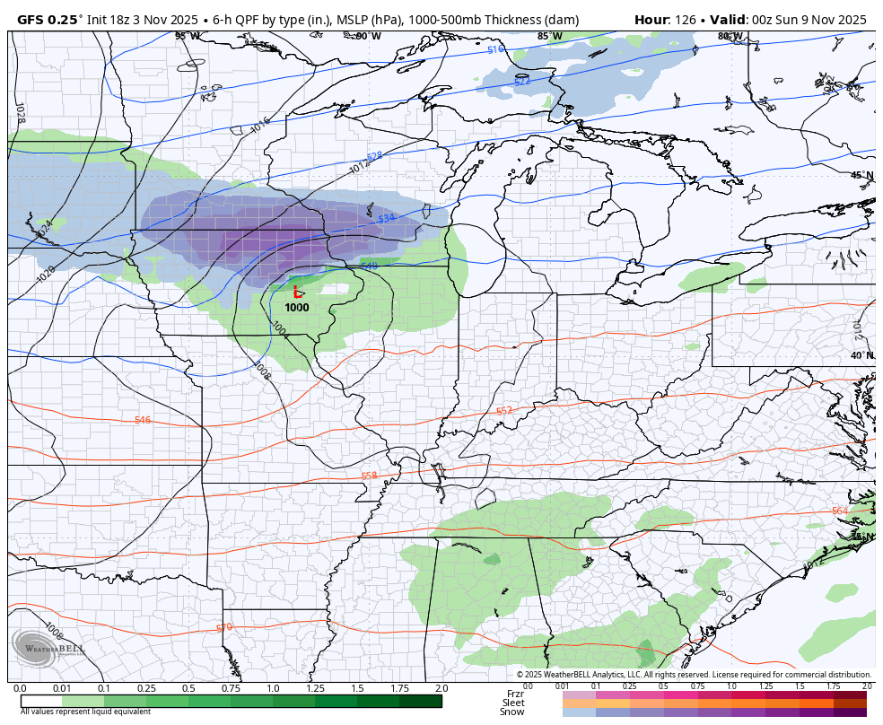
The GFS has this too but you have to slow it down a bit. Remember, the GFS is often too progressive with these types of systems…
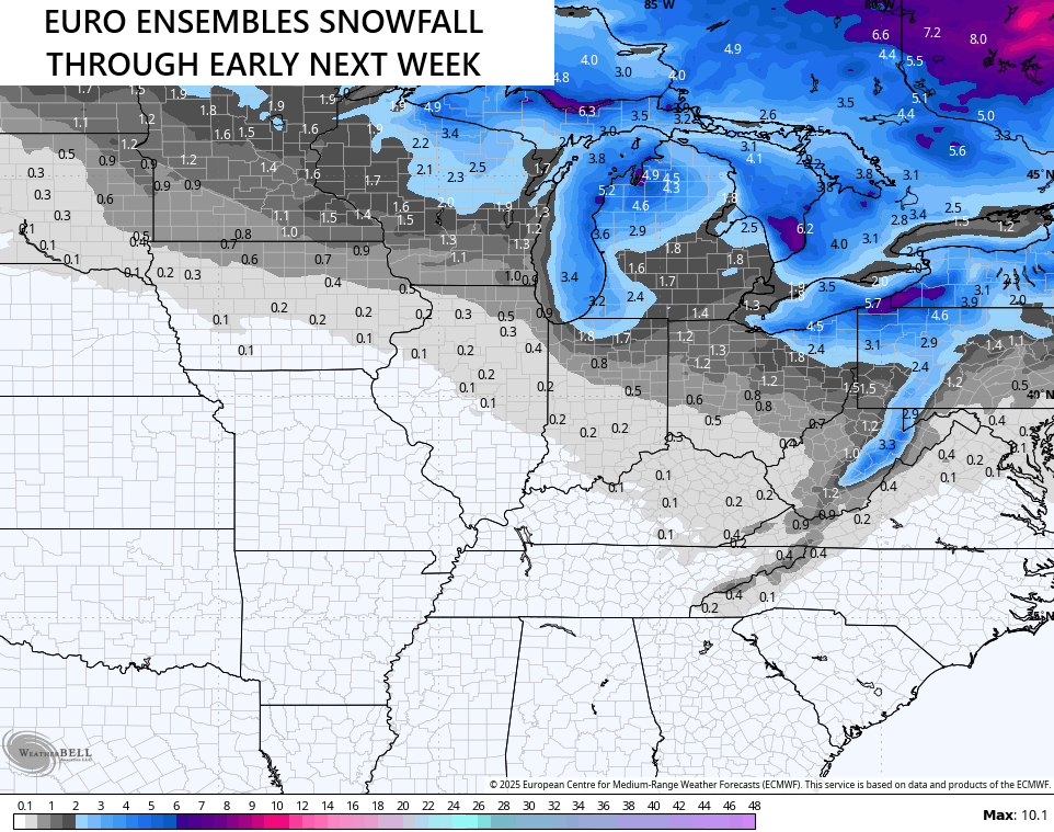
The EURO Ensembles show much of central and eastern Kentucky with the chance of seeing the first flakes…
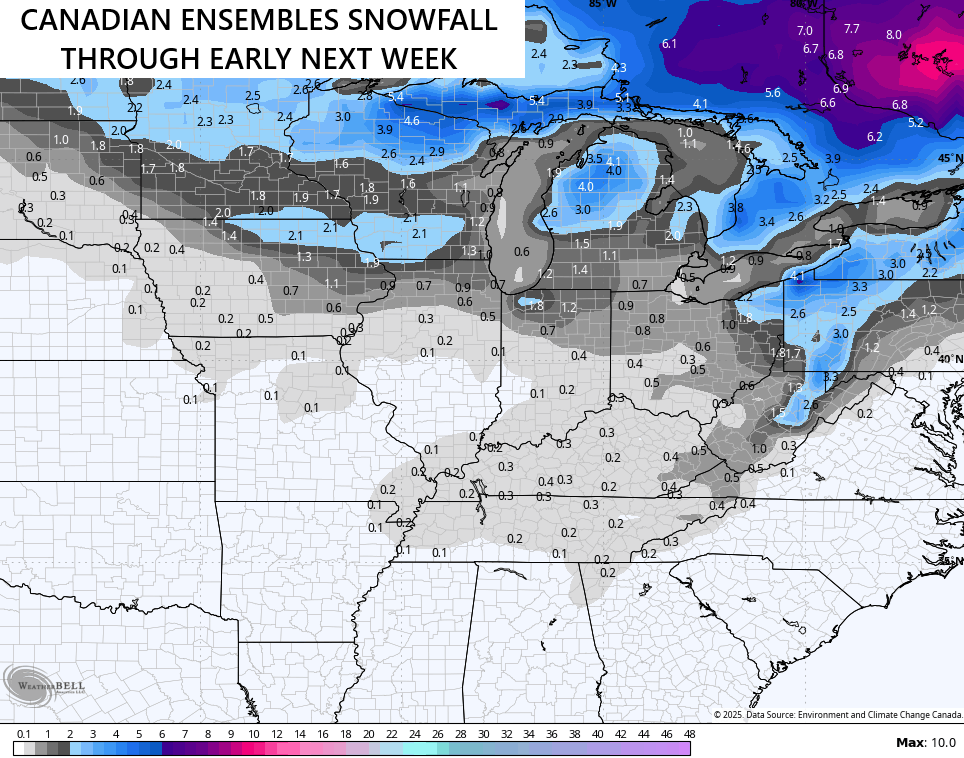
The Canadian Ensembles looks to be a little more optimistic for the entire state…
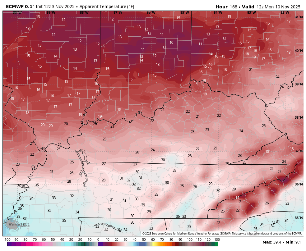
Temps with this system are frigid with wind chills looking to be out of the heart of wintertime. This wind chill forecast from the EURO starts at 7am Monday and goes through 7am Tuesday…
You know what it means when I’m taking about the first festive flakes? Take it away, Bing…
Enjoy the evening and take care.
