Good Tuesday, everyone. It’s another great fall day and we have more in store for the next few days. Once into Friday, we start to change it up with our first taste of winter lurking for later this weekend into early next week.
Temps out there today reach the 60-65 degree range for most with upper 60s west. Sun and some clouds help make this one amazing fall day. Wednesday is another nice one as mild winds gust up ahead of a weak cold front dropping in from the northeast. Winds on Wednesday may reach 35mph or greater.
That front knocks many of our highs back into the 50s for many as our skies stay pleasant.
A much stronger cold front sweeps across the state with gusty showers and even a rumble of thunder Friday and Friday night…
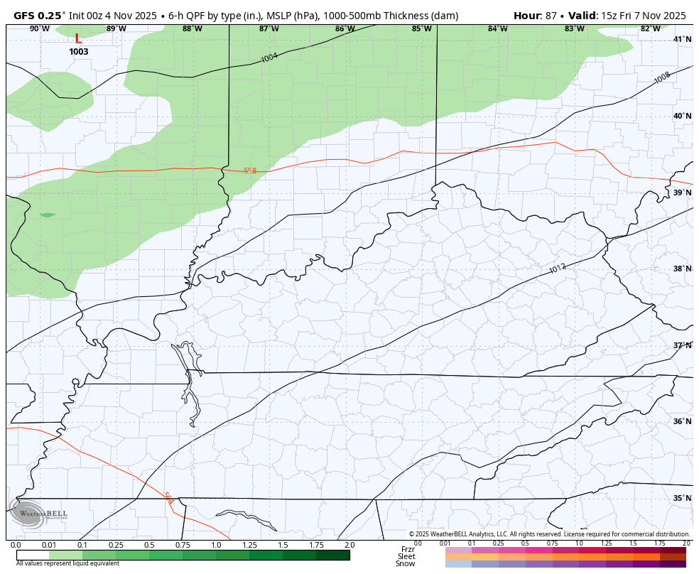
This is a fast-mover and may spit out winds reaching 40mph at times.
Saturday’s weather looks pretty good as we get set for a quick-hitting blast of winter later Sunday through Tuesday. The jet stream takes a big dip into our region, unleashing a look more typica of the heart of winter than the first half of November.
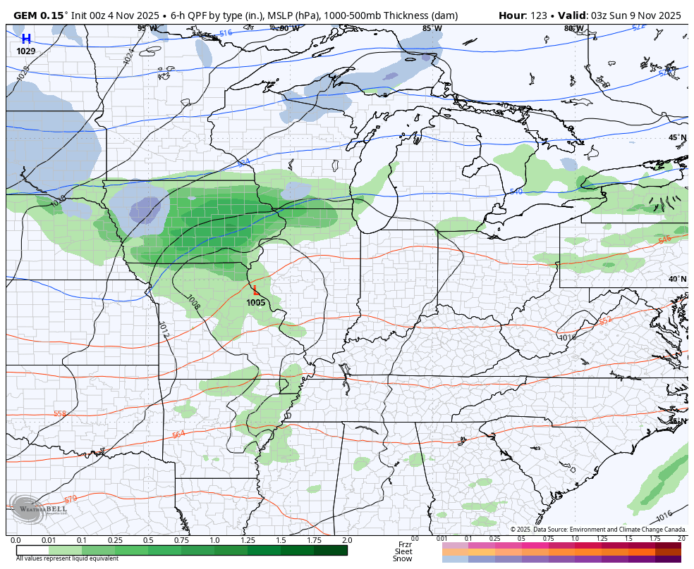
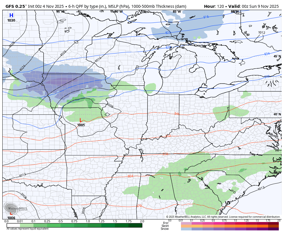
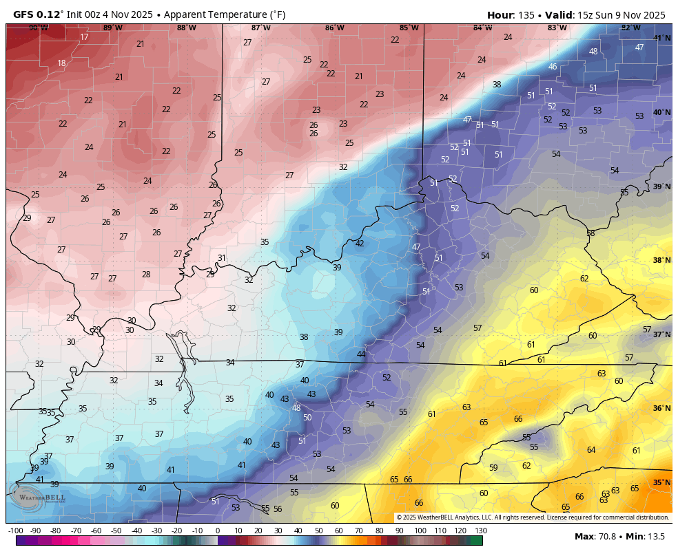
Low pressure rides through the Ohio Valley on Sunday and drags a potent cold front through here with cold air pouring in behind it. Gusty showers will be noted along and ahead of the front with enough energy coming in from the northwest Sunday night and Monday to give us the chance for flurries or snow showers. The best chance continues to be across central and eastern Kentucky.
The Canadian Model wants to do a little more than produce a few flakes as it has a potent upper level system spinning up some decent light snows Monday. This animation starts Saturday night and goes through Tuesday morning…
The GFS is on the other end of the spectrum with a flatter system that’s too progressive. Still, the model spits out a few flakes…
The GFS is a bit of a cross between the Canadian and GFS…
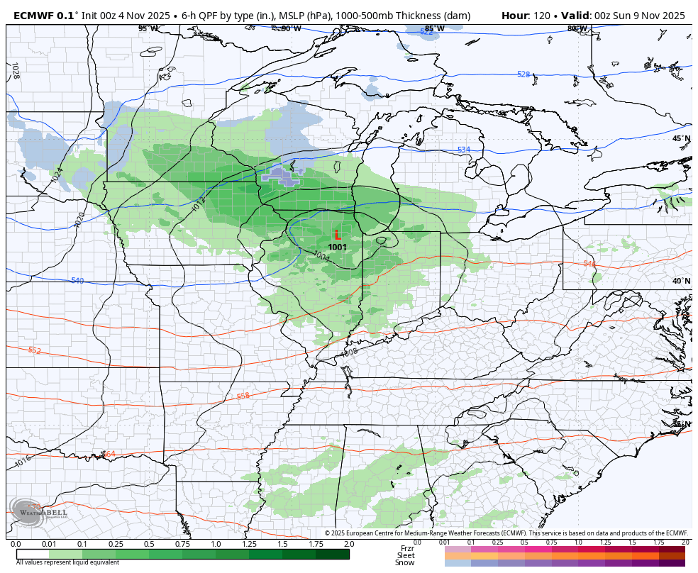
As you can see, we have a pretty good shot at getting in on some festive flakes from Sunday night through Monday evening.
Gusty winds and cold air will combine to give us some wicked early season wind chills. This animation starts at 10am Sunday and goes through 7am Monday and shows the cold crashing in…
This winter shot is in and out with milder winds later next week as we go into more of a back and forth pattern for the middle of the month.
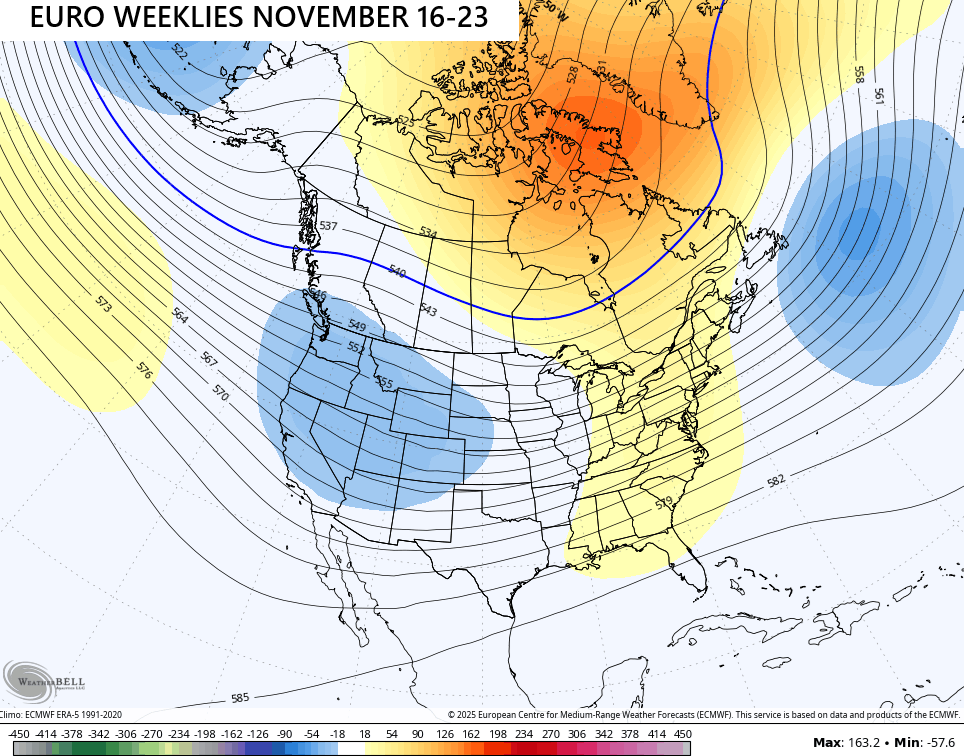
The latest from the EURO Weeklies continue to show a fast start to winter from late November into the first half of December.
Watch how the 7 day period before Thanksgiving week features a transient ridge in the east and a trough in the west…
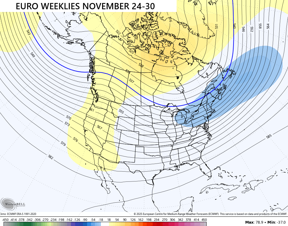
What how quickly that shifts for Thanksgiving Week as the trough digs into the east while a ridge pops along the west coast…
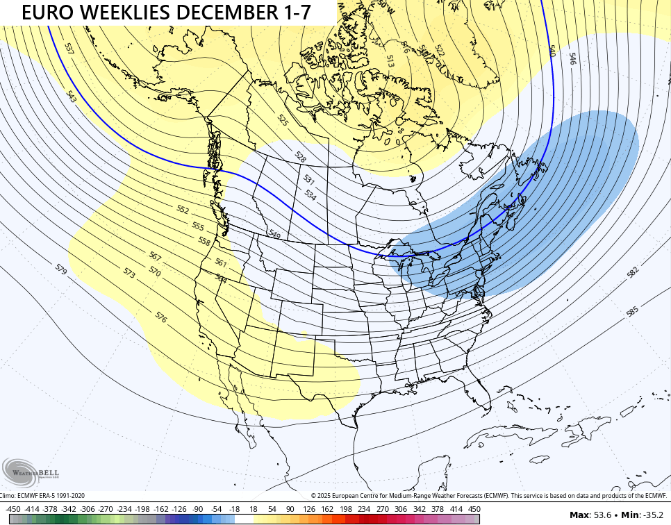
That same look shows up even stronger for the first week of December…
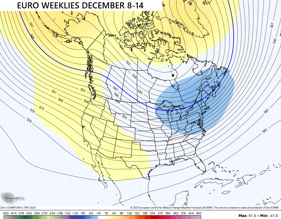
And really starts to kick in during the second week of the month…
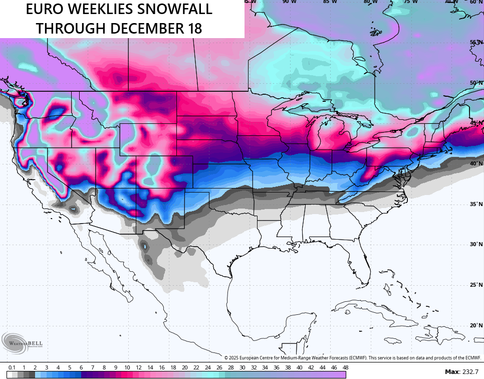
The snowfall potential from this run…
I’ll throw you another update later today. Have a great Tuesday and take care.

I think I’ll wait tell January before getting to exciting for snow.
Thanks Chris. I will be liking the few mild days ahead, but don’t care for the southwest winds ahead of cold fronts coming through the region. I would be surprise if those Clipper Systems deposit that much Snow, as the Snow maps indicate.
The PDO reading came out for October. It has gone deeper into the negative, which means ENSO / La Nina is here. This negative has been on going since 2019, and Scientist can’t explain why.