Good evening, everyone. Windy and mild weather is in store for the day on Wednesday but the focus is on a big change this weekend. It’s a change now likely to bring our first taste of winter into Kentucky and surrounding areas later Sunday and Monday.
Winds are a big player Wednesday and Wednesday night as mild temps continue. Gusts may top 35mph at times, making for a leaf storm.
The next system set to impact our weather is a cold front sweeping in Friday afternoon and evening with an increase in showers and some thunder…
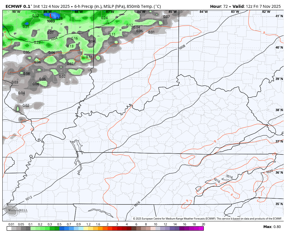
Wind gusts of 30mph-40mph will be possible as this front moves through.
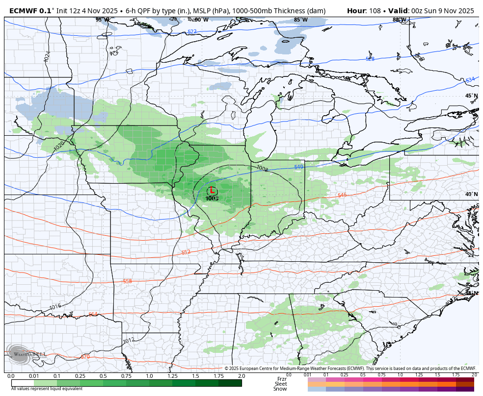
The winter blast coming in from Sunday through early Tuesday is likely to produce the first flakes around here. The best chance comes Sunday night and Monday as an upper level disturbance drops in.
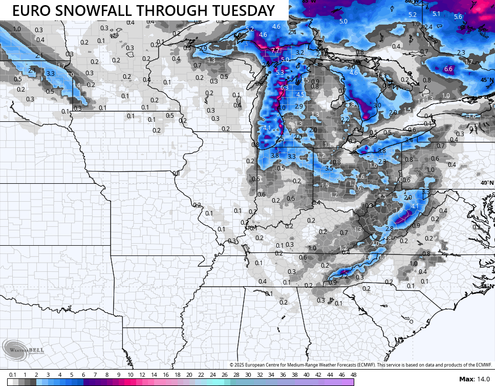
Here’s how the EURO sees this system from Saturday night through Monday night…
That run of the EURO likes the snow showers and flurries across much of Kentucky…
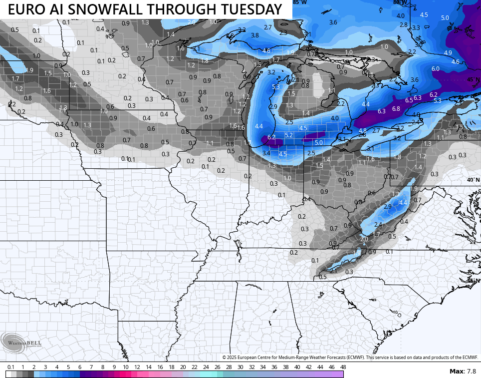
The EURO AI does too…
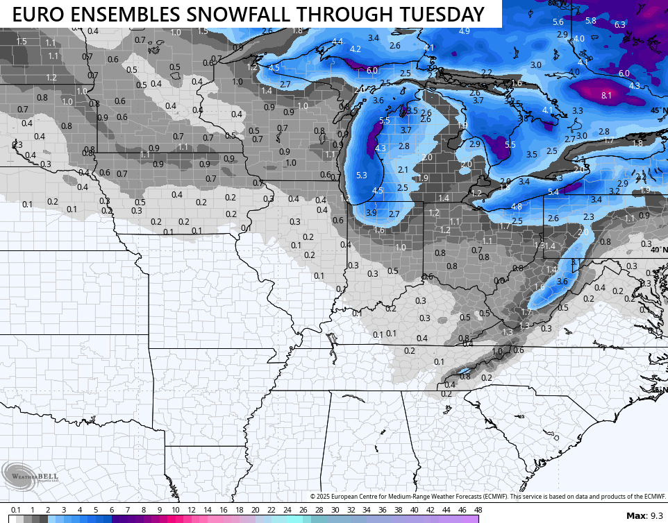
The Euro Ensembles look enthusiastic about some flakes…
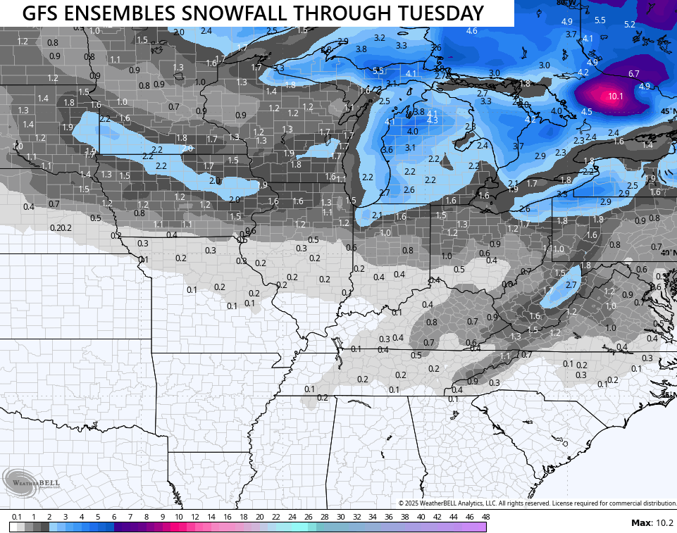
So do the GFS Ensembles…
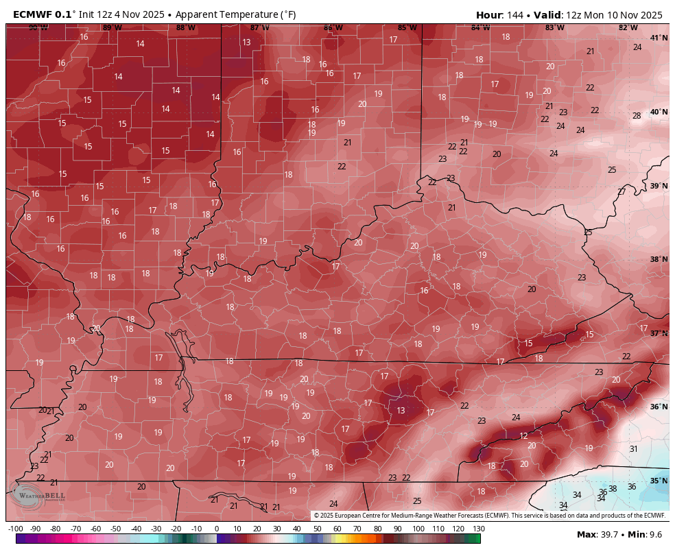
Temps crash all day on Sunday with highs staying in the 30s for Monday. Wind chills are pretty darn brutal for this time of the year. Check out the numbers from 7am Monday to 7am Tuesday…
I’ll see you back here later tonight. Make it a great evening and take care.
