Good Wednesday to one and all. It’s a very mild wind that’s blowing across the Commonwealth today, but big changes are about to take place. These changes lead us into a very early taste of winter by late Sunday into Monday. That’s when some festive flakes may fly across our part of the world.
Temps today are deep into the 60s on a strong south to southwest wind. Gusts of 35mph will be possible through this evening.
A weak cold front drops in tonight and knocks our temps down several degrees for Thursday. Many of us are back into the upper 50s with another great looking sky. Soak it up.
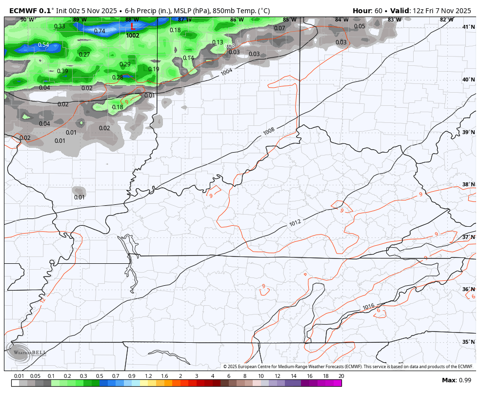
Clouds and winds increase quickly on Friday as a cold front approaches from the west. This front brings showers and some thunder from west to east across the state Friday afternoon and evening. Winds along this boundary may spike to near 40mph.
This animation goes from Friday morning through Saturday morning…
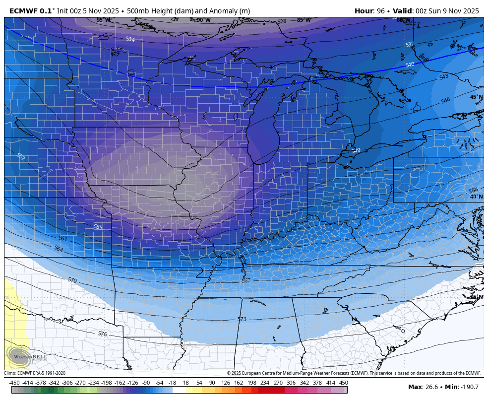
The setup from Sunday through Tuesday is straight out of winter as a deep dip in the jet stream sweeps into the eastern half of the country…
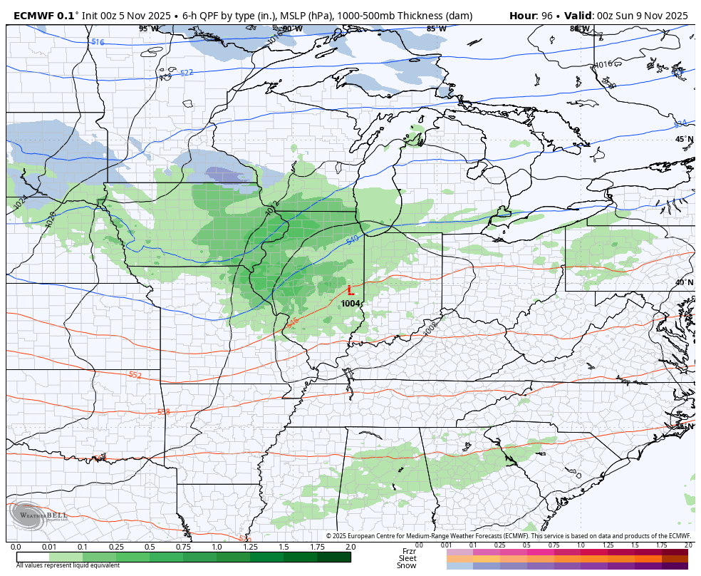
Low pressure rolls into the Ohio Valley and deepens as it pushes toward the northeast Sunday and Sunday night. Gusty winds, showers and crashing temps will be noted along and behind this front. Cold air really kicks in on a northwest flow Sunday night and Monday and will combine with a weak upper-level disturbance dropping in at the same time. That produces snow showers and flurries, especially across central and eastern Kentucky.
The EURO continues to be the strongest with this setup, giving us the best chance for some widespread snow shower action…
The GFS is slowly coming around, albeit still too fast with everything. The model has the snow showers and flurries flying on Sunday instead of Monday…
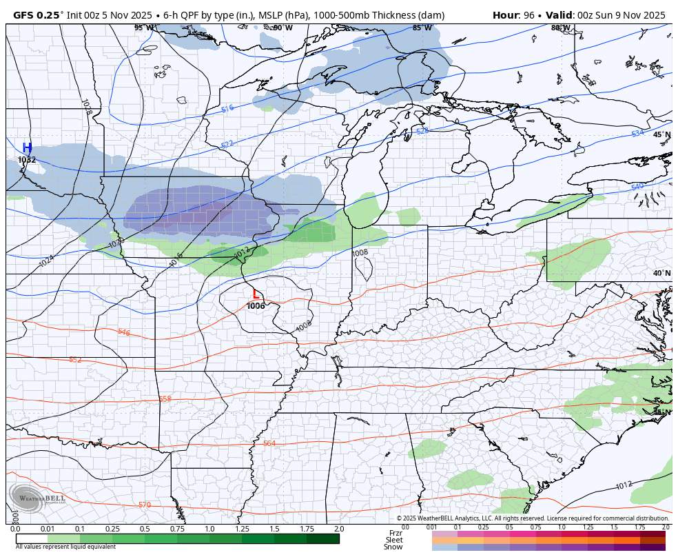
That run of the GFS only gives central and eastern Kentucky a few flakes…
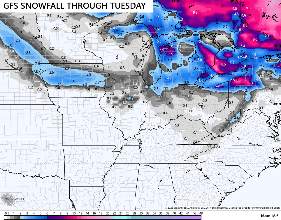
The EURO has the best chance for some light accumulations and would even mean some flakes for our friends in the west…
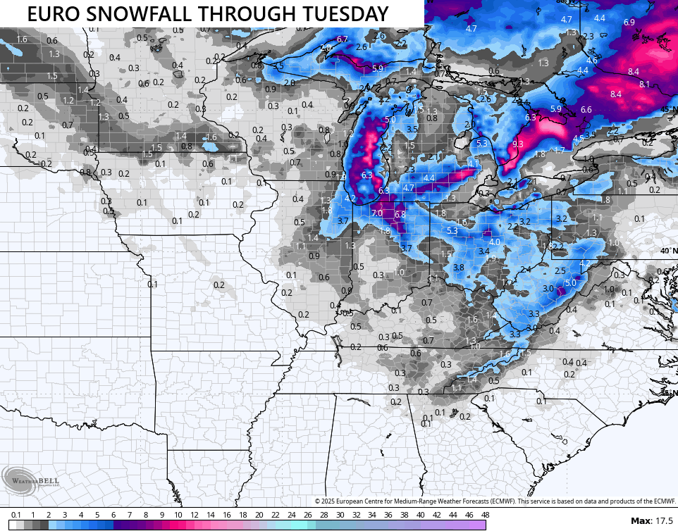
I suspect the truth is, as usual, in between those two.
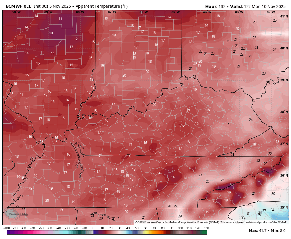
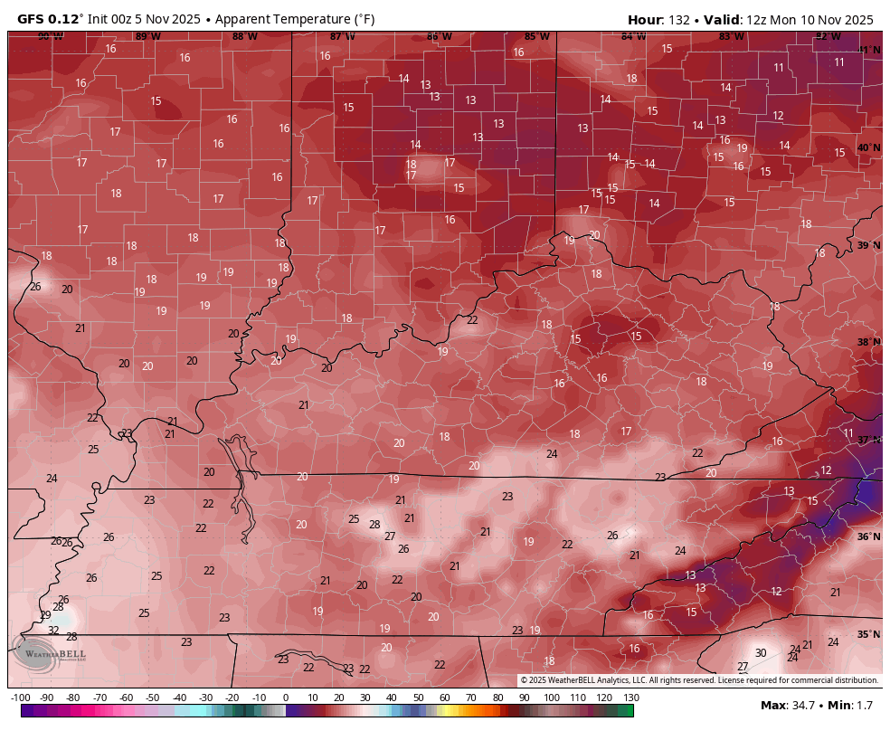
The one thing they do agree on is the frigid temps and the brutal early November wind chills. Wind chill numbers are in the teens Monday morning and again on Tuesday morning. This wind chill animation goes from 7am Monday through 7am Tuesday…
EURO
GFS
This is NOT going to hold as seasonable temps return for the second half of next week with a lot of back and forth with the pattern set to follow.
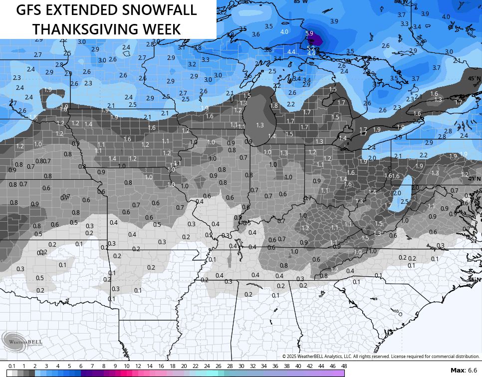
Y’all know my thoughts on true winter getting started a little earlier than normal this year as I’ve talked about this since back in the summer. I’ve been showing how the EURO Weeklies are on board with this and now we find the GFS Extended jumping in.
They start the change Thanksgiving week just like the EURO weeklies do. The GFS Extended shows the chance for some snows
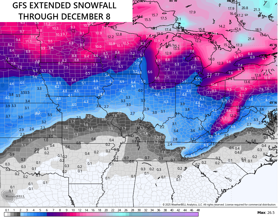
The GFS Extended doesn’t go out as far as the EURO Weeklies, but it still shows some pretty good snow chances showing up into early December…
I will have another update later today and I’ll send out some updates on my Meteorologist Chris Bailey Facebook Page .
Make it a wonderful Wednesday and take care.

I’d be fine with nothing but festive flakes all winter. 🙂
Snow cover is below normal across North America in October, and above normal across Eurasia. What Global Warming of the Earth ? Here’s the link : )
https://climateimpactcompany.com/daily-feature-october-2025-snow-cover-below-normal-in-north-america-above-normal-across-eurasia-2/
All of the above is due to a large blocking High Pressure System in Canada. Keeping the Arctic air on the other side of the World. One of these years it will be our turn for a long cold Winter.