Good evening, everyone. It’s full-steam ahead toward a very active weekend of weather across Kentucky. This weekend looks to bring strong thunderstorms and snowflakes as cold air surges in from the northwest.
Let’s hit the high points of this whole setup.
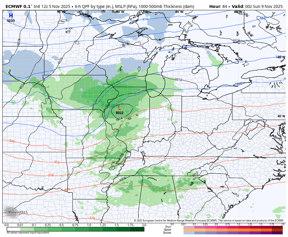
We begin with the threat for a few strong to severe storms Friday afternoon and evening. This looks like a setup where a broken line of showers and storms develops around the Ohio River then increases as it heads toward the southeast.
The Storm Prediction Center has a Marginal Risk to Slight Risk for severe storms for most of the state…

Damaging wind is the primary threat.
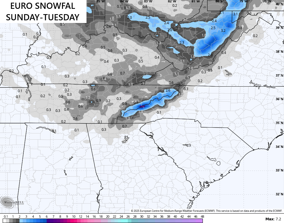
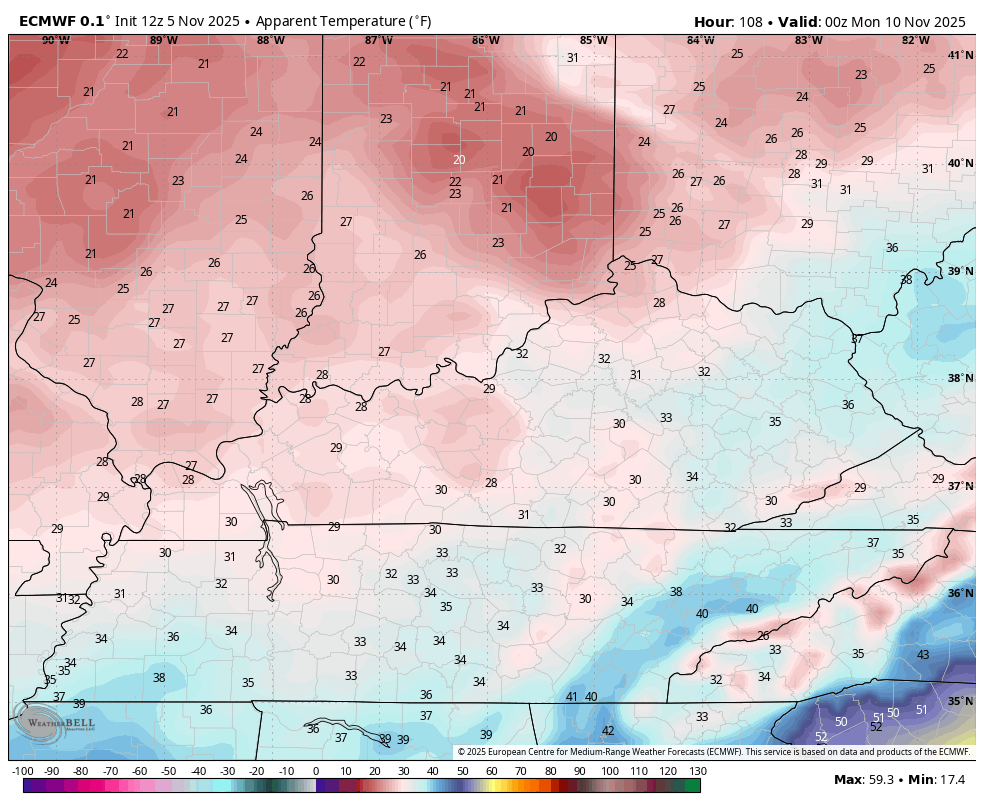
I have no changes to the winter weather part of the program from Sunday through Tuesday. A deep trough dives into our region pushing a surface low to our northeast with a trailing cold front across the state.
This means chilly showers along and ahead of the front with cold air and flurries behind it. An upper level system drops in on a stout northwest flow Sunday night and Monday. That brings a period of snow showers and flurries through here.
The EURO continues to have the best handle on this setup and has been pretty steady. This animation starts Saturday evening and goes through Monday night…
The EURO gives us the best chance for a little light accumulation in some spots…
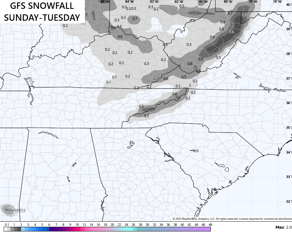
The GFS isn’t as robust but is seeing the flakes better…
So is the ICON…
![]()
![]()
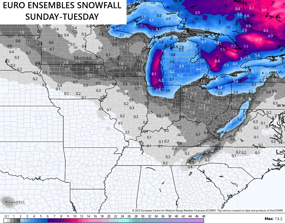
The EURO Ensembles give us a pretty good look…
As do the Canadian Ensembles…

Gusty winds and falling temps show up Sunday with wind chills dropping into the teens Sunday night then again Monday night. Take a look at the wind chill forecast from 7pm Sunday through 7am Tuesday…
A full update comes your way later today. Make it a good one and take care.
