Good evening, gang. We continue to head toward a very active weekend of weather across the region as two systems roll across Kentucky. They bring everything from strong storms to the first flakes of the season.
Let’s start with the Friday strong to severe storms threat. This is a low-end risk as a broken line of showers and storms develops along the Ohio River and then increases as it races quickly to the southeast Friday afternoon and early evening.
The future radar from the Hi Res NAM shows this line well…
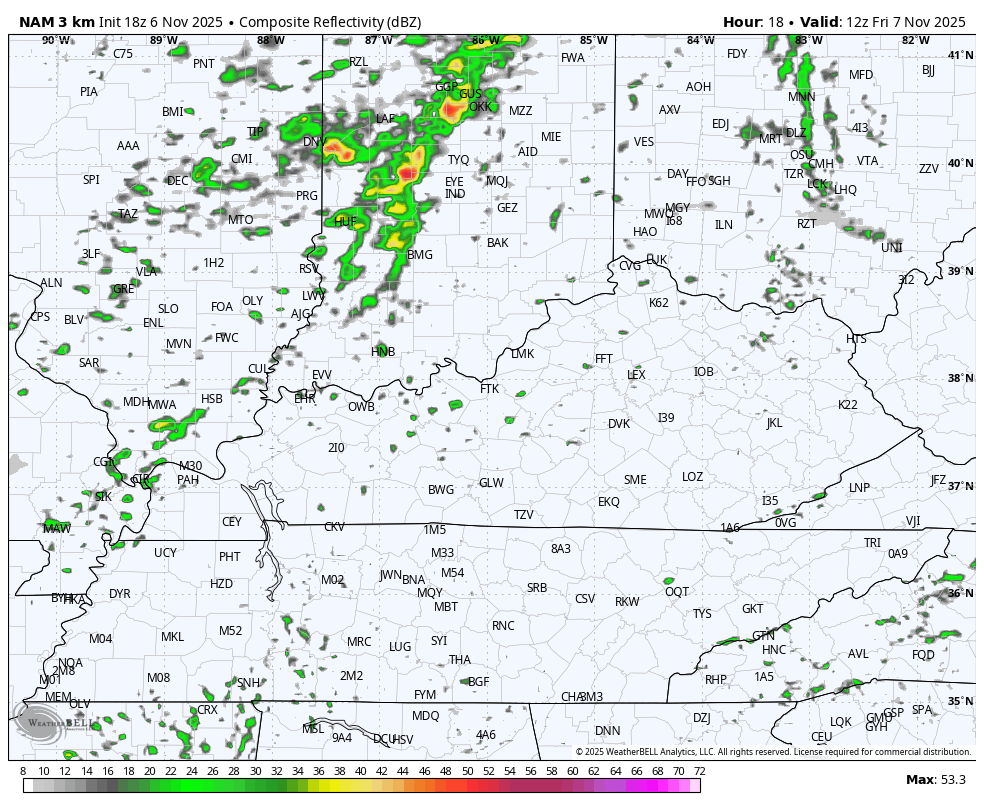
There’s a lot of dry weather showing up Friday as this line is narrow and moves very quickly.
In terms of the severe storms, the Storm Prediction Center continues with the Marginal Risk to Slight Risk across the state…

The individual severe weather threats look like this…


Regardless of severe storms or not, winds are a big player with gusts of 30mph-40mph at times.
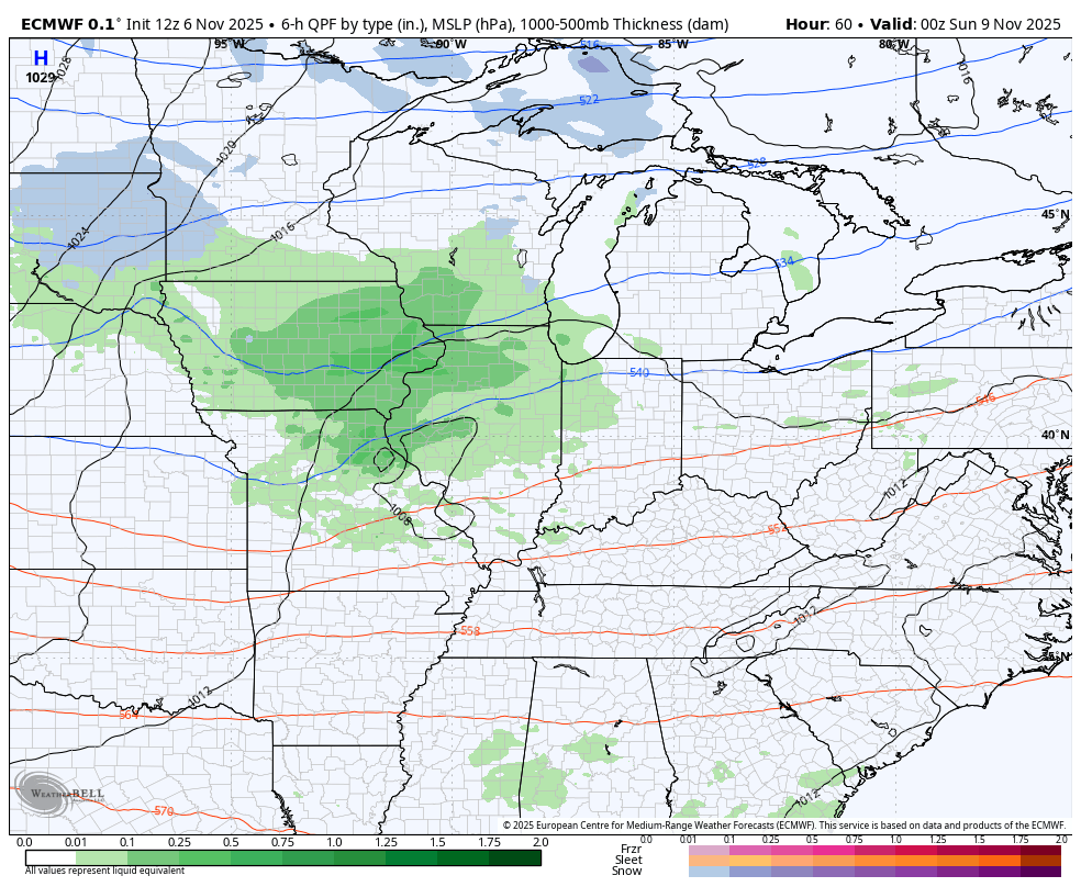
I have no changes to the winter weather potential and arctic air coming in later Sunday through Tuesday. The EURO is most consistent…
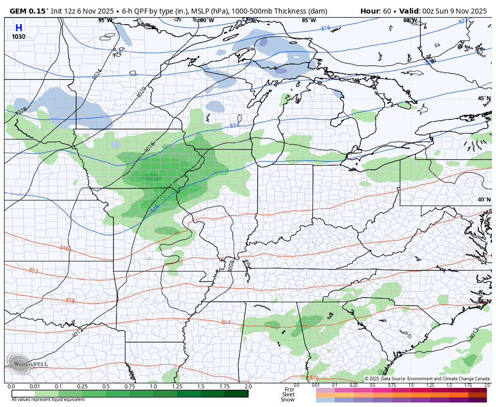
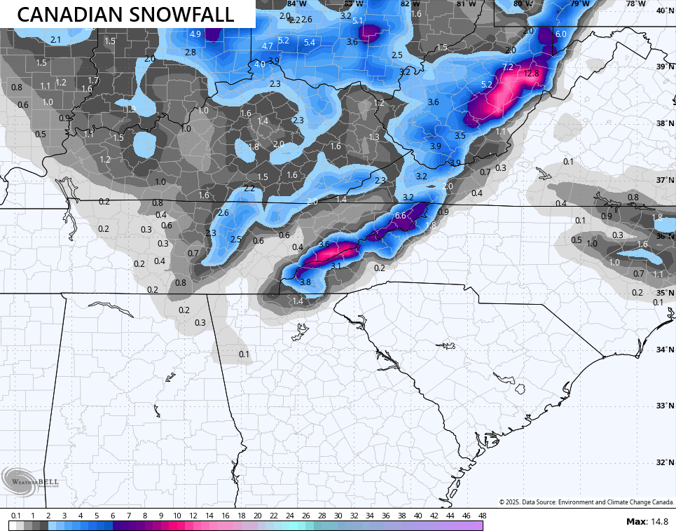
The Canadian Model now looks similar…
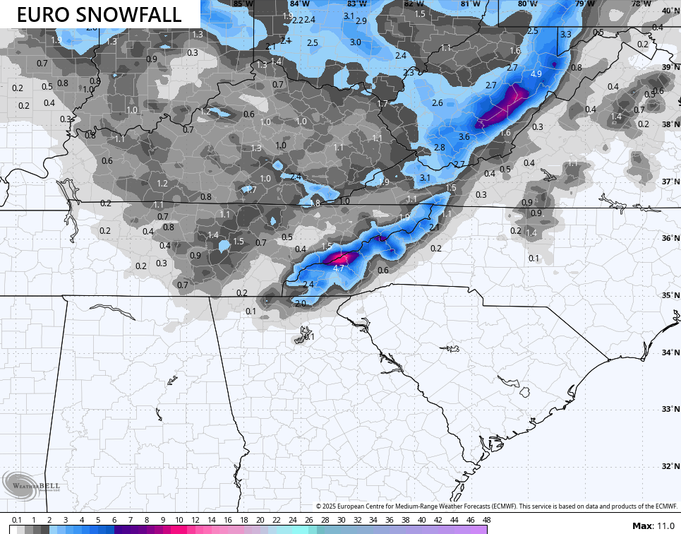
The EURO snow potential map looks more realistic with the chance for some light stuff…
The Canadian is more amped up…
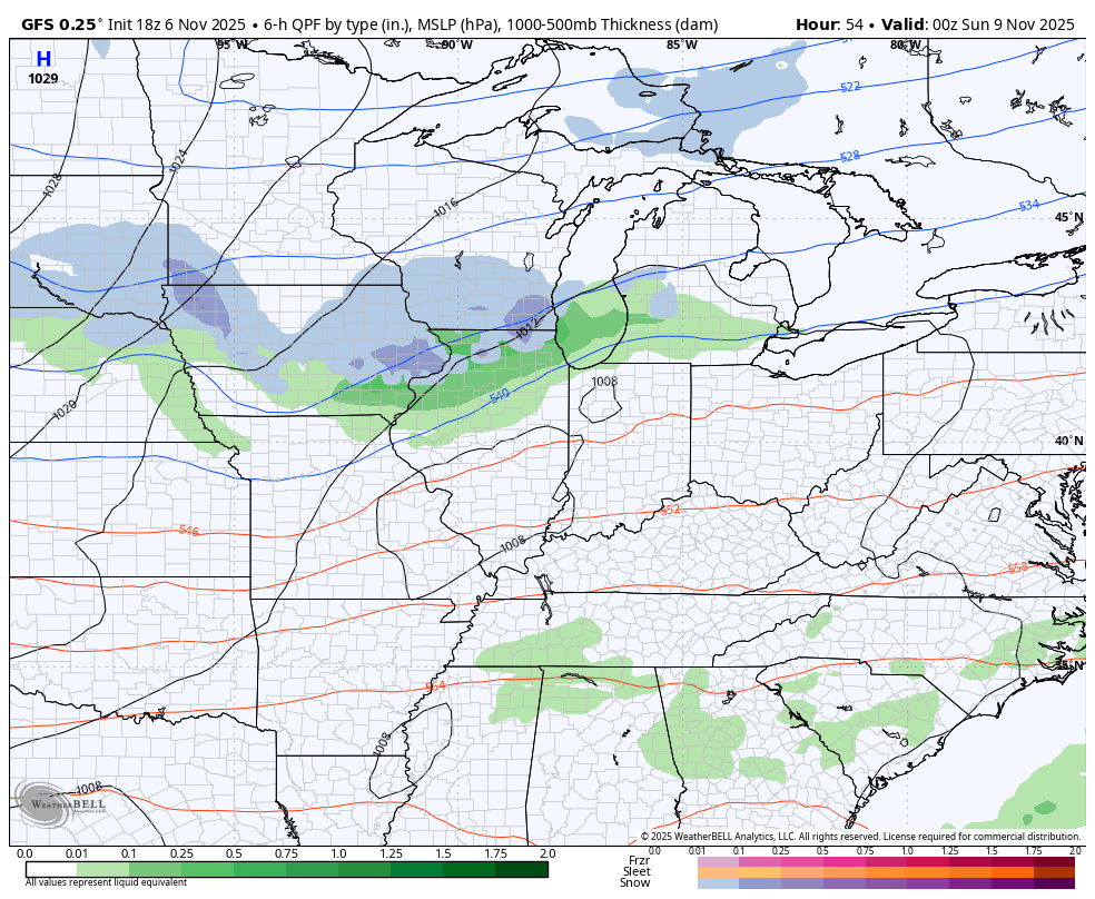
The GFS continues to be way too progressive as it jumps all the energy with the lead low way too far to the north. Here’s a look at what it’s showing…
And the snow map…
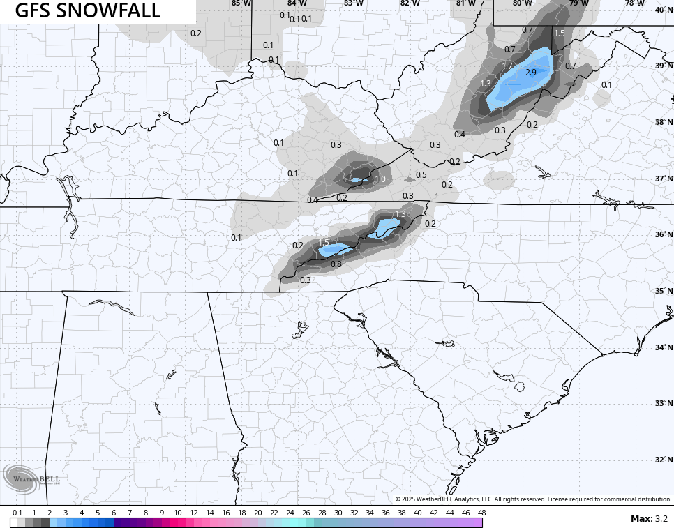
The best chance for a few flakes is Sunday night with the best chance for snow showers or a period of light snow being on Monday into Monday evening as the upper low spins in from the nrothwest.
Winds will be gusty giving us wind chills in the teens by Monday morning then again Tuesday morning.
I’ll have your full update later tonight. Make it a great day and take care.
