Good Friday, everyone. Strong to severe storms develop today for parts of Kentucky and this kicks off a rather extreme setup through early next week. Our pattern is going from possible severe storms to arctic air and the first snowflakes of the season.
Let’s start with today’s severe threat. The greatest threat for strong to severe storms will be across southern and southeastern Kentucky with a lower threat farther north. Here’s today’s Severe Weather Outlook from the Storm Prediction Center…

There is a low chance for a tornado or two to spin up. Here’s where the SPC is highlighting…

Areas of wind damage and large hail will also be possible…


Much better weather follows this up for Saturday with mild winds and a really nice sky. This is a great day to do some fall yardwork or to get out there and put up some Christmas lights and decorations.
Sunday and Monday look like really good days to put the inside decorations up as a blast of winter rolls into our region. This is an early season arctic blast for our region and the entire eastern half of the country.
Low pressure works through the Ohio Valley Saturday night and Sunday, bringing showers along for the ride. Cold air pours in, meaning the high on Sunday may occur at 12:01 am with the low for the day hitting at 11:59pm.
As temps drop into the 30s by afternoon and evening, some flakes may try to mix in with the initial showers across the region. From there, we watch an upper level system dropping in here on that strong, cold northwest flow Sunday night and Monday.
The exact path and strength of this upper low is the determining factor on whether or not between us only seeing festive flakes or actually seeing some light accumulations.
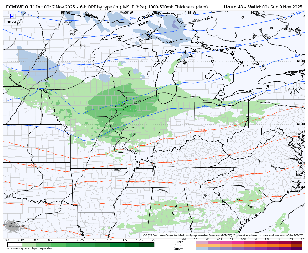
The European Model is steadfast on a stronger upper level system tracking on top of us, giving us the chance for light accumulations. This animation starts at 7pm Saturday and goes through 7am Tuesday…
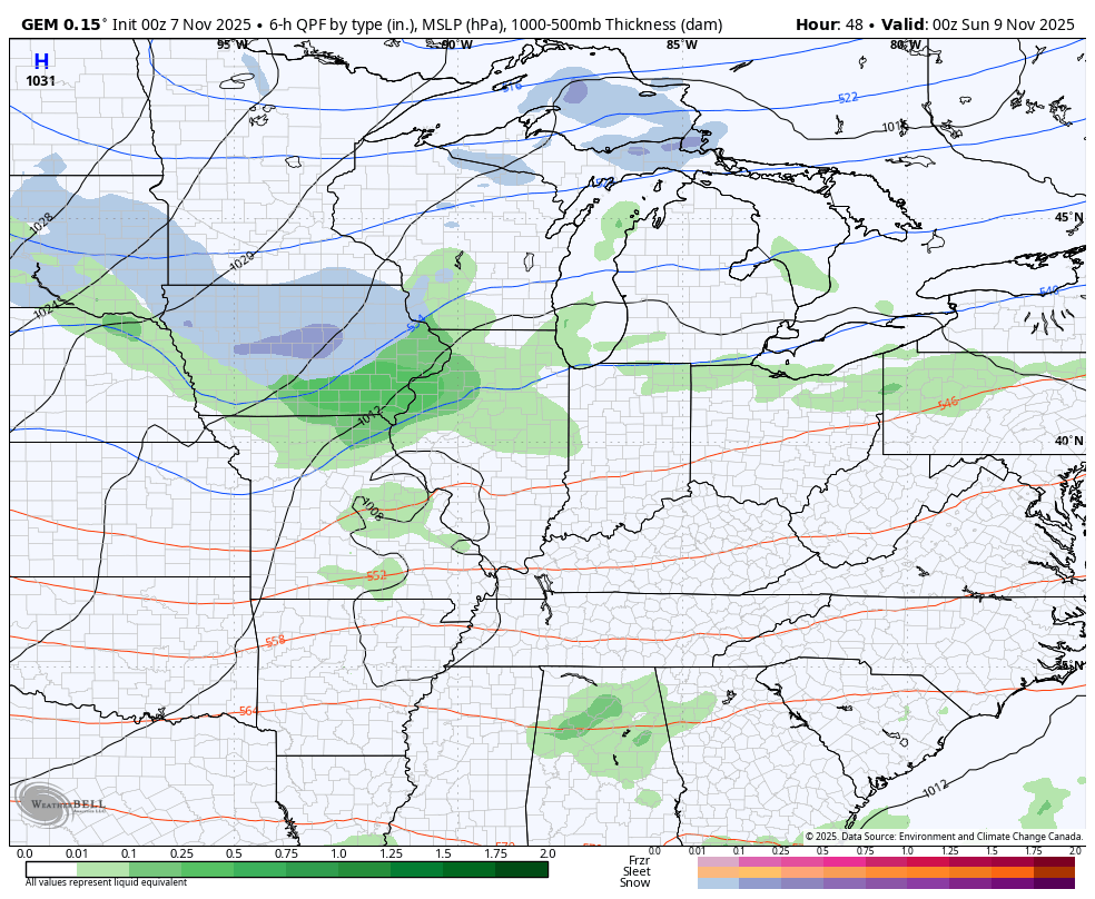
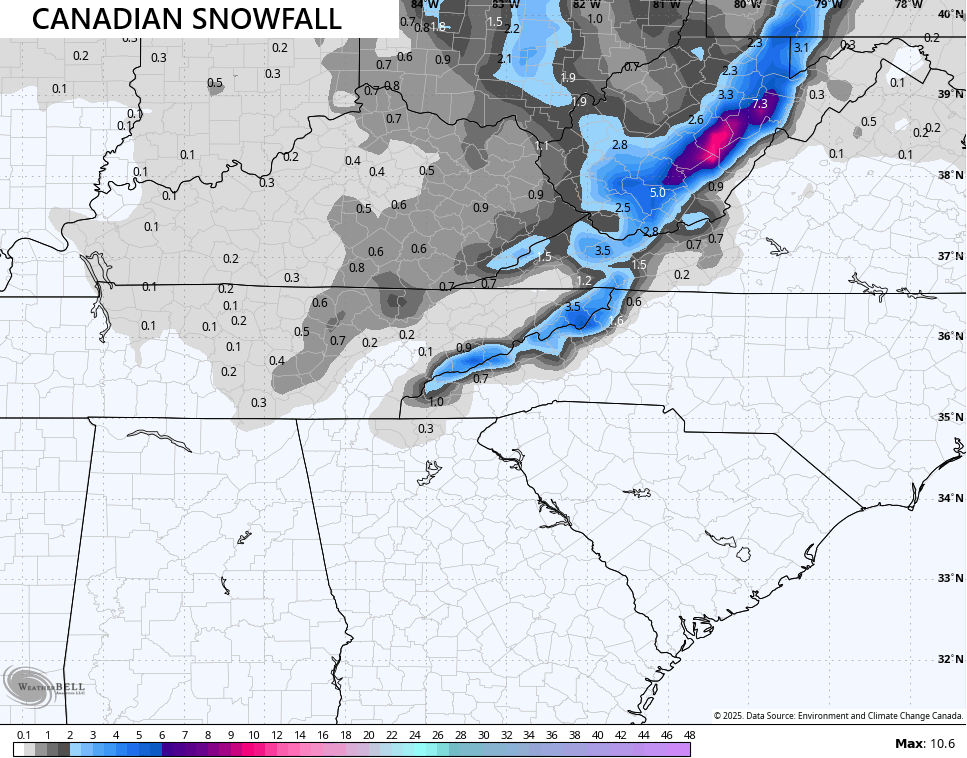
The Canadian Model has a similar setup but is a little weaker with the upper low…
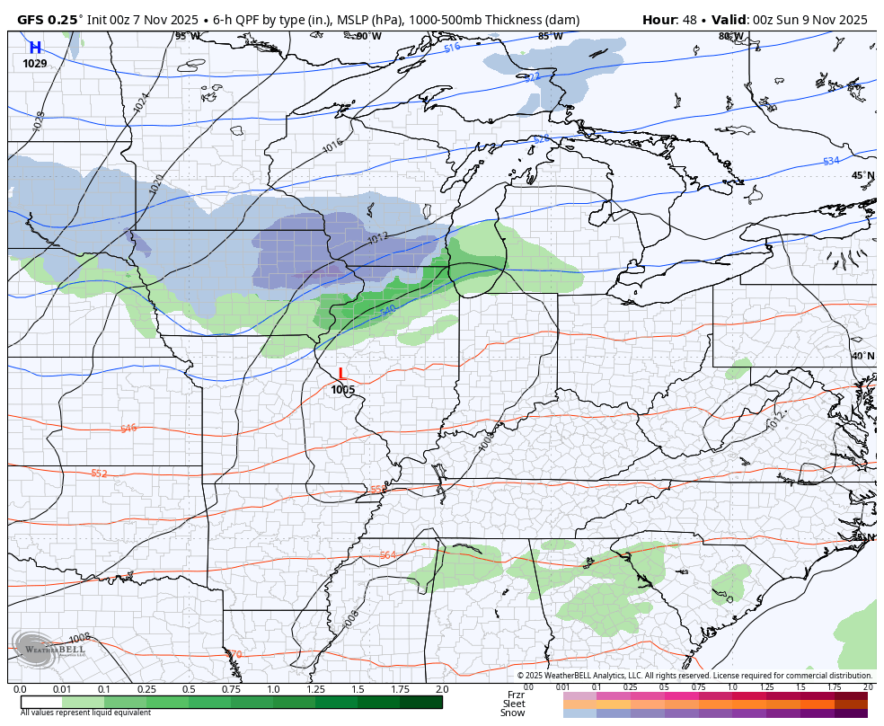
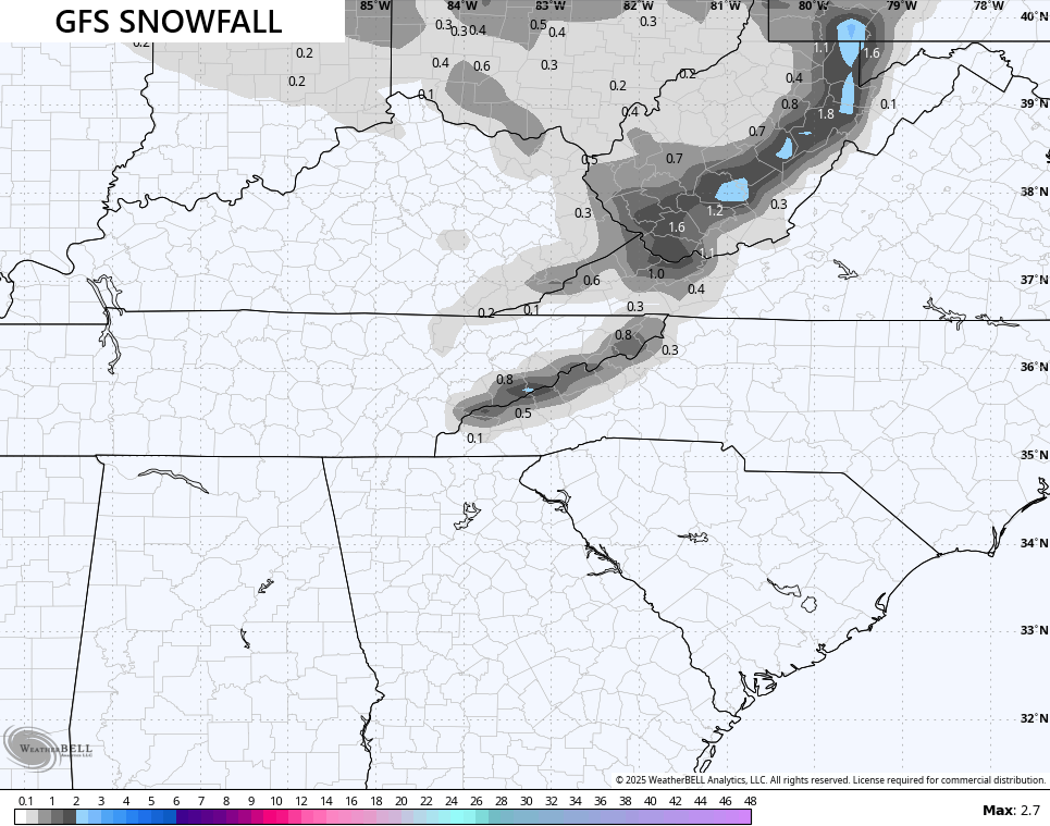
The GFS continues to be way too progressive, but you can see the model trying its best to tell us it’s about to find the upper low in future runs…
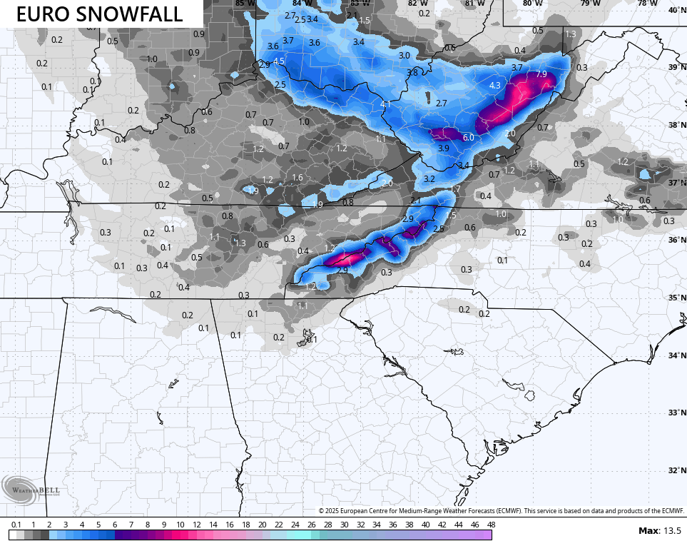
In terms of potential snowfall, the EURO continues to show a comma head of snow along and north of the track of that upper low. Given the EURO is pretty strong with this upper low, it’s spitting out the best snowfall potential of all the models…
The Canadian has a much weaker look, but you can see a similar orientation of the snows…
The ICON is also similar to the EURO, but with a much weaker snow band…
![]()
![]()
The GFS is still going to GFS, but you can see changes in the model from prior runs as it’s starting to figure out to slow things down and allow the upper low to dig in…
I may very well have to come out with a “best chance” map later today.
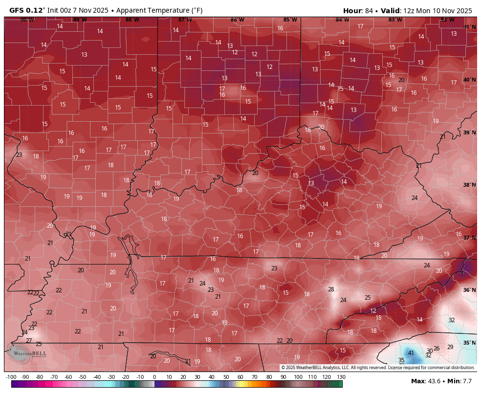
Bitterly cold wind chills are with us from Sunday night through Tuesday. It’s rare to see wind chills in the low and mid teens this early in November, but that’s one thing the EURO and GFS continue to agree on.
Here’s the EURO from 7am Monday to 7am Tuesday…

The GFS is similar for the same time period…
This cold slowly pulls away with near normal temps for the second half of the week. The setup after this is likely to see some back and forth with the temps and I’m still concerned we could get another overachieving trough to dig into the eastern half of the country the following week.
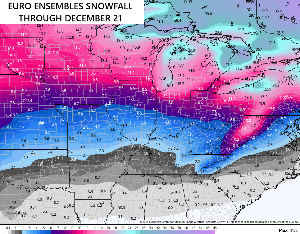
Looking down the road, we continue to see the EURO Weeklies heading toward an early start to winter. If we look at the 30 day period from November 21-December 21, we see a large trough in the means across much of the country…
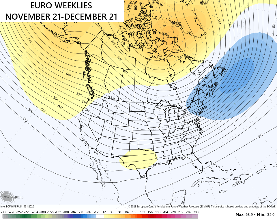
That’s a cold setup and one that can feature some pretty intense cold shots as we get deeper into December. It’s also one that continues to give us a pretty decent snow signal across the country. The average from the 101 members of the EURO Ensembles looks like this through December 21…
I will have updates as needed today and on my Meteorologist Chris Bailey Facebook Page
Until then, here are your storm tracking tools for the day…


Current watches

Possible Watch Areas

Make it a great Friday and take care.

Adjustment in the Winter 2025 – 26 outlook issued 11 / 7 / 25 : )
https://climateimpactcompany.com/u-s-month-1-4-outlook-winter-2025-26-is-adjusted-colder-especially-east-in-january-2-2/
Trending cooler – interesting! Thank you for sharing!