Good evening, everyone. The severe risk across south central and southeastern Kentucky is winding down this evening as the first system moves away. This leads us into a nice Saturday before Old Man Winter makes an early appearance from late Sunday through Tuesday.
The Storm Prediction Center continues to highlight the south and southeast for the evening severe threat…

This action moves out of the state around mid-evening.
I promised you guys a map for the late Sunday and Monday snow potential and I made one earlier today. This is a first look at my thoughts which will change as we get closer. Needless to say, I like the snow potential…
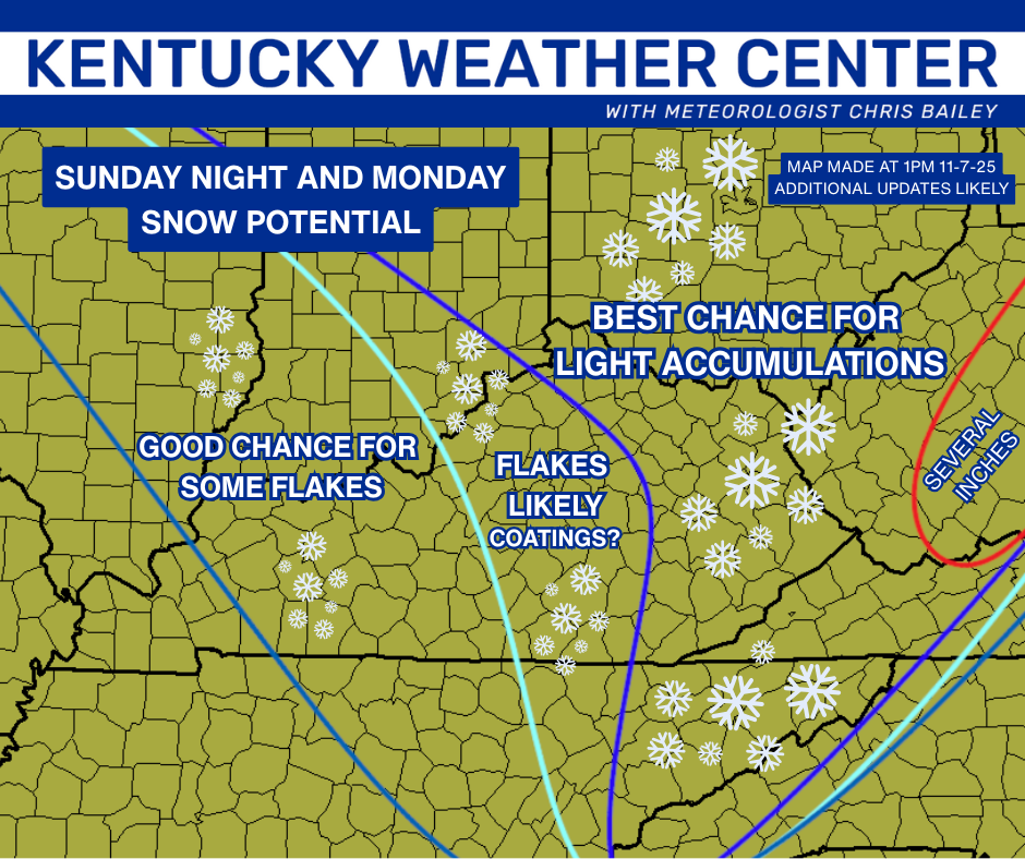
Could the first First Call for Snowfall of the season be needed for this one? Probably so.
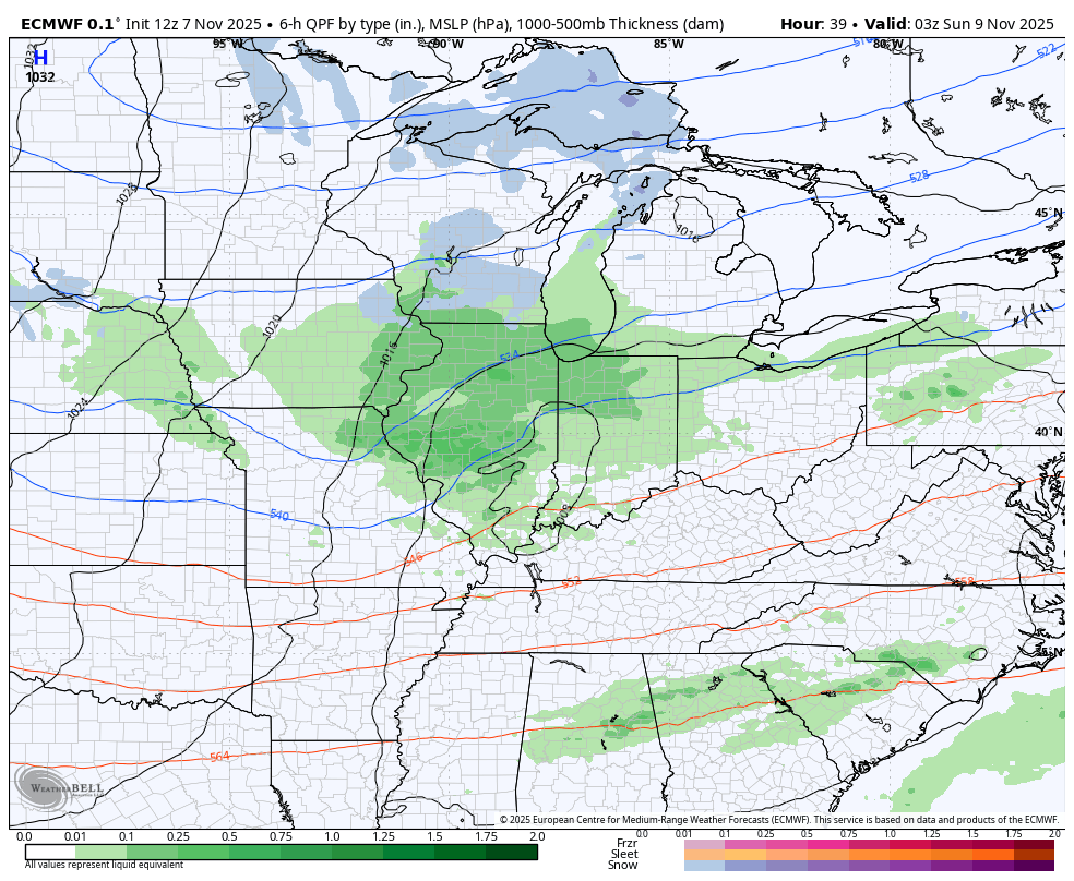
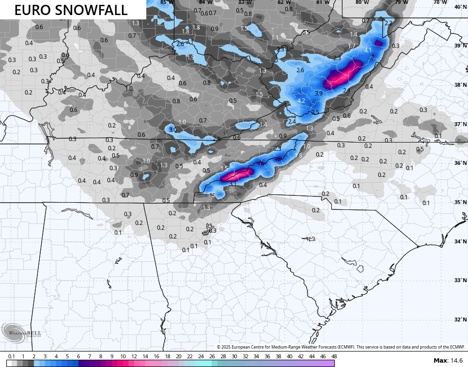
As far as the models are concerned, the EURO has been leading the way and continues to do so. It has been insistent upon rain showers changing to snow showers being the main low Sunday evening. It’s also been the only model consistently bringing the upper low dropping in from the northwest with widespread light snow and snow showers for Monday.
Here’s the latest EURO from Saturday night through Tuesday…
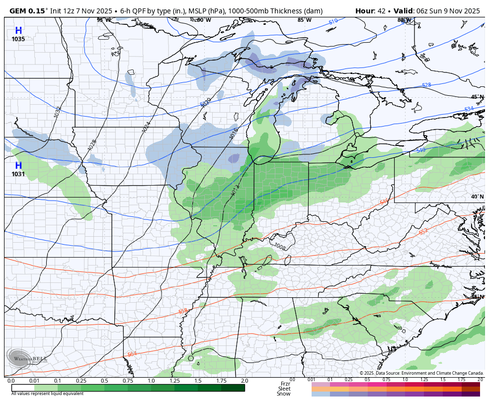
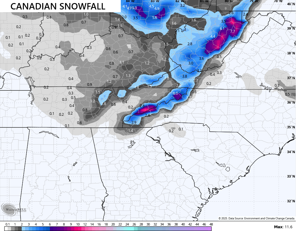
The Canadian caught up to the EURO a day ago and it’s pretty much in lock step…
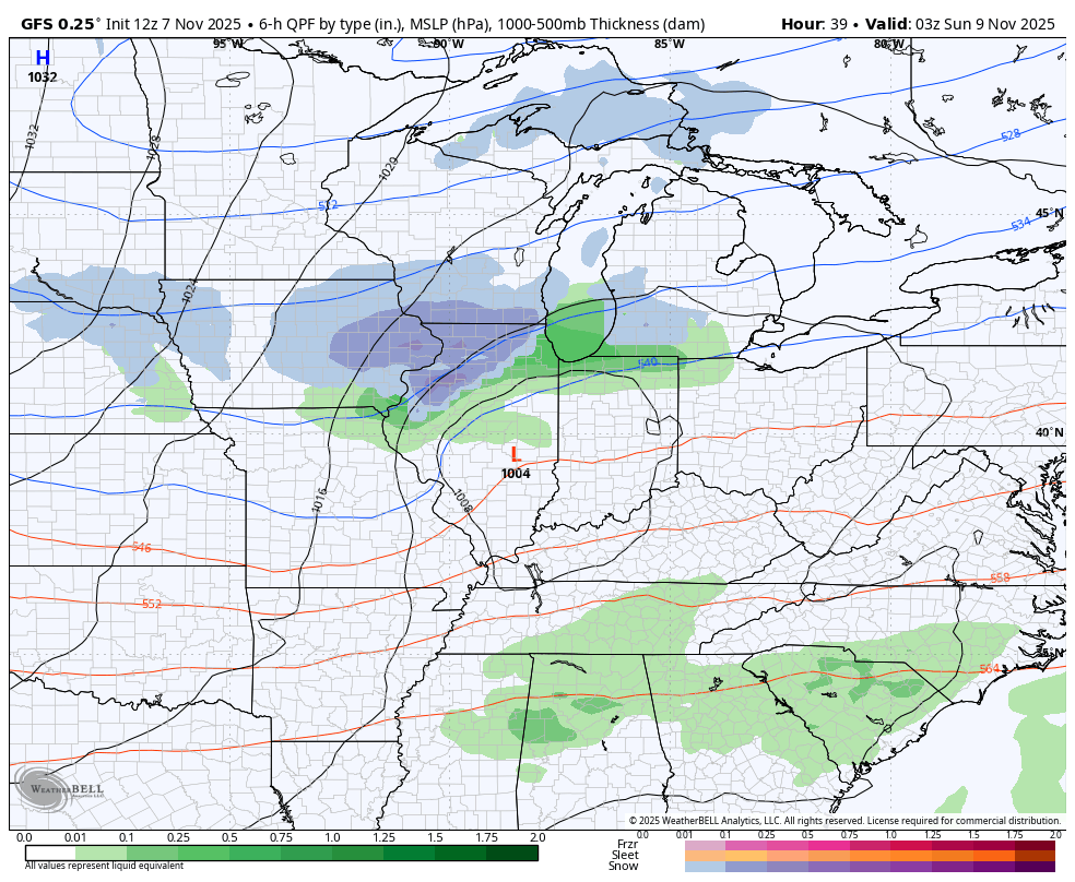
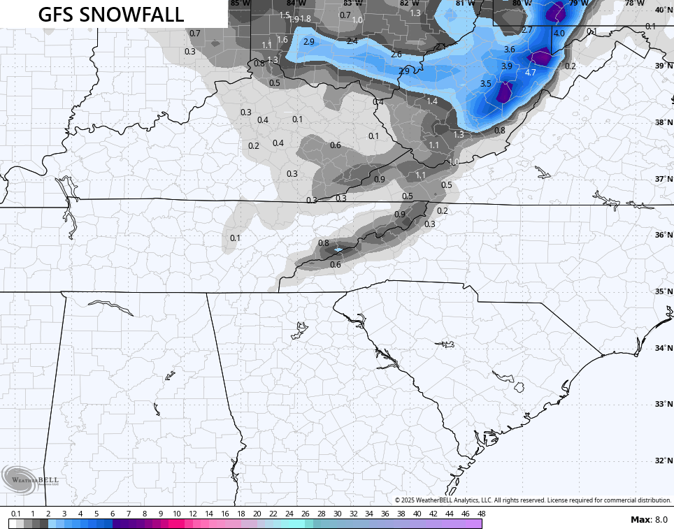
Low and behold we find the GFS starting to do exactly what I said it would as it’s finally starting to see the upper low for Monday, but still has work to do…
The latest snowfall maps from the models are starting to slowly look like one another…
Even the GFS is coming around…
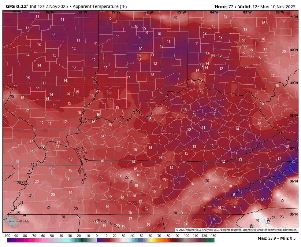
Wind chills continue to look brutal from Sunday evening through Tuesday morning. Teens are likely Sunday night and Monday night. This wind chill animation starts at 7am Monday and goes through 7am Tuesday…
I will have updates as needed today and on my Meteorologist Chris Bailey Facebook Page
Until then, here are your storm tracking tools for the day…


Current watches

Possible Watch Areas

Make it a great Friday and take care.
