Good Saturday to one and all. Today is a great weather day across the Commonwealth as we await the arrival of our first blast of winter. This blast brings arctic air and the first snows of the season later Sunday into Monday.
Temps today reach the upper 50s to middle 60s across the state with a mix of sun and clouds. This is a really nice weather day, with a foggy start being the main drawback.
Low pressure rolls through the Ohio Valley later tonight and Sunday with gusty winds and crashing temps from west to east. Showers are likely along and behind this boundary into Sunday. From there, we find a switch to snow showers and flurries from northwest to southeast Sunday evening.
The upper low drops into the region Monday with another round of light snow, snow showers and flurries with the greatest concentration across central and eastern Kentucky. I like where I have the snow potential lines as of now…
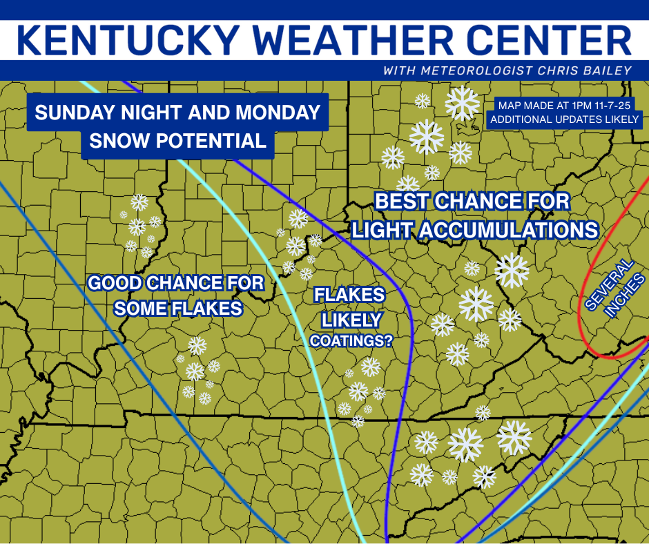
I’ll likely put out the first First Call for Snowfall of the season at some point today, so check back.
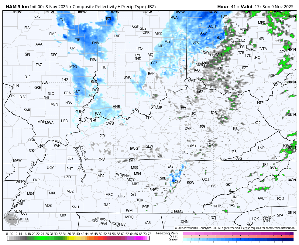
The Hi Res NAM only goes through Sunday night as of this update. The future radar from the model gives us a good look at the initial snow showers and flurries through Sunday night. This animation starts at Noon Sunday and goes through 7am Monday…
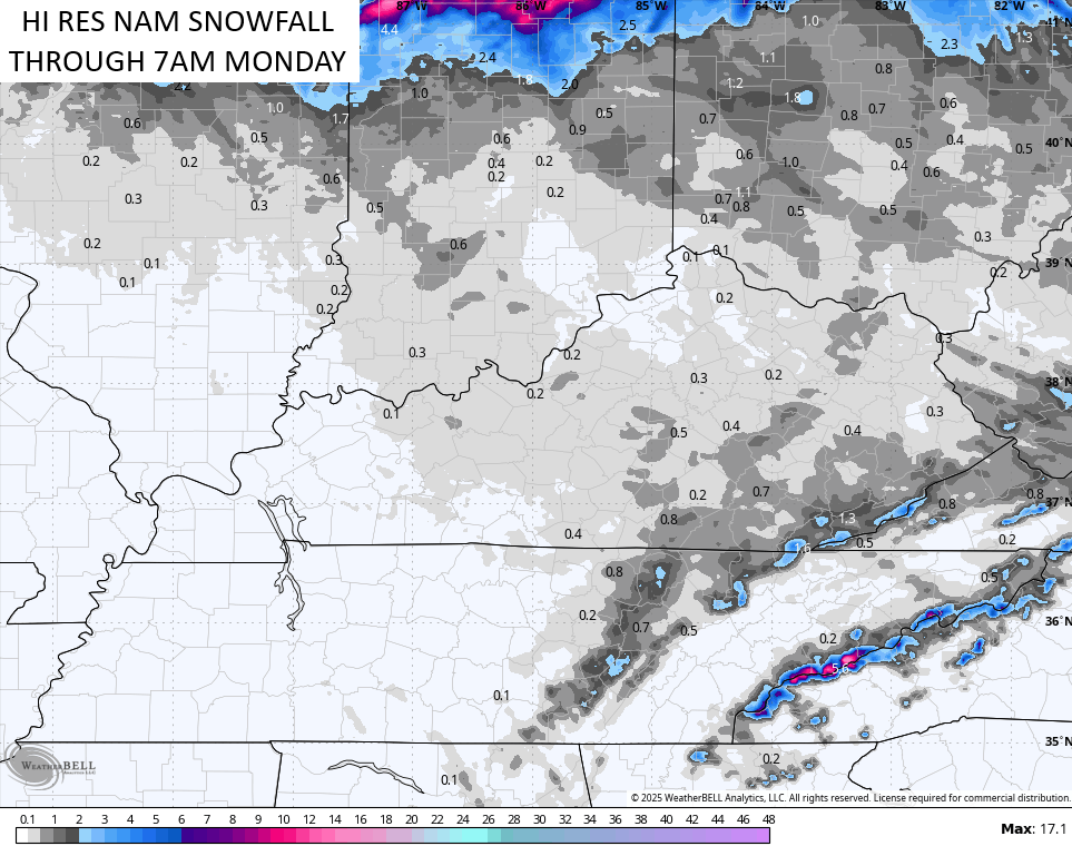
Here’s the snow outlook from that run through 7am Monday…
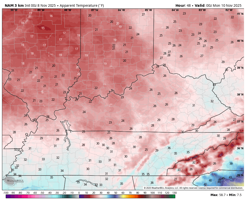
Let’s keep focusing on this Sunday and Sunday night period for a second as the wind chills are brutal. Watch how quickly the wind chills drop through the 20s from 7am Sunday to 7pm Sunday…
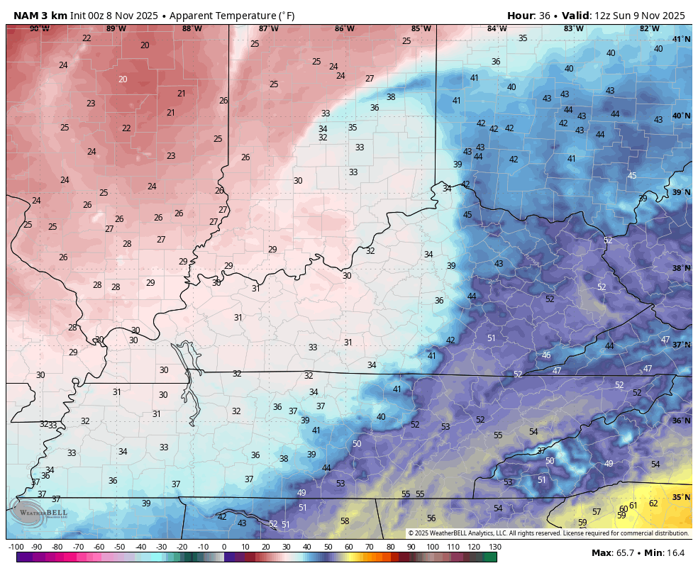
This sets the stage for a wicked cold Sunday night with wind chills in the low teens…
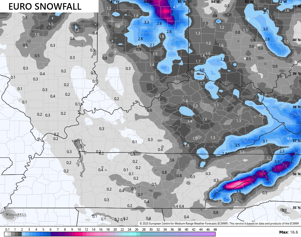
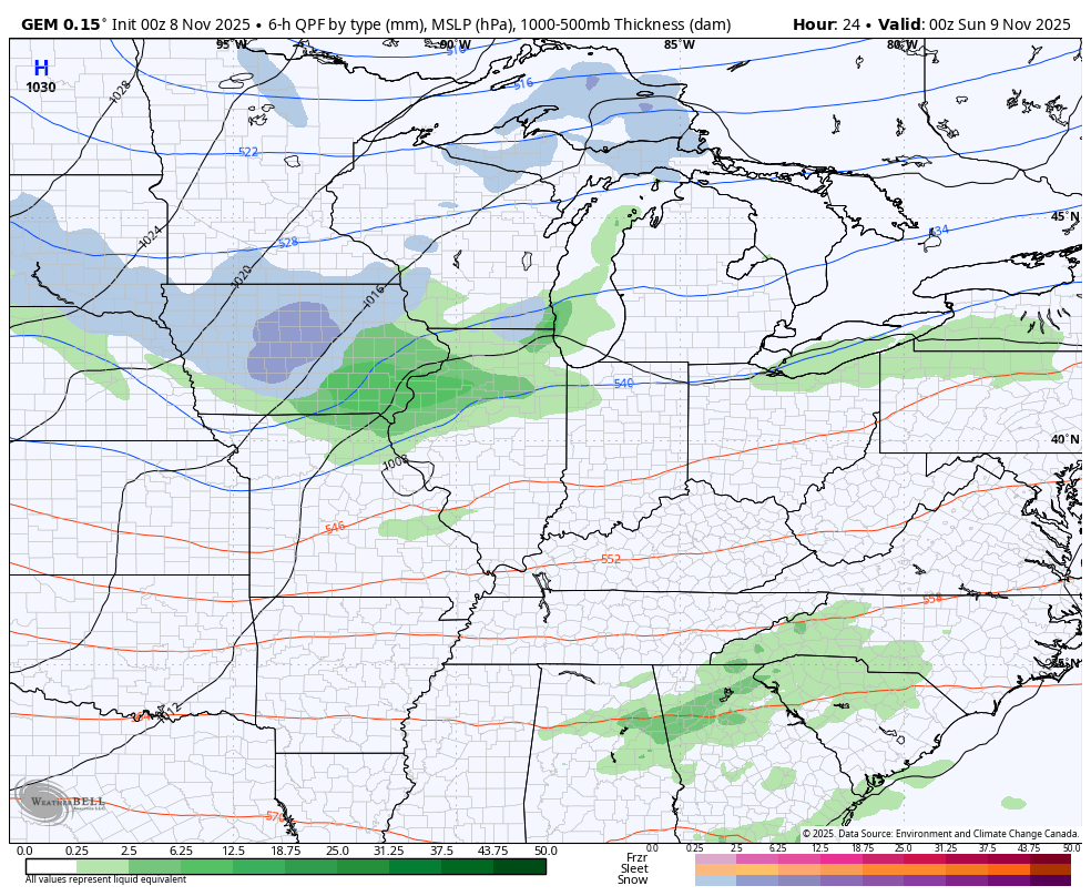
The European Model continues to be our most consistent forecast model and has been for many days now. It’s still the strongest with the upper low dropping in from the northwest on Monday, bringing a good swath of light snow with it.
This animation starts at 7pm this evening and goes all the way through Tuesday morning…
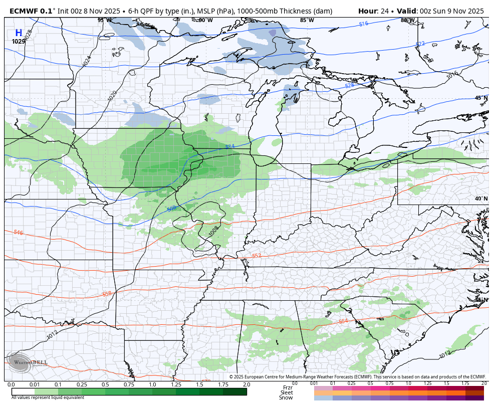
The latest from this model continues to bring a good shot of light accumulations to much of central and eastern Kentucky…
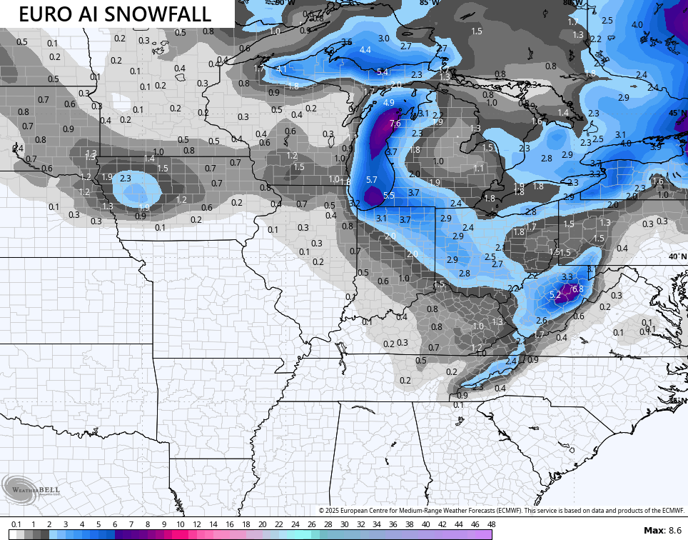
The EURO AI isn’t as specific with snowfall, but has a similar overall swath…
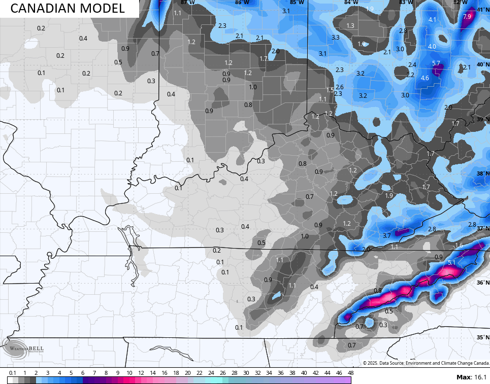
The Canadian is also giving us a good view of this same upper low…
It’s just a touch east with the track compared to the Euro and this is also reflected in the snowfall forecast…
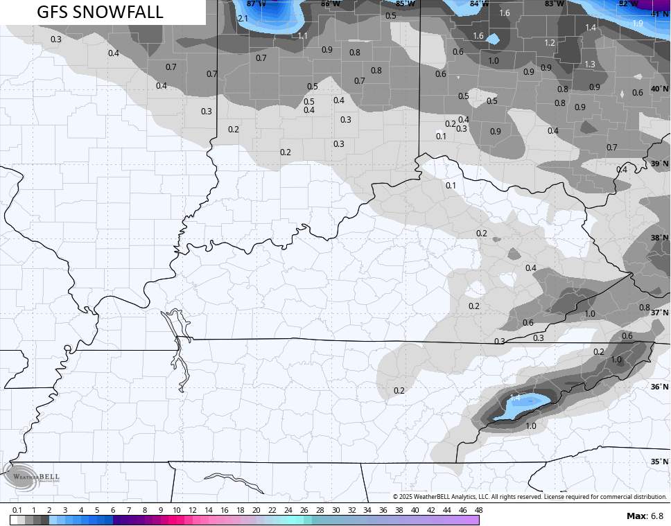
The GFS continues to have issues with the whole evolution…
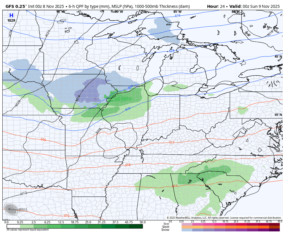
The snowfall map doesn’t have any other model friends as of right now…
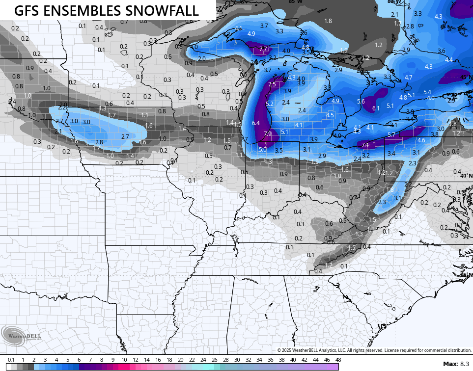
Even the GFS Ensembles average snowfall is healthier and more widespread…
The wind chills are pretty darn ugly for so early in the season with teens for Monday morning then again Tuesday morning. We start things at 7am Monday and roll through 7am Tuesday…
I will have a couple updates coming later today and on my Meteorologist Chris Bailey Facebook Page
Make it a sensational Saturday and take care.

Festive flakes and nothing more.
Thanks Chris. Your Snow potential map describes La Nina’s Winter pattern perfectly.
A Winter Storm Watch had been issued for Cook County in NE IL for the Sunday night and Monday time frame for intense lake effect snow with rates in excess of over 2 inches an hour, with a total accumulation of over 6 inches in some areas.
It’s exciting to have a significant snow event this early in the snow season, even though this won’t be widespread. Maybe this snow season we’ll make up for the much-below normal snowfall of the last two seasons.
Road trip
That’s wonderful Mike. A good Snowstorm gets everyone in the Holiday Sprit. Lake Michigan is a great Snow maker, when we have La Nina Winters. I don’t think we will have a flake of Snow here in South Central Kentucky, but we did have a decent rain yesterday evening. The great Snows will be in the West Virginia mountains, as Chris indicated on his Snow map. Right now the weather here is beautiful, as are the Fall colors. I hate to see all that Cold, Dry Arctic Air coming in late tomorrow and Monday, but it looks like a nice warm up later in the week ahead.