Good afternoon, everyone. With gorgeous fall weather out there today, it’s hard to believe that Old Man Winter is about to smack us around for a while. Arctic cold temps and snows are on the way to much of the region. That means I’m dusting off the First Call for Snowfall map pretty darn early this year.
Before we get to the winter weather, there’s the chance for a few strong storms later tonight as the cold front crashes in. This boundary will bring gusty winds and crashing temps along for the ride as well.
The Storm Prediction Center even has a small area in northern Kentucky included in the Marginal Risk for severe storms tonight…

Before we get to the First Call, here’s a quick breakdown of what’s to come:
- Gusty showers will be with us during the daytime on Sunday as temps drop into the 30s during the afternoon.
- Rain showers mix with and change to snow showers from the northwest Sunday evening into Sunday night.
- Some small accumulations will be possible Sunday night.
- Monday has the best chance of seeing some snow on the ground as the upper level low drops in from the northwest.
- Light snow and snow showers should be fairly widespread Monday before tapering off Monday evening.
- Light accumulations are a good bet during this time, especially on elevated and grassy surfaces.
- A few flurries and snow showers will still be possible Monday night.
- Watch for another sneaky band of light snow and flurries trying to move in on Tuesday.
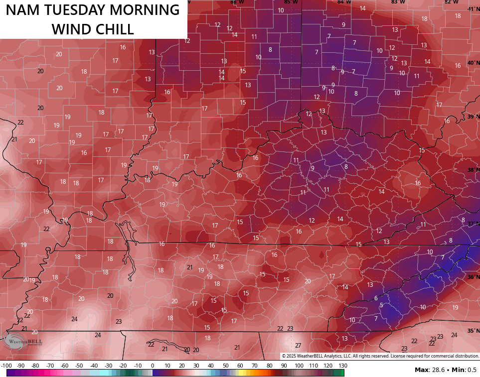
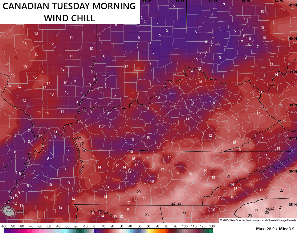
- Bitterly cold wind chills are likely from Sunday evening through Tuesday morning. There’s even the chance for a few single digit wind chills.
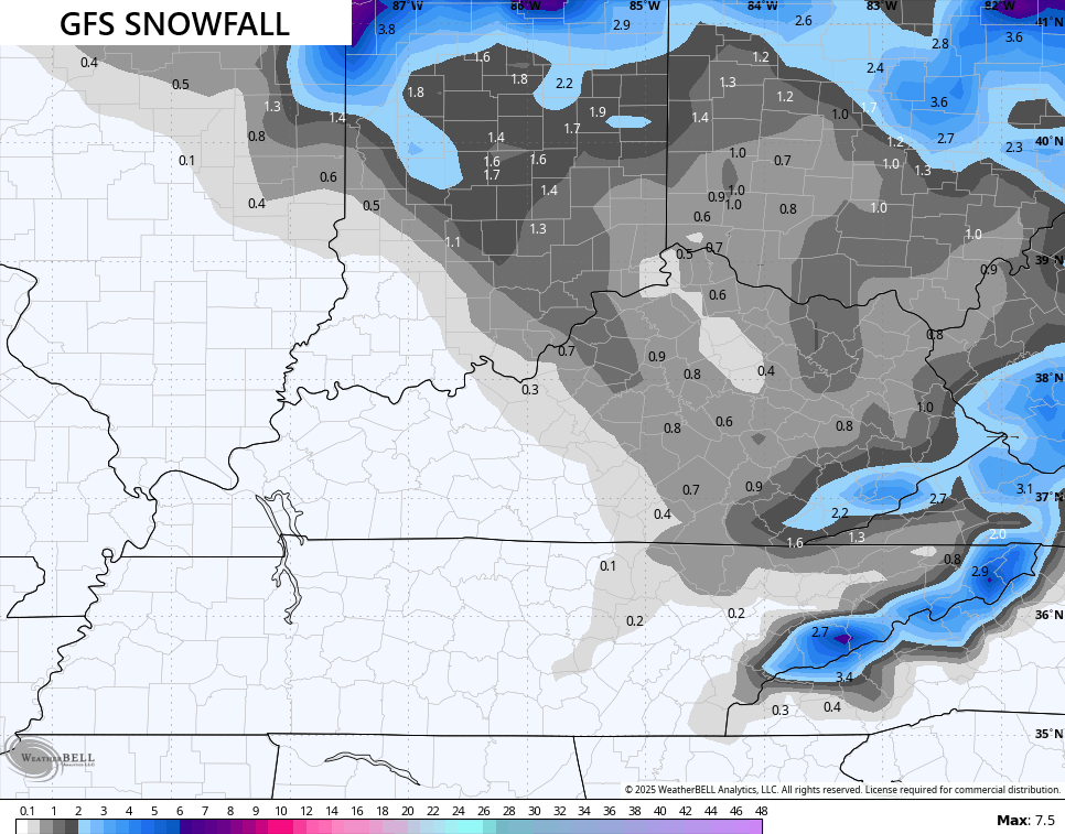
Here’s the first First Call for Snowfall of the season…

Again, much of anything that sticks will be on the grass and elevated surfaces. I’ll be updating that through Sunday and finish with the Last Call for Snowfall.
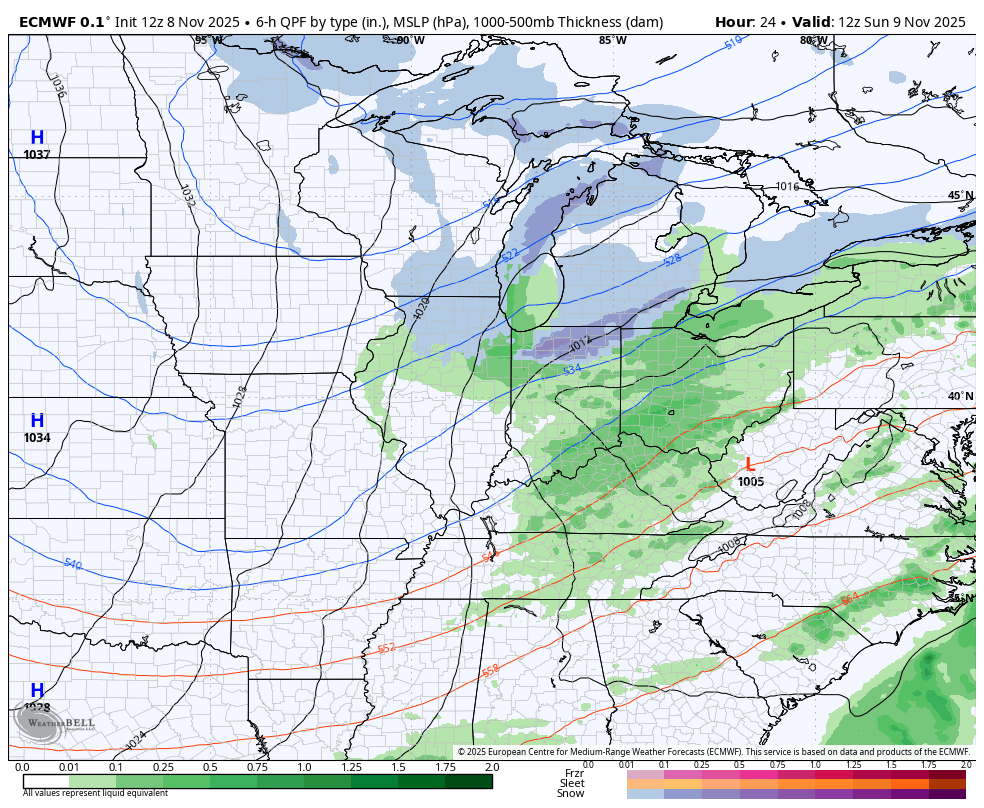
The models are finally all in pretty good agreement, even the GFS.
If we look at the future radar from the Hi Res NAM, we can clearly see the comma head of snow from the upper low on Monday. That could very well overachieve in some areas. This animation starts Sunday afternoon and ends at 7pm Monday…

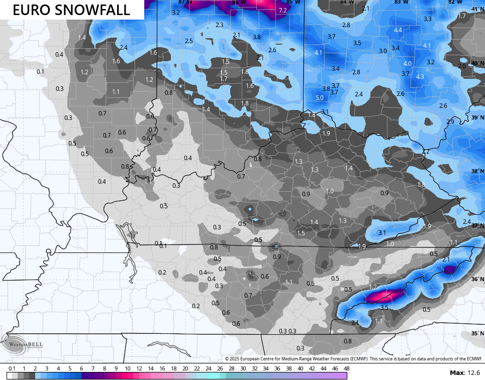
The EURO has been steady as a rock with all this and it continues to show the same thing it’s shown for 5 or 6 straight days…
Here’s the snowfall map from the EURO…
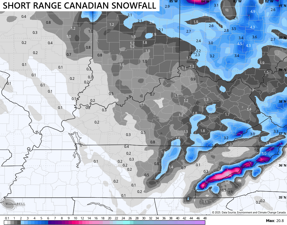
The EURO has had the Canadian Model has it’s best friend for the past few days and the Canadian family shows a similar snowfall look…
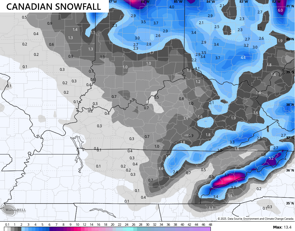
After being lost in the wilderness through this entire event, the GFS is finding some daylight as it trends toward what everything else has been saying…
Brutally cold wind chills kick in later Sunday through Tuesday. Watch how fast those wind chills drop from 7pm Sunday to 8am Monday…
Monday will feel like the low and mid 20s all day long, setting us up for even colder wind chills to start Tuesday. Several models are showing wind chills dropping into the high single digits for some areas…
I will have another update later and I’ll have frequent updates on my Meteorologist Chris Bailey Facebook Page
Until then, here are your tracking tools for the day…


Current watches

Possible Watch Areas

Make it a great Saturday and take care.
