Good evening, everyone. Our wild weekend weather ride is about to kick it up a notch or ten tonight and Sunday as Old Man Winter comes calling. It’s looking more and more like a few strong storms will usher in our first flakes, the first light snowfall and arctic cold temps.
The cold front moving in tonight spawns a few strong storms with a low-end risk for a few severe storms. The Storm Prediction Center has the Marginal Risk out for areas of north-central Kentucky…

Local wind damage is the main threat.
Gusty showers and crashing temps then will be with us during the daytime on Sunday. Once into Sunday evening, we find snow showers and flurries taking over and those increase Sunday night with light accumulations possible.
Periods of light to moderate snow will be likely Monday for much of central and eastern Kentucky. Some embedded areas of intense snow showers and squalls will even be possible. Thunder?
The future radar from the Hi Res NAM gives us a good view of everything I just talked about. This animation starts Sunday afternoon and goes through 7pm Monday. Check out those deep blues showing up…
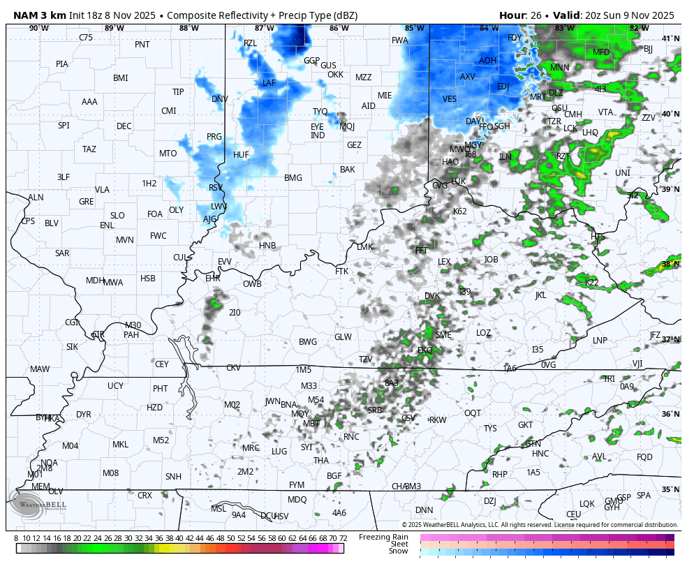
I’m rolling with my First Call for Snowfall, but I have a sneaking suspicion I may have to up a few spots with the overnight update…

One of the most underutilized forecast models in the wintertime is the RAP. You guys have seen me post it many times through the years because it seems to perform pretty well in the cold weather season.
The current snowfall forecast from the RAP goes through 7pm Monday and looks like this…

Well, that’s impressive.
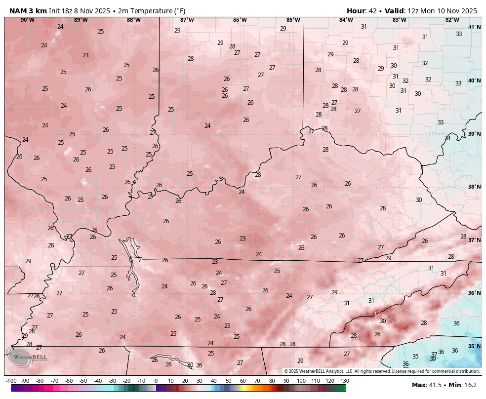
One of the reasons for a better chance for sticking snow on Monday is the temperature trend continues to come way down. Actual temps may stay below freezing all day Monday and the NAM fam is showing this well.
This temperature animation runs from 7am to 10pm Monday…
Throw in the winds and the wind chill may barely crack 20 during the heart of the day. Here are the wind chills for the same time period…
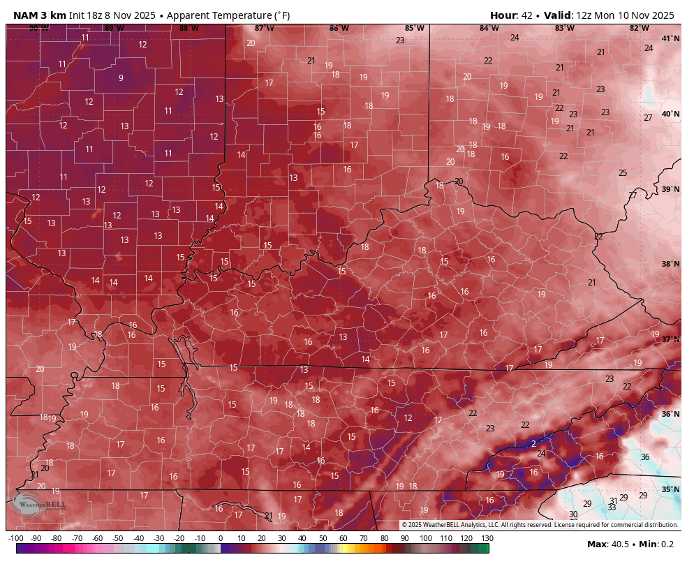
Single digit wind chills are very possible in some spots Tuesday morning.
This is one impressive early season blast of winter, folks.
I will have a full update later tonight and I’ll have frequent updates on my Meteorologist Chris Bailey Facebook Page
Until then, here are your tracking tools for the day…


Current watches

Possible Watch Areas

Make it a great Saturday and take care.
