Good Sunday, everyone. Old Man Winter is announcing his presence with authority around here and across the eastern half of the country. This is a heart of wintertime setup that’s bringing accumulating snows and arctic air for the next few days.
We already have a Winter Weather Advisory for far southeastern Kentucky. There is a REALLY GOOD chance this gets expanded to include many more counties before all is said and done.
Here’s your breakdown of what to expect:
TODAY
- Showers and a few strong storms are possible ahead of the cold front early this morning.
- Winds will crank along and behind this boundary as temps tank.
- Readings drop into the 30s from northwest to southeast this afternoon.
- Gusty rain showers will mix with snow showers by early evening.
TONIGHT
- Periods of snow showers and flurries are likely for central and eastern Kentucky.
- Light accumulations will show up on grassy and elevated surfaces, especially.
- With temps dropping into the 20s, slick spots may develop on bridges and overpasses.
- Cold winds drop our wind chills into the teens overnight into the start of Monday.
MONDAY
- The upper low spins right on top of us, bringing widespread snows to central and eastern Kentucky.
- Light to moderate snows will show up with some heavier bursts in snow showers and squalls.
- There’s even a small chance for some thunder.
- A light snowfall is likely for much of central and eastern Kentucky. Much of that is on the grass and elevated surfaces.
- High temps may not get above freezing, meaning some slick spots on roads will be possible.
- Winds are cranking, creating wind chills ranging from the upper teens to low 20s for much of the day.
- This is just a really nice winter day if you’re into that kind of thing!
MONDAY NIGHT-TUESDAY
- Snow showers wind down Monday night in the southeast with some flurries elsewhere.
- A band of lake effect snow from Lake Michigan may graze northeastern Kentucky Monday night.
- Another flurry maker may also zip across the north and northeast Tuesday.
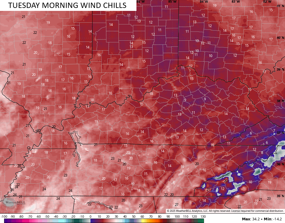
- Wind chills Tuesday morning may hit the high single digits for some areas.
- Tuesday afternoon finds the whole setup finally pulling out of town.
What am I thinking in terms of snowfall? Here’s a New Call for Snowfall…
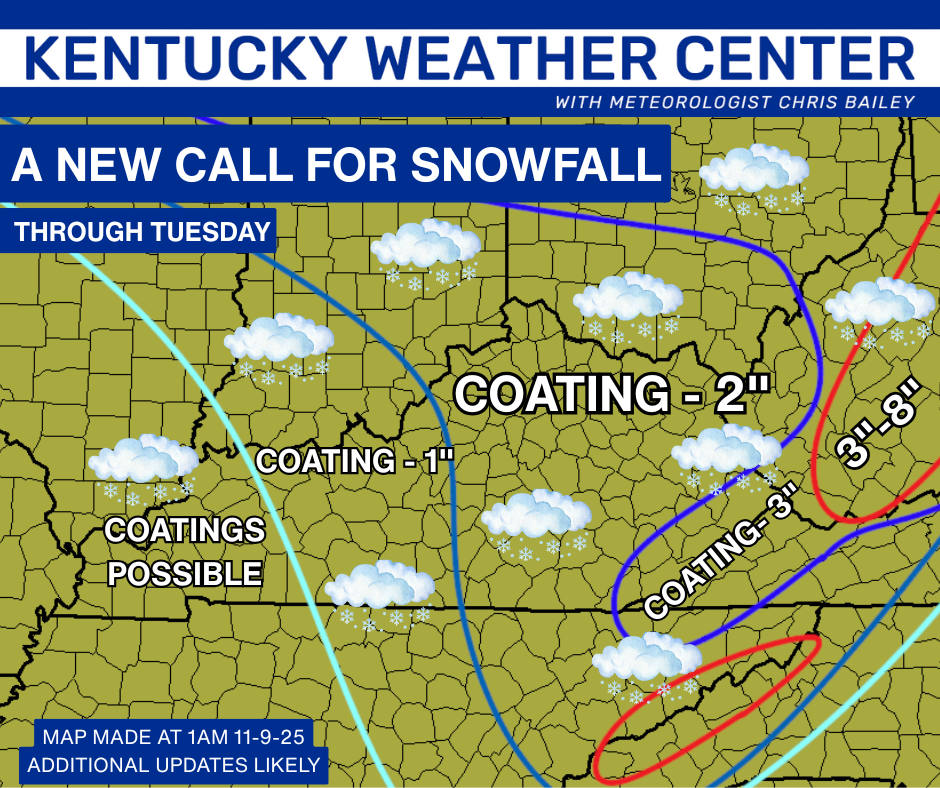
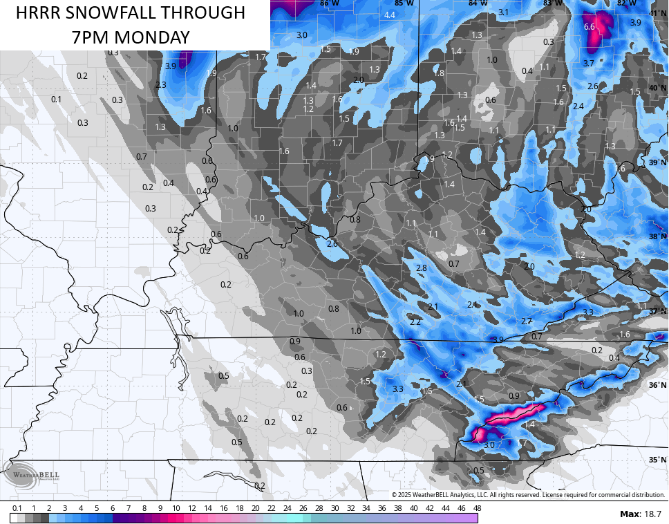
The models are all pretty much set with this whole setup now. The future radar from the HRRR is interesting with the potential for some very heavy snows embedded within this whole mess. Watch the comma head of snow around that upper low Monday.
This animation starts this afternoon and rolls through 7pm Monday…
The HRRR is also showing hints of some… gulp… thundersnow. Check out the lightning potential on Monday…
Here’s the snowfall map from that run of the HRRR…
The HI RES NAM has similar ideas…
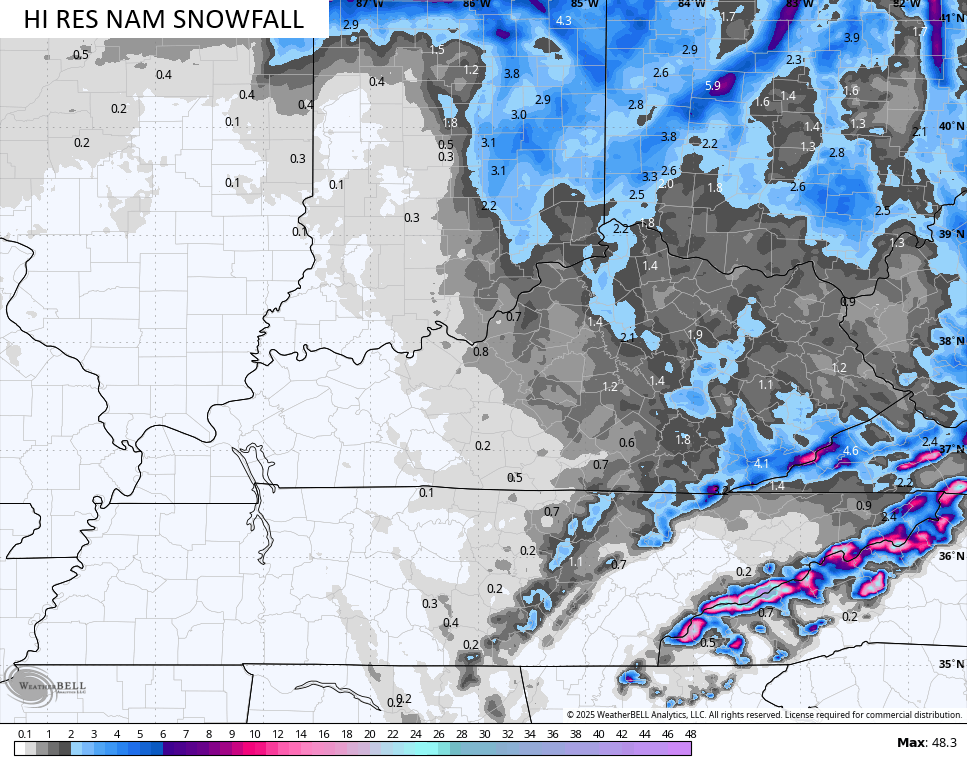
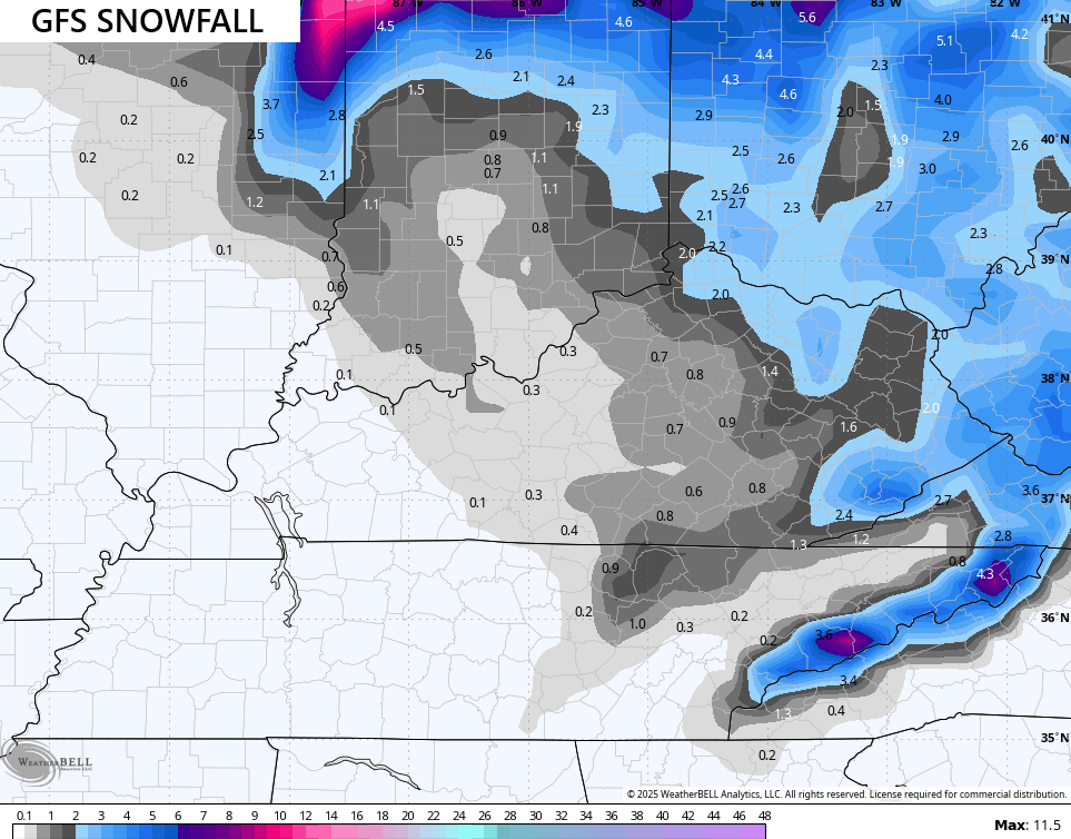
It’s taken until less than 24 hours before the first flakes fly for the GFS to actually see the strength of this upper low. Watch how it increases the snows spinning around it on Monday…
The GFS is also growing snowier with each run…
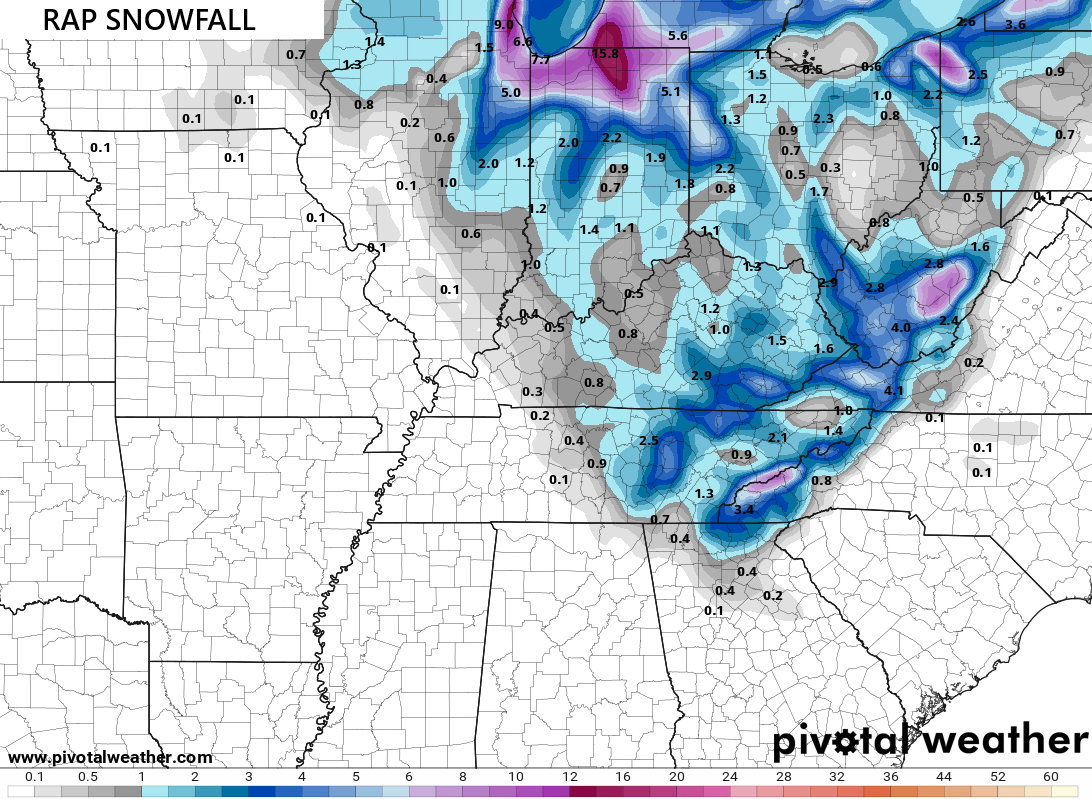
The RAP is pretty darn snowy…
The brutal wind chills are really amazing to see this early in the season, especially coming off such a mild stretch of weather like we just had. This is a wind chill animation starting at 7pm this evening and running through 8am Monday…
Wind chills from 8am Monday through 7pm Monday are nasty…
All of this sets the stage for some rare early November single digit wind chills by Tuesday morning…
Looking deeper down the road to December, I continue to beat the drum about the potential for a lot of winter weather around here and for much of the country. The signs have been there for a while in my analogs, which is why I started talking about a fast start to winter back in the summer.
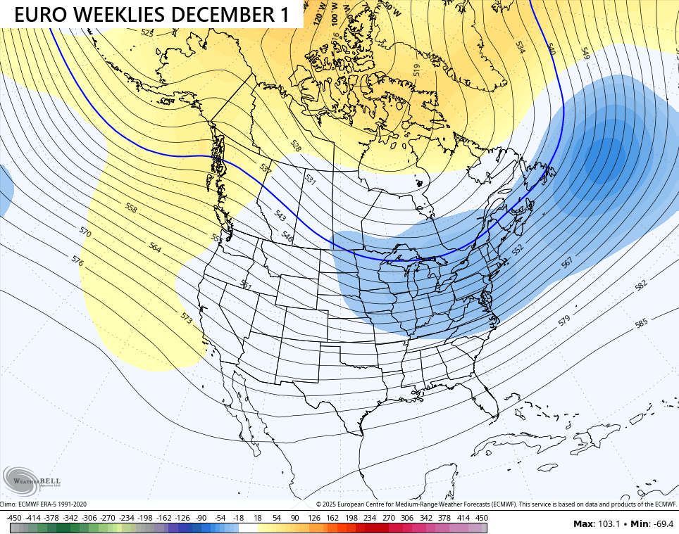
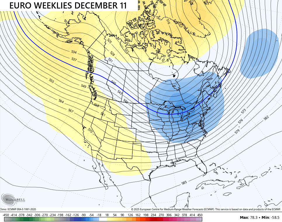
The EURO Weeklies continue to show a very healthy winter pattern for December, and you have to keep in mind that the Weeklies have a very tough time picking up on cold and troughs. The fact they’re consistently seeing this is pretty telling.
Here’s the trough to start the month…
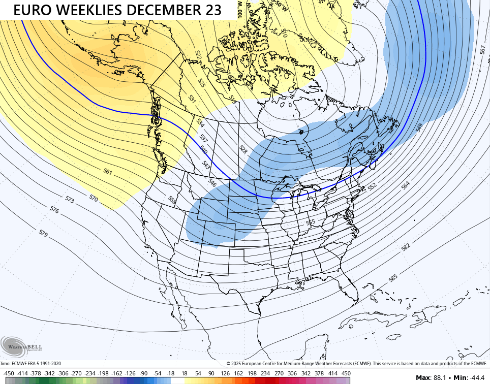
Getting toward the middle of the month…
And into Christmas week…
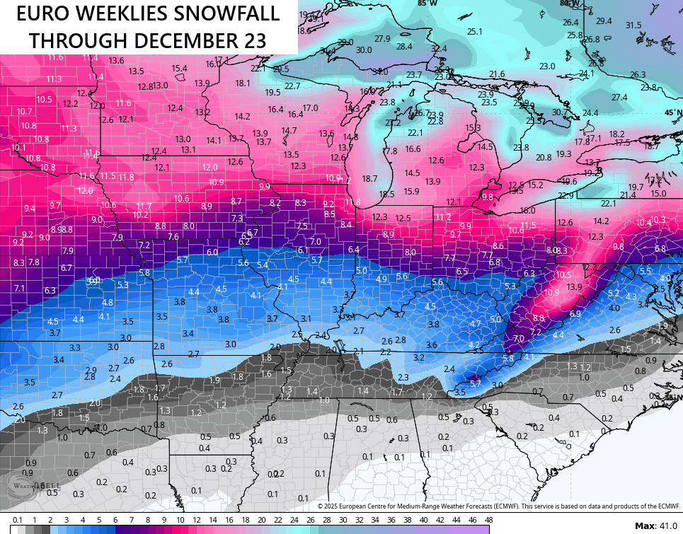
High latitude blocking could very well mean a cold December for much of the United States. You can’t have snow without the cold and the model is seeing plenty of snow opportunities. Here’s the average snowfall through December 23 from the 101 members that make up the EURO Weeklies…
Bring. It. On.
Updates come your way later today here on KWC. I’ll also have frequent updates on my Meteorologist Chris Bailey Facebook Page
Until then, here are your tracking tools for the day…


Current watches

Possible Watch Areas

Make it a great Sunday and take care.

It’s November 9th! You have to admit it’s kind of crazy as it’s still very early to even entertain even flurries.
“Bring. It. On.”
Incorrect take.
If we had an active subtropical jet stream ( + ) merging with the Polar jet stream ( – ) the whole State would have their first accumulating Snow, but that would only occur with a weak El Nino / positive PDO. Doesn’t seem to happen anymore, so we will have to be content with Snow Flurries followed by Cold, Dry Arctic Air UGH ! I’m glad that this first real Cold snap will be short lived. Hoping that the hard freeze tomorrow night will kill the Asian Beetles that are currently surrounding my home.
This is going to be quite a prolific lake snow event for the immediate Chicago area. Winter Storm Warnings have been issued for several counties adjacent to Lake Michigan for Sunday night into Monday morning. The NWS said in their forecast discussion that the amount of instability that will be over Lake Michigan is incredible, and something they have rarely ever seen before. They are even warning of impossible life-threatening travel early tomorrow for areas that get hit with the heaviest lake snow bands. Snowfall rates could be as high as 3 to 5 inches an hour!
The predicted accumulations are absolutely crazy… between 12 and 18 inches for the city of Chicago and nearby areas by Monday afternoon, with a ceiling of 2 to 4 feet of snow if the most intense snow bands park over any area for several hours!
The departing system brought us the first snow of the season, about a half-inch of slushy accumulation on non-paved surfaces this morning where I am located about 40 miles SW of Chicago.
It’s a very cold, windy day, with temps in the low 30s and a wind chill near 20. Perfect Bears weather for the football game today!
Thanks for the update Mike, and Stay Safe. Keep us posted on your Snow accumulation. Very interesting weather to track there. Boring here.