Good afternoon, everyone. An early-season winter blast is sweeping into Kentucky, delivering not just our first snowflakes but also the season’s first light accumulations. Bitterly cold early November wind chills will also flex on us over the next few days.
Let’s start with a look at the Winter Weather Advisory for far southeastern Kentucky…
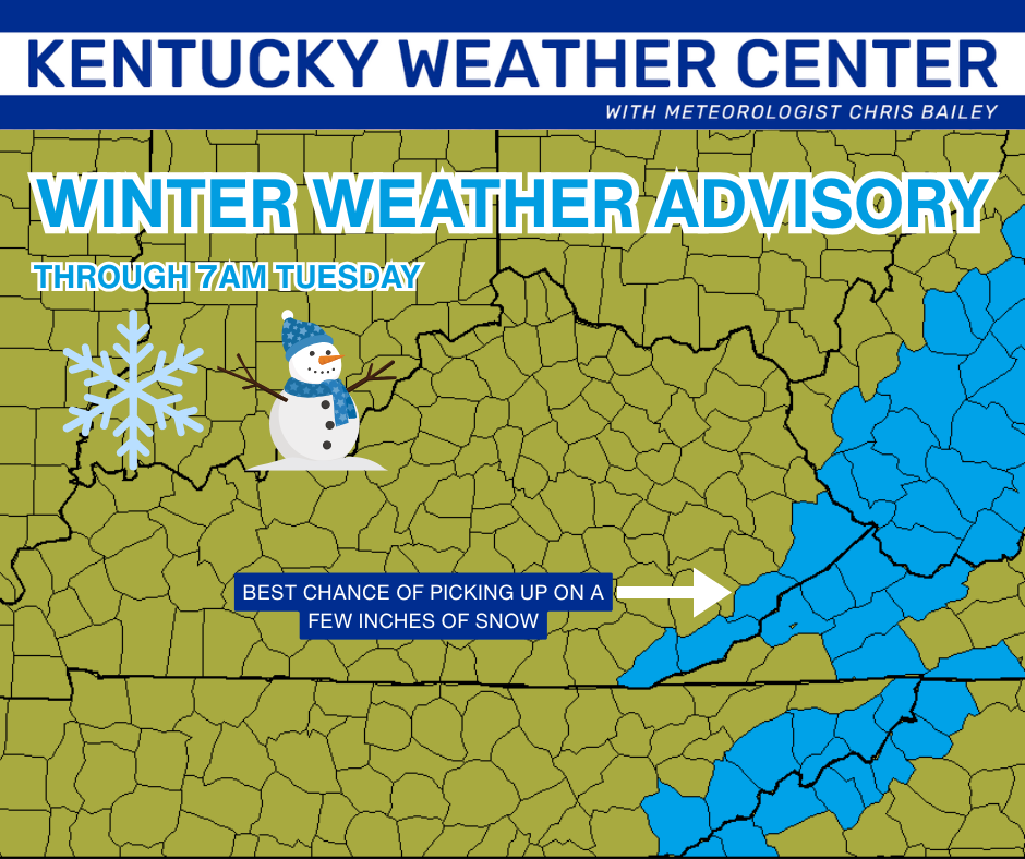
I expect several more counties to be added to that at some point later today or tonight.
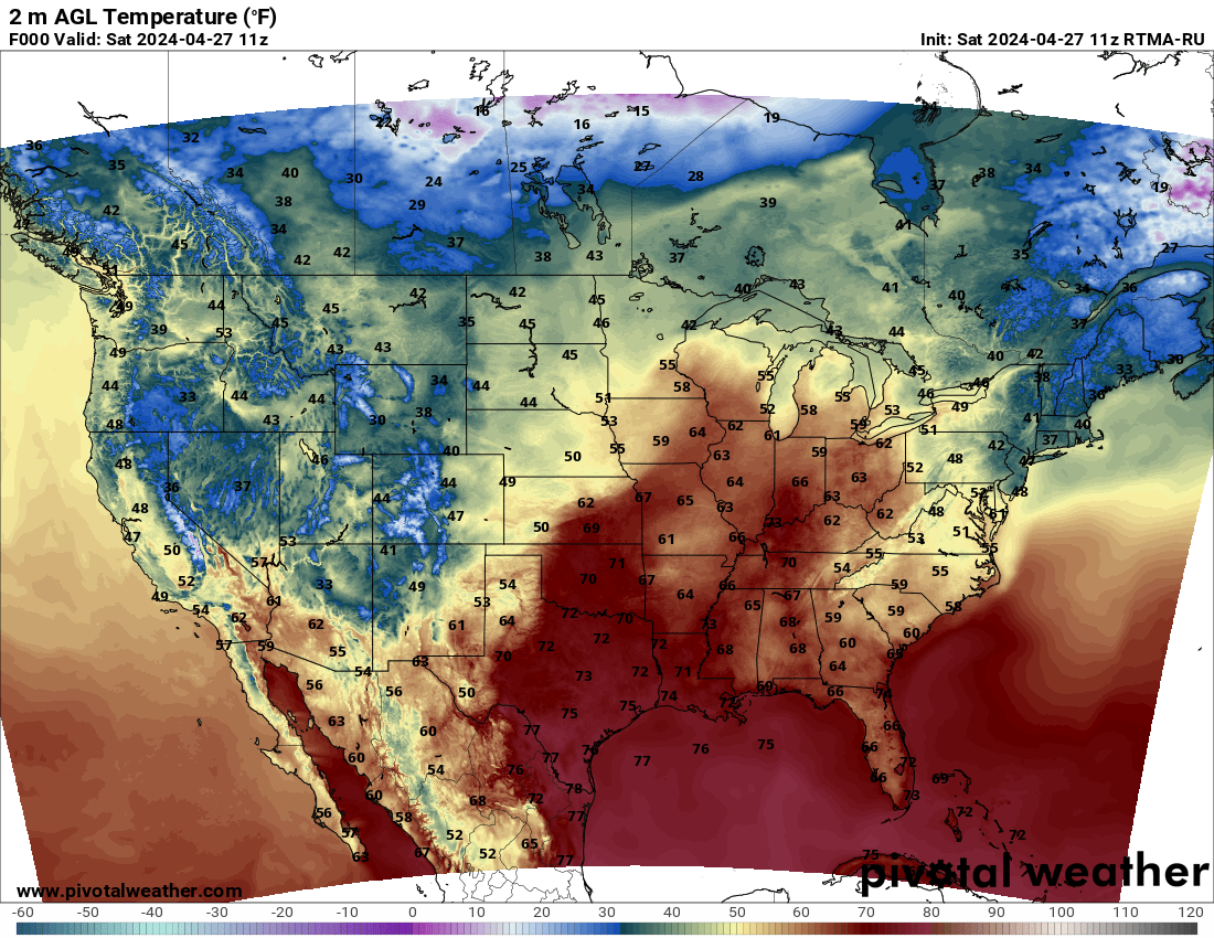
Temps are crashing across the Commonwealth this afternoon as the 30s take over from northwest to southeast. Track the cold with this map that updates around the top of each hour…

A broader look at the temps shows the impressive surge of arctic air diving in here from the northwest…
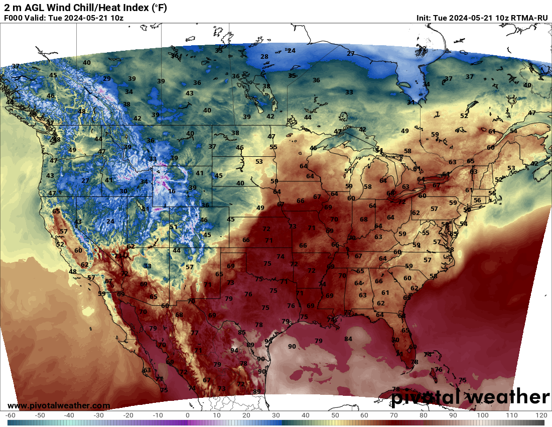
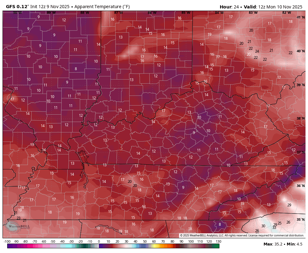
The Wind Chills are brutal…
I have no changes to the overall forecast as rain showers change to snow showers and flurries this evening with those continuing through tonight. Light accumulations show up for some
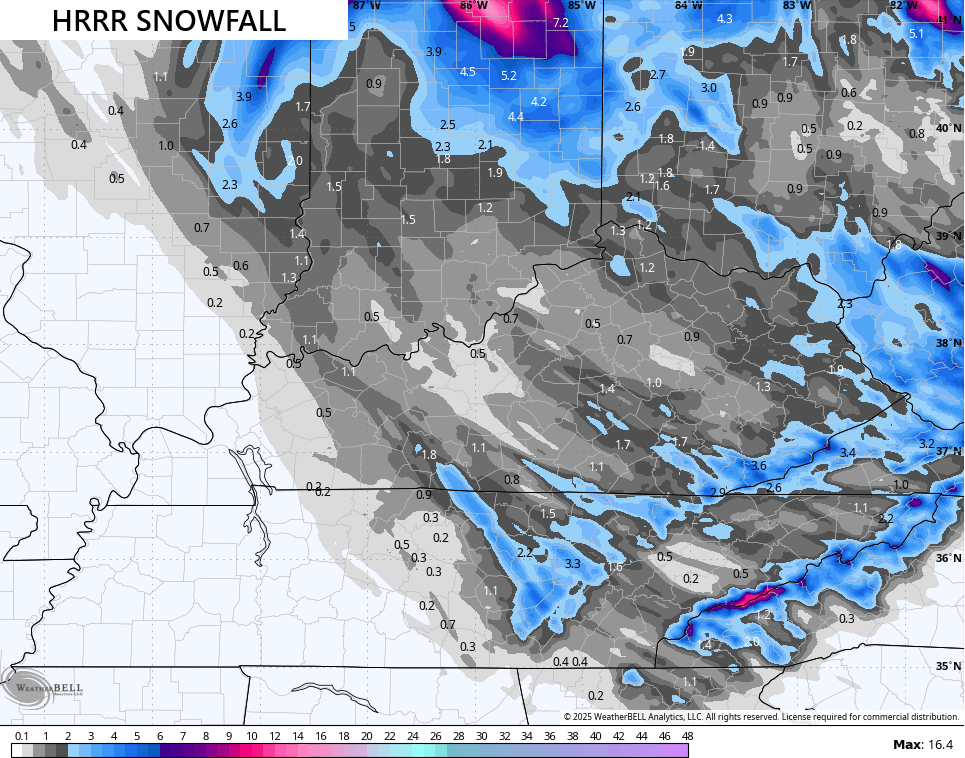
with the best snows coming on Monday as the strong upper low swings in from the northwest. The latest Call for Snowfall stands…
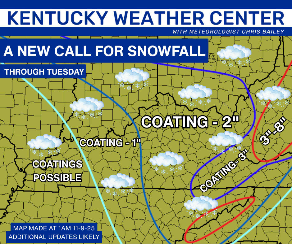
The HRRR continues to show streaks of heavier snows farther west and that is a concern if snow squalls ramp it up…
Brutally cold wind chills are kicking in right now and will drop close to 10 in some cases tonight then again Monday night…
Another update or two will come your way later today here on KWC. I’ll also have frequent updates on my Meteorologist Chris Bailey Facebook Page
Until then, here are your tracking tools for the day…


Have a great Sunday and take care.
