Good Friday to one and all. Mild winds are REALLY kicking in out there today and this will continue into Saturday before a cold front cuts it off by Sunday. This leads us into a very busy pattern taking shape for next week. That continues into the start of Thanksgiving week with winter lurking to end the big week.
Today is a mainly dry sky with just the chance for a stray shower. Temps surge toward the low 70s west and low to mid 60s east.
Winds really crank tonight into Saturday with 30mph gusts a possibility. Temps hit 70-75 west and 65-70 east on Saturday. Clouds will be noted from time to time ahead of a cold front dropping in here Saturday night.
This looks to spit out a broken band of showers in the central and east…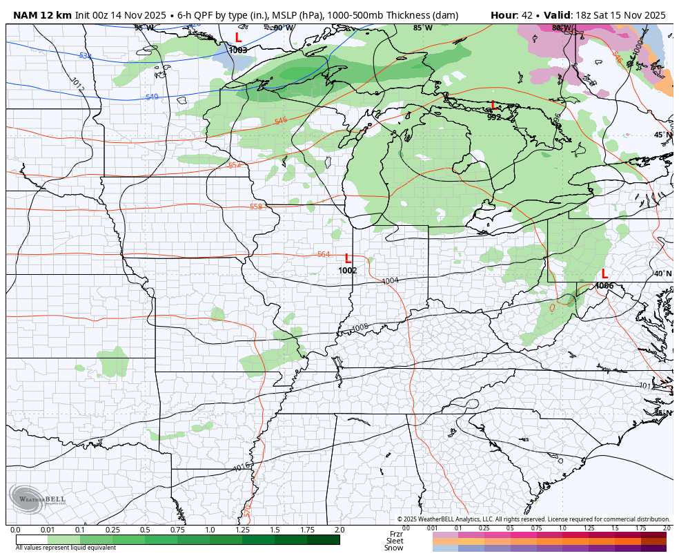
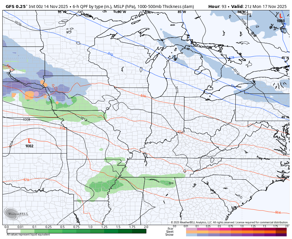
Temps come down to seasonable levels on Sunday into Monday with another system coming in from the west late Monday into Tuesday. This brings a quick-hitting round of showers with it…
This active setup is a lot for the models to handle as we have several big storm systems set to roll across the country. With high latitude blocking kicking in, some wild swings will continue to show up with how the models handle each system.
The system coming in for mid to late next week looks different with each run. The latest is for a slower system with more cold air coming behind it…
Canadian…
This is not a good pattern for the EURO as the model is pretty much awful with western troughs and knowing how to eject those eastward.
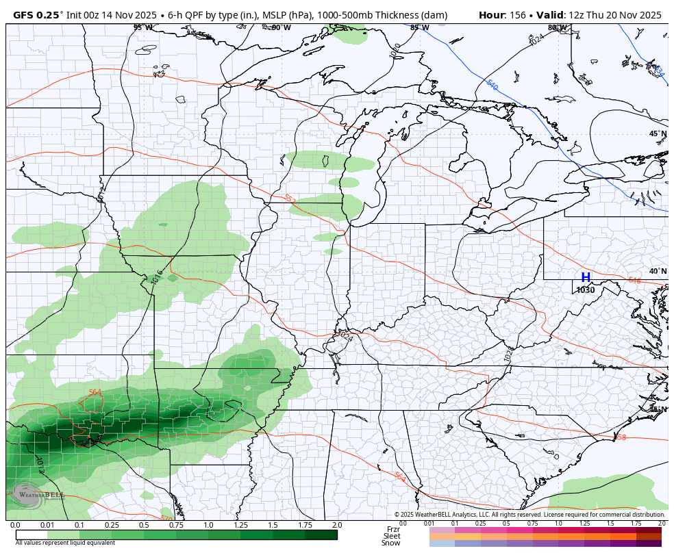
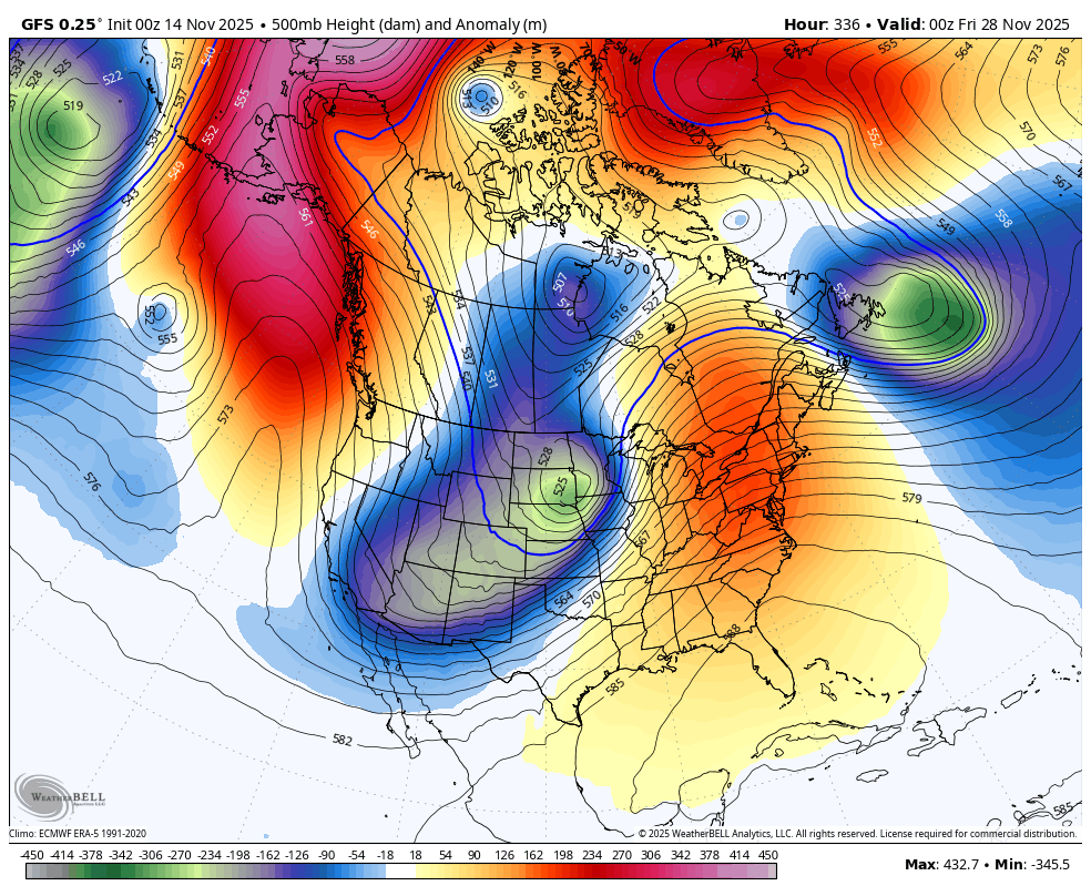
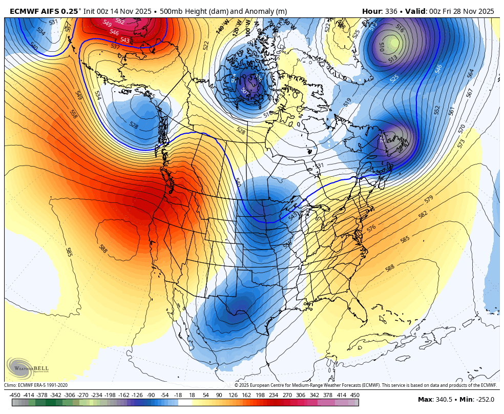
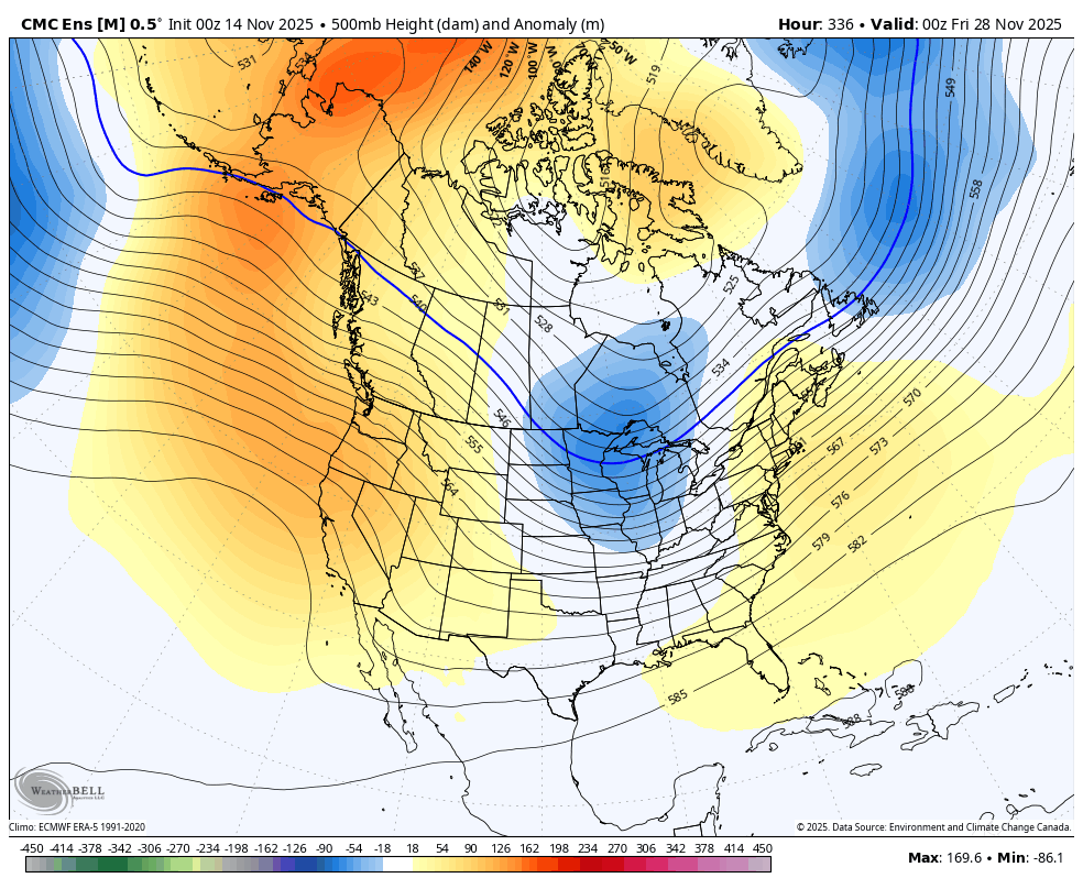
Thanksgiving Week is the week of change as the blocking gets more established, sending a deepening trough developing across much of the country during the big holiday weekend. This time period is now getting within the range of the operational models and their ensembles.
The operational GFS for Thanksgiving Weekend…
The EURO AI for the same weekend…
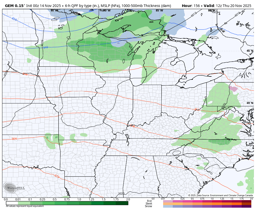
The more smoothed out Canadian Ensembles…
This kicks off what is likely to be a very wintry pattern for much of the country in December. The latest from the EURO Weeklies just keeps on keeping on with high latitude blocking and a coast to coast cold looking pattern…
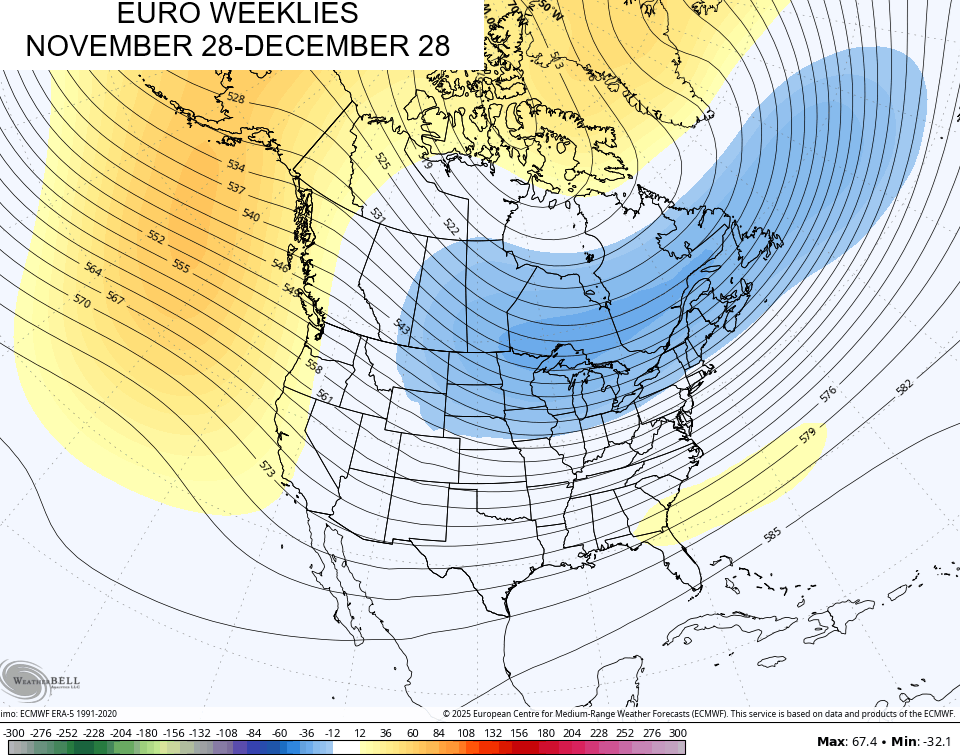
With the EURO having serious issues with the whole setup in the Medium Range, I’ve noticed that sometimes bleeds over into the EURO Weeklies. Don’t be surprised if they hiccup a time or two over the next few days until the whole EURO product figures out these troughs aren’t going to stick in the west.
I’ll have an update or two later today so check back. Have a fantastic Friday and take care.

Thanks Chris. With all those troughs developing or propagating over the entire CONUS, could mean a Winter like we had in 2009 ? What occured in 2009, was one of the worse Ice Storms in the states history. With all that High Pressure to our South, overrunning warm air aloft and below freezing temperatures at the surface may be a weather event in the comming Winter ?