Good Saturday, everyone. It’s a mild and windy day across the Commonwealth as we gear up for a cold front to drop in tonight and early Sunday. This brings in normal air for a few days before our pattern turns active ahead of a big transition to winter.
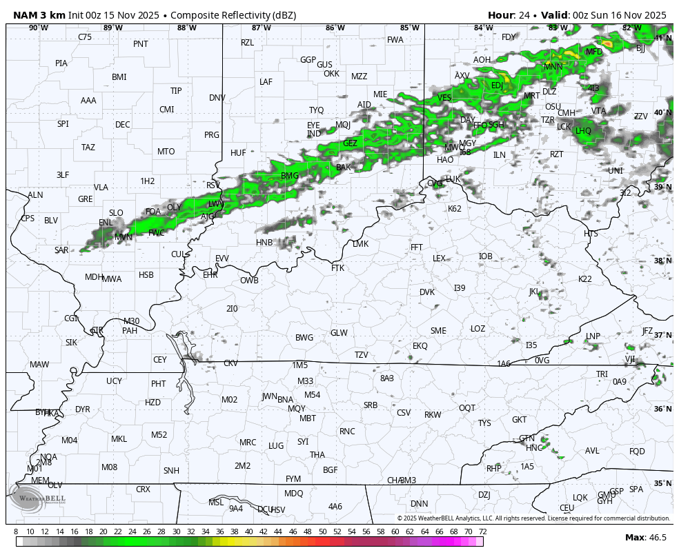
Temps today range from the upper 60s to middle 70s on a strong southwest wind. That wind is ahead of a cold front that touches off a broken line of showers and even a clap of thunder as it moves through tonight. You can see this on the future radar from the Hi Res NAM from 7pm this evening and ending at 7am Sunday…
Skies clean up very quickly Sunday with northwest winds knocking the highs down to the upper 40s to middle 50s. It’s still a pretty darn good weather day.
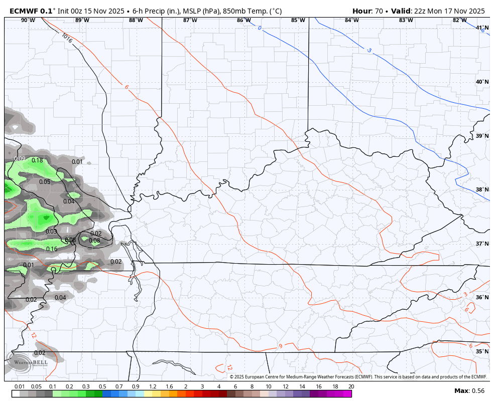
Similar temps will be noted for Monday as clouds increase ahead of our first storm system set to blow through here Monday night through Tuesday night. This system follows along a stout temp gradient…
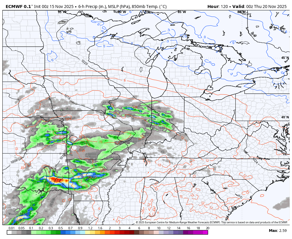
That sets the stage for a couple stronger storm systems to impact our weather from later this week into the start of Thanksgiving Week. These systems may very well bring strong to severe storms, gusty winds and heavy rains…
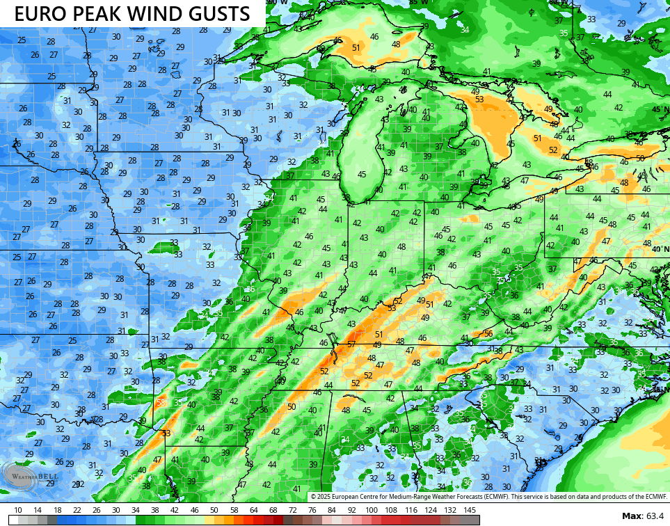
Some healthy winds are possible with these systems…
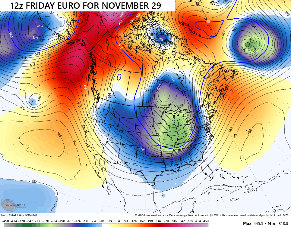
I’ve talked about how these patterns offer up some absolutely wild forecast model flips and that’s exactly what we are seeing, especially on some of the operational runs. Of course, that’s to be expected with any forecast map that goes out for more than a week. That said, this may be one of the all-time flips by the EURO on back-to-back runs. Check out the massive trough digging in here with the Friday run…
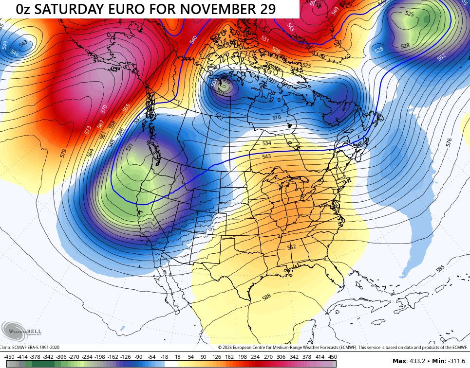
The very next run has a huge ridge in here for the exact same time…
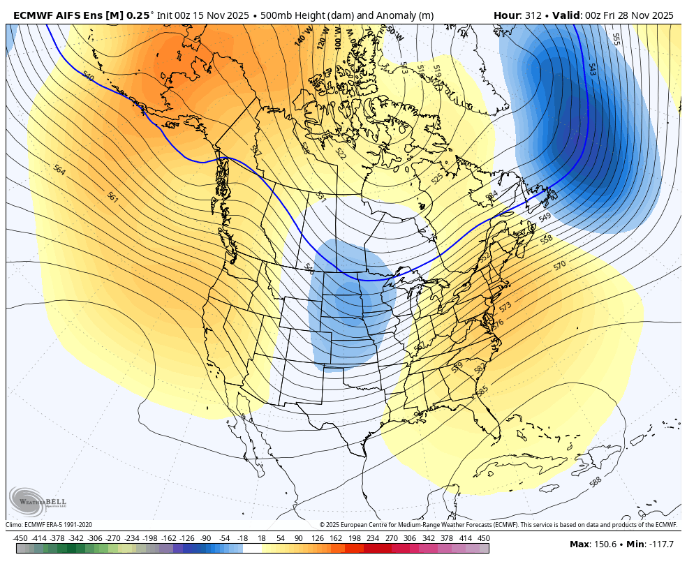
This is why the Ensembles are a much more reliable and consistent signal than the operational models. The EURO AI Ensembles sees the trough developing during Thanksgiving Weekend…
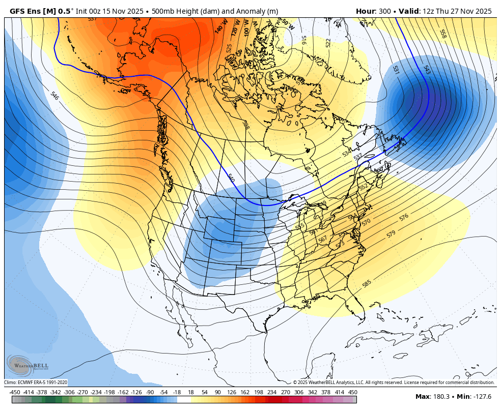
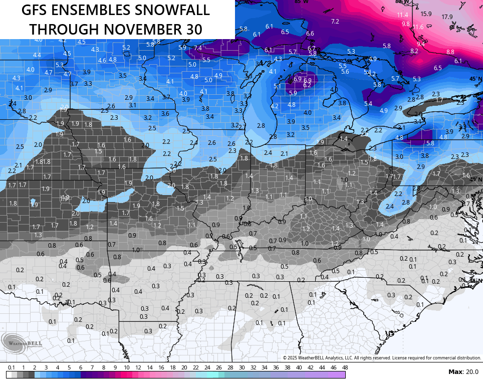
The GFS Ensembles are similar…
That shows some flake chances before the month is over, too…
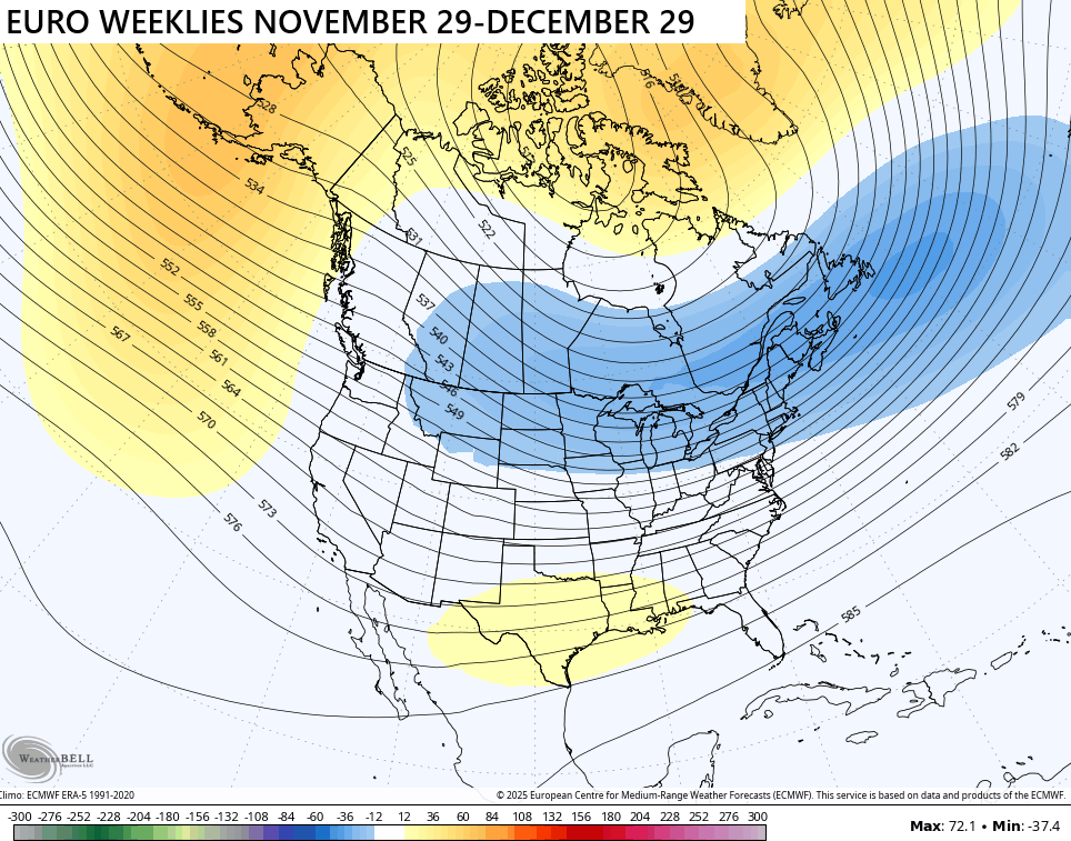
The signal from the EURO Weeklies continues to be for coast to coast colder than normal temps in December…
Let’s rock the start of this winter!
I’ll also have another update or two today and I’ll have updates on my Meteorologist Chris Bailey Facebook Page
Until then, here are your tracking tools for the day…


Have a sensational Saturday and take care.

Thanks Chris. Most of what we call Winter weather is currently in Eurasia. An early Snow pack has dropped low temperatures to – 50 degrees in areas of Russia. We had a brief bout of Winter weather a week ago, and now it’s back to September weather, which is more dominate, due to frequent ridging to our South. A characteristic of La Nina, which is having a noticeable impact on the weather pattern across the CONUS. A negative Pacific decadal Oscillation ( PDO ) will cause more Winter weather from Southwestern Canada to Maine, with only a brief periods of Winter weather for the mid- section of the CONUS. Warm and dry in the Southern States. It will be interesting to see if ENSO / El Nino will make an appearance for Autumn 2026, and a positive PDO will reign for a change. A reverse change to the current weather pattern.
Here’s the link to a very interesting article on model forecasting, and why the GFS model is so out of touch 🙂
https://climateimpactcompany.com/u-s-midday-update-is-the-12z-gfs-arctic-air-in-the-11-15-day-period-real-2/