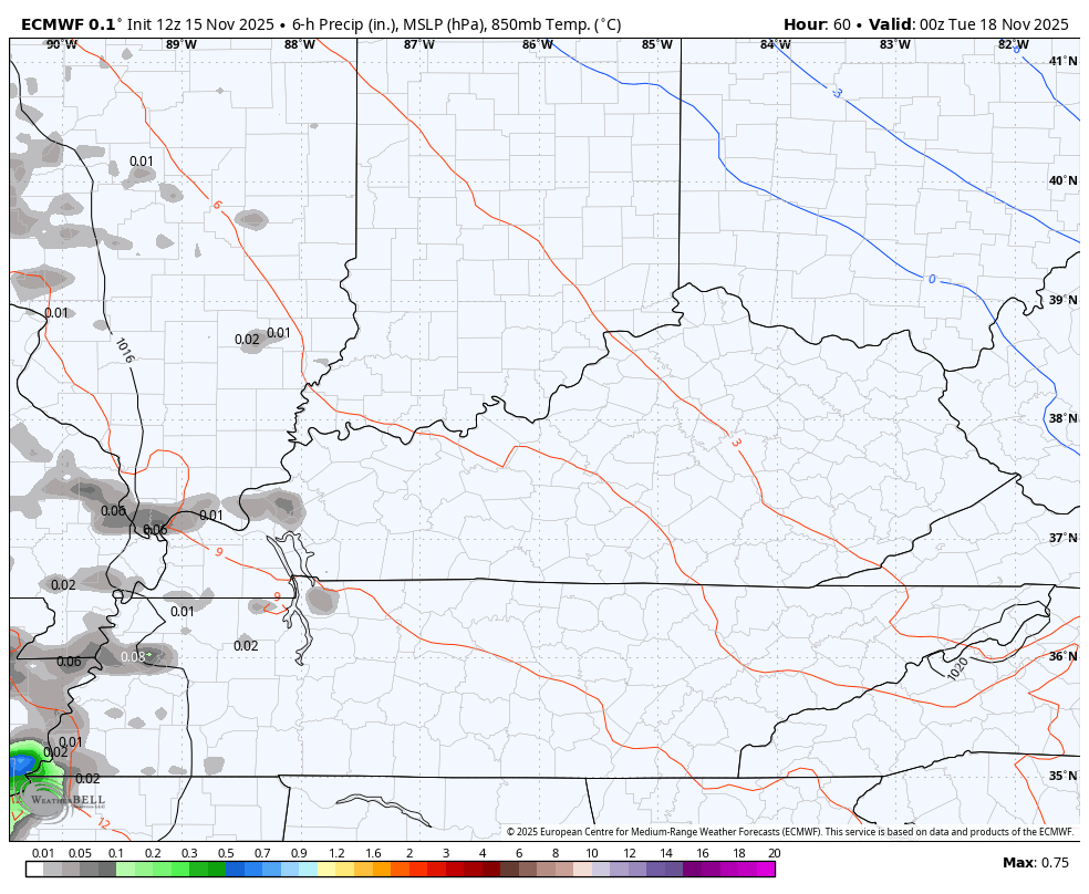
Good evening, everyone. Our windy and warm Saturday is coming to a close with a cold front rolling through the region. This boundary is the first in a series of storm systems set to impact our region, taking us into a winter pattern Thanksgiving Weekend.
The front tonight has just a shower or two with it as the temps drop to seasonable levels for Sunday and Monday.
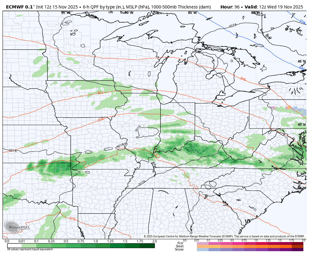
A west to east boundary sets up across Kentucky from Monday night through Wednesday. This allows for low pressure to roll along this boundary that features a near 30 degree north-south temp gradient on either side of it. It’s possible to have southwestern Kentucky in the 70s with northeastern Kentucky in the 40s.
That kind of setup can spit some overachieving rounds of showers and thunderstorms. The EURO has been on this for a while…
That can easily drop an inch or two Tuesday and Wednesday, with locally higher amounts.
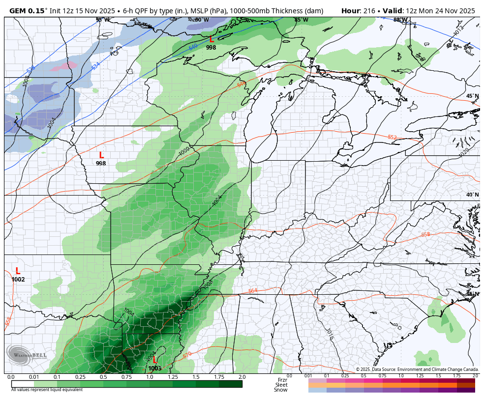
A much more potent storm system then rumbles in here later Thursday and Friday. Temps will surge once again with the potential for a few strong storms and gusty winds on Friday. Another system then comes through here later this weekend and early next week, but the models are taking on a slightly colder look behind this one.
Here’s the EURO from Wednesday through the following Monday…
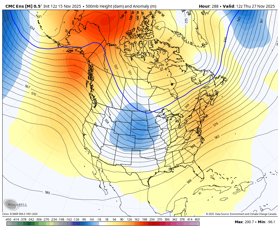
The colder look is something the Canadian is also seeing as it tries to usher in the change to winter before we get to Thanksgiving…
That may be a little too fast while the other models may be a tad too slow. It’s fun to watch the EURO go right back into bringing winter in here Thanksgiving Weekend…
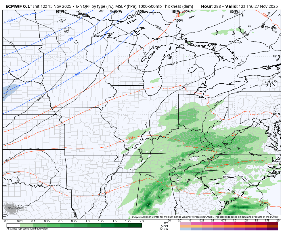
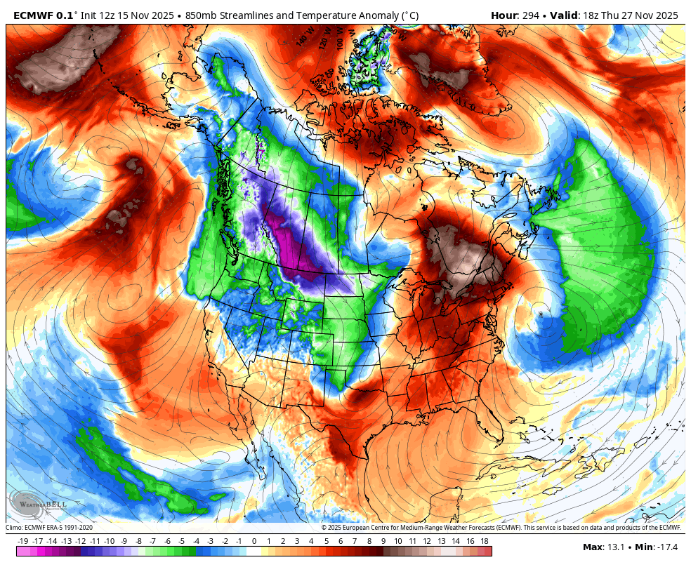
Yes, the EURO is back with the correct assessment of the trough slamming through the central and eastern parts of the USA…
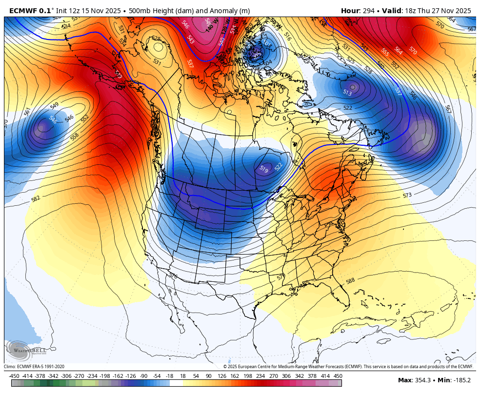
It’s also back to seeing the arctic air with that…
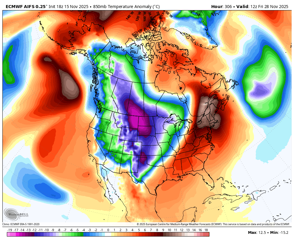
The EURI AI says look out below…
That’s matching what the Ensembles have been showing all along and continue to do so…
Again… We are setting the stage for what may become a memorable winter period for many parts of the country in December and into January. The usual long-winded update comes your way later tonight.
I’ll also have updates on my Meteorologist Chris Bailey Facebook Page
Until then, here are your tracking tools for the rest of the day…


Have a great evening and take care.
