Good Sunday, everyone. Temps today are back into the normal range and we stay there for a whopping one more day before things change. That change brings a busy pattern into our region with showers and some thunderstorms rumbling through this week. Thanksgiving Week and Weekend is when we start the transition to a full-blown winter setup.
Temps today are largely in the 50s with a partly sunny sky. A brisk northwest wind will make for a seasonable chill in the air, setting the stage for a cold overnight with temps in the 20s. Monday is another nice day that’s similar to what we have out there today.
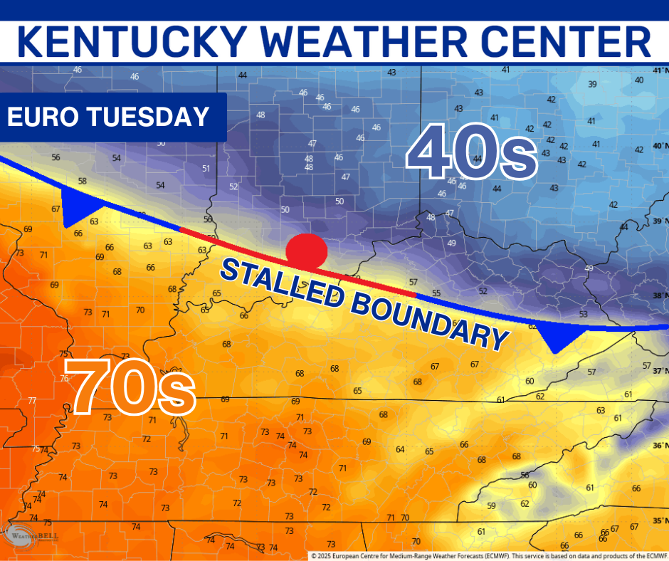
A boundary then slows down on top of us on Tuesday, leading to a MAJOR temp gradient. From the upper 40s in the northeast to the low 70s in the southwest will make for one colorful temperature map…
That boundary leads to showers and some thunderstorms rumbling across the state from late Monday night through Wednesday…
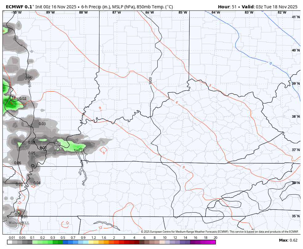
That could bring 1″-2″ rains to parts of the state.
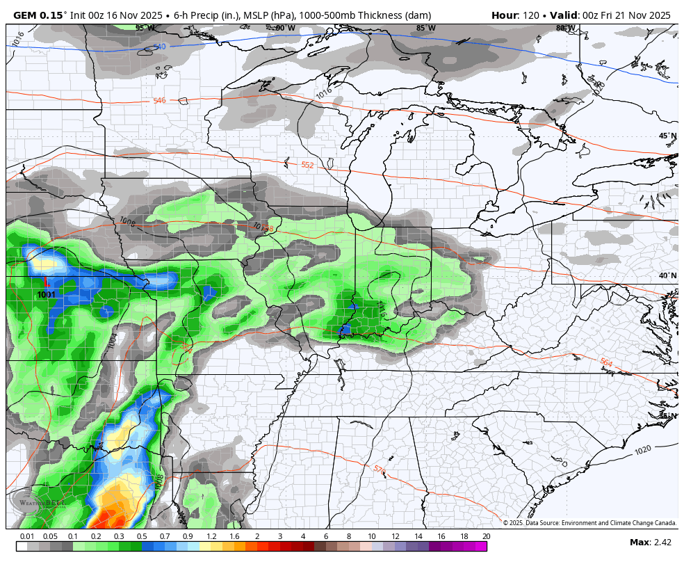
Warm winds will then blow ahead of the next system set to bring a few more waves of showers and storms Thursday into Friday. That’s when a few strong storms may even show up with seasonably chilly winds coming in behind it for the weekend. Another storm system targets us to start Thanksgiving week…
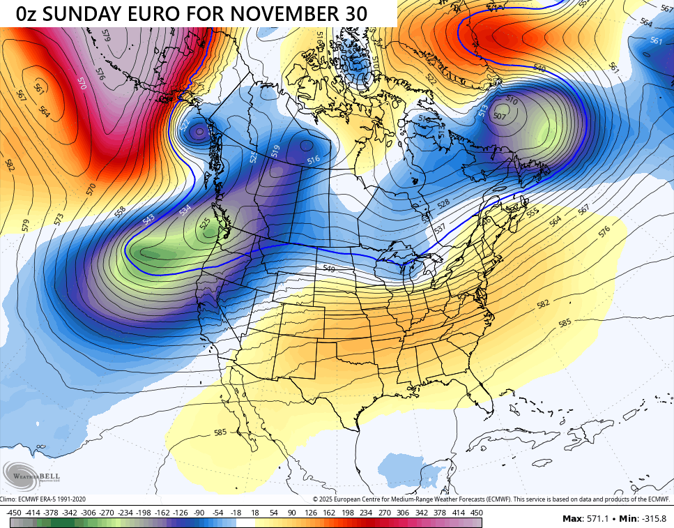
The EURO continues to show some of the wildest swings you’re ever going to see in an operational model. The following images look a lot like the ones I posted from the last update, but they are fresh runs doing the EXACT same thing we have seen for 3 days in a row now.
Deep trough engulfing much of the country on the run to start Saturday…
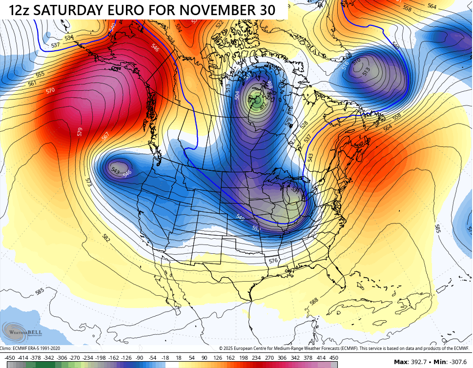
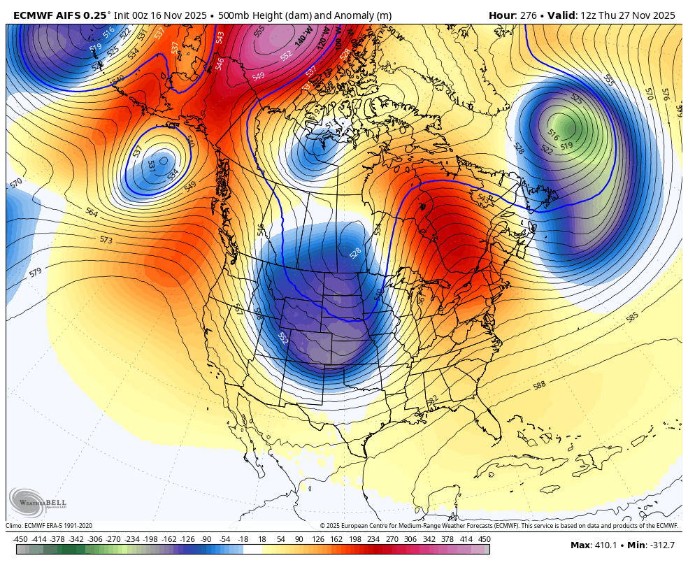
The very next run puts that same exact trough in the Pacific Ocean with a big ridge for most of the country…
Operational Models are always really bad from more than a week out, but what the EURO is doing from one run to the next on a regular basis is pretty incredible. I’ve been tracking model runs for more than 30 years now and I don’t recall seeing such drastic changes. Even the old models like the MRF, AVN, NGM and ETA are impressed at what the EURO is doing.
Of course, it’s not like the GFS is doing any better but that model is in bad shape and has a hard time seeing what’s happening a day or two out, let alone beyond a week. Remember how the GFS said there would be no snow or cold last week?
The EURO AI model has been pretty consistent and continues to be in showing this deep trough taking over much of the country Thanksgiving Weekend…
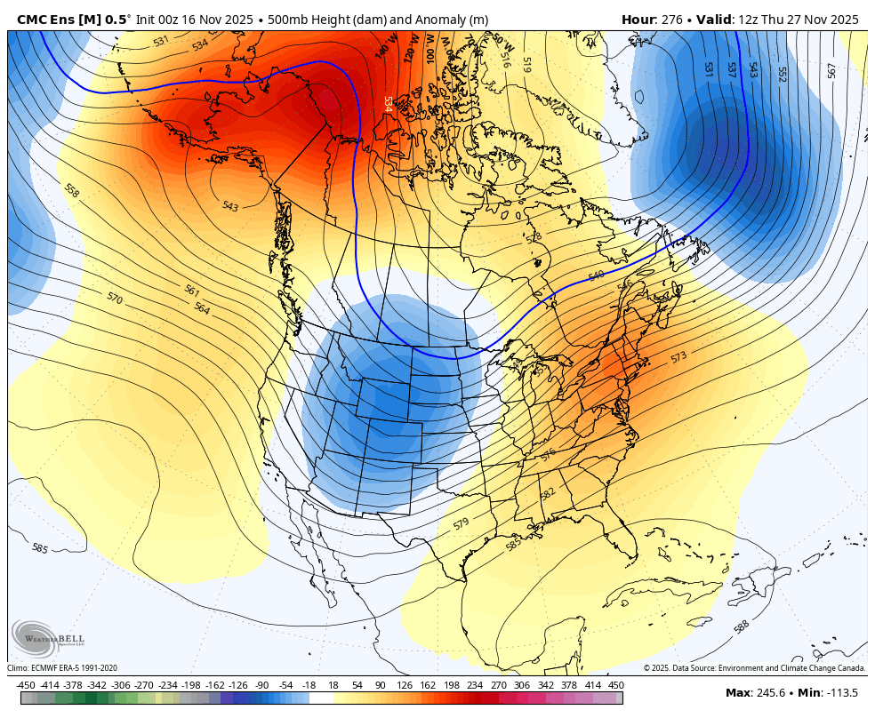
The other consistent model has been the Canadian Ensembles…
The stars continue align for a fast and potentially harsh start to winter for much of the country. The EURO Weeklies continue to indicate blocking in the high latitudes with leads to that deep trough encompassing much of the country for December…
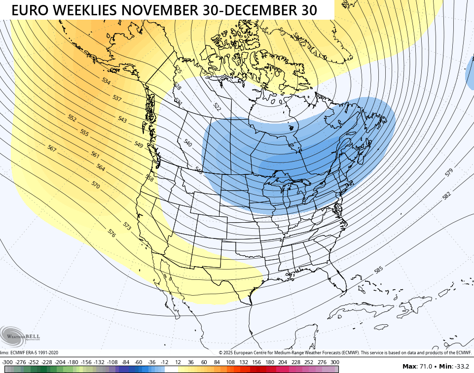
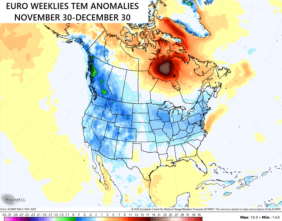
The EURO Weeklies typically have a hard time picking up on troughs and colder than normal temps, but they have not been shy about seeing where this pattern is going. The latest 30 day average temperature departure shows coast to coast below normal temps…
Keep in mind that shows the average from 101 different members that make up the EURO Weeklies. So does this snowfall map that takes us through the second to the last day of the year…
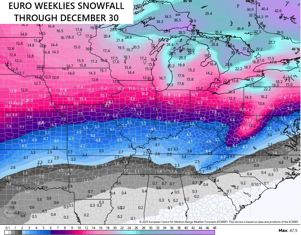
As you can see, the EURO Weeklies love the potential for several snow opportunities in December.
I’ll also have another update or two today and I’ll have updates on my Meteorologist Chris Bailey Facebook Page
Until then, here are your tracking tools for the day…


Have a great Sunday and take care.

Thanks Chris. Enjoying the above normal temperatures yesterday, but I’m ready for Winter weather to begin, with some Snowy days ahead.
I trust no models more than 7-10 days out.
The high temperature Saturday of 71 degrees at Chicago’s O’Hare Airport tied the record high for the date set back in 1971.
Talk about wild weather swings! From snow and wind chills in the lower teens Monday morning to a high of 71 just five days later! It’s a lot colder today though, with the high temp right near the normal high for the date of 49.
Temperatures are back to normal highs here to Mike, but there have been very extreme changes, which is typical of a La Nina type weather pattern.