Good evening, everyone. We are about to hit a new week and it’s another very active setup on the way to Kentucky and surrounding areas. Rounds of rain and a few thunderstorms will be noted in the run up to Thanksgiving week with a change to winter coming Thanksgiving Weekend.
My time tonight is short as I’m in “putting up Christmas lights” mode. So, let’s just hit the high noted…
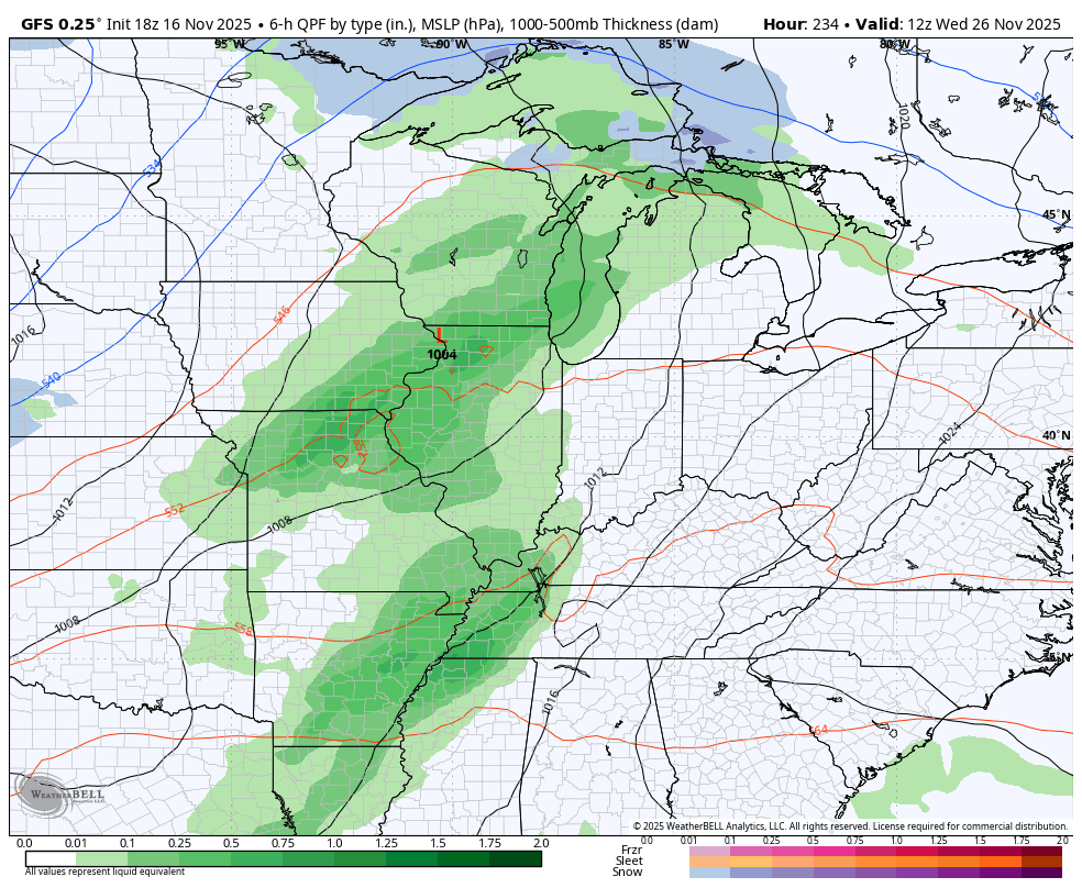
The system coming in Monday night through early Wednesday will feature that steep temperature gradient we’ve been talking about for a while. This leads to showers and some thunderstorms rolling from west to east…
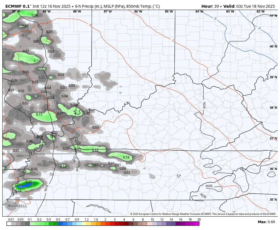
Some 1″-2″ rains will be possible during this time…
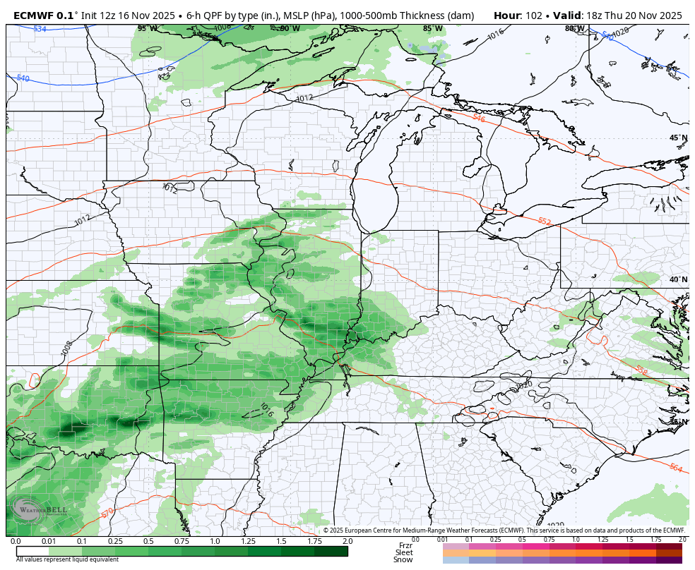
The pattern after this will feature another storm system coming at us with showers and thunderstorms later Thursday into Friday and will be followed up by another system coming in over the weekend into early next week. That will be followed by a shot of chill…
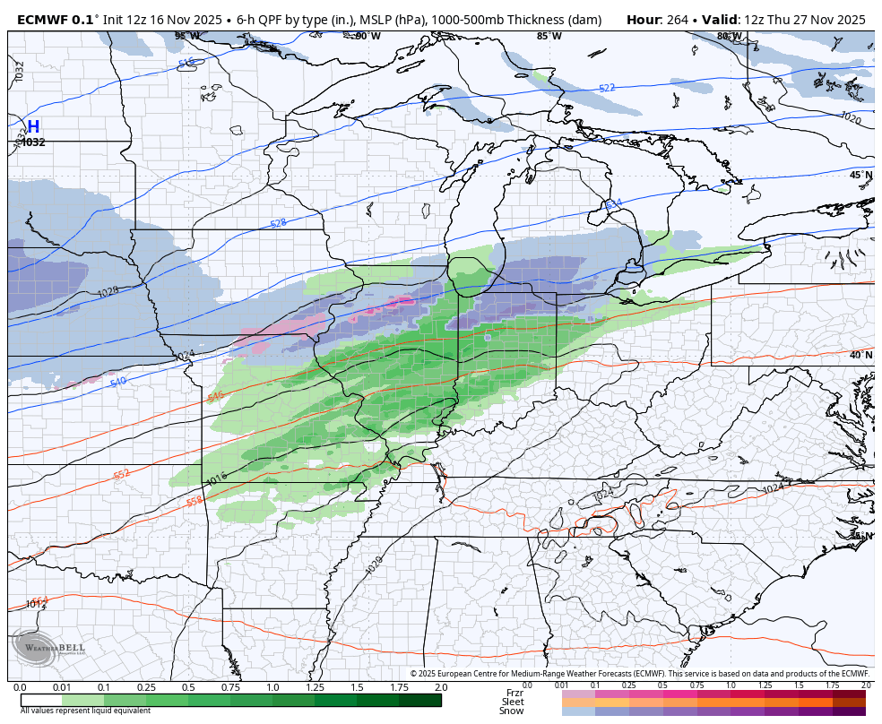
The setup after this will then feature another big storm system around Thanksgiving or Black Friday. The models don’t know how to handle the systems before this one, so they’re really going to struggle with the setup for that, especially with arctic air coming in behind it.
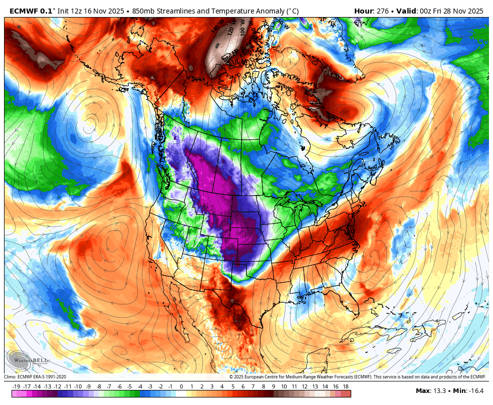
Here’s the EURO that’s back seeing the cold…
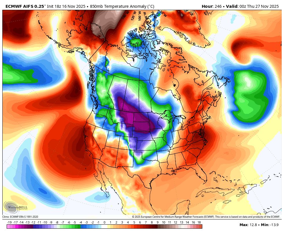
The GFS has a similar overall idea and also sees the cold…
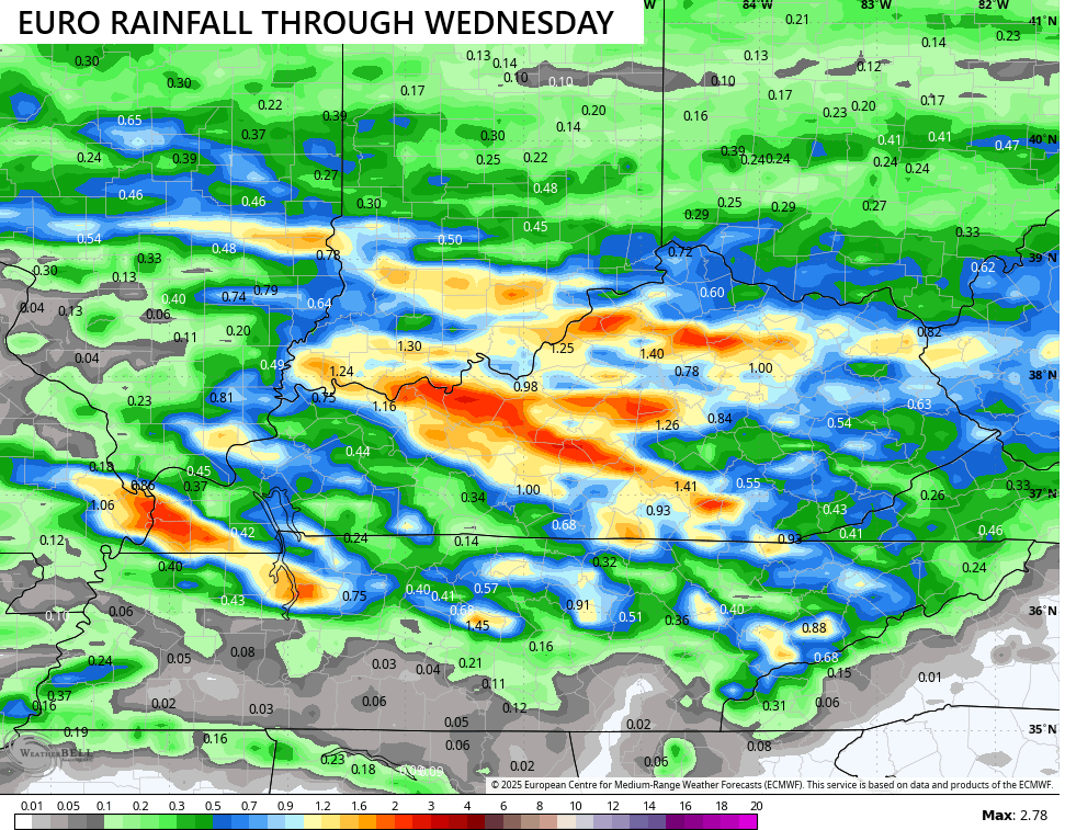
I made a map last week showing the potential for several inches of rain being possible through Thanksgiving and I still am all in on that. The latest from the EURO went to the extreme and is very likely overdone…
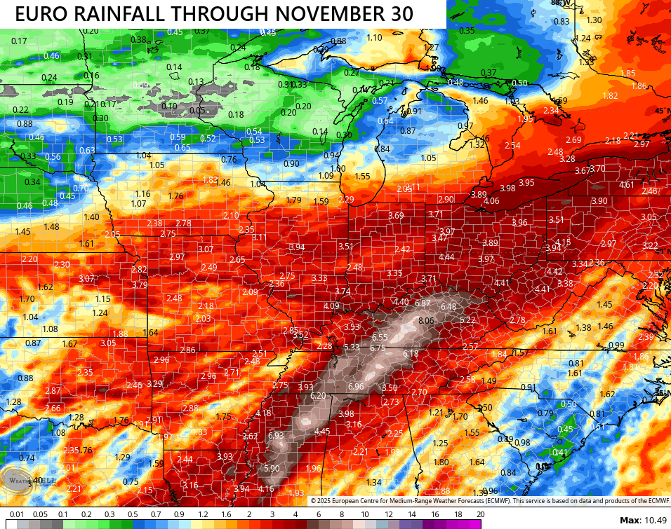
We hope it’s overdone, at least.
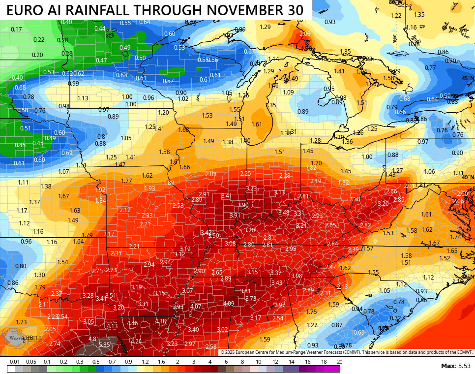
The EURO AI looks more reasonable…
I mentioned how the EURO is back to seeing the troughs sweeping into the east…
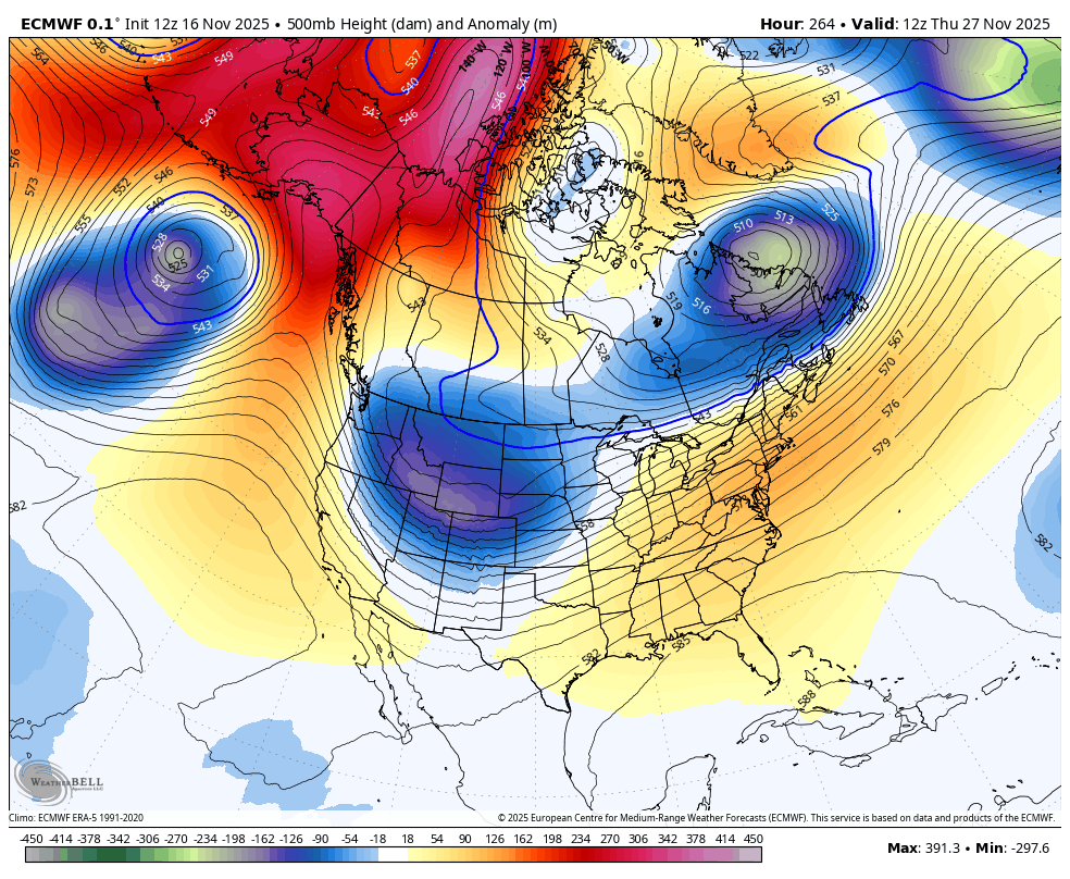
That’s some serious cold with these troughs as the Barney colors show up on the EURO…
The EURO AI sees those Barney colors with the initial shot then goes beyond Barney with the one surging in behind it…
I’ll see you guys back here later tonight. Enjoy the evening and take care.
