Good Monday to one and all. Our new week is off and running on a seasonable temperature note but that won’t last. Milder temps will bring along very wet weather in the coming days with the chance for thunderstorms to show up. This action packed pattern is ahead of the transition toward winter for Thanksgiving week and, especially, weekend.
Clouds thicken from the west today with some showers and storms getting into the far west this evening. This occurs as a wave of low pressure works eastward along a stalled boundary. This boundary will have one heck of a temp gradient with it. The north and northeast may stay in the 40s with the southwest in the 70s.
The end result will be some pretty good showers and storms rumbling through here tonight through early Wednesday. This shows up well on the WRF Future Radar animation that starts at 7 tonight and goes through 7am Wednesday…
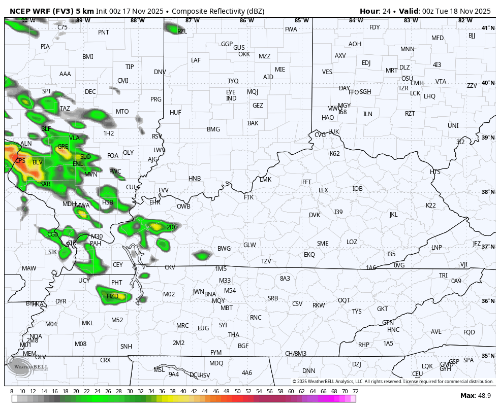
I look at the setup for Tuesday and wonder if the west and south can squeeze out a strong or locally severe storm. Just in case, here’s Tuesday’s Severe Weather Outlook from the Storm Prediction Center…

A few more showers and storms move in on Thursday ahead of a big wet weather maker later Friday into Saturday. This may be followed up by another hefty system by Monday and Tuesday, but that’s not a certain.
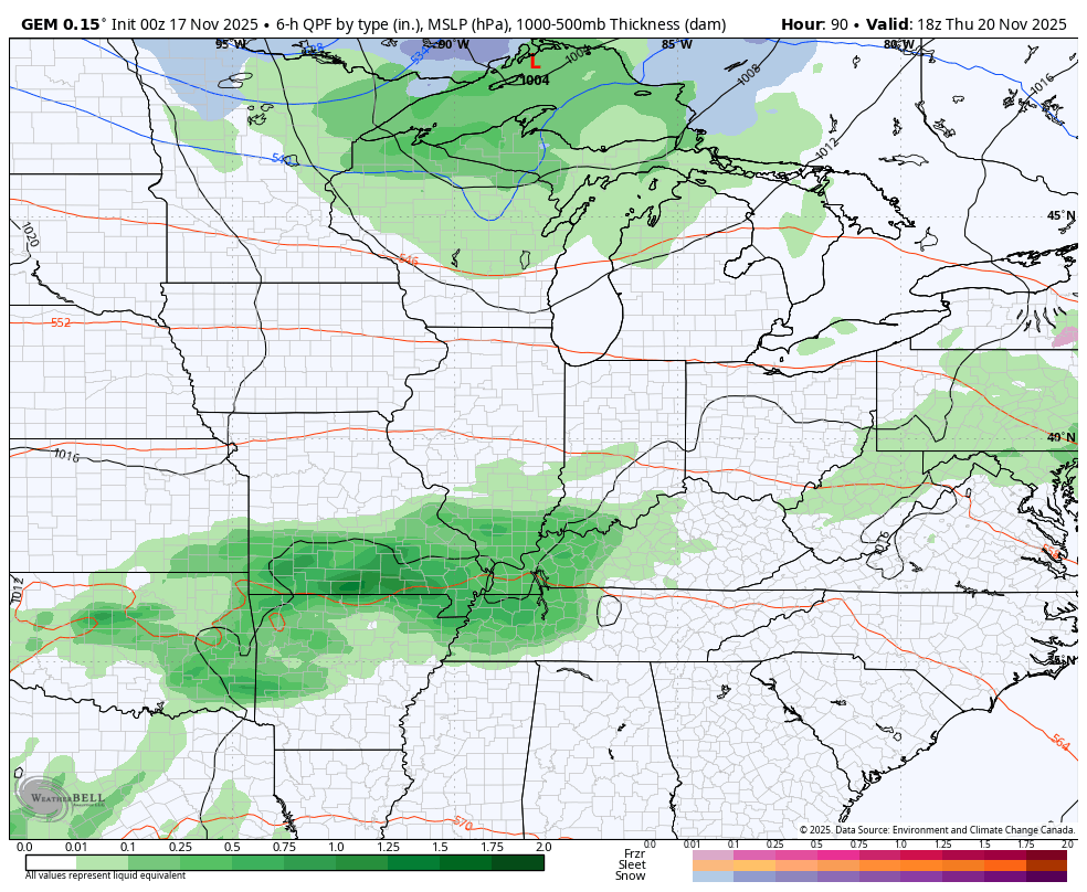
The Canadian shows two systems well…
This is ahead of the big change to wintertime coming Thanksgiving Weekend and into the start of December. A big storm system or two will sweep through with cold air crashing in during this time.
DO NOT take any one model run to heart as that’s just not smart at any time, let alone more than a week away and in such an extreme transition. That said, they can give us clues to the overall pattern and that overall patten is progressing toward what we’ve been talking about for a long time now.
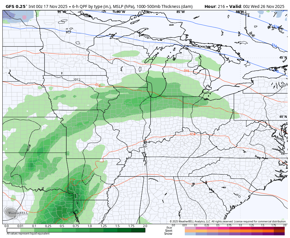
The GFS is beginning to see the transition now with this animation that starts on the Planes, Trains and Automobiles Day and goes through the first day days of December…
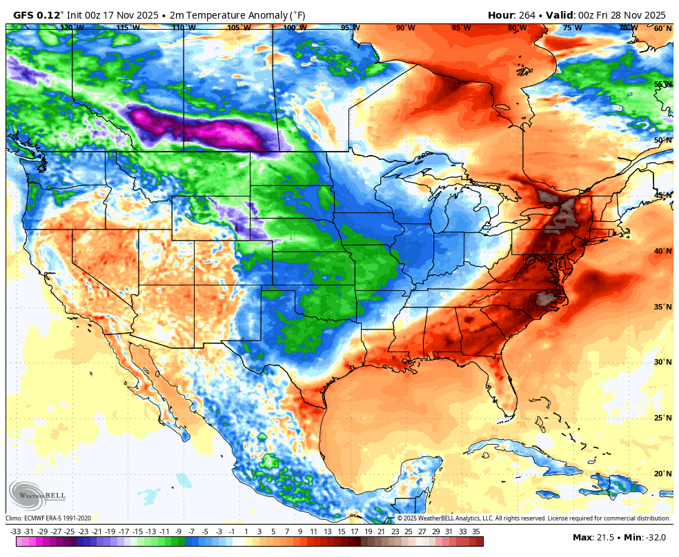
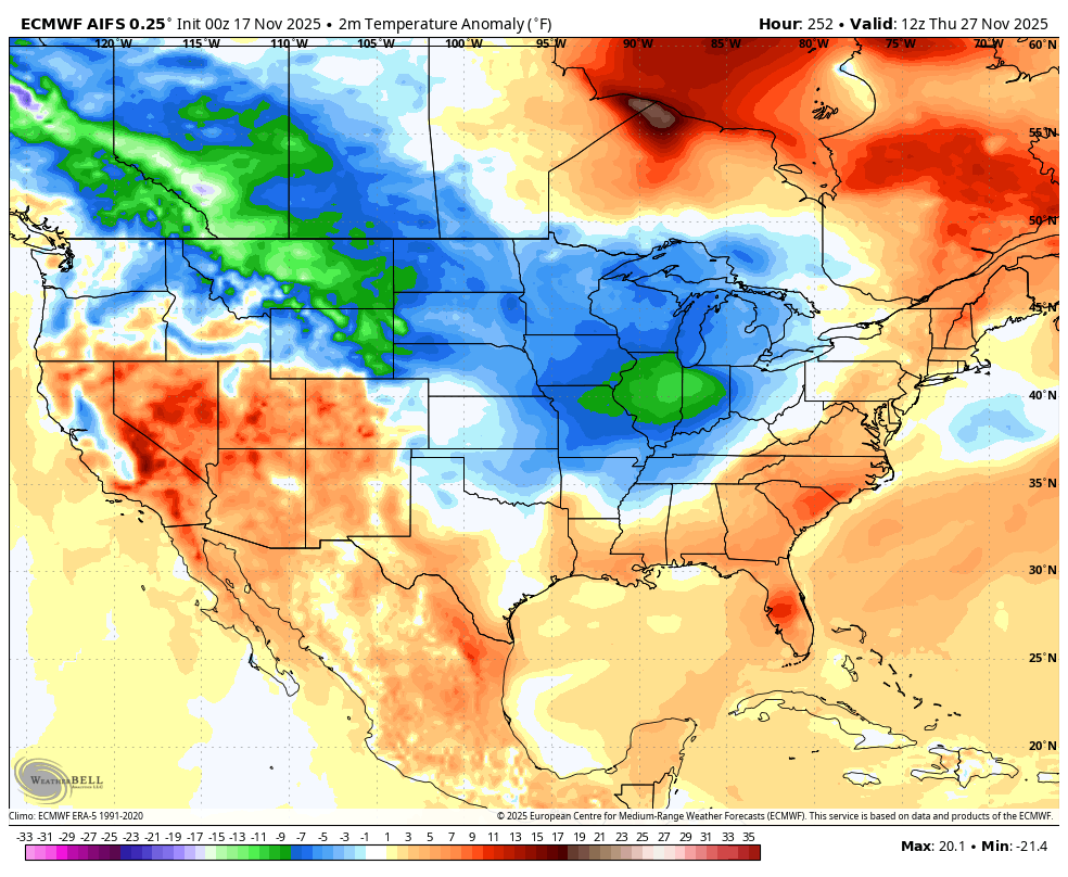
Check out the cold shots the model is seeing starting behind that initial system around Thanksgiving…
The EURO AI hasn’t really waffled on the overall setup, but it does give you small deviations as you would expect…
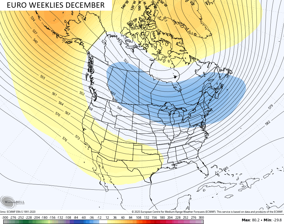
That high latitude blocking is really showing up during this time with the prospects for it to really increase into December and January. The latest from the EURO Weeklies now go through the entire month of December and they are locked in on a rocking December. That’s a textbook winter look for a 30 day average…
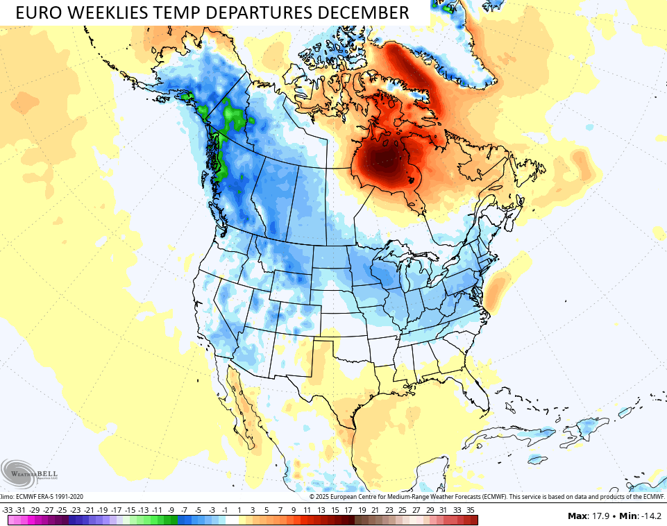
Arctic cold starting up in Alaska and the Yukon looks to slide southward and southeastward into the USA at times during the month. The EURO Weeklies show coast to coast colder than normal from Alaska to California all the way to the Mid-Atlantic States…
You know the model has a healthy winter signal when it shows the potential for snows all the way into the Gulf Coast States…
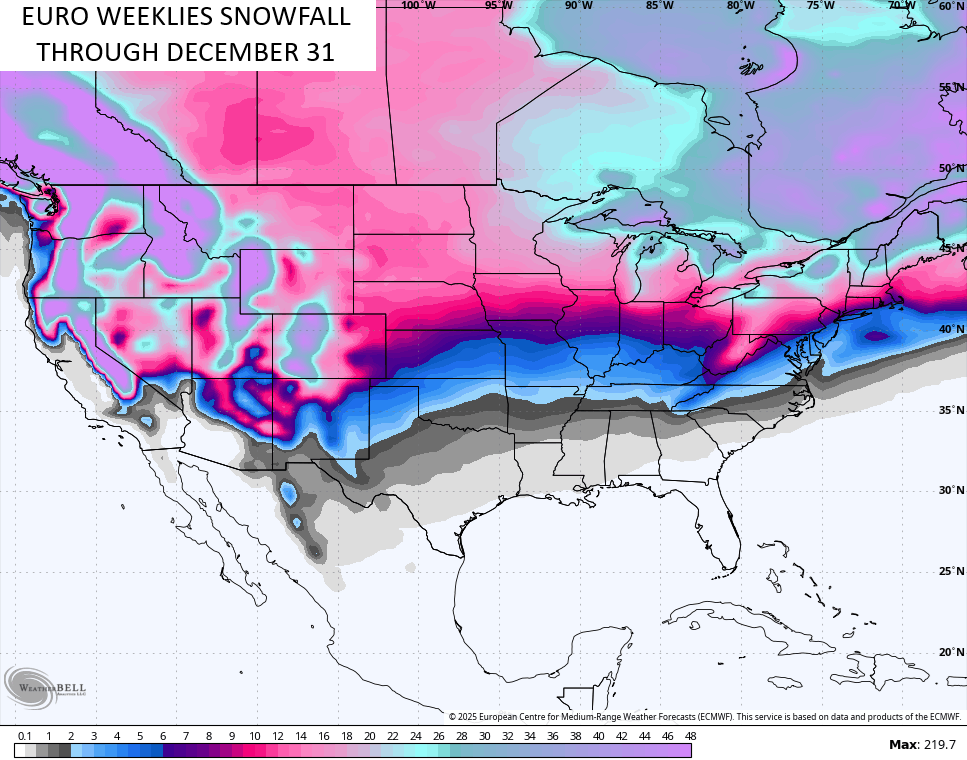
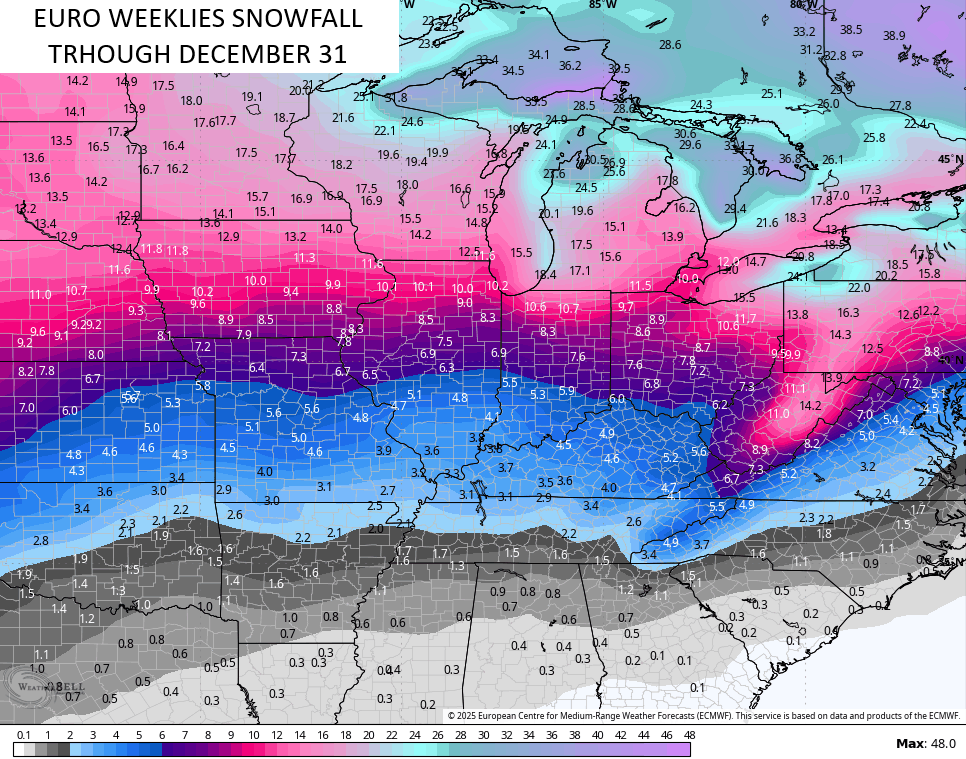
Here’s what the average of the 101 members that make up the EURO Weeklies shows for snows around here…
Cue it up…
I hope you’re singing that all day now!! ha
I will have updates as needed today and on my Meteorologist Chris Bailey Facebook Page
Until then, here are your tracking tools to follow the showers and storms in from the west…


Make it a great Monday and take care.

Thanks Chris, for the detailed Blog this Morning. Hoping your predictions for December happen, but with this very weak La Nina, plus a very negative PDO, I still have my doubts. Hope those doubts go away, with that first major Snowstorm sometime before Christmas. We all must remember though, that it doesn’t matter what weather type we have on Christmas Day.
Here’s the latest on La Nina from the Climate Impact Company : )
https://climateimpactcompany.com/weekly-enso-diagnostics-report-la-nina-gaining-strength-2-2/