Good evening, everyone. Rounds of showers and storms continue to race across the region and some of these are severe. Additional heavy rains are on the way later in the week with a major pattern change still on track for Thanksgiving Week/Weekend. That brings winter to town.
The showers and storms this evening are rolling quickly from northwest to southeast in waves. Some of these may be strong or severe and the Storm Prediction Center continues with the Marginal to Slight Risk for most of the state…

The Tornado Risk isn’t zero, but the chance for a brief spin up is still there…

The Damaging Wind Risk looks like this…

And the chance for pockets of Large Hail, especially in the west…

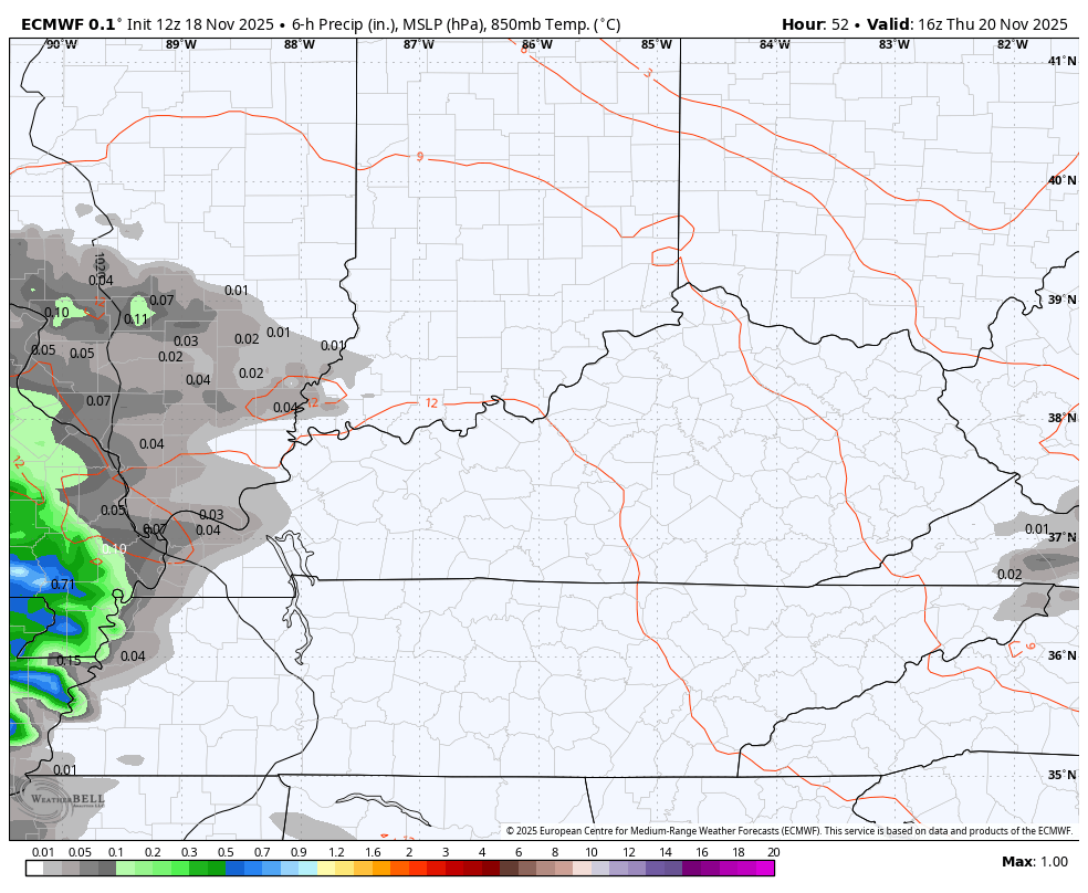
That big temp gradient of more than 30 degrees is out there today and may be noted again on Wednesday as this boundary stalls around the Kentucky/Tennessee border. This allows for another storm system to roll eastward along it, bringing waves of heavy rain and a few storms from later Thursday into Saturday.
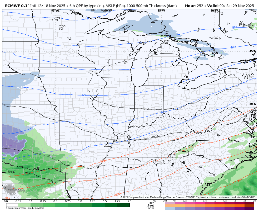
You can see this well on the EURO…
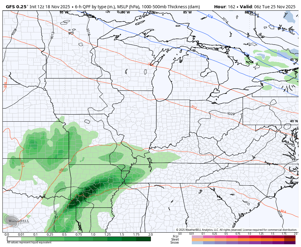
A pre-Thanksgiving storm system rolls in from the southwest later Tuesday into Planes, Trains and Automobiles Wednesday. That’s a rain and wind maker around here before it brings cold air crashing in behind it for Thanksgiving Day.
The boundary sliding in is likely to meet some initial resistance in the form of ridging off the southeast coast. That may slow the boundary enough to allow for another wave or two of low pressure to develop along it and bring the threat for rain, snow or a mix Thanksgiving Day into Black Friday.
The Canadian doesn’t go out in time as far as some of the other models, but it has been the one suggesting this potential and it continues to do so. This animation runs from Tuesday Night through Black Friday Morning…

The GFS continues to have all kinds of issues seeing this entire pattern as it goes from one extreme to the other. This is 100% to be expected and why I say to NEVER get excited about a single run.
One of those runs from the GFS came this morning when it showed a massive winter storm Thanksgiving Day and Black Friday…
Of course, it lost this on the very next run…
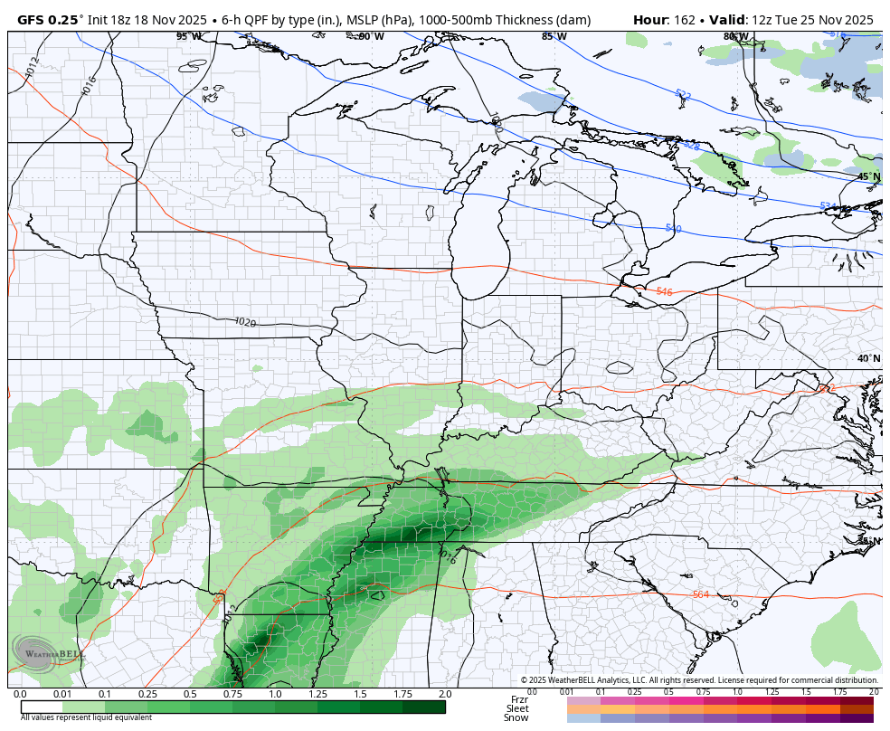
Guess what? Both of those are wrong.
As a matter of fact, every single model I’m showing you is wrong. We are showing them to follow the trends and not for specifics.
The trend is for cold air to crash in around Thanksgiving with a possible wave of low pressure developing at some point from Thanksgiving into Thanksgiving Weekend.
The EURO has our big travel storm with a weaker push of the Thanksgiving Front…
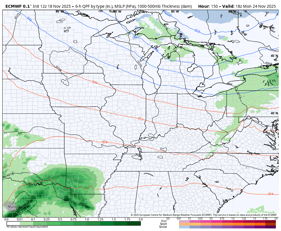
But it does develop a bigger system with winter weather right behind it and then keeps the cold air coming in from the northwest…
All of this kicks off what will turn into a harsh December for much of the country.
I’ll get into all of that with the full update later tonight and, of course, I’ll have updates on my Meteorologist Chris Bailey Facebook Page
Until then, here are your tracking tools for the day…


Current watches

Possible Watch Areas

Make it a great Tuesday and take care.
