Good Wednesday to one and all. A slow-moving boundary continues to hang out across the region today and this will be the focal point for more heavy rain in the days ahead. This active pattern will lead us into a big change to Winter as we go into Thanksgiving Week and Weekend.
Lots of low clouds and some fog will likely be common for much of the day with areas of drizzle or a light shower. Temps across the northern half of the state stay in the 40s with 60-65 in the far south and southwest.
This similar temperature boundary hangs around for Thursday as a stalled front starts to get active again. Low pressure develops to our west and rolls eastward along the front Friday into early Saturday. That means additional waves of heavy rain producing showers and some thunder.
The NAM shows all this well from Thursday afternoon through Saturday morning…

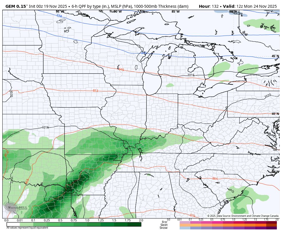
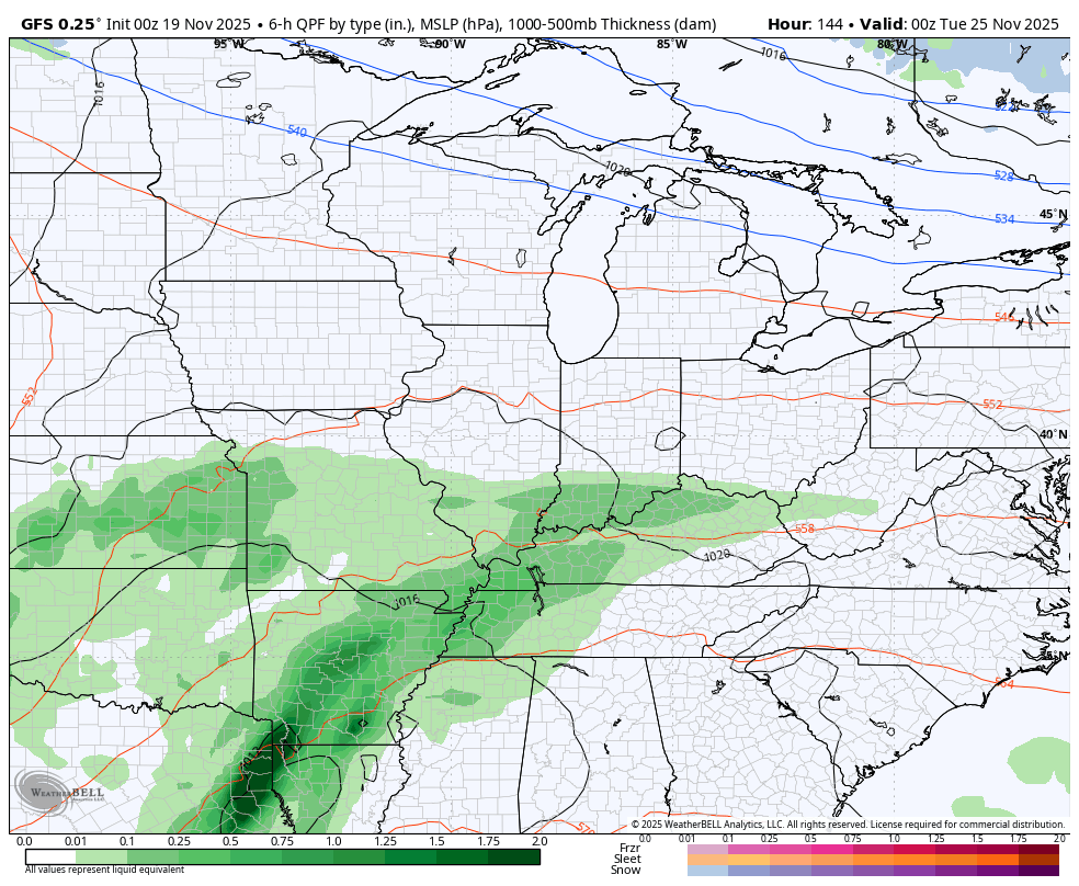
This has all the makings of another 1″-2″ rainfall for much of Kentucky, and this will bring the weekly total to greater than 3″-4″ for some.
All of this leads us into ANOTHER big storm system to start our Thanksgiving Week. This moves in from the southwest with more in the way of heavy rains from late Monday through the busy travel day on Wednesday. Cold air then crashes in behind this system for Thanksgiving Day and takes us through the big holiday weekend.
Will we have a wave of low pressure to bring some winter weather as the cold air crashes in? Will another system develop at some point during the weekend? Both of those are the questions we will be trying to answer in the coming days.
The Canadian Model has been consistently showing the wave of low pressure with some rain and snow for Thanksgiving. This animation goes from Monday through Black Friday…
The GFS has been all over the place with everything from a shut down snow storm to just flat out frigid with maybe a flake. The latest GFS is in the frigid and flake mode. This animation starts Monday and goes through Black Friday Night…
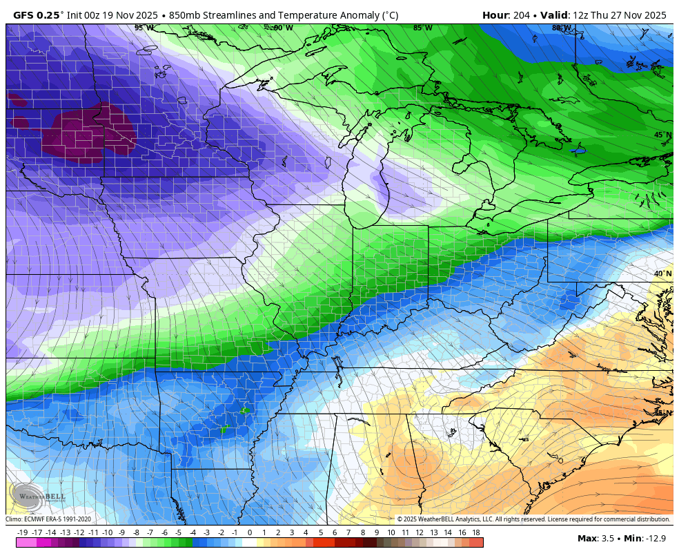
The cold coming in for Thanksgiving Day through the holiday weekend is stout with Barney spending the holidays around here…
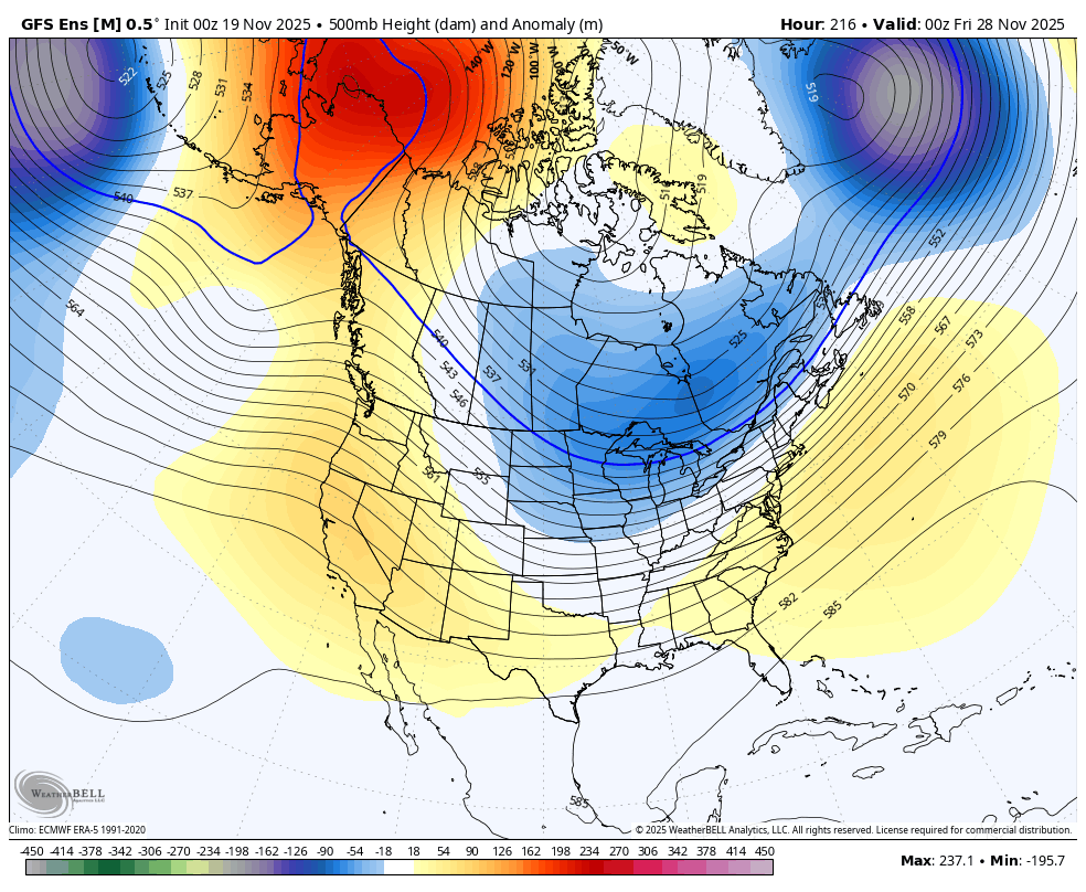
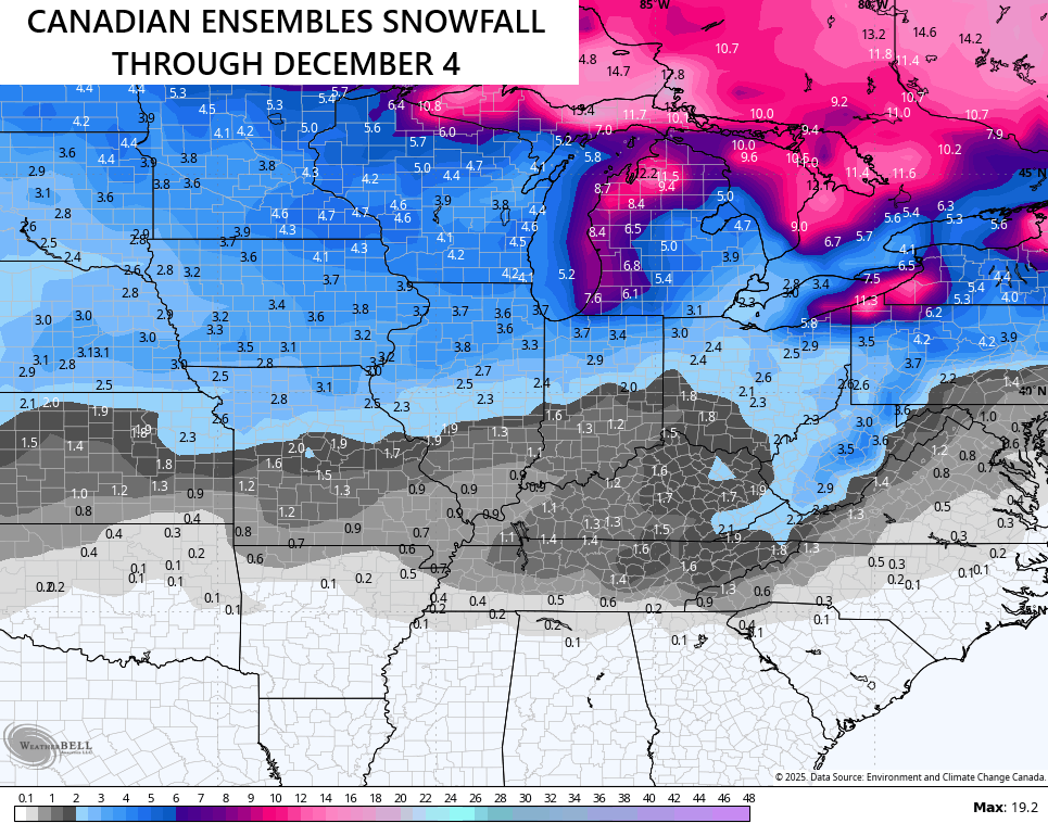
This kicks off a series of deep troughs that dive into the country to end November and begin December. We’re now getting into the range for the Ensembles to pick up on all this. The Canadian Ensembles are stout through the end of the run on December 4th…

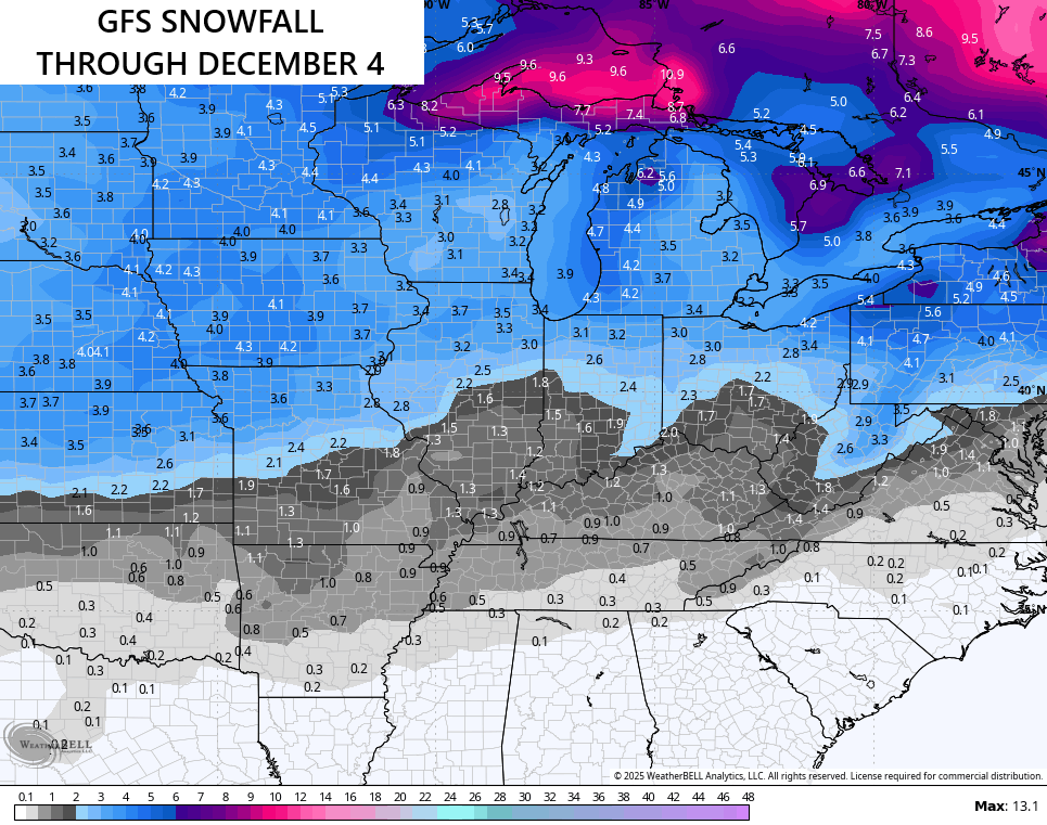
The same goes for the GFS Ensembles…
Both are seeing some snow chances for the end of November into the first few days of December…
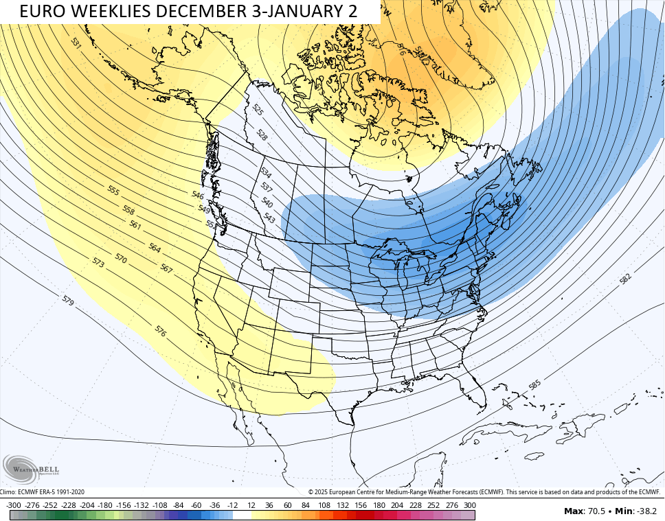
The EURO Weeklies just keep plugging away at a harsh looking winter setup for much of the country in December. This is the 30 day mean from 101 members that make up the EURO Weeklies and that is one strong signal for deep troughs sweeping across much of the country…
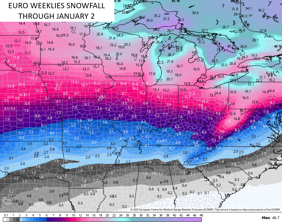
Snowfall opportunities continue to show up stronger with each passing run…
It’s almost time, folks.

I’ll have another update or two later toda and, of course, I’ll have updates on my Meteorologist Chris Bailey Facebook Page
Until then, here are your tracking tools for the day…


Make it a wonderful Wednesday and take care.

Thanks Chris. Yesterday, late afternoon, we had a thunderstorm, with lots of loud thunder, and cloud to ground lightning. Lucky, we didn’t have the severe winds. A period of welcome rain / showers resulted all through the evening.
With the colder Arctic Air predicted to move into the area after Thanksgiving, could result in the first Snowstorm of the season, if we have a phased low pressure system on the southern stream. A wait and see game.
A very interesting article explains what will happen next month : )
https://climateimpactcompany.com/u-s-early-notes-evolution-of-a-colder-pattern-as-december-arrives-2/