Good evening, everyone. The fog and drizzle continue across the region as another big rainmaker gets set to move in over the next few days. This leads us into a massive change for Thanksgiving week as winter crashes into the region.
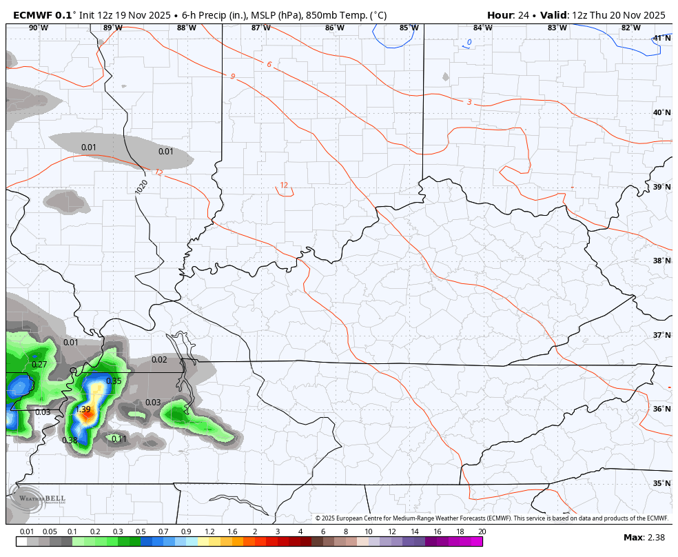
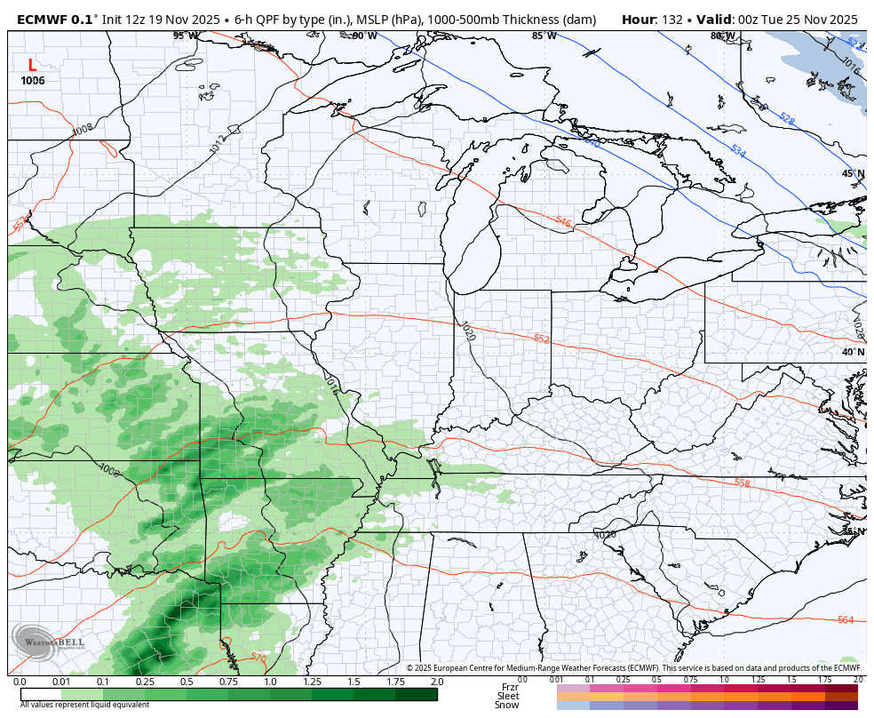
Let’s start with the system moving in here later Thursday through Saturday morning. Rounds of showers and a few storms will move through from west to east during this time. This can put down another 1″-2″ of rain in many areas. Here’s the EURO…
Much better weather moves in later Saturday into Sunday so make plans to get out and take advantage of it because it won’t last long.
We’ve pointed to Thanksgiving Week for a big change to winter for a few weeks now and we continue to see medium range models trending in that direction. Still, they have a long way to go to figure out exactly how that arrives.
One thing is for sure and that’s the early week rainmaker sweeping in late Monday and Tuesday. That will be followed up by cold air crashing in with a strong cold front arriving later Wednesday into Thanksgiving Day.
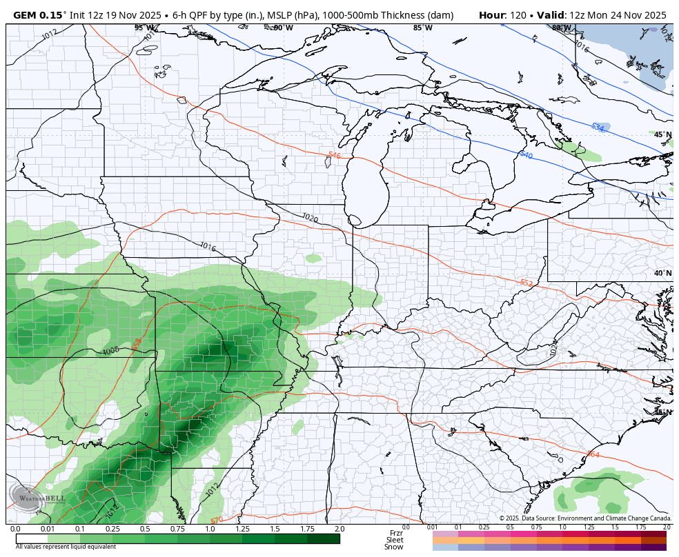
The Canadian had been showing a wave of low pressure and some snow. The latest run doesn’t have that and would only imply some flakes on a cold northwest wind…
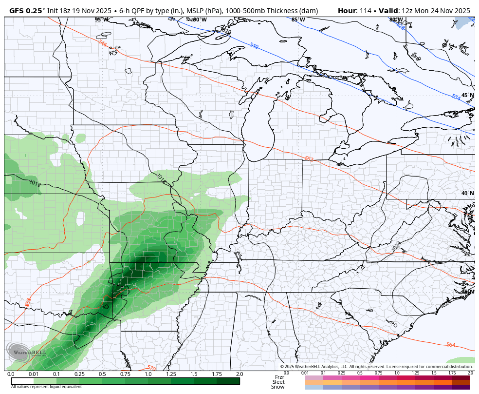
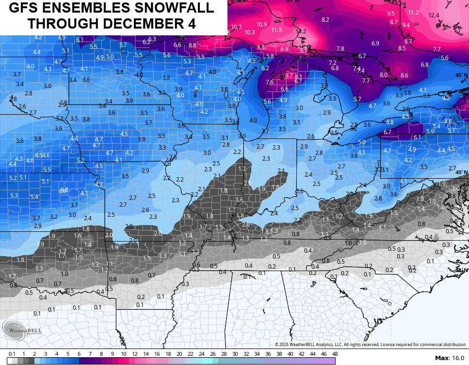
The GFS has a wave of low pressure that’s really strong and turns it into a big winter weather maker around here. Here’s the GFS from Monday through the following Saturday afternoon…
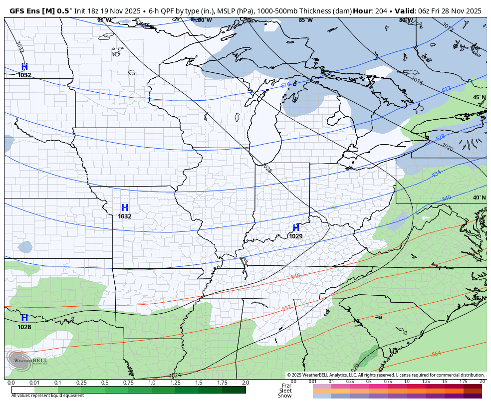
It is interesting that the GFS Ensembles are seeing a similar system…
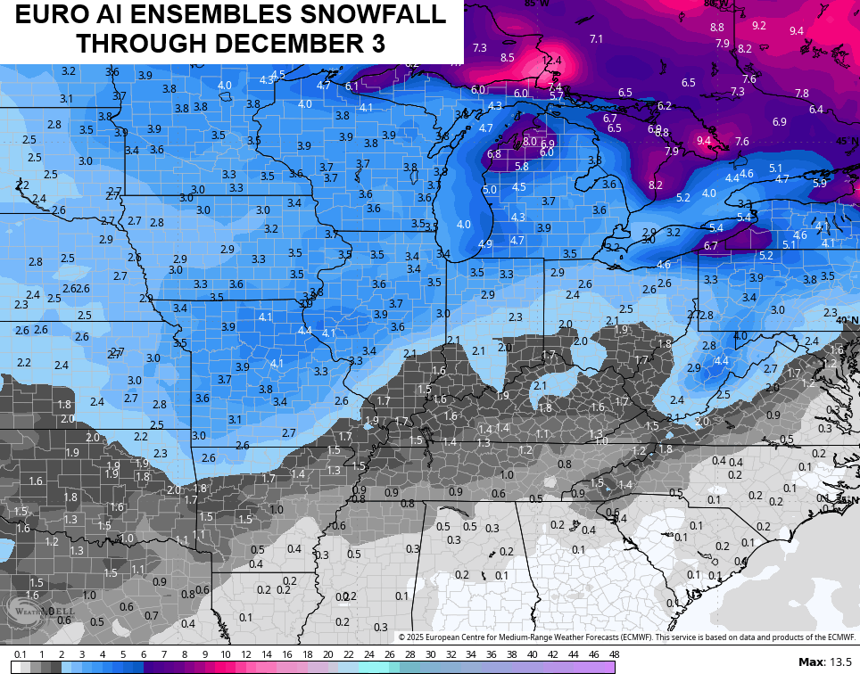
The EURO doesn’t have that wave and is more in line with the Canadian…
Cold air keeps coming at us in waves into the first few days of December, leading to more snow chances. The Ensembles are really starting to pick up on this potential…
I’ll see you back here with a full update later tonight. Enjoy the evening and take care.
