Good Thursday, everyone. The first of two big rainmakers is rolling into the region today and takes us into the start of the upcoming weekend. After a short break, we have another big rainmaker to start Thanksgiving week with some winter to potentially end the week.
Before we look ahead, that deep trough that brought the snow early last week apparently set some records for our region…
Confirming the extent and margin of this mid-atmosphere monthly cold record: 500mb temperatures were the lowest on record for November from Illinois to the East Coast.
The all-time record actually was marginally broken at one spot (ERA5 data since 1950) pic.twitter.com/HcfTPgzfAI
— World Climate Service (@WorldClimateSvc) November 19, 2025
That’s impressive!
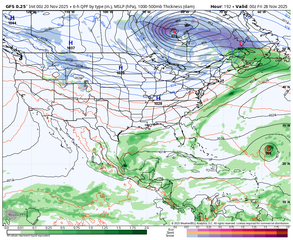
Let’s start with the current setup. Rounds of showers and storms roll in from west to east today with areas along and south of Interstate 64 having the best chance of getting in on the afternoon and early evening action.
Showers and some thunder then increase areawide tonight through Saturday morning and you can see that well on this animation from the EURO…
 Another 1″-2″ of rain will show up for some areas.
This system moves away on Saturday, leaving us with some really nice weather from later in the day through Sunday. Clouds increase on Monday ahead of the pre-Thanksgiving storm system set to bring more rain in here from Late Monday through, at least, early Wednesday.
Cold air dumps in behind this system for Thanksgiving Day and into the holiday weekend, but how all this works out continues to drive the models nuts. We may very well have some kind of wave of low pressure trying to zip in here with some winter weather at some point.
Every single model run shows something different from the prior run of each respective model. This is what happens, folks and it’s why I say trust no one model solution.
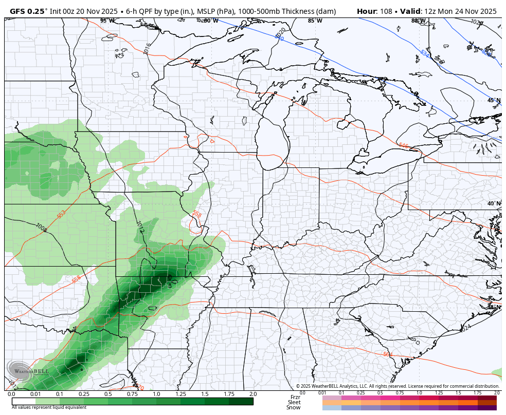
The latest GFS has our pre-holiday rainmaker then follows it up with the wave along the front on Wednesday night and early Thanksgiving Day before showing another system bringing light snow into the holiday weekend…
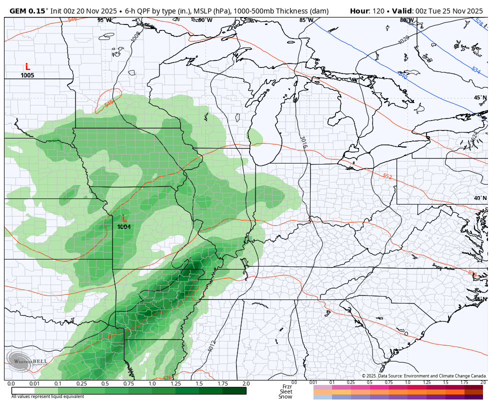
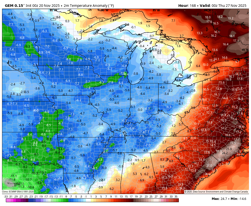
The Canadian Model has a similar theme as the GFS but has the holiday weekend light snow maker wimping out before it gets in…
That’s some really cold air for Thanksgiving weekend with lots of Barney…
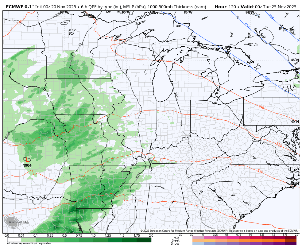
The EURO has a similar theme to the GFS and Canadian but the bias of the model being too slow ejecting energy from the southwest is on full display. It’s seeing all kinds of storm systems because it can’t figure out how much energy to eject out and when to do it…
There’s an interesting phenomenon going on with just about all of the models and ensembles right now. The 0z runs show one thing only to have the 12z runs show something different, and at times, quite different. This has been happening for days now, so there’s some kind of data ingest change that’s happening with each cycle.
I’ll add this… I’ve noticed a lot of the 0z runs of the models trying to fire up spurious tropical action. The GFS shows two such systems trying to spin up over Thanksgiving Weekend with one working toward the Caribbean and a smaller disturbance spinning in the Gulf…
While not totally unheard of, the chances of something like that happening are pretty slim, but it shows how something funky is going on with the models right now. Maybe someone much smarter than me (the bar is low for that) can figure all that out.
We’ve focused a lot on the EURO Weeklies and the strong winter signal they’ve had for December, but the GFS Extended has also been all in on the December winter signal. If we look at the 30 day average 500mb height anomalies, we see that big ridge along the west coast going all the way to Alaska and into the Arctic. In turn, we get a deep trough across much of central and eastern USA…
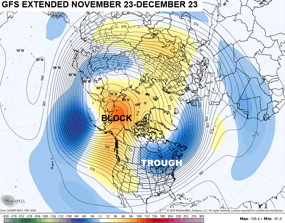
That’s a stout look for winter weather fans in much of the country.
Don’t forget that it’s Winter Forecast Day on WKYT-TV at 6pm. We also debut our new First Alert Weather show at 6:30pm on WKYT+ and the CW Lexington.
I will have another update or two later today and, of course, I’ll have updates on my Meteorologist Chris Bailey Facebook Page
Until then, here are your tracking tools for the day…


Make it a great Thursday and take care.

OK… So get this. I’m in McConnell’s Trace subdivision. The other night when we had some heavy rains/thunder, freaking lightning hit 3 houses down from me. I heard it. It was a really strange sound and very close. I wasn’t sure if it had hit something but sure enough, the firetrucks arrived pretty quickly…. Luckily it wasn’t that bad. What blows my mind is this happened in November and not even during a bad storm with temps in the 40s… It’s just that you don’t (or at least I don’t) expect thunderstorms of all things with temps in the 40s out
Mark, these cold – weather ( elevated thunderstorms ) can occur when a layer of warmer, moist air riding over a colder surface, creating the instability needed for thunderstorm development.
Looks like we’re about to hear those words”polar vortex “ again as a SSWE is likely towards the end of month.Maybe even a reversal..There’s lag time so December going into January could be interesting..Also models are hinting at the MJO going to phase 8 at the same timeframe which is a cold phase for December..Interesting times maybe for parts of the Ohio valley..As always we will see..
Thanks Chris. Models these days are unreliable due to a combination of factors, including the inherent chaos of the atmosphere, which makes long – term predictions difficult, and issues with data quality and model accuracy. Blame budget cuts and staffing shortages.
La Nina expected to be different this time around. Here’s the link : )
https://climateimpactcompany.com/u-s-early-notes-following-2-issuesdeveloping-cold-pattern-and-texas-rains-2/