Good evening, everyone. That cold air crashes into the region right on cue and it’s kicking off a very active period of winter weather. This gets started with a system moving in over the weekend that brings rain and some snow.
This system is showing up colder as we get closer because the air in place is very cold and dry so as precipitation moves in, evaporative cooling quickly drops the temps toward freezing. There’s also very weak warm air advection ahead of this system.
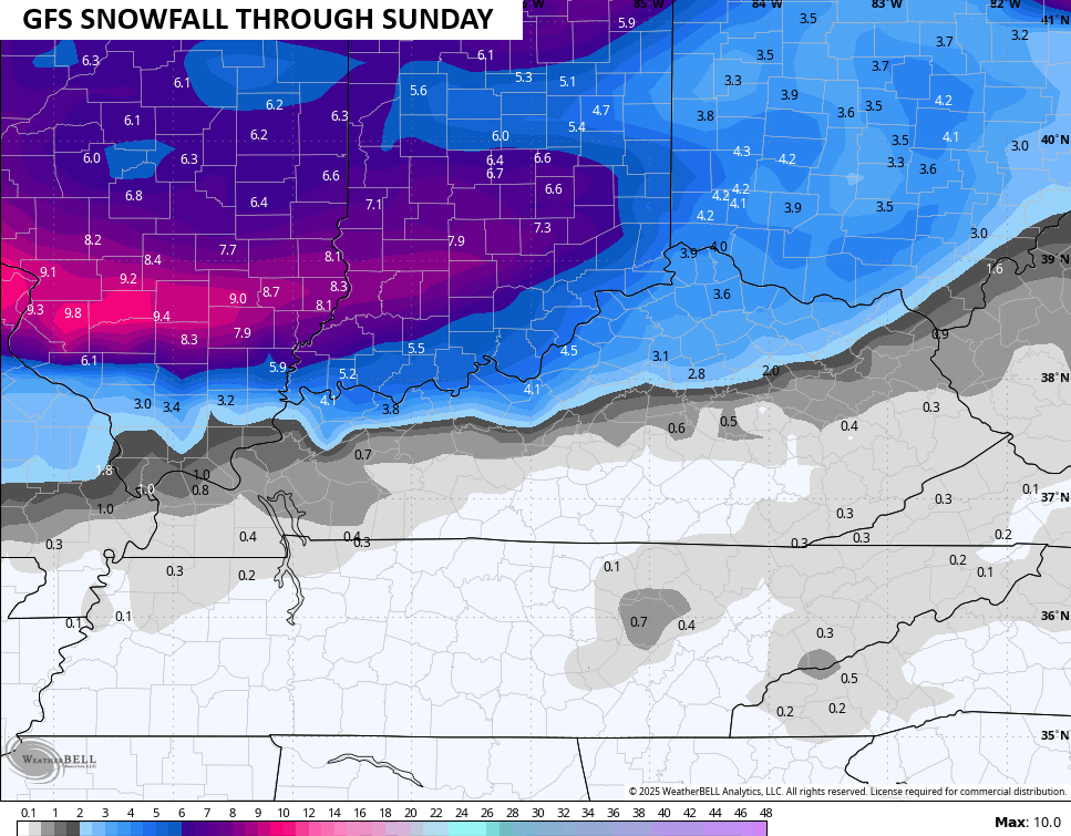
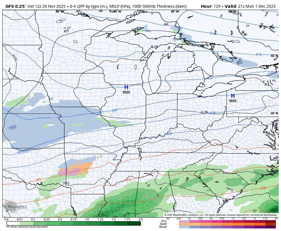
The GFS is the coldest and snowiest of all the models with the weekend system…
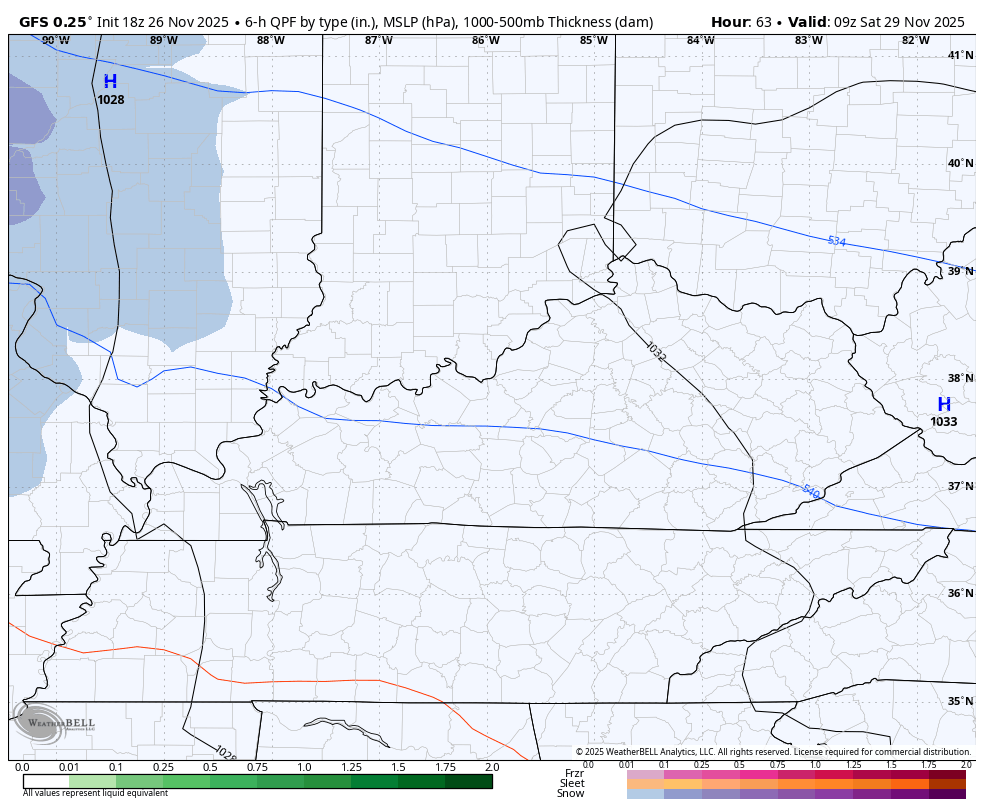
That particular snowfall map from the GFS is beefy…
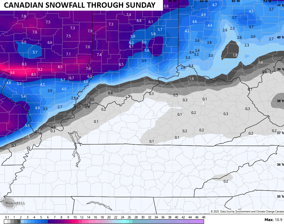
The Canadian Model is colder than earlier runs, but it’s not quite as far south with the initial rain/snow line…
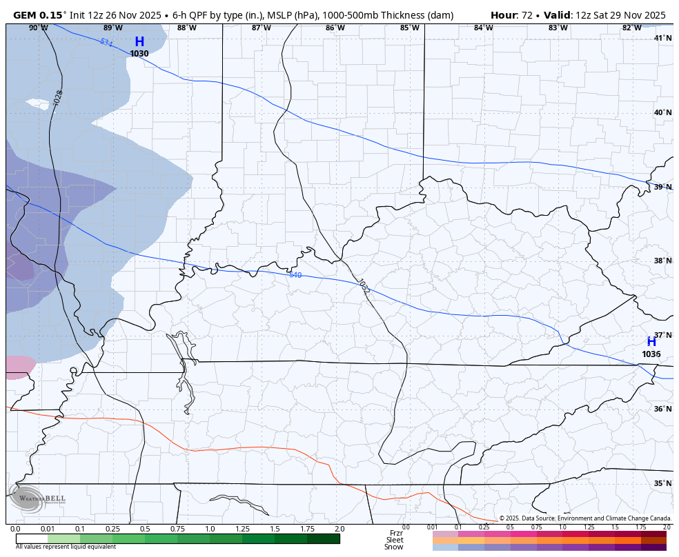
Still, the model likes northern Kentucky for some accumulations with some wraparound light stuff for the rest of the area…
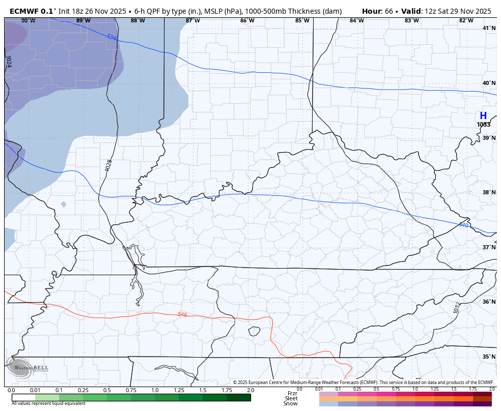
The EURO has just a bit of a mix across many areas with some light snow in the north…
The next system quickly rolls our way by Monday night and Tuesday and has the chance to be a pretty impactful system. All modes of winter weather are on the table, depending on the track of the low.
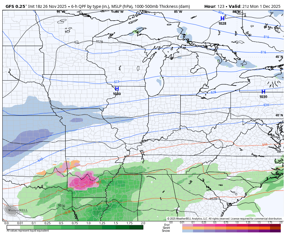
The morning run from the GFS was a little colder…
The afternoon run was just a tad warmer…
The models will vary a lot with track and intensity of this particular system.
The extended pattern into December continues to look pretty harsh.
I will have your full update later tonight and I’ll have a few updates on my Meteorologist Chris Bailey Facebook Page
Until then, here are your tracking tools for the day…


Make it a wonderful Wednesday evening and take care.
