Good evening and Happy Thanksgiving. Here’s hoping you guys are having the best Thanksgiving ever. Temps are cold and getting colder as we move into tonight and Black Friday. From there, rain and some snow moves in for the weekend with a much bigger system threatening us by Monday night and Tuesday.
My time is limited and I know yours is too, so lets get after it.
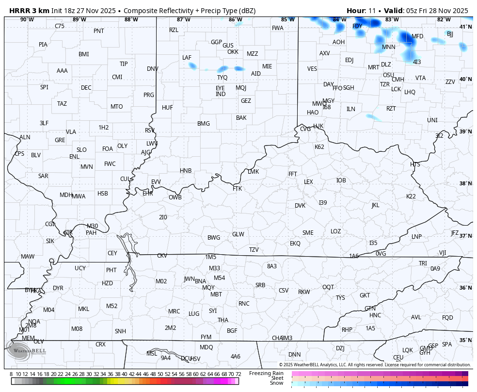
This cold northwest flow tonight and Friday may squeeze out a couple of flurries and snow showers in the east. The HRRR future radar is picking up on this…
The system coming in late Saturday into Sunday is a fast-mover and light precipitation maker for Kentucky. Light rain and some light snow move east through the day on Saturday with many of us seeing chilly light rain later Saturday night into Sunday. All of this can end as snow showers and flurries later Sunday and Sunday night.
The best chance for light accumulations is still in a southwest to northeast corridor along and just south of the Ohio River.
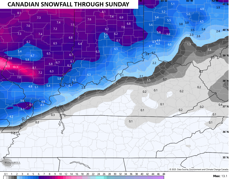
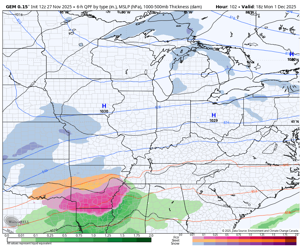
In terms of the models, we find the Canadian as the snowiest and farthest south…
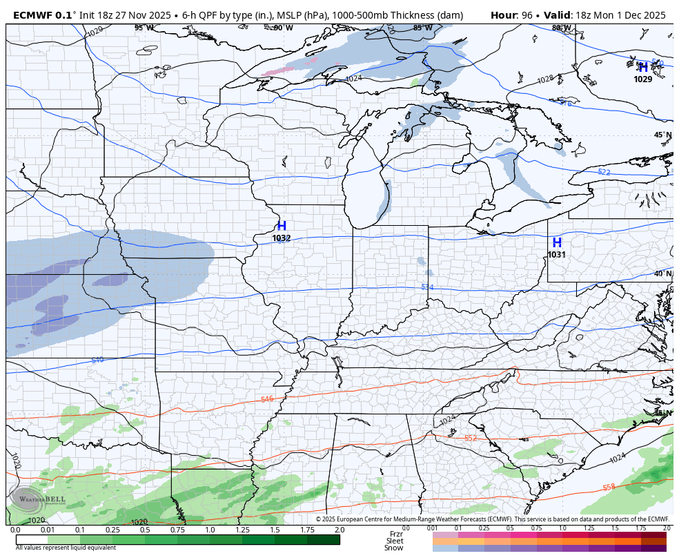
The EURO continues to be on the other end of the spectrum and is very far north…
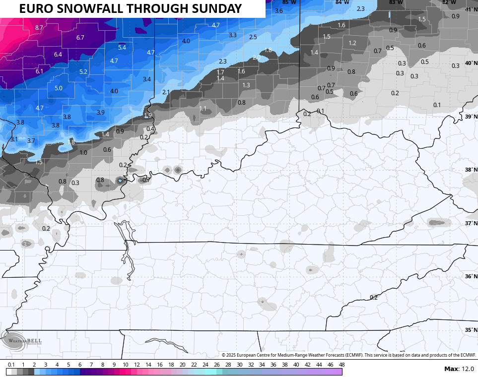
As with most things in life, the truth likely lies in between the two extremes and that’s where most other models are.
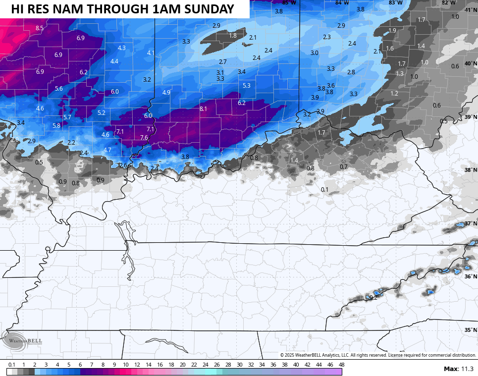
The Hi Res NAM only goes out far enough to get the first part of this system…
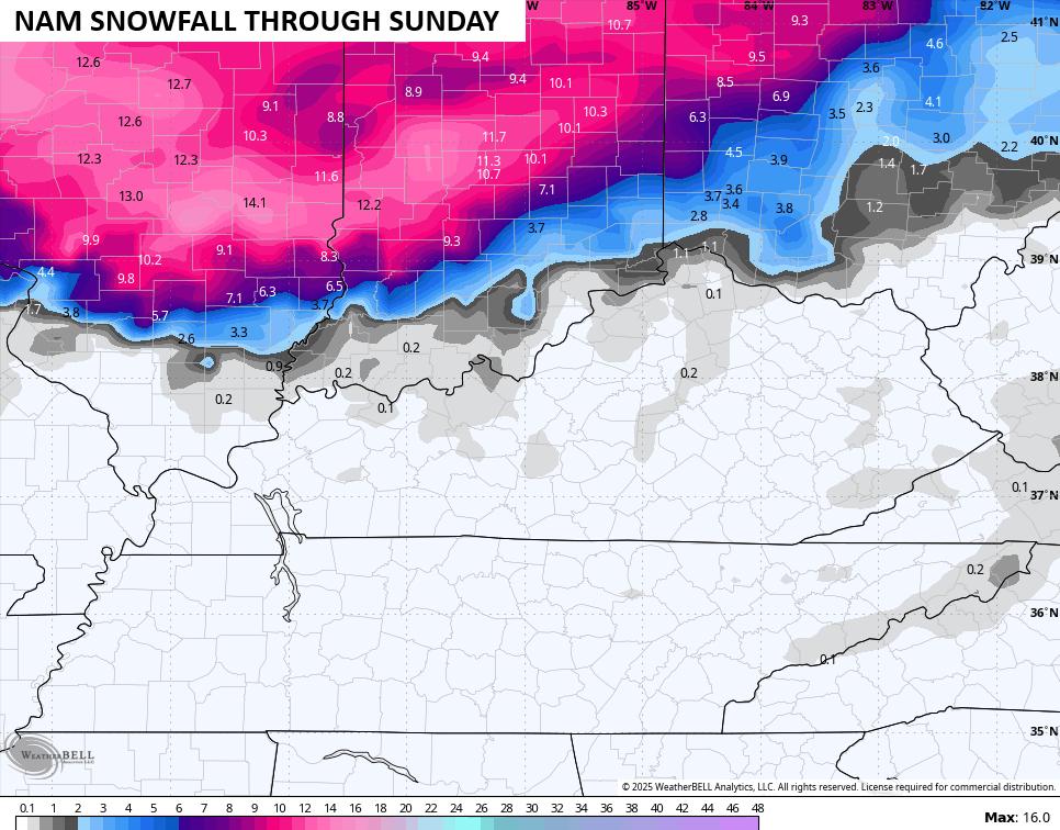
The NAM is a little north of that…
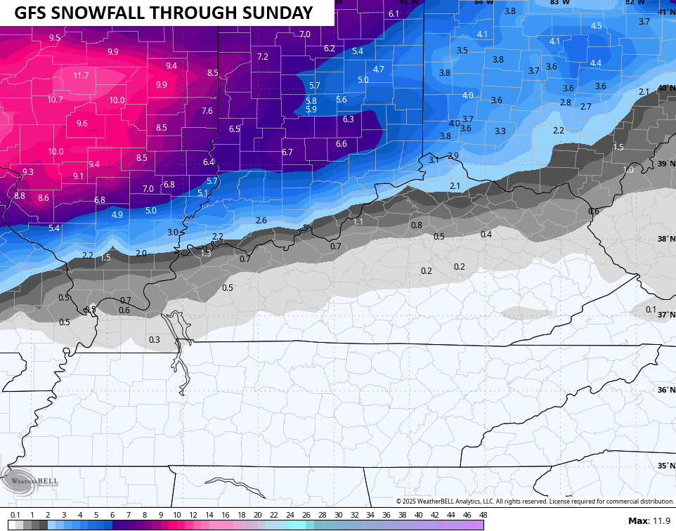
The GFS tilts a little more toward the Canadian side…
If needed, I will have a First Call for Snowfall map later tonight or Friday. If needed.
The next system is likely to track from the near the Gulf Coast to the Carolinas late Monday through Wednesday. At the same time, a weaker low tries to get into the southern Appalachian Mountains. How far north and west that gets will be the determining factor on which precipitation type and how much of whatever you get where you live.
This system has the potential to become our first WST of the season.
The models are, as expected, still trying to get a handle on this whole setup and that’s why we see big swings in the details of this storm. Listen… It’s way, way too early for details.
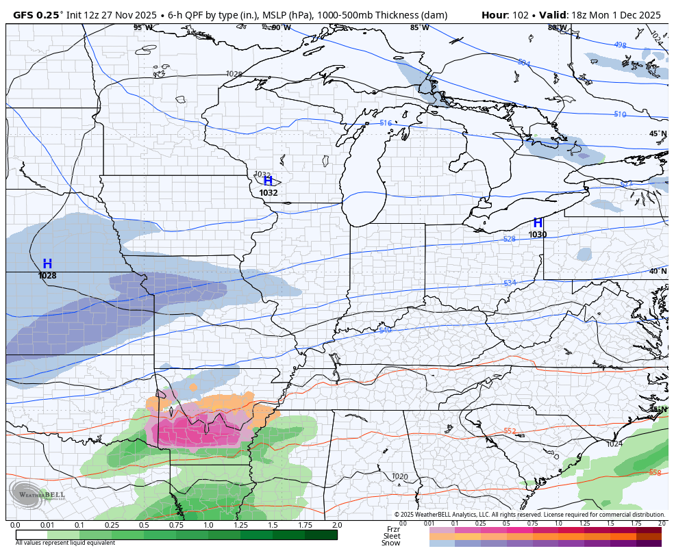
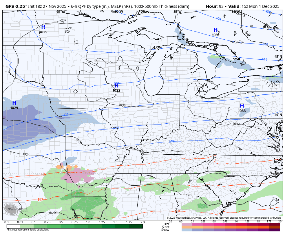
The last two runs of the GFS show how the details change from one run to the next…
The Canadian is probably closest to my initial thoughts…
The EURO is similar…
The full update comes your way later tonight and I’ll also have a few updates on my Meteorologist Chris Bailey Facebook Page
Until then, here are your tracking tools for the day…


Make it a great evening and take care.
