Good Friday and Happy Black Friday to all those who celebrate. It’s a cold day for all the holiday shoppers out there as we look ahead to an action packed pattern. A system this weekend brings rain and some snow into the state with a much bigger winter weather threat lurking by Monday night and Tuesday.
Temps today are frigid with upper teens and low 20s to start and 30s for highs. Wind chills will be much colder. A mix of sun and clouds will be noted with the clouds in the east having the chance to spit out a few flakes.
Weak low pressure rolls into the Ohio Valley Saturday and Sunday with rain and snow. Here are some early thoughts:
- A rain/snow mix moves into western Kentucky Saturday afternoon while the central and east see increasing clouds.
- This mix rolls eastward into the evening hours with the greatest snow threat across the north.
- Northern Kentucky has the best chance of seeing light accumulations.
- Much of the rest of the state sees a chilly rain Saturday night into Sunday.
- As the system goes by, a few flakes and snow showers will be possible Sunday afternoon and evening.
- This same system will bring a monster Thanksgiving Weekend snowstorm to the northern half of the Ohio Valley.
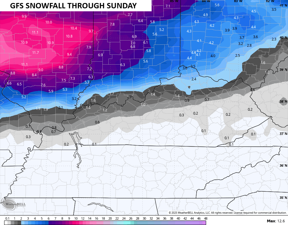
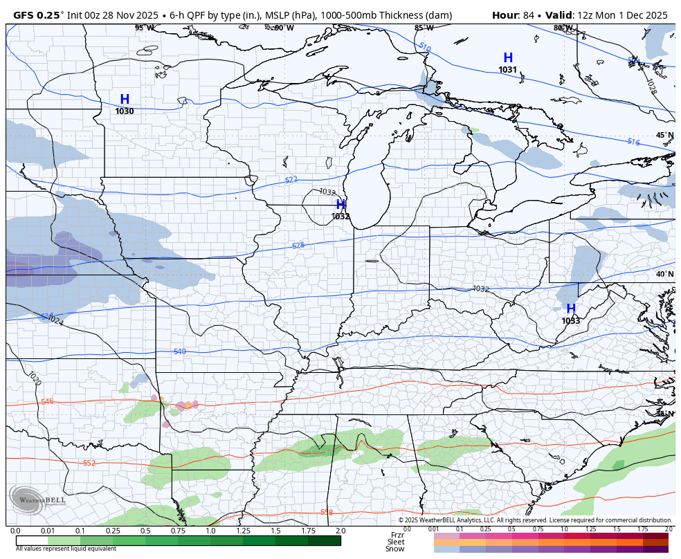
In terms of the forecast models, the GFS continues to be the coldest with the farthest south snow line at the start…
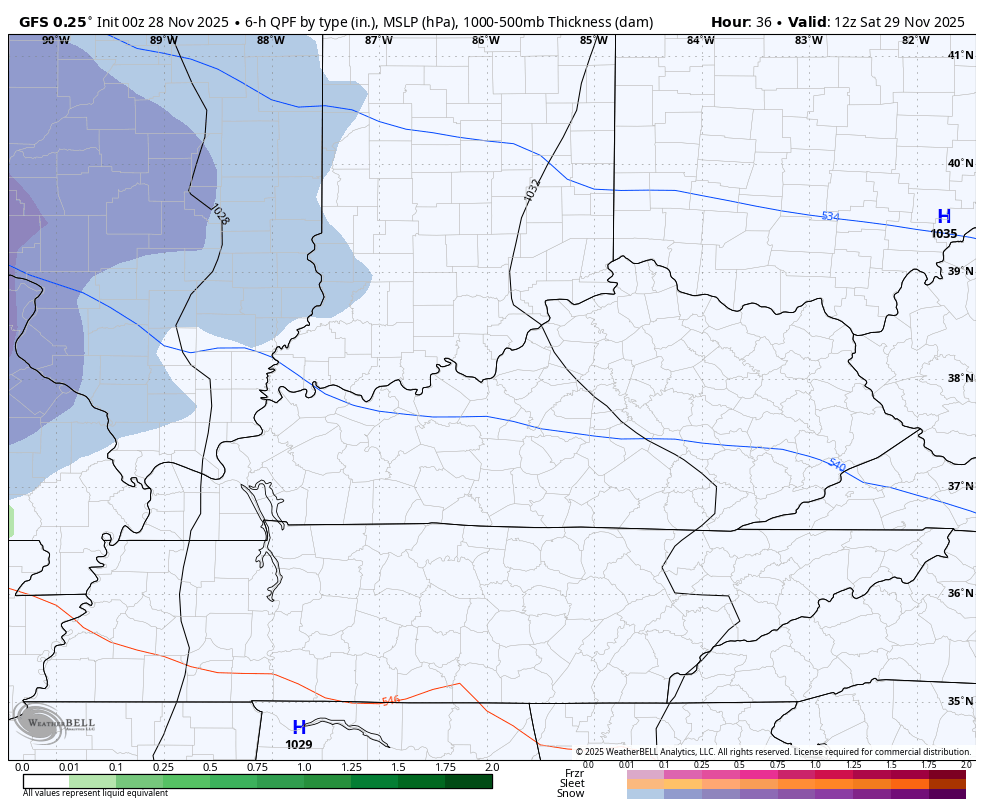
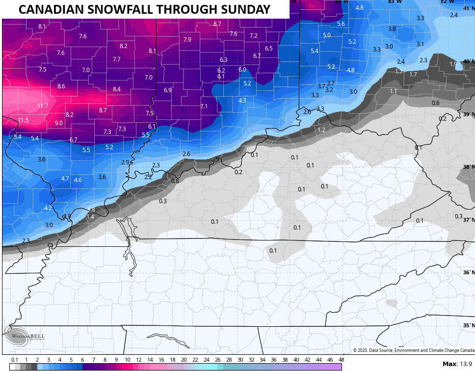
Here’s the snow map from that and it’s likely too snowy this far south…
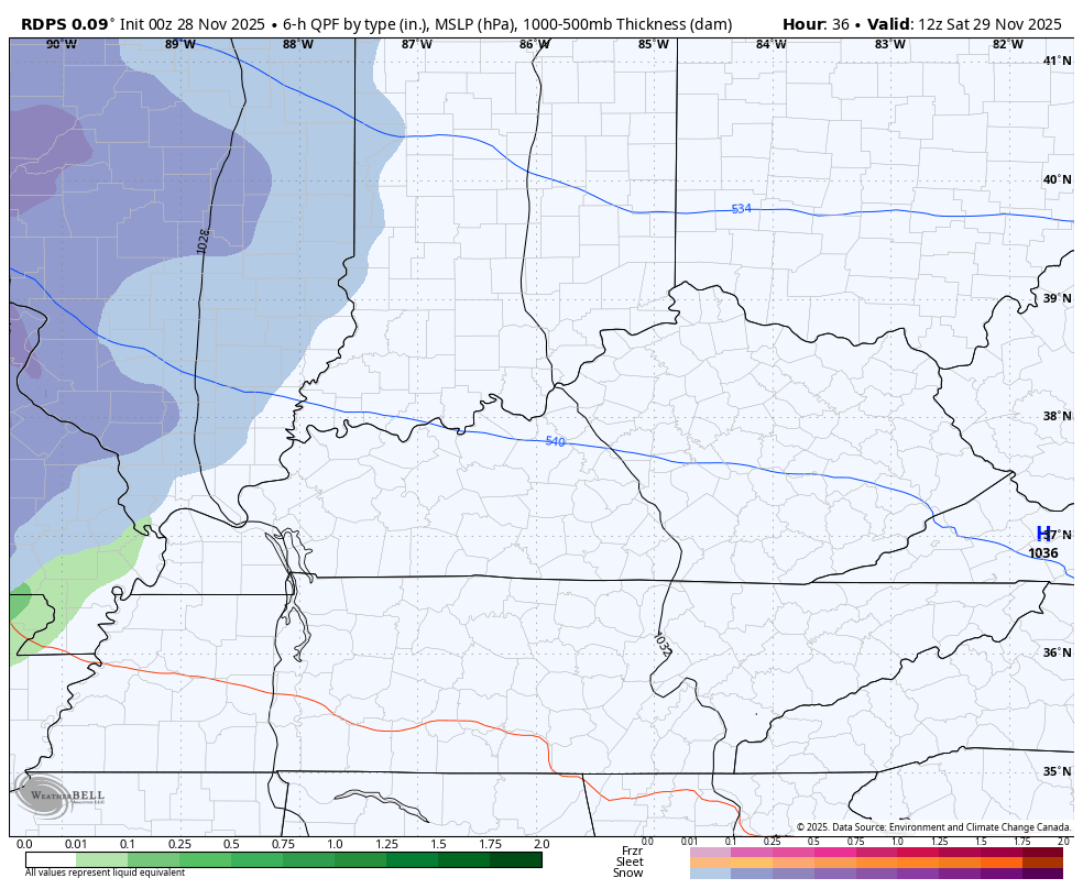
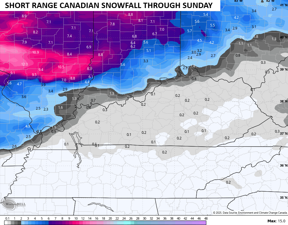
The Canadian Family of models is probably now more to my liking…
Here’s the snow map from the Short Term Canadian…
The regular Canadian…
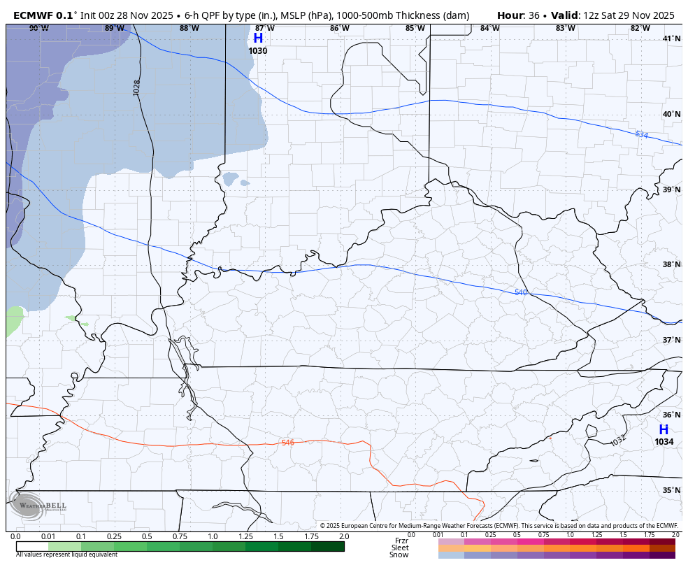
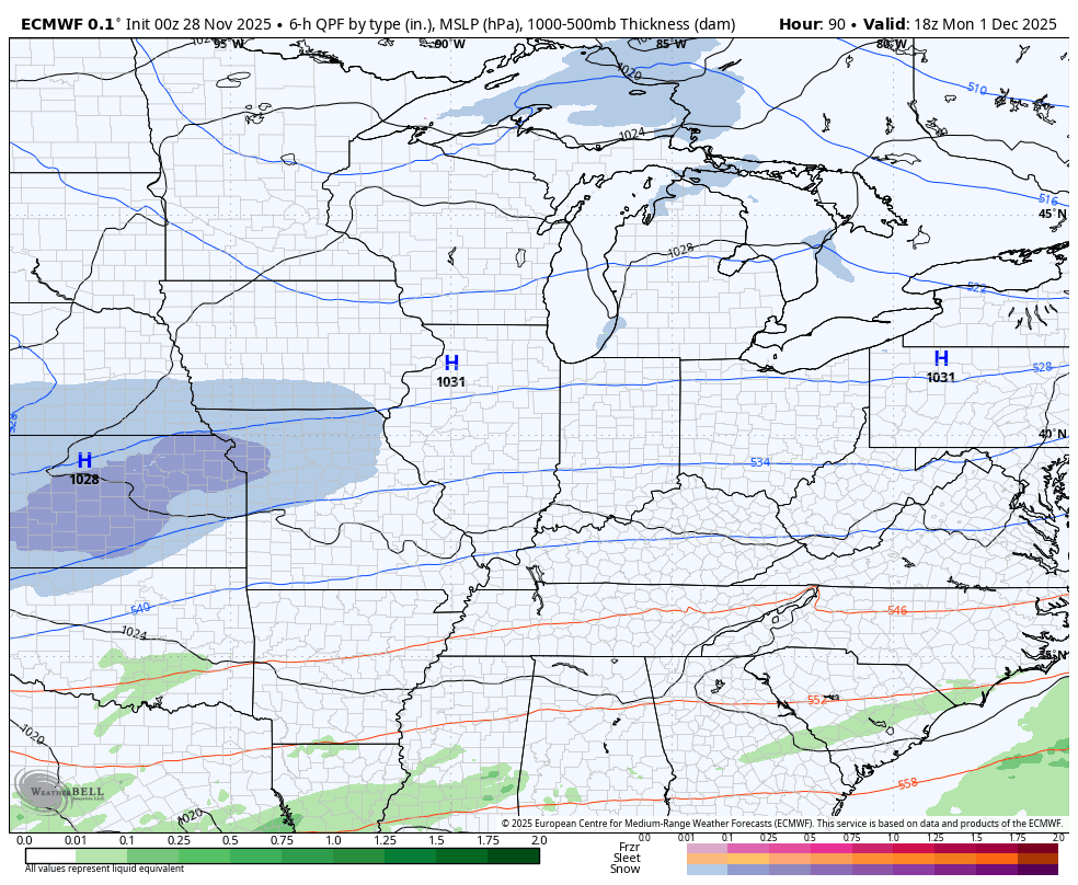
The EURO continues to be the farthest north, but it is starting to see the possibility of the rain/snow mix across Kentucky…
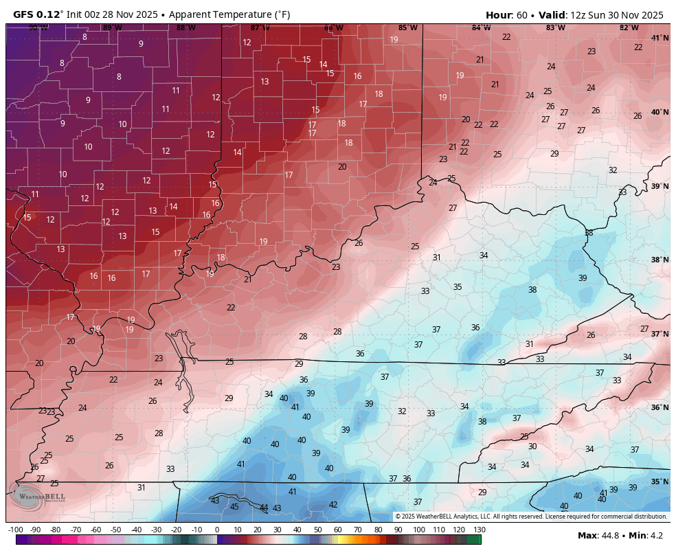
Gusty winds and another blast of frigid air comes crashing in behind this. Wind chills from 7am Sunday to 7am on the 1st day of December Monday are way down there…
This sets the stage for a stronger system to impact us from Monday night through Tuesday night. The exact impact on any one location is still a work in progress and won’t be known until we get into the weekend.
One low works toward the southern Appalachian Mountains while a stronger low works from the Gulf Coast through the Carolinas. This particular setup means all mode of precipitation are on the table for our region as it’s all about the track and strength of the lows.
The models all have a similar theme with this setup, but vary from model to model and run to run.
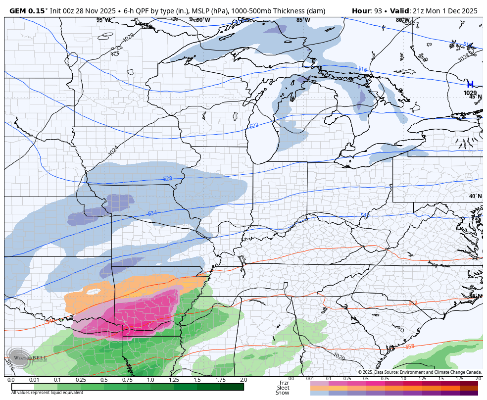
Here’s the Canadian…
The GFS…
The latest EURO…
Another system of interest arrives late next week into the first weekend of December. This leads us into a series of arctic shots dropping into the country with the potential for a couple of severe arctic blasts before we even get to Christmas.
Watch the Barney shots diving into our region in the first 12 days of December…
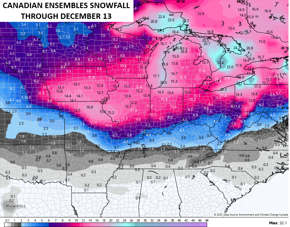
Many of the various ensembles are now sniffing out the snow opportunities we have over the next few weeks…
I will have another update coming your way later tonight and I’ll also have a few updates on my Meteorologist Chris Bailey Facebook Page
Until then, here are your tracking tools for the day…


Make it a great Friday and take care.

Black Friday shopping is extremely overrated.
So true Jeff.
Thanks Chris, for the update.
Illinois Mike, Check this out : )
https://climateimpactcompany.com/u-s-early-notes-widespread-early-season-snows-2/
A very interesting Snowstorm to track !
Yeah, the monster weekend snowstorm that CB alluded to in this post will definitely affect the Chicago Metro Area, which is under a Winter Storm Warning from early Saturday morning to early Sunday morning. All of Northern and Western IL is included in the warning. A widespread 6-to-10 inch total is expected by Sunday morning, with locally higher amounts.
We’re going to get more than half our total snowfall from last year from this storm!
Mike, looks like there is a parade of Snowstorms headed in your direction, along with more Arctic Air. Will keep the Snow on the ground for a longtime. I’ve seen this happen in the winter 1969 – 70 in South Central Indiana, where we maintained a Snow pack all through December and half of January. Have fun shovelling, but don’t over do.