Good afternoon, everyone. I wanted to drop by for a quick midday update on the rain and snow moving into the region this weekend and the system that follows that up early next week. The second of those two will have a much bigger impact.
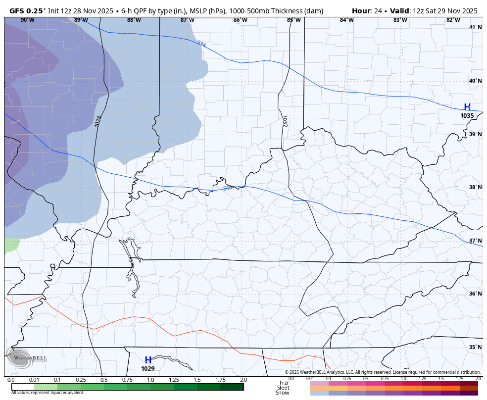
I have no substantial changes things play out with this system. Rain and some light snow move into western Kentucky early Saturday and spread east from there. Many areas may, at least, start as a few flakes before going over to rain, especially along and south of I-64. Northern Kentucky has the best chance to put a little snow on the ground during this time.
Some flakes will then show up on the back edge of everything as it moves out on Sunday.
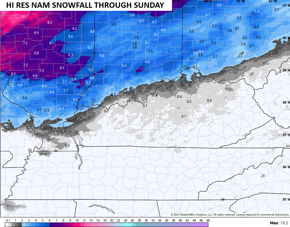
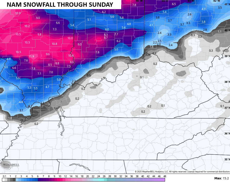
The future radar from the Hi Res NAM seems to have a good handle on this…

The GFS does, too…
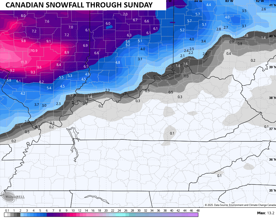
I’ll have a First Call for Snowfall coming later today, but here’s a look at what we may be seeing across the state for the initial stuff Saturday and Saturday night…

The GFS and Hi Res NAM are similar in their respective snowfall thoughts…
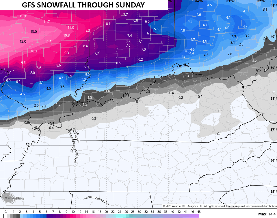
The Canadian seems to be on board with those two in a general sense…
The NAM often overdoes warm air advection but could be a touch south…
The new EURO wasn’t out at the time of this writing, so we will get in on this evening.
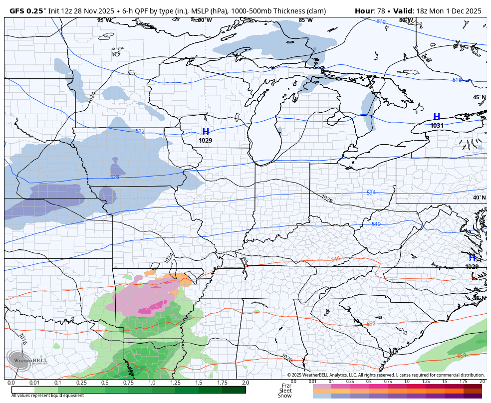
The bigger system arrives Monday night and Tuesday and may very well be our first Winter Storm Threat of the season. The models continue to give us a nice storm signal, but they are, as expected, really struggling with the details. All modes of precipitation may show up across Kentucky.
Here’s the Canadian…

And the GFS…
I will have another update coming your way later this evening and I’ll also have a few updates on my Meteorologist Chris Bailey Facebook Page
Until then, here are your tracking tools for the day…


Make it a great day and take care.

Thanks for the update Chris. Hope those models are wrong with the freezing rain.