Good evening, everyone. Our winter storm is long gone but festive flakes and frigid wind chills remain as December starts with a bang. We have a few more systems to track in the coming days, but these are going to be hard to time.
Let’s start with a quick look back at how this winter storm was actually historic for a few cities…
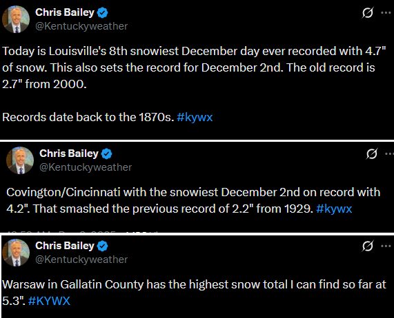
The corridor of heaviest snows we talked about set up from southwest to northeast and exceeded Winter Storm Warning criteria in several areas. Now you’re seeing why my forecast had 5″ as the high end range.
Flurries and a few snow showers continue to fly tonight and those may continue into early Wednesday. Some light coatings are possible across central and eastern Kentucky. Wind chills are in the teens for many tonight and early Wednesday.
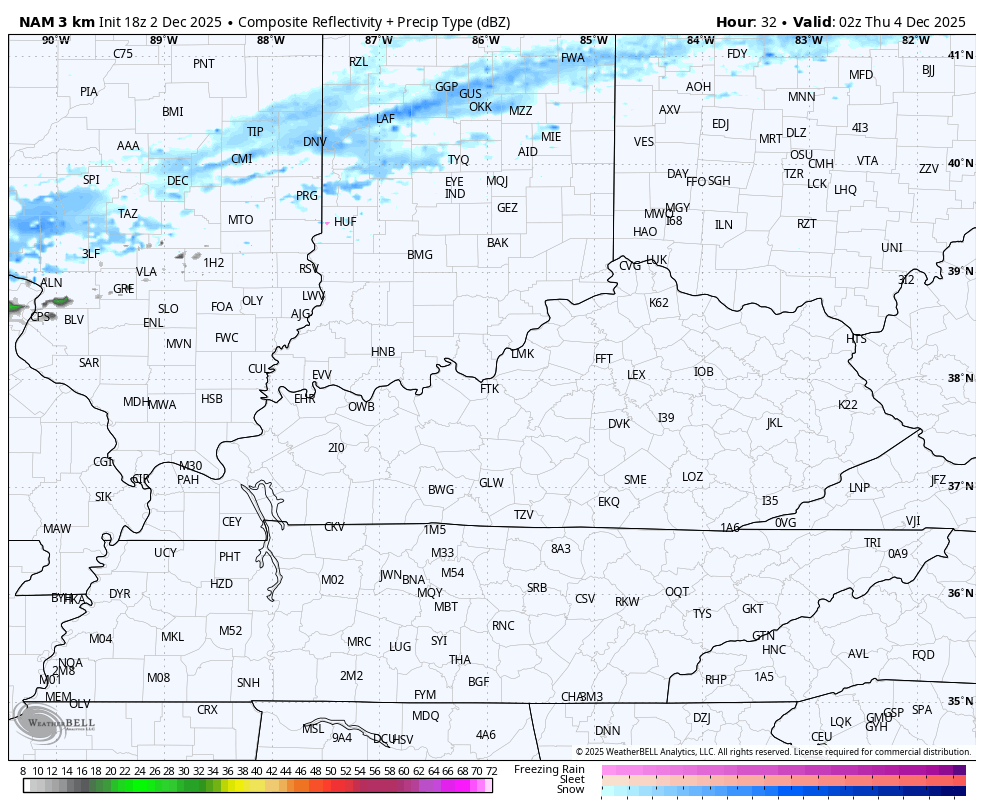
An arctic front then slides in from the northwest Wednesday night and Thursday morning. This will have a narrow band of snow showers and flurries with it. This band may spit out light accumulations in the north before it fades the farther south it gets.
The Hi Res NAM Future Radar picks up on this very well…
The models really diverge after this, starting with the southern system on Friday. Most models keep this to our south, but the EURO is giving southern and southeastern Kentucky the chance at some light snow and a mix…
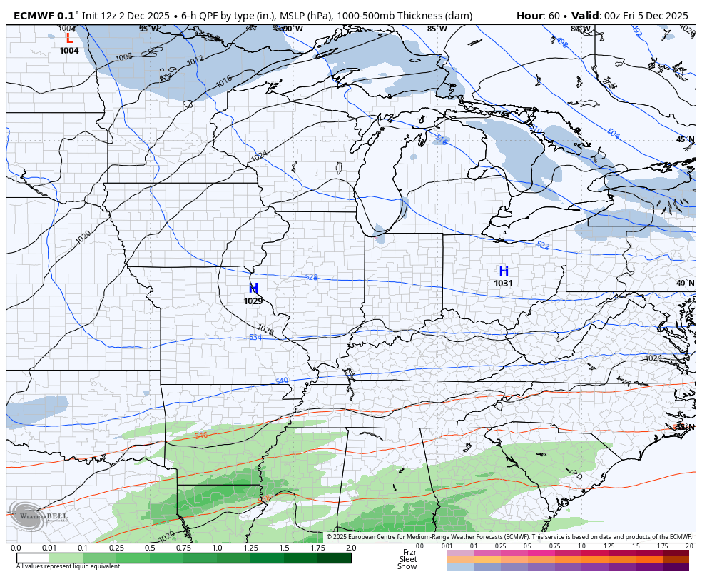
This is a system the models were really hyped about a few days ago but backed off the past few. I’ve been around long enough to see this happen before and then the models find it again at the last minute.
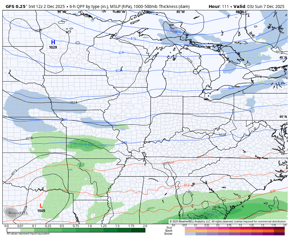
A series of clippers then move our way later this weekend into next week. Each run of each model handle these differently. I’ve talked about how we will need to watch for one of these to really dig in and become something bigger.
Recent runs of the GFS have been trying this with our Sunday system, but I’m not sold on this scenario…
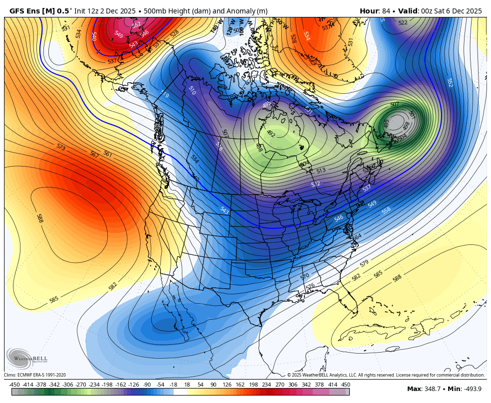
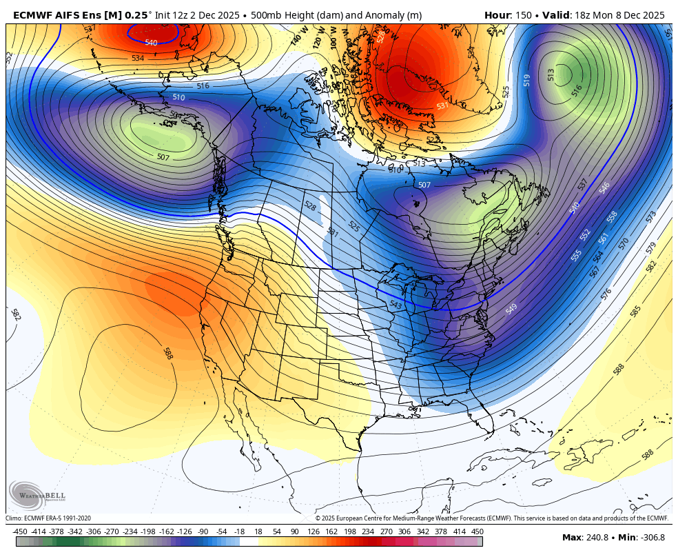
The pattern on the ENSEMBLES continues to show deep troughs diving into the eastern half of the country next week. There could be a bit of a break at some point as a southeast ridge tries to pop before it gets beaten back down pretty quickly. That would be similar to what just happened. 10 days ago, the models had the first week of December as a very warm one in the east. I didn’t bite on that one, but I’m more open to a small ridge for a day or two.
You can see all this on the GFS Ensembles…
And the EURO AI Ensembles…
I’ll have a full update later tonight. I leave you with your tracking tools for the evening…


Make it a great evening and take care.
