Good Wednesday to one and all. Our very cold start to December continues out there today with a few more festive flakes. More of those flakes will fly later tonight and Thursday morning as another cold front drops in from the north, setting the stage for a southern system to potentially impact our weather.
Temps today are much colder for areas with snow on the ground than areas without snow on the ground. If clouds hang around, the numbers would be held under the freezing mark again. With some clouds, a few flakes will wonder by your sky from time to time, especially early today.
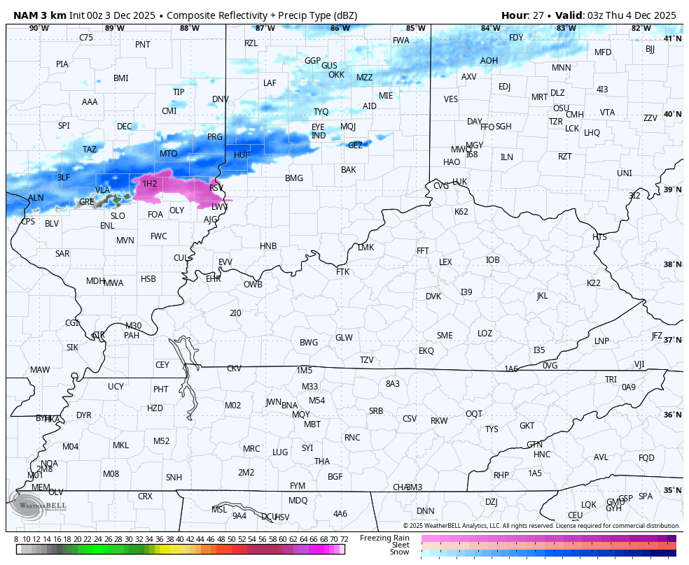
The boundary arriving early Thursday will have a pretty solid band of light snow and flurries along and ahead of it. This band can put down some light accumulations across the northern half of the state before the flakes fade as it drops south of Interstate 64. The Future Radar from the Hi Res NAM shows this well…
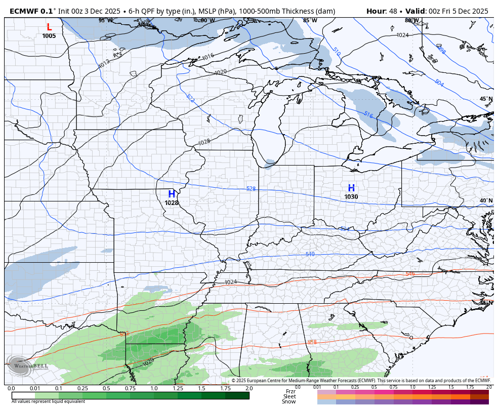
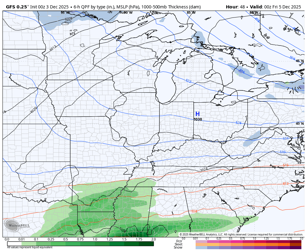
A system is going to lift through the deep south and Tennessee Valley Thursday night and Friday. This has a decent chance to bring a swath of light snow and a light mix for parts of Kentucky. The EURO is a bit farther north with this system and brings light a quick-hitting light snowfall…
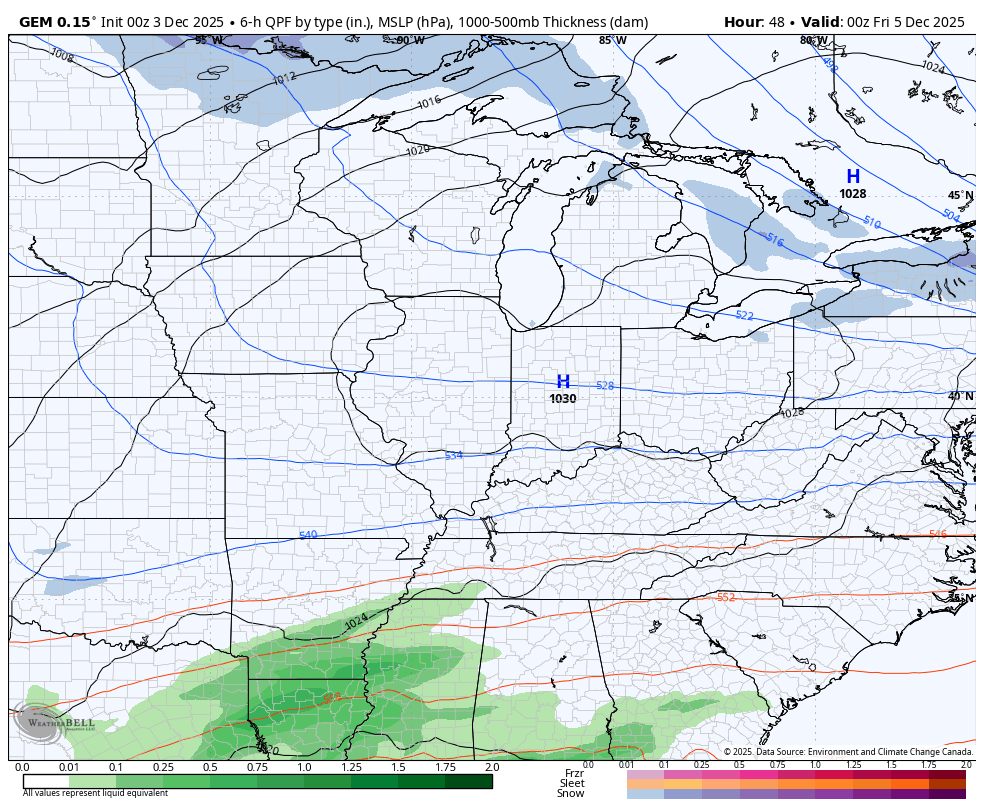
The Canadian isn’t as far north, but it has a swath of accumulating snow in the south and southeast…
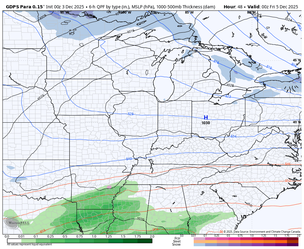
The Parallel Canadian is a smidge farther north…
The GFS shows a little bit of light snow barely getting into the far southeast with this system…
We need to watch for a northward shift in the modelling today and Thursday.
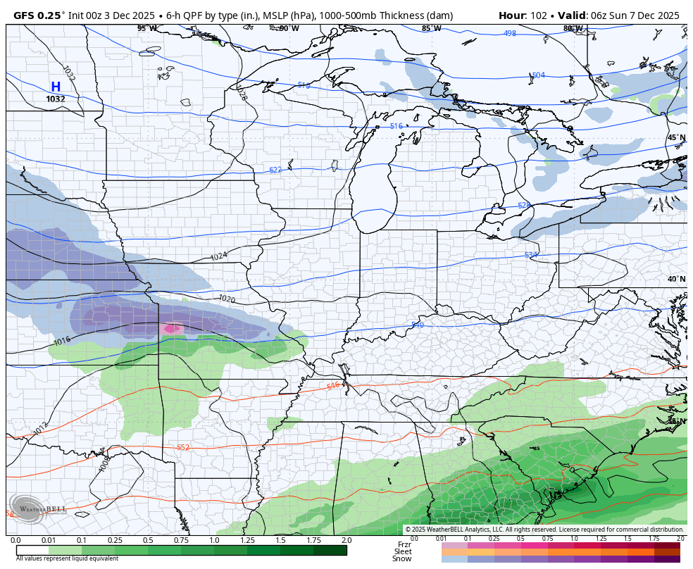
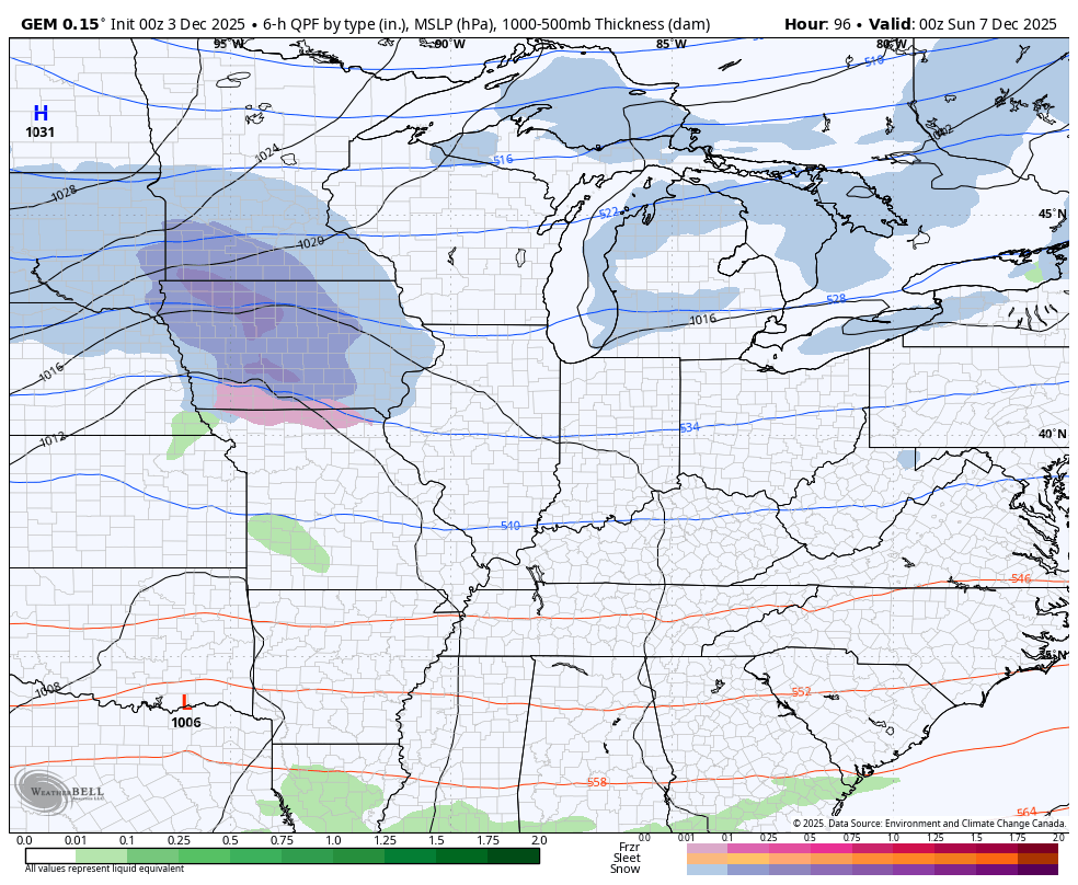
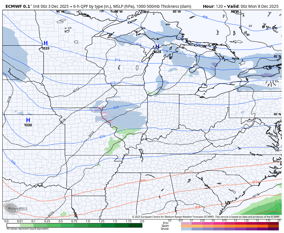
The system coming in after this late in the weekend continues to show up a bit different on each of the models. I know you’re shocked by that.
The GFS is farther south and deeper with this system, developing it into a full-blown winter storm that bowls through here…
Something like that is what I said to be watching for with the series of clippers dropping in over the next 10 days, but the Sunday system wasn’t exactly the one I thought had the chance to develop.
The Canadian is trying to pop something, but is nowhere near as put together as the GFS…
The EURO is much weaker with a clipper…
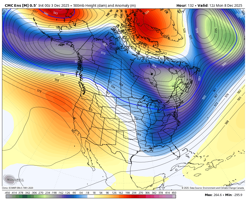
Looking farther down the road into next week, we will find several systems dropping into the region from the northwest. One or two of these may try to amplify into something stronger and we could very well get into a really cold arctic shot behind one of these.
It’s interesting to watch the various ensembles already beating down any attempt at a ridge to go up in the Medium Range…
The models are reacting to the MJO going into Phase 8… That’s a really cold phase for much of the country.
I’ll have updates later today. Have a wonderful Wednesday and take care.
