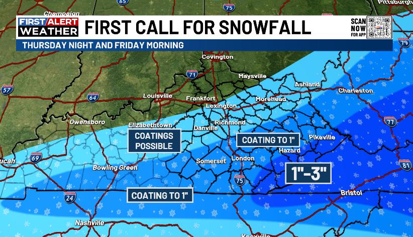
Good Thursday, everyone. We continue to track winter weather across the Commonwealth as two different systems impact different parts of the state today. One is a weak cold front this morning and the other is a southern system arriving later this evening and tonight.
The first front is bringing light snow and flurries across the northern half of the state this morning. That may even put down light, fluffy accumulations with the Covington area potentially picking up a half inch to an inch. Coatings would be possible for the rest of the north.
Flurries will be possible through the day as temp stay WAY below normal. Highs range from the upper 20s to middle 30s for many.
I still have a few questions with the system coming in from the south tonight and Friday morning. Just how far north can this system get? It’s a fast-mover and I believe it can put down a light snowfall across southeastern Kentucky, and potentially, across southern Kentucky.
This is close enough for a First Call for Snowfall…
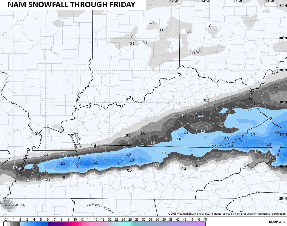
I like what the NAM is doing…
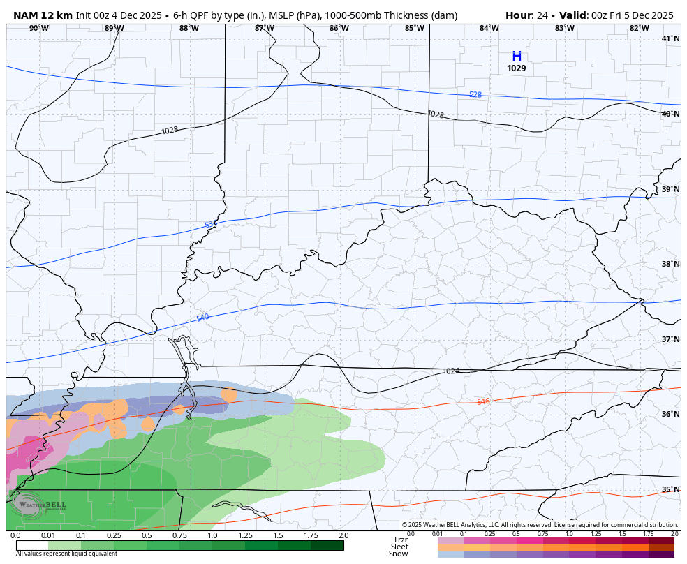
The NAM has a light snowfall for areas that missed out on the Winter Storm earlier this week…
The ICON is enthusiastic as well…
![]()
![]()
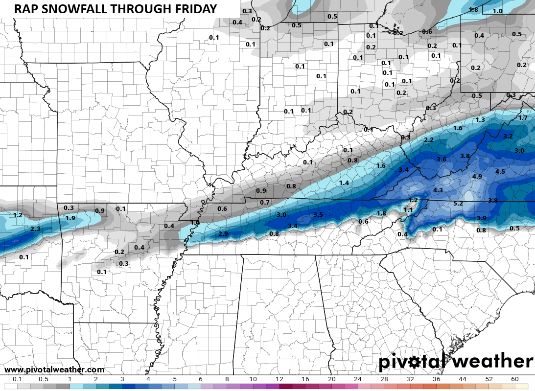
So is the RAP…
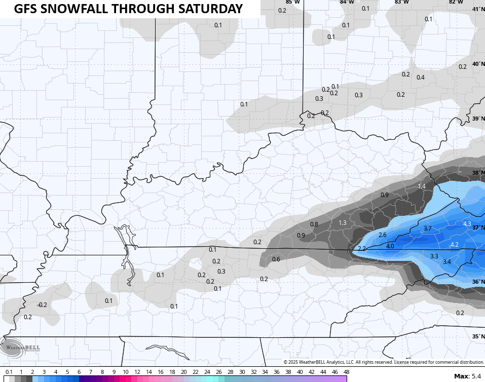
The GFS only likes the far southeast for a light snowfall…
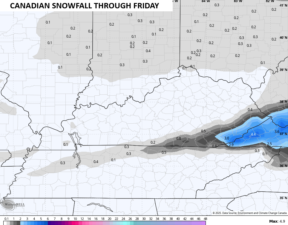
The Canadian is similar…
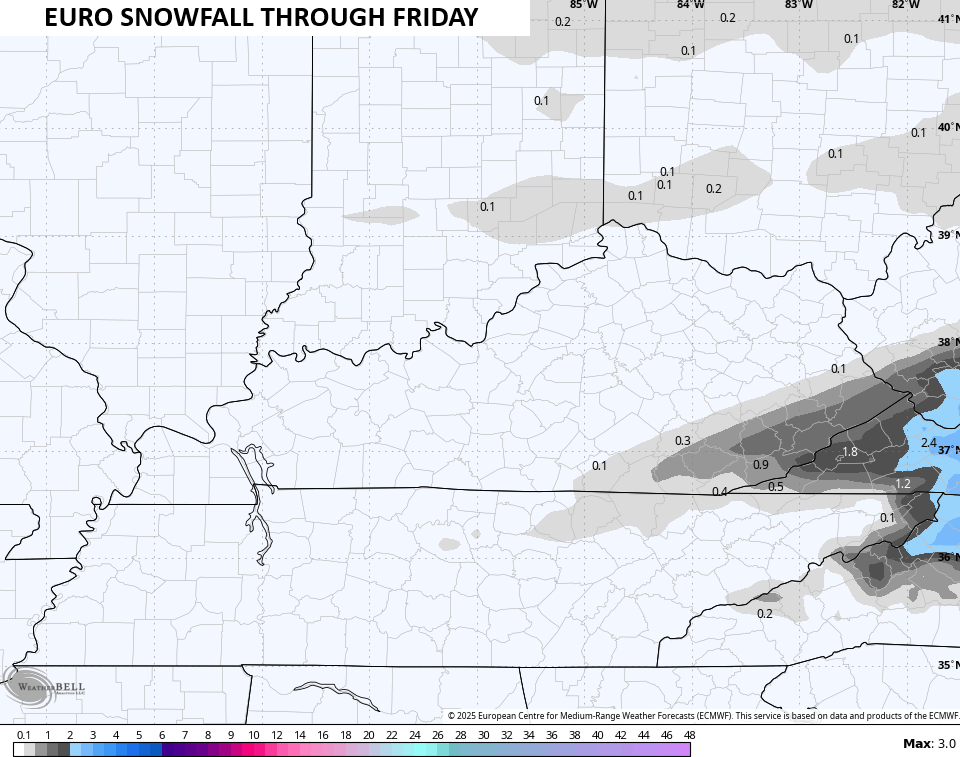
The EURO went from showing snow across the entire state to barely showing any snow in southeastern Kentucky. This changed happened in 24 hours…
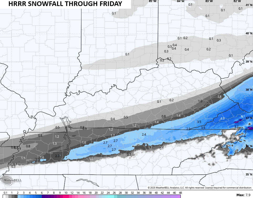
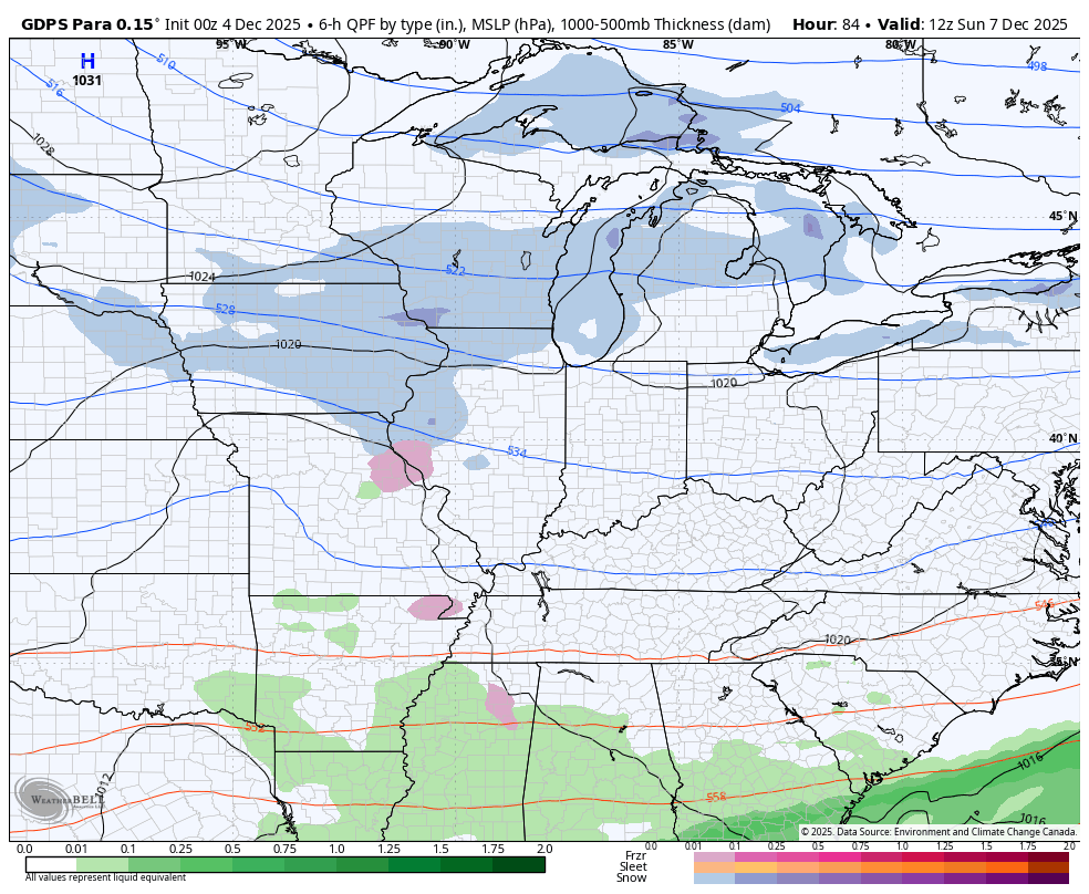
The HRRR is more in line with the other models…
The system coming after that later this weekend looks rather light, but it has some room to strengthen. This arrives with some light snow and flurries Sunday into Monday. As usual, the models are struggling to handle this system.
EURO…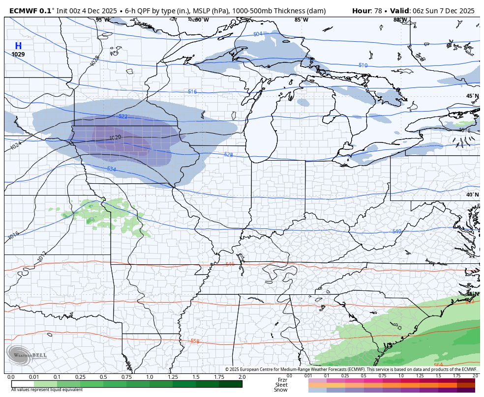
Parallel Canadian…
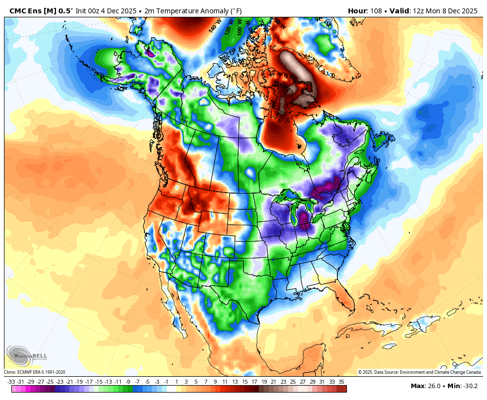
The models have struggled immensely this cold weather season and they will continue to do so. They just cannot handle all the energy diving into the country, nor can they handle the amount of cold. Watch how the Ensembles keep arctic shots diving into the country and notice how they keep originating in the same place… Northwestern Canada and Alaska…
This animation from the Canadian Ensembles starts Monday and goes through December 19th…
They are right about several systems diving into our region next week, they just have no earthly idea what do to with them. I still maintain one of these will amplify into something bigger next week, so we shall see.
Updates will come your way later today. I’ll also have a few updates on my Meteorologist Chris Bailey Facebook Page
Until then, here are your tracking tools for the day…


Make it a great Thursday and take care.

I vote for whatever model has the least snow.