Good afternoon, everyone. I wanted to drop by for a quick update on the light snowmaker rolling into parts of the state tonight and Friday. Overall, the forecast I have out appears to be in good shape as the models are all on board with this.
My First Call for Snowfall that I made Wednesday evening still stands…
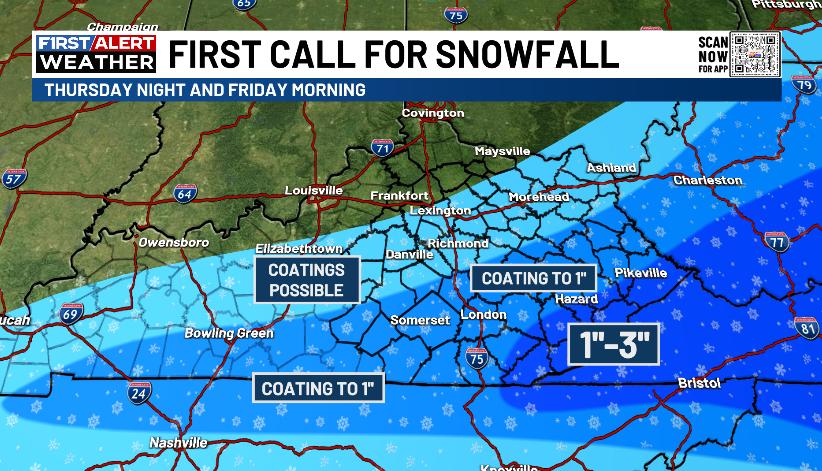
I’ll be updating that again later today on WKYT-TV starting at 4pm. Some of the higher elevations along the Virginia border may go above 3″ and I may have to extend the 1″-3″ farther southwest some.
Winter Weather Advisories should already be out for this area , but that’s not the case. Now that the models see it, perhaps those will get issued soon…

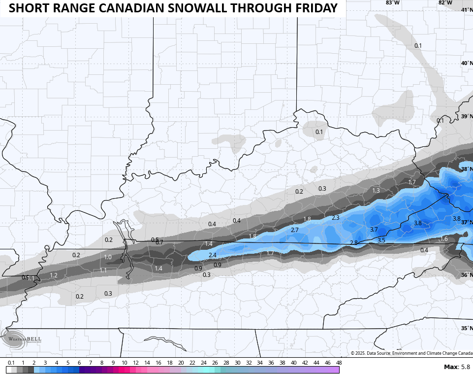
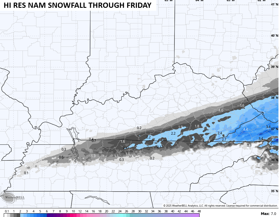
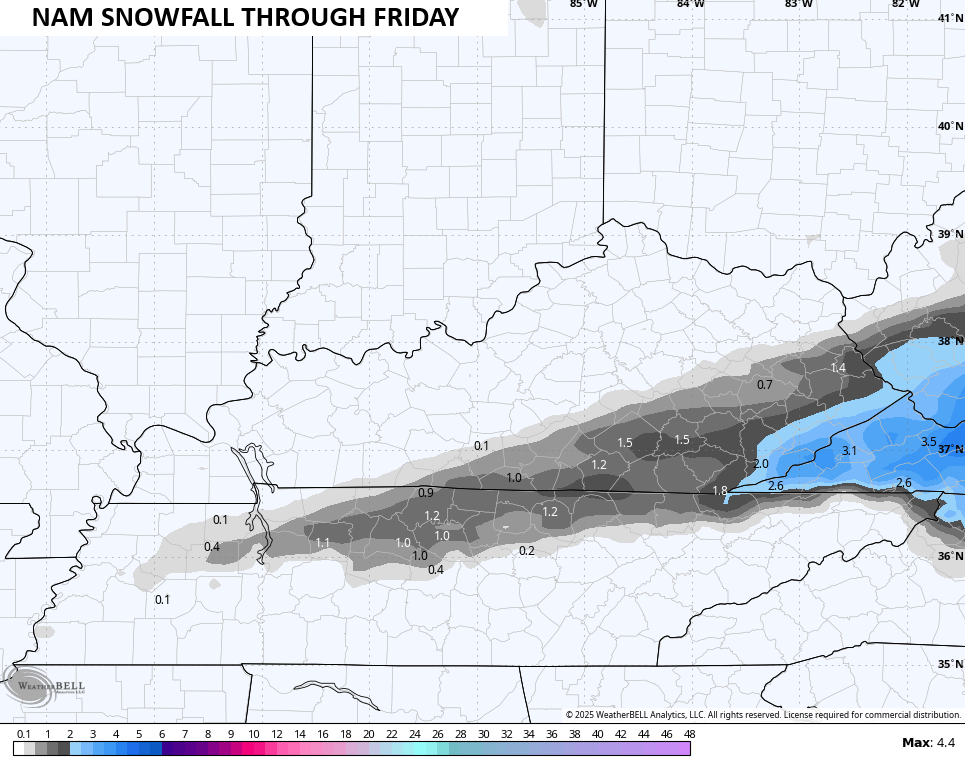
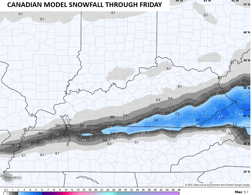
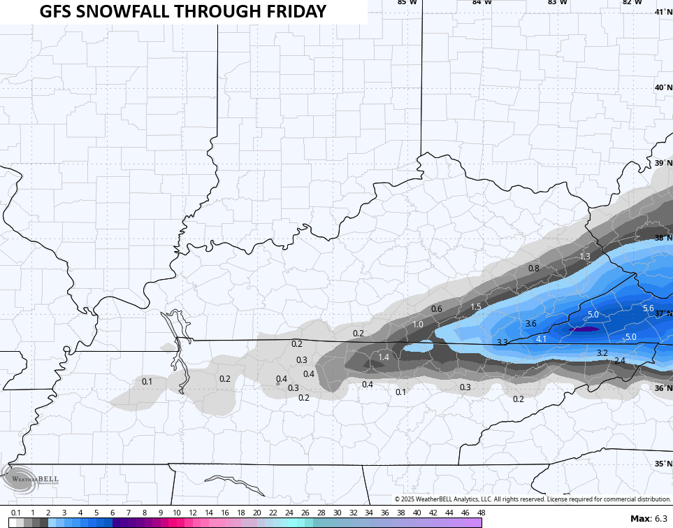
Speaking of the models, we find pretty good agreement with the normal variations.
The Canadian Family has this band of snow flexing much earlier with the 1″-3″ impacting southern Kentucky too…

The NAM fam isn’t as beefed up, but they’re in the ballpark…
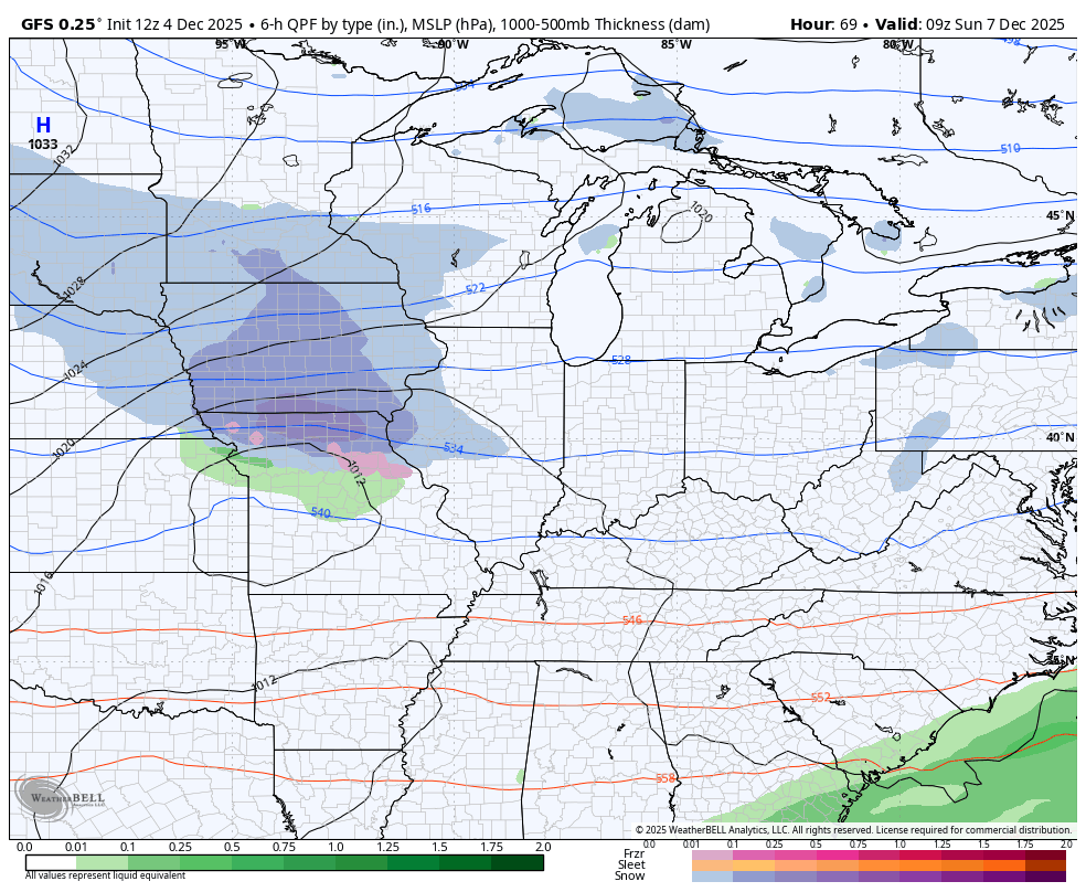
The GFS is a more concentrated on the southeast with the snowfall…
The RAP was the first to show this system with a more widespread look and this model has beefed up totals even more…
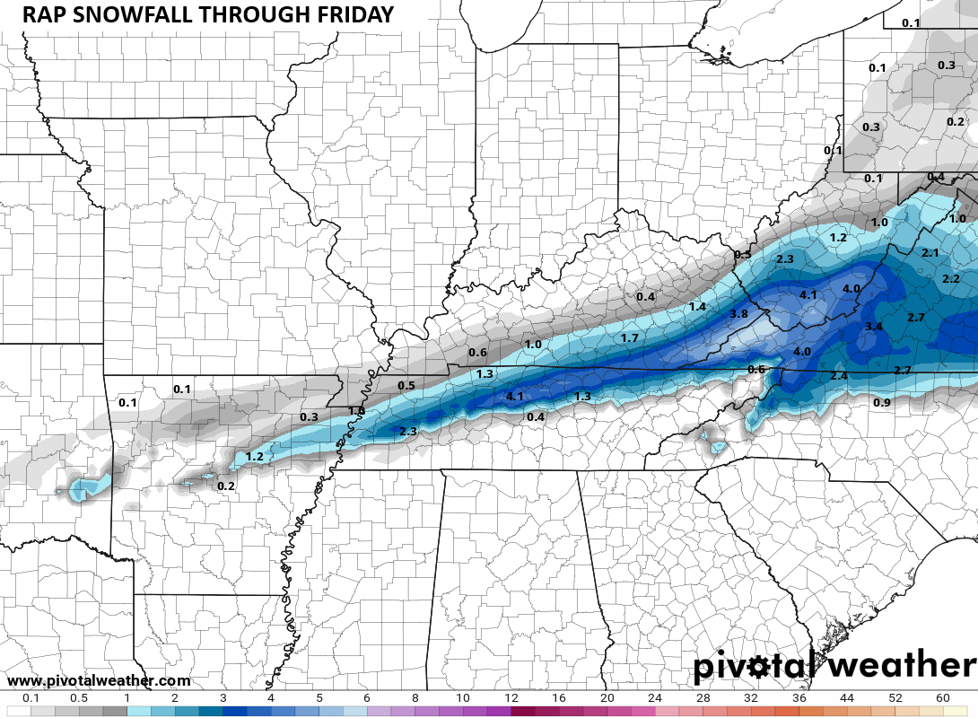
That would approach warning criteria along the Virginia border.
A few flurries will fly on Saturday as we wait for a system to drop in from the northwest Sunday and Monday. That brings another possible light snowfall with it and the Canadian is back to showing this…
The GFS sees this again, but the bias of the GFS in this setup is to make the northern impulse too strong. Correct this thing south a few hundred miles and it has a good idea…
Next week has a lot of potential with these systems dropping in from the northwest!
Updates will come your way later today and on WKYT-TV starting at 4pm. I’ll also have a few updates on my Meteorologist Chris Bailey Facebook Page
Until then, here are your tracking tools for the day…


Make it a great rest of your day and take care.

Wonder will WKY have some good snows this wintet….
Russell, What is a good Snow to you ? My thoughts would be anywhere from 12 to 15 inches. It’s been 10 years since we had that amount here in Maple. I just don’t think the weather pattern we have now, is going to produce such amounts. Back in the Winter of 2015, we were in a El Nino phase of ENSO, operating in a positive PDO, which means the El Nino back then was reacting with the atmosphere creating a very active subtropical jet stream and a weak southeast ridge, hence a Snowy Winter for our part of the World.
At this point any at all. But a good snow is one where you need the 4 x 4. It seems most of central and east ky get most of the snow while WKY misses out. Just like this afternoon.