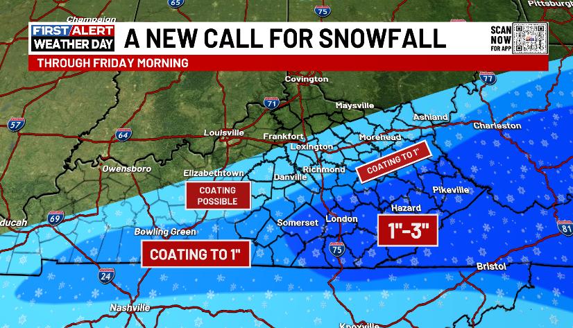
Good evening, everyone. Our Winter Weather Advisory is out for southern and southeastern Kentucky as a light snowmaker rolls through this part of the region. How far north can we get some light accumulations? That’s the question of the evening.
Here’s a look at your Winter Weather Advisory into Friday morning…

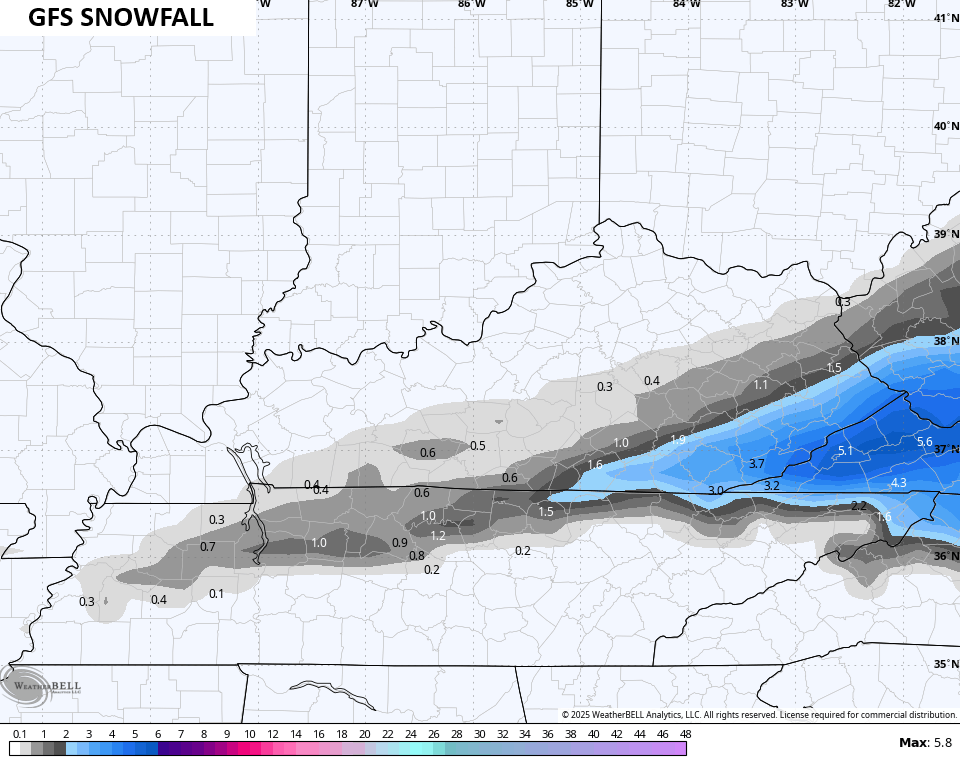
My New Call for Snowfall looks a lot like the initial outlook…
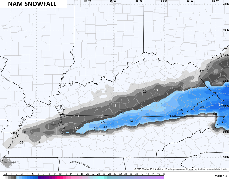
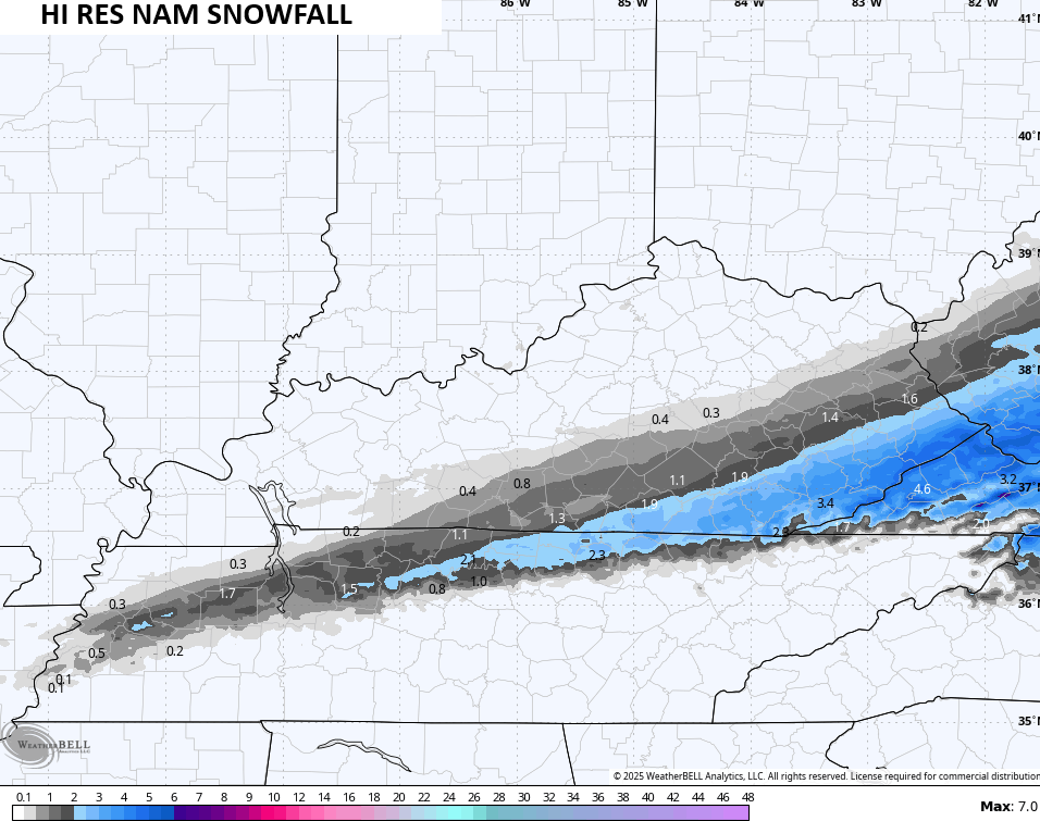
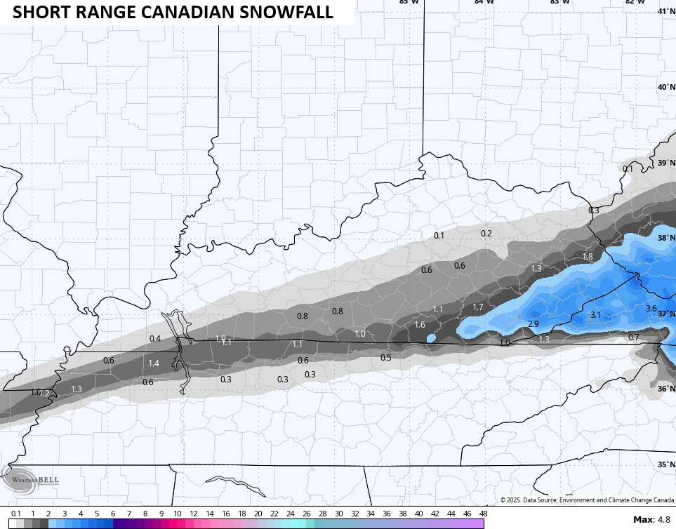
The various forecast models look similar to the forecast I’ve had out for a few days now…
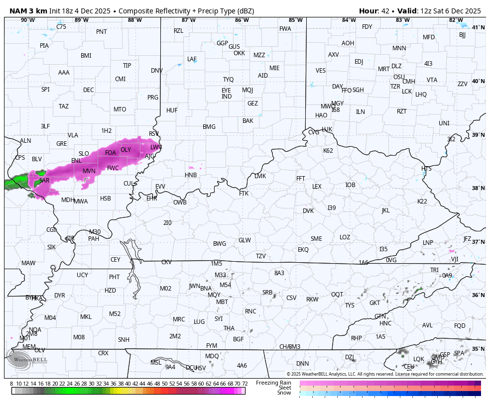
Following this is a weak light snow and flurry maker across the northern half of Kentucky Saturday…
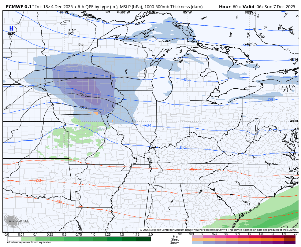
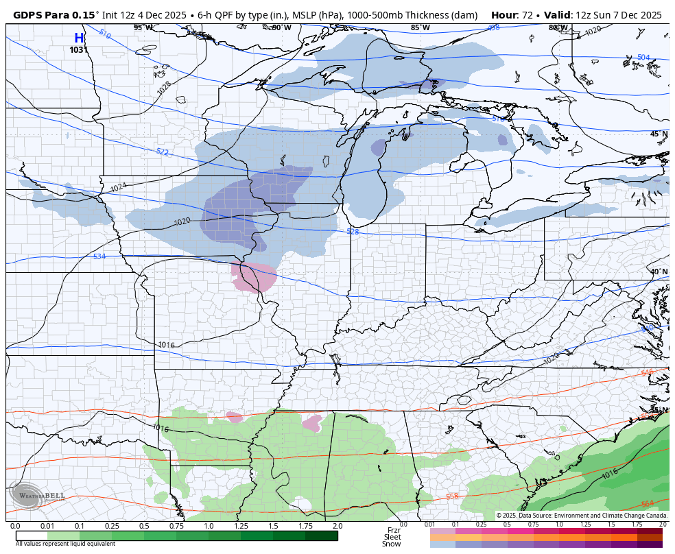
The system coming in Sunday and Monday still looks to bring a light mix and light snowfall to the region. The details are murky still, but the models are seeing this possibility…
EURO
CANADIAN PARALLEL
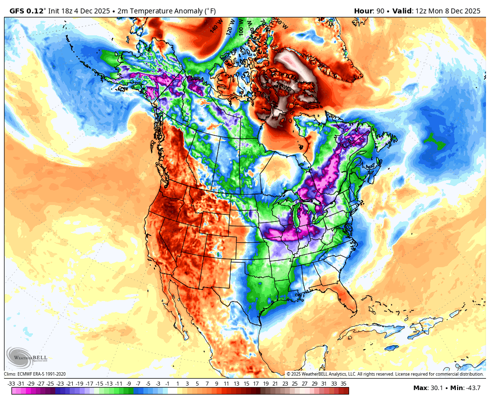
Another big arctic front slams in behind that by Wednesday and Thursday and that is likely to bring some winter weather back here. You’re also now starting to see the operational models figuring out that troughs in the west and ridges in the east are not really a thing this month.
Look at all the Barney shots on the GFS over the next two weeks…
A full update comes your way later tonight. I’ll also have a few updates on my Meteorologist Chris Bailey Facebook Page
Until then, here are your tracking tools for the day…


Make it a great rest of your day and take care.
