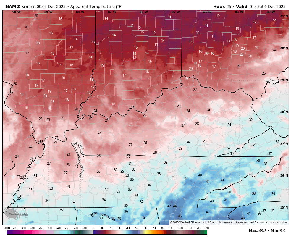
Good Friday to one and all. The second snowfall of the month is exiting southeastern Kentucky early today as December is starting out on a very wintry note. Old Man Winter is just getting started as arctic shots are lined up through the rest of the month. Each of those will have more snow chances.
This morning’s snow in the southeast gives way to a few flurries with highs in the low and middle 30s for many. Gusty winds will make it feel even colder. Wind chills tonight and early Saturday will be dropping into the teens once again.
This animation starts at 8 this evening and goes through 8 Saturday morning…
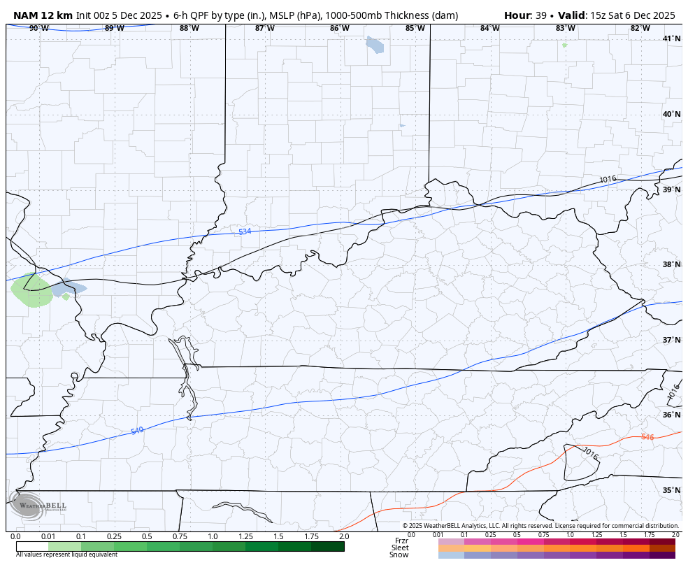
There’s a very weak system around Saturday afternoon and evening and this may spit out a few flurries and snow showers, especially across the northern half of the state. The NAM shows this well..
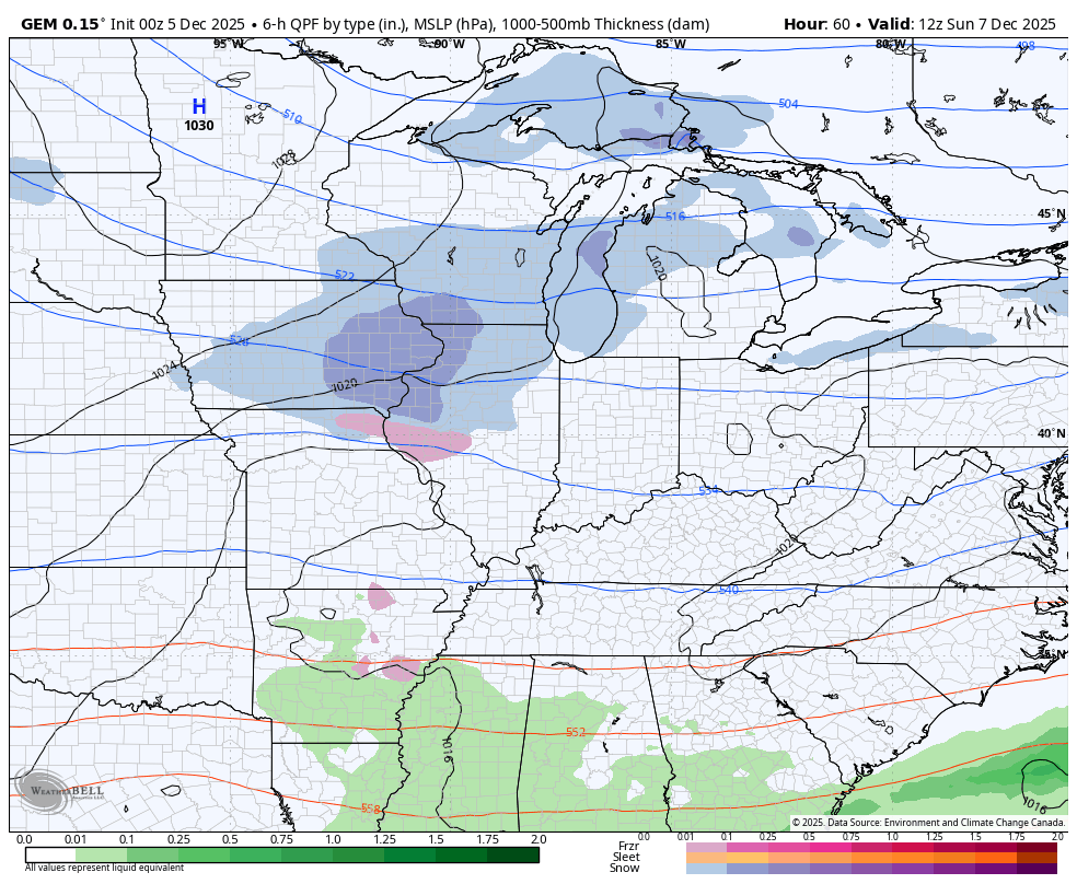
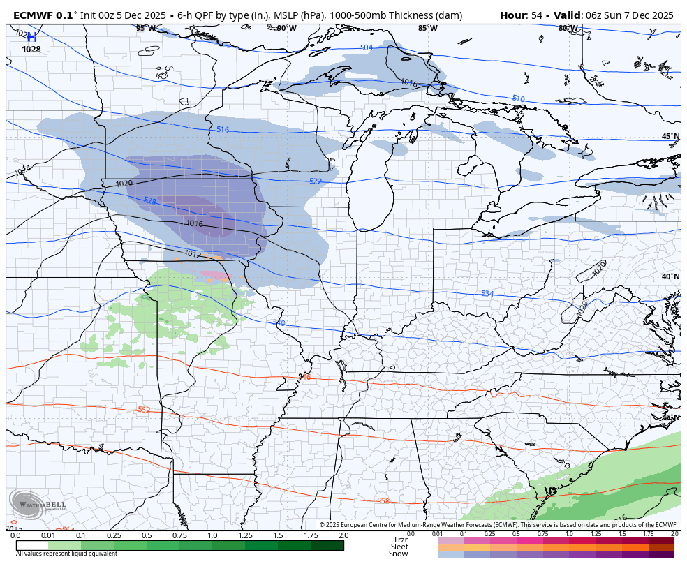
The system dropping in here Sunday and Monday may very well come in two pieces. The first arriving Sunday looks to be weakening as it pushes in with some light snow and a bit of a mix. The second part of the system arrives Sunday night and Monday and has a swath of light accumulating snow with it.
Here’s the Canadian…
The EURO is pretty similar…
Some really cold air comes in behind that with daytime temps dropping into the 20s on Monday with wind chills in the teens.
This sets the stage for several systems to drop in from northwest as bitterly cold air gets involved in the pattern. The forecast models have the general idea in pretty good shape, but the details won’t be known for some time.
Here’s the Canadian with the clippers from Wednesday the 10th through Sunday the 14th…
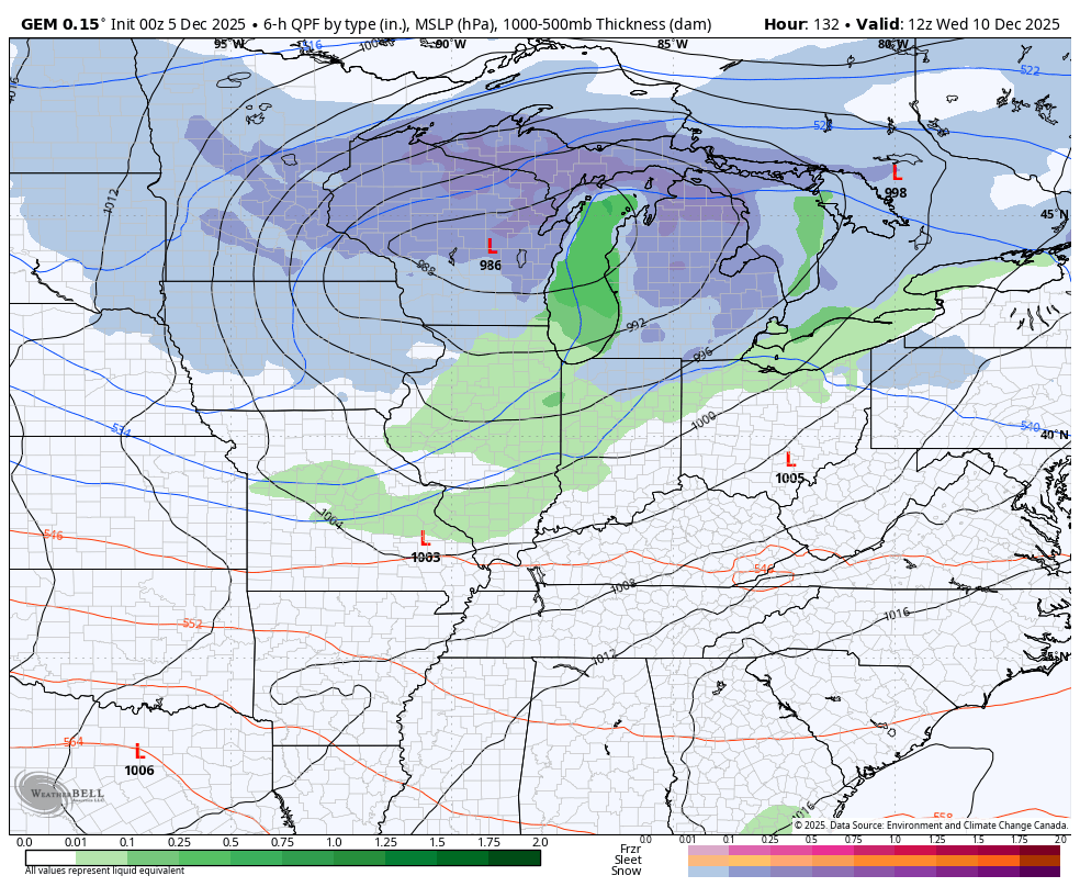
Check out the arctic air coming in behind this. That’s some severe Barney with temps going way below normal…
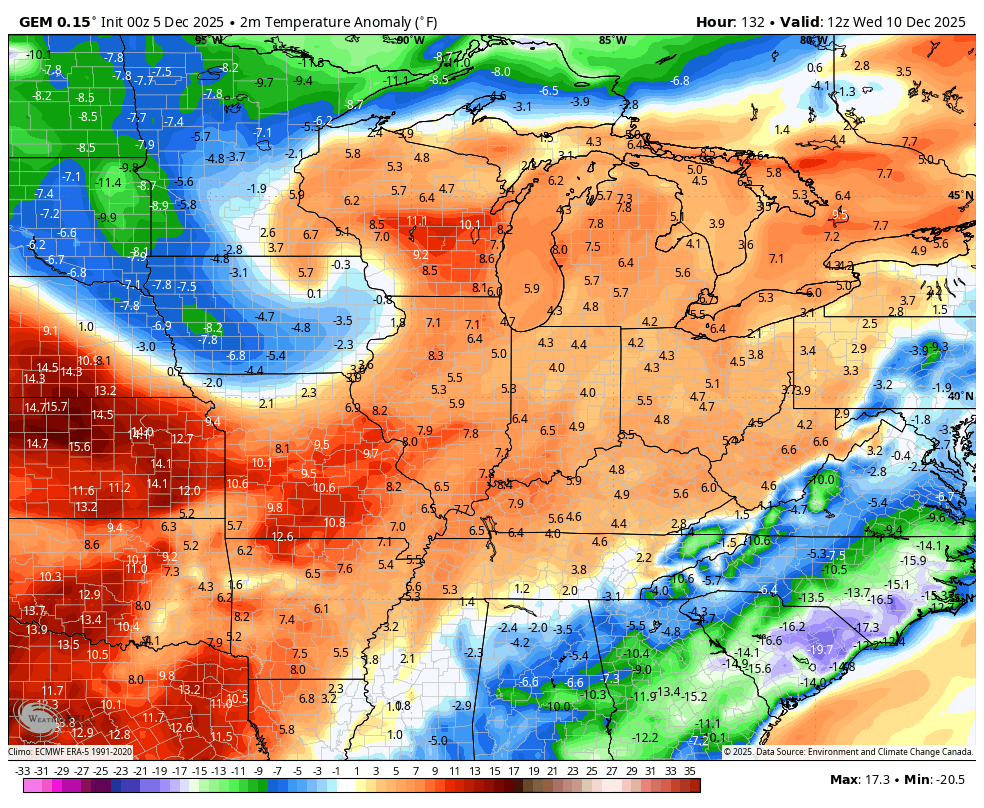
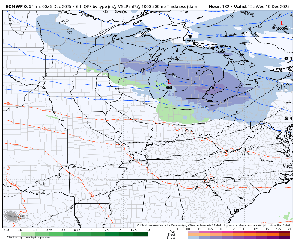
The EURO has a similar overall look with the clippers bringing snow potential as they unleash bitterly cold air…
The EURO is usually pretty conservative with temps, so to see these kinds of anomalies says something…
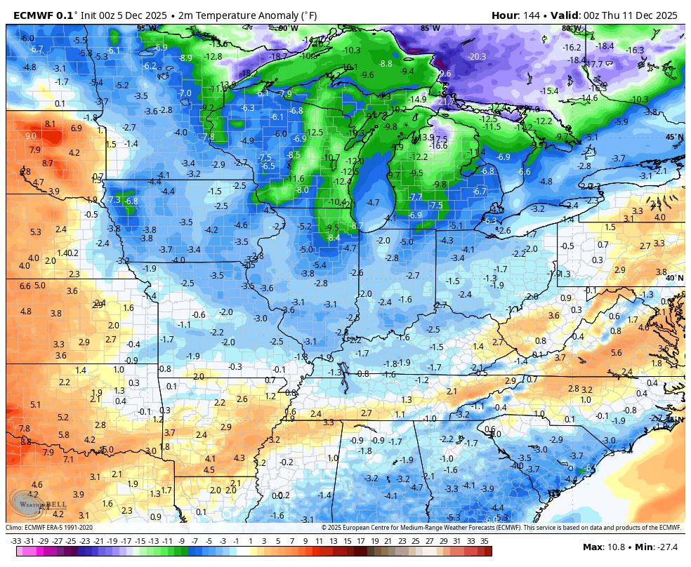
I’ve pointed toward the middle of December as having the chance for a severe shot of arctic air and some of the operational models are now seeing this. With a deep snow pack just to our north, that increases the odds for some bitterly cold temps in the coming weeks.
Updates will come your way later today. I’ll also have a few updates on my Meteorologist Chris Bailey Facebook Page
Until then, here are your tracking tools for the day…


Make it a fantastic Friday and take care.
